about us | links | permit info
Subscribe to Hiking With My Brother Email Subscribe Follow Hiking With My Brother on Facebook Follow Hiking With My Brother on Twitter Hiking With My Brother Picasa Hiking With My Brother YouTube
Showing posts with label cougar mountain. Show all posts

Licorice Fern Trail (S6) to Far Country Falls

Our Hiking Time: 2h
Total Ascent: 200ft
Highest Point: 700ft
Total Distance: 3.8 miles
Location: N 47° 31.26, W 122° 7.7033
Required Permit: None
Difficulty: Easy

Nathan's PhotoOver the years we have spent many an afternoon tromping up and down Cougar Mountain. Still, with many miles of official, “unofficial” and abandoned trails, there are still areas we have yet to explore. Recently we had a chance to check out the often-overlooked Licorice Fern Trail, which offers a quiet alternative approach to Far Country Falls.
We’ve covered much of Cougar Mountain’s past on previous hikes. From the early coal mining days to the area’s more recent military history, the nearly 30-year-old park contains and preserves a rich cultural legacy. Envisioned by Harvey Manning and first proposed in 1979, the Cougar Mountain Regional Park concept eventually managed to block planned residential development in the park and gain enough voter support to pass a bond measure. Today the park is the largest “urban wildland” in the United States with over 3,000 acres of forest riddled with 38 miles of hiking trails.

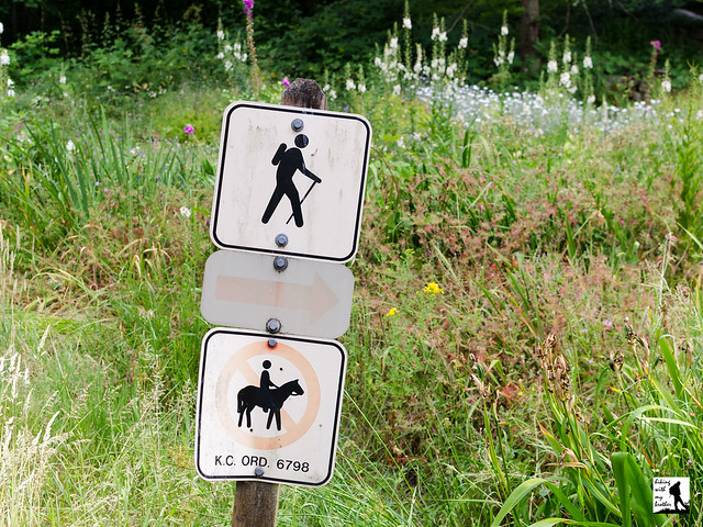
The trail begins directly from 169th Street and is largely unmarked. Only a small sign picturing a hiker gives any indication of a trailhead. Once you find roadside parking, be sure to avoid the paved driveway leading uphill to the left and the grassy yard to the right as you begin the hike. Instead stay on the wide gravel path leading into the trees. From here the trail angles uphill, winding beneath mossy alders and through a thick understory of vine maple and fern. After a mile of hiking, the trail crosses SE Licorice Way before continuing to climb another third of a mile to the junction with the Indian Trail (W7).

Head left at the junction, following the Indian Trail for a half-mile to the Far Country Trail (S1). Continue straight ahead to reach the Far Country Falls overlook. The seasonal multi-tiered cascade drops about 20 feet through a field of moss-covered boulders. While not necessarily spectacular, the falls are interesting enough to make a good destination for those looking for a short hike. You can add some mileage by hiking another third of a mile down the Far Country Trail, to the Far Country Lookout, though this somewhat overgrown peek-a-boo view of the surrounding suburban landscape is unlikely to hold your attention for long.

This trail is a great alternative to the more popular Cougar Mountain trailheads, offering the same outdoor experience with a little less foot traffic. Easy and approachable for any hiker, this easily accessible trail is also a good option during the off-season or just a rainy day as Far Country Falls is fueled entirely by rain or snow melt. Next time you head out for jaunt up Cougar Mountain, consider trying something a little different and exploring the Licorice Fern Trail.

To get there, take I-90 out to Exit 10A, merging onto I-405 South. Stay to the right to take Exit 10 onto Coal Creek Parkway. Follow Coal Creek Parkway four miles to May Valley Road. Take a left onto May Valley Road and continue 2.2 miles to a sharp bend in the road and veer left, continuing to stay on May Valley Road. In .1 miles keep left as the road splits, merging onto SE 112th Street. Continue another .4 miles to the first big curve in the road. As you turn left up the hill the road becomes 169th Ave and the trailhead is here. Find parking along the roadside. -Nathan

Print Google Directions >>
Licorice Fern Trail

Wilderness Peak Loop - Cougar Mountain

Our Hiking Time: 2h
Total Ascent: 1200ft
Highest Point: 1600ft
Total Distance: 3.5 miles
Location: N 47° 31.1880, W 122° 5.6100
Required Permit: None
Difficulty: Moderate

Nathan's PhotoAlthough we’ve explored much of Cougar Mountain, we’d yet to climb its highest peak and tour the somewhat lesser-traveled south-eastern portion of the park. A few weeks ago we finally found some time to head back into the Issaquah Alps and head up Wilderness Peak for a short hike a little closer to home.

wilderness peak cougar mountain hikingwithmybrotherWe’ve covered much of Cougar Mountain’s past on previous hikes. From the early coal mining days to the area’s more recent military history, the nearly 30-year-old park contains and preserves a rich cultural legacy. However, Wilderness Peak is conspicuously absent from this saga. Our only guess is that this section of forest really was something of a wilderness at one time – at least compared to the nearby coal mining operations. Wilderness Peak is made of different rock than other portions of Cougar Mountain, so there was little to lure the miners away from the rich coal seams that ran below the peak. And while some portions of the park were logged in the 1920s and 1940s, other sections were never logged at all, including areas near the top of Wilderness Peak.

The trail begins at the Wilderness Peak Trailhead, and combines the Wilderness Creek, Wilderness Peak, and Wilderness Cliffs trails into a short loop through Cougar’s lush mixed forest. Begin by heading uphill and almost immediately crossing Wilderness Creek, which will be your companion for the next mile or so. Gently switchback through a sea of sword fern and salal for about a half-mile under a canopy of alder and maple to find the first junction. Here, a small bridge crosses the creek and the Wilderness Creek Trail continues to the left while Wilderness Cliffs Trail branches right. Either trail will get you to the top, but because the Cliffs Trail is significantly steeper, most folks head left onto the Wilderness Peak Trail.

wilderness peak cougar mountain hikingwithmybrotherAs you head left, you’ll pass through The Boulders, a collection of moss-covered glacial erratics deposited millennia ago by retreating glaciers. As you climb up the creek valley, more and more surfaces are covered with moss and fern. At the same time the forest increasingly yields to larger numbers of cedar and fir. Soon you’ll find yourself crossing boggy areas on narrow boardwalks before climbing out of the creek valley up to Shy Bear Pass where a number of trails intersect and connect up with the rest of the Cougar Mountain trail system. From here you can follow the Shy Bear Trail into the center of the park, or take a quick jaunt out to Long View Peak. While the area is well-signed, if you're looking to do a little extra roaming, you may want to take along a map.

We veered to the right onto Wilderness Peak Trail, which glides fairly easily to your destination. A short spur leads out to Cougar’s highest pinnacle. There are no views here, just the quiet of heavy forest, a sturdy bench and a summit register. Take a moment to write a little something in the register, then head back to the main trail and take the Wilderness Cliffs Trail down to complete the loop. One word of caution as you near the bottom: there is a very tempting trail junction that continues downhill. Resist the urge to follow it and head back to the Wilderness Creek Trail and the creek crossing.

wilderness peak cougar mountain hikingwithmybrother
This is a great hike for an afternoon or post-work tromp through the forest. While not incredibly steep, it is a little bit of a work out through Cougar’s varied landscapes – everything from bogs to old growth. This loop is also hiker exclusive, so you’re unlikely to encounter any horses, which may be important to some dog owners. What this hike lacks in views it makes up for in landscape and solitude, as you can expect a little less traffic in this section of the park. If you haven’t made it out to this end of Cougar Mountain yet, consider a trek up to Wilderness Peak in the coming weeks.

To get there, take I-90 to Exit 15 and head right onto Highway 900, also known as Renton-Issaquah Road. Continue for a little over three miles to the signed Cougar Mountain Wilderness Creek Trailhead on your right. The driveway is easy to miss – keep an eye out for a paved road heading uphill. Park in the small parking lot and head up. -Nathan

Print Google Directions >>

Wilderness Peak

Coal Creek Falls - De Leo Wall Loop - Cougar Mountain

Our Hiking Time: 2h 30m
Total Ascent: 800ft
Highest Point: 1100ft
Total Distance: 5.5 miles
Location: N 47° 32.0760, W 122° 7.7220
Required Permit: None
Difficulty: Easy

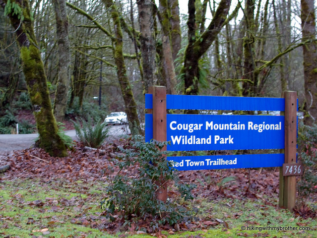
Nathan's PhotoLingering holiday obligations kept us from venturing too far from home this week. Instead, we headed out to Cougar Mountain and the Red Town Trailhead to tour a different portion of the sprawling park.

cougar mountain cold creek falls hikingwithmybrotherCougar Mountain’s friendly greenery gives little indication of the industrial history of the area. Back in 1863, coal was discovered on Cougar Mountain. Over the next 100 years, miners would pull 11 million tons of coal from the mountain before finally sealing the mines in 1963. All that coal prompted folks to dub the area "Newcastle Hills," after England's coal-rich city of Newcastle. Soon, Newcastle Hills coal drove the the creation of Seattle's first railroad, which hauled coal from Cougar Mountain out to Lake Washington and eventually Elliot Bay. Mining towns cropped up around shafts bored into the mountain. One of those settlements was Red Town, named for the color most of the buildings were painted. The current Red Town Trail largely follows what was then Hill Street, the town's main thoroughfare running past houses, schools and businesses. Most of these settlements faded away as the coal industry declined in the 1920s, and by the time World War II was over, neighbors sought to move beyond the area's mining past, and renamed it Cougar Mountain. Today, with a little effort, one can still find the rusting artifacts, lingering cement foundations, and abandoned equipment of those bygone industries. More likely than not, a friendly interpretative sign will be nearby to lend historical context to many of the lingering traces of Cougar Mountain's past.

With 36 miles of official trails and many more miles of “unofficial” or abandoned trails, there is a lot to see on Cougar Mountain. We mapped out a rough route taking us up to the De Leo Wall and past Coal Creek Falls, though it required hop-scotching between a surprising number of cougar mountain cold creek falls hikingwithmybrothertrails. Fortunately, trails are coded and well signed, keeping confusion down to a minimum.

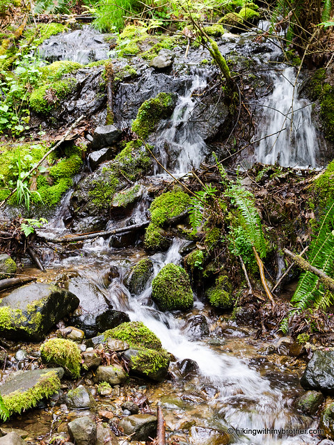
We took the Wildside Trail towards De Leo Wall, a rocky outcropping that affords something of a view of the surrounding housing developments. Trails are well maintained by thousands of booted feet and an army of volunteers. Alders and hemlocks dominate the low forest riddled with streamlets and occasional bogs. On our way back down from the wall we hooked over to see the underwhelming Far Country Falls before pushing on to Coal Creek Falls. The Coal Creek Falls Trail is mild and contains few ups and downs, making it a perfect trail for the kids or trail running, both of which were in attendance on a rainy Sunday morning. The 25’ falls can make a good rest stop along the route or are a popular destination in and of themselves.

While not our usual high-adventure, Cougar Mountain does manage to have a little something tcougar mountain cold creek falls hikingwithmybrothero offer everyone – history, waterfalls, miles of trail, and accessibility for the whole family. Heck, there’s even a zoo. Proximity to the city means there will be a lot of folks to share the trail with, though it isn’t too difficult to head out to more remote parts of the park to find some peace and quiet.

To get there, take I-90 to Exit 13. Head right up the hill on Lakemont Boulevard just over three miles. Look for the entrance to the Red Town Trailhead on the left side of the road. - Nathan
< Cold Creek Falls - De Leo Wall

Cougar Mountain - Anti-Aircraft Peak

Our Hiking Time: 1h 40m
Total Ascent: 600ft
Highest Point: 1400ft
Total Distance: 3 miles
Location: N 47° 31.2500, W 122° 5.4833
Required Permit: None
Difficulty: Easy

tiger mountain hikingwithmybrotherNathan's PhotoDespite greater Seattle being pretty much snowed in, and I-90 closed past North Bend, and fresh snow beginning to fall, we decided to go for a quick hike anyway. Still, this severely limited our options. We chose Cougar Mountain because we were familiar with parts of it already and knew the 8 inches of snow would make the hike that much more fun. Plus it would round out the Cougar-Squak-Tiger trifecta for us. Major roads were not too bad and we managed to make it to the Anti-Aircraft Peak Trailhead with only a few questionable moments. We positioned the car so we wouldn’t get stuck, geared up, and took a study of the free trail maps before setting off.

The peak is named in honor Cougar Mountain's military legacy. Following World War II, 90mm anti-aircraft guns were installed in 1953 to guard Puget Sound until they were replaced from 1957-1964 by a Nike Ajax Missile Defense System. The installation languished until 1983 when King County acquired it from the military and began developing a regional park to preserve Cougar Mountain's cultural and historic heritage. Envisioned by Harvey Manning and first proposed in 1979, the Cougar Mountain Regional Park concept eventually managed to block planned residential development in the park and gain enough voter support to pass a bond measure. Today the park is the largest “urban wildland” in the United States with over 3,000 acres of forest riddled with 36 miles of trails.
tiger mountain hikingwithmybrother
We took to the trail and tromped down the Tibbetts Marsh trail toward the Fantastic Erratic, a short mile and a half away. The trails are wide and very well used and maintained, taking you over streams, beside gullies, and through a mixed forest of alders and evergreens. The network of trails is sprawling but well signed. If you’re unfamiliar with the 45 trail names that appear on these signs, however, be sure to take a map to help reorient you when needed. Trails are also helpfully named with what side of the park they are on they are at as the first letter, (N)orth, (S)outh, (E)ast, (W)est and (C)enter.

The Fantastic Erratic was much less fantastic under a layer of snow, but the trek down to the basin where it resides was worth it - especially after Jer took a tumble or three off the trail and the Erratic itself. Not only did the snow keep most people away, but provided that close, tiger mountain hikingwithmybrotherinsulated feel, making it seem like were snowshoeing deep in the Cascades instead of within a few miles of sprawling housing developments. We did not meet up with anyone else on the trail, though the fresh tracks we encountered let us know we were not entirely alone. Having started at the top, our way back was almost entirely uphill, made more slightly more difficult by the icy crust that had formed over the snow clawing at our boots and gaiters.

Overall, the trails are easy – great for the family, pets, or trail running – though from our own experience and from everything we’ve read, this is a very popular destination, so expect some company on your forays. The Anti-Aircraft Trailhead can be accessed via I-90 Exit 13. Take a left up Lakemont Boulevard following for roughly 3 miles before taking a left onto Cougar Mountain Way. Meander through the housing developments, continuing to head uphill and Cougar Mountain Way will change into Cougar Mountain Drive and terminate in the trail head parking lot. - Nathan

Print Google Directions >>

Cougar Mountain
Copyright 2008-2016 - hikingwithmybrother.com
hikingwithmybrother@gmail.com