about us | links | permit info
Subscribe to Hiking With My Brother Email Subscribe Follow Hiking With My Brother on Facebook Follow Hiking With My Brother on Twitter Hiking With My Brother Picasa Hiking With My Brother YouTube

Tin Cup Joe Falls

Our Hiking Time: 7h
Total Ascent: 1200ft
Highest Point: 2000ft
Total Distance: 11 miles
Location: N 47° 30.8520, W 121° 29.2560
Required Permit: Northwest Forest Pass
Difficulty: Moderate

Nathan's Photo
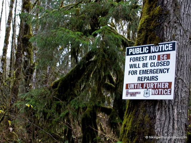
Last year, after tackling Stegosaurus Butte, we did some research and compiled a list of hikes we wanted to do in the Middle Fork Snoqualmie Valley. Less than a week after we came up with the list, a series of storms washed out large sections of the only access to the Middle Fork, Forest Road 56. Now, after months of repairs, FR 56 has been re-opened. This week we took advantage of the opening to explore the trail up to a somewhat hidden, but very impressive waterfall: Tin Cup Joe Falls.

tin cup joe falls hikingwithmybrotherThe falls are found on Cripple Creek as waters flow out of Derrick Lake down to the Middle Fork Snoqualmie River. Cripple Creek was known as Tin Cup Joe Creek back in the 1890’s, when mining was big in the Middle Fork Valley. Local miners evidently named the creek in honor of a roving prospector. Later, for reasons we were not able to dig up, it was renamed Cripple Creek. Today, those hiking along the Middle Fork Snoqualmie Trail #1003 cross the signed Cripple Creek as they continue on to Goldmyer Hot Springs.

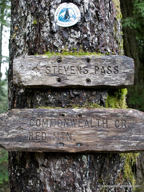
There is no official or very clear trail all the way to Tin Cup Joe Falls. While this makes the trip a bit tricky, it also means you’re very likely to have this stunning set of falls all to yourself. And more good news is that two-thirds of the hike is an easy stroll along the well-maintained and much loved Middle Fork Snoqualmie Trail #1003. From the Gateway Bridge follow the trail tin cup joe falls hikingwithmybrotherabout five miles to Cripple Creek. On the west side of the bridge (before you cross) you should be able to make out the faint indications of a bootpath leading steeply up the hill. Take a few minutes to fuel up and get out the hiking poles - the next mile or so is not going to be easy.

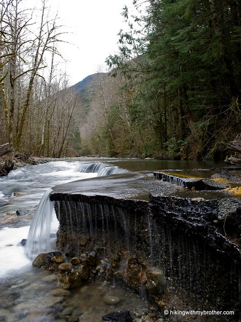
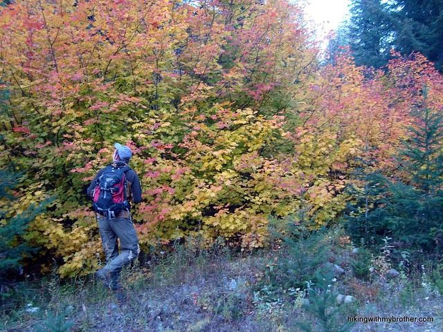
Keep an eye out for the subtle signs of well-worn vegetation. At times the trail will completely disappear or take short detours around blowdowns. When in doubt, follow the creek and the path of least resistance; generally the path reappears before you know it. As you continue to struggle onwards, a distant roar will begin to grow. You’ll glimpse the first set of falls cascading down from cliffs hundreds of feet above. As you make your way down to the creek to cross it, you’ll see another set of falls just upstream and realize the creek has branched, and that you’re looking at two sets of waterfalls for the price of one.

It is tempting to make a beeline to the horsetail falls you see ahead, but don’t clamber across the creek just yet. Although not quite as impressive from the creek level, we recommend you push past these first falls and continue on to the second set of Tin Cup Joe Falls. Circle wide and scramble up the rocks above short falls to a large rocky plateau. From here, water gushes off 200’ cliffs from three separate channels invisible from the creek below. This little alcove of amazing waterfalls are among the most impressive we’ve ever seen – though we’re sure that the volume of water helped make this tin cup joe falls hikingwithmybrotherall the more spectacular. Once you catch your breath, head back down and check out those other, taller, but a little less secluded, falls.

We highly recommend this hike. Although it’s a little rough, most hikers should be able to make it up to the falls if they’re comfortable with a little bushwhacking and route finding. There’s no serious risk of getting turned around and lost with the creek as your guide, and the elevation gain is significant enough to feel, but not insurmountable. Find the time to make the trip out to Tin Cup Joe Falls – it’s well worth it.

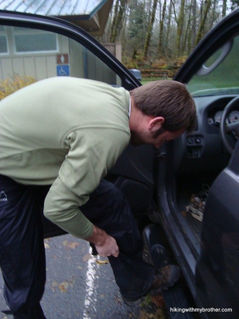
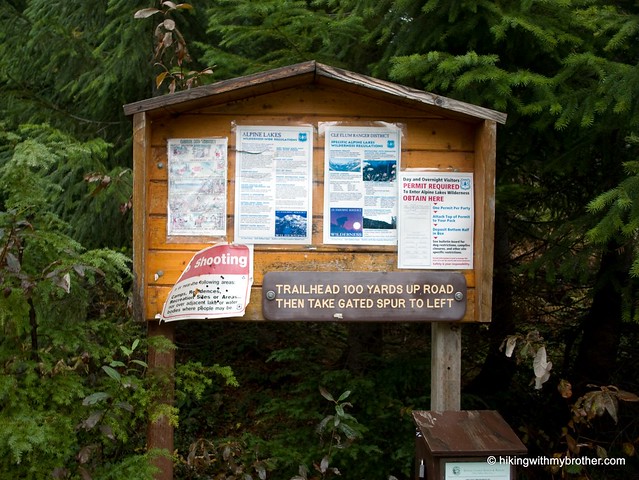
To get there, take Exit 34 off I-90 and take a left on 468th Ave. Follow the road past the truck stop for about a half-mile until you reach SE Middle Fork Road, also known as Forest Road 56. Continue to follow the twists in the road until the pavement runs out. From here it’s almost an 11 mile gravel road to the Middle Fork Trail head parking lot. The trailhead and Gateway Bridge are at the north end of the lot. -Nathan

Tin Cup Joe Falls

Lake Isabel Trail #1080

Our Hiking Time: 6h 20m
Total Ascent: 2400ft
Highest Point: 2850ft
Total Distance: 10 miles
Location: N 47° 51.9720, W 121° 35.9820
Required Permit: None
Difficulty: Hard

Nathan's PhotoDuring the winter months we always have a backup hike, just in case something goes awry on the way to the trailhead. This past week was another shining example of the need to fall back on “Plan B.” Our cursory research regarding a hike to Mineral City missed a key fact: the Index-Galena Road to the trailhead had been washed out. So we headed back to Gold Bar to explore a hike we knew very little about: the trail to Isabel Lake. We found the trailhead after some fumbling attempts, hit the trail and quickly discovered that we would very likely be alone for the duration of the hike.

index galena road hikingwithmybrotherThere’s not a lot out there on Isabel Lake, and we would now assume hikers simply avoid it. During our research, we learned that the area is beloved by many other outdoor-enthusiast types – mostly lovers of all-terrain vehicles and motorcycles. Evidence of their presence was legion. A goodly portion of the hike is along utility roads winding under power lines and by wrecked cars, while dodging mud holes and piles of garbage. Overhead you may hear the occasional float plane coming in to land on Isabel Lake, evidently an ideal recreational destination for pilots flying out of Seattle.

In addition to the trail being somewhat unpleasant, the path to the top is occasionally difficult to follow. Paths are constantly branching off from the main road and the road itself occasionally splits off in multiple directions. To make matters worse, bridges over May Creek are universally lake isabel falls hikingwithmybrotherwashed out, forcing a hiker to search up and down the riverside for a fallen log or some rocks to hop across. This is definitely a hike to bring the GPS on so that you can avoid getting turned around or lost.

As you continue to ascend, the road becomes progressively rougher and the crossings more treacherous. Perhaps during summer and early fall the water levels fall to a more approachable depth. When we crossed, the rocks were covered in layers of ice; pretty, but it made crossing particularly difficult. Perseverance across May Creek and up a particularly nasty washout will lead you to a marked trail into the forest. Here, the hike becomes enjoyable. More a bootpath than a full-fledged trail, the way is occasionally marked by pink ribbon, and it is clear that one needs to follow the creek in order to get to the lake.

We heard Isabel Falls before we saw it. We weren’t expecting a pretty amazing 200’ waterfall at the end of the hike – and this made up for some of the drudgery we’d endured to get there. The falls have a feeling of isolation and seclusion. Clambering up the rocks above the first tier of the waterfall is well worth the effort, and is the perfect place to settle down for lunch. We happily spent a good deal of time here just taking the waterfall in. lake isabel falls hikingwithmybrotherWhen you’re done basking, Isabel Lake is just a few hundred feet above – find and follow the trail on the right side of the falls to reach the shore.

This is a hard hike to recommend. While the goal is noble, most of the journey is unpleasant. However, we do note that with the area currently closed to motorized vehicles, this might be the best time to explore Isabel Lake. We can’t say this is a hike for just anyone – it’s a slog, and one should definitely have a good deal of experience hiking and navigating via map or GPS before attempting it.

To get there, take Highway 2 through Gold Bar. About two miles past town take a left on Reiter Road. Follow Reiter Road for another two miles, avoiding the turn down May Creek Road. There should a large graveled area on the left after two miles. Find a place to park and unload. Follow the access road toward the powerlines and onward to Isabel Lake. -Nathan

Lake Isabel

Wallace Falls Loop

Our Hiking Time: 3h 15m
Total Ascent: 1150ft
Highest Point: 1500ft
Total Distance: 6.3 miles
Location: N 47° 52.5120, W 121° 38.7900
Required Permit: Discover Pass
Difficulty: Moderate

Nathan's PhotoThe slow recovery of a sprained ankle is keeping us from our usual lofty heights, but is also providing us with an opportunity to explore some hikes we would normally overlook. This week we made it out to Wallace Falls State Park to do a little tromping around. We have not been to a Washington State Park since we visited Olallie back in January – it was good to do a hike a little closer to civilization for a change.

Created in 1975, Wallace Falls State Park covers almost five thousand wallace falls hikingwithmybrotheracres of mountains, lakes, and forest. The many features dubbed “Wallace” in the area were named for Joe and Sarah Kwayaylsh, Skykomish tribe members among the first homesteaders to settle nearby. Around the 1920’s the area was logged extensively and a railroad was built to haul timber back to Seattle. The tracks are long gone, but the grade remains and is a popular for biking and trail running.

The trail begins under buzzing powerlines, but quickly ducks beneath the shelter of second-generation forest. Shortly after entering the woods, the trail diverges; the old railroad grade veers left, and to the right the Woody Trail hop-scotches up the river stopping at prominent cascades along the way. The Woody Trail was named in honor of the late senator Frank Woody, who was a stalwart advocate for the Youth Corps that helped build the trail.

The winding path is short and well marked – a map indicating where you are at is occasionally posted along the trail and at picnic shelters near the falls. There are a few hills along the way, but they should not pose much of a challenge. The pounding of thousands of feet along this popular trail keeps the path flat and wide, and the constant vigilance of trail advocates keep it in good shape. Even on the chilly, rainy day we hiked this trail there were many other folks on it, so expect some company – though the close proximity to the river blankets most of the hike in the din of rushing water lending a feeling of isolation.

The falls themselves are impressive. Each of the lower, middle and upper falls are upwards of 200’ drops, creating an exciting scene. Often what you can see from the trail isn’t ideal, but closer looks require a precarious scramble out on slick rocks high above the river, which have wallace falls hikingwithmybrotherbeen wisely barricaded behind railings and warning signs. Once you reach the upper falls, you have the option of taking the railroad grade back the parking lot, making the trip a loop.

This hike is absolutely accessible to the whole family and is great for a short jaunt out to see a little nature. Those looking for a hike should probably skip this for something a bit more challenging – this is more of a stroll – but it certainly has some big rewards for little effort. If you’re looking for something more, there is a lot of park to explore – a hike out to Wallace Lake, for instance, is a 12-mile commitment that might satisfy more adventurous appetites.

To get there, take Highway 2 east to Gold Bar and follow the copious signage directing you to take a left on First Street and beyond to Wallace Falls State Park. In recent years, the park was charging an entrance fee, though this practice seems to have gone by the wayside. Park and hit the trail! -Nathan

Wallace Falls

CCC Trail - Eastern Trailhead

Our Hiking Time: 3h 30m
Total Ascent: 500ft
Highest Point: 1500ft
Total Distance: 8.2 miles
Location: N 47° 30.9600, W 121° 36.7680
Required Permit: None
Difficulty: Easy

Nathan's PhotoEarlier this year we hiked the first half of the then snow-bound CCC Road. This week, with a slowly recovering sprained ankle to tend to, we explored the remaining portions of a road that once served as the main artery for accessing the timber and mineral interests in the Middle Fork Snoqualmie Valley.

The Civilian Conservation Corps built the CCC Road in 1939, putting young unmarried men to work doing public good during the Great Depression. Eighty years later, the road is still in good shape, thanks to the Forest Service and a small army of volunteers keeping nature at bay.

CCC road trail hikingwithmybrotherWashouts on Forest Road 56 blocked direct access to the easternmost entrance to the CCC Road, so we quickly decided to make a short loop out of the hike. Our recent trek up Bessemer Mountain took us up the Big Blowout Creek entrance to the CCC trail, so we saved it for the end of our hike and instead explored further down FR 56 on foot. This portion of FR 56 hugs the Middle Fork Snoqualmie River, lending easy access to a number of angling sites, some of which are a happy trail jaunt through scrub and rocks to reach the riverside. Eventually one arrives at the trailhead, where the CCC Road intersects with its modern replacement, FR 56. Somewhat overgrown and unmarked, the trailhead is easily marked with what Manning creatively refers to as “Tall Moss Cliff”, which is, unsurprisingly, a tallish mossy cliff-face. Hook left and dive into the trail.

The western portion of the trail mirrors much of the east – heavily deciduous, filled with alders and vine maples, sword ferns and salmonberry. Streams and rivulets cut across the trail, at times with such ferocity that they have obliterated large chunks of the former road, forcing the hiker to pick their way across a rubble field of talus and fallen timber. Small breaks in the foliage afford occasion views of the valley below, but the majority of the hike is shrouded beneath the second-generation forests that line the trail. The trail meanders a bit before connecting up with CCC road trail hikingwithmybrotherthe logging roads on Bessemer, which will lead you back down the FR 56.

The CCC Road is not a backbreaker, it is not a full of amazing views, and it is not going to lead you to secluded groves or hidden meadows. Still, the old road is a nice introduction to the less-traveled Middle Fork area that is fairly easy to access.

To get there, take I-90 to exit 34 and take a left onto 468th Ave. Follow the road past the truck stop for about a half-mile until you reach SE Middle Fork Road, also known as Forest Road 56. The road has a few twists and turns, but continue on until the asphalt ends at Mailbox Peak Trailhead. Press on for about six miles to Tall Moss Cliff on the left, 9.7 miles from I-90. -Nathan

CCC Trail - Eastern Trailhead

Winter Hiking Tips

Nathan's PhotoA sprained ankle forced us to skip our hike this week. Still, we thought it would be a good idea to map out some of the things that were on our mind as the winter hiking and snowshoeing season begins. Drawing on lessons learned last year, we've put together the following tips.


1. Always bring your gear. Even if you don’t plan on much snow, even if the day is perfect and sunny, even if you are only planning on going two miles, throw all your gear into the car. In fact, just leave your snowshoes in the car for the season. Weather changes quickly and you never know the conditions on the trail. It is best to bring everything you’ve got to the trailhead and make a decision from there. You can always leave things in the car.

2. Check the weather. Just before you leave, double check the weather conditions in the area you are going to. Knowing what’s happening right now might cause you to choose a different hike and you’ll save a lot of time going directly to your revised destination.

3. Check the avalanche report. Unless you’re positive that there is no chance of an avalanche along you’re hiking route, you need to take the time to check the avalanche conditions. Get in the habit of checking the report for each hike you take. The local ranger station is a good place to start.

4. Make sure the trail is flagged or bring a GPS. Snow can make things extremely confusing. Make sure the route you’ve chosen is tagged or flagged in some way or check to see if it’s been recently groomed. Generally, if it’s not a popular snowshoe route, it’s unlikely to be marked. For those hikes, bring along your GPS. It’s very easy to get turned around and lost when the snow makes everything look like the trail. We had this happen to us around Melakwa Lake last year.

5. Have a backup plan. Winter weather can cause all sorts of problems that might bar access to your trailhead. Storms can wash out roads, winds can topple trees, and snows can be so deep as to make a road impassable. Any or all of these might prompt a road closure. Having a backup hike in mind saves a lot of time and keeps the frustration levels to a minimum.

6. Bring your emergency gear. It almost goes without saying, but bring your hand warmers, emergency blankets, whistles and extra food. Weather really does change extremely quickly, going from pleasant to blizzard in the span of an hour. Couple that with the ease of losing the trail and wandering through snowbound forests, and you’ve got a recipe for a scary situation. So even if you’re doing a short snowshoe just a few miles from civilization, bring the gear anyway.

7. Tell someone where you’re going and when you expect to be back. This is a good way to make sure that if something happens someone knows where to look for you. Cell phones don’t always work and this can be made worse by weather.

8. Hike smart: if the weather changes or conditions worse beyond what you are prepared for, turn around. No matter how close you are to your goal, avoid the temptation to press on, your goal will still be there to try for again another time. We probably should have done this on East Tiger Mountain.

Mirror, Cottonwood, and Twilight Lakes

Our Hiking Time: 3h 15m
Total Ascent: 1250ft (650ft in; 600ft out)
Highest Point: 4200ft
Total Distance: 5 miles
Location: N 47° 20.6640, W 121° 26.2320
Required Permit: Northwest Forest Pass
Difficulty: Easy

Nathan's PhotoIt’s difficult to spend much time tromping through the woods without running across some body of water dubbed Mirror Lake. We saw the waters of a Mirror Lake en route to the top of Silver Peak and made a mental note to explore its shores in the near future. This week was the perfect opportunity to take a short trip over the Pass to check it out.

The Mirror Lake Trail #1302 begins off Forest Road 5810, momentarily cotton wood lake mirror lake hike hikingwithmybrothertraversing the lingering scars of logging activities circa the 1970s. Shortly however, respite is found in the quiet embrace of forests of fir and pine. The trail is well trodden and easy to follow; however, there are no formal bridges over any of the streams or creeks you encounter. This should not pose much of a problem during the drier months, but rains and snowmelt can make for swollen streams that are tricky to navigate. Creative use of rocks and fallen snags will convey you across, but might make things complicated for young hikers.

Placid Cottonwood Lake is your first destination, replete with campsites for PCT travelers along shores surrounded by the ridges of Tinkham Peak. A nice stopping point perhaps, but Mirror Lake lies less than a mile beyond and easily outclasses Cottonwood Lake. Continue on past the junction leading up to Tinkham and Silver Peaks and down to the lake. Aptly named, the crags of Tinkham are reflected on the glassy surface of Mirror Lake. Find your own little nook within the trees to soak in an alpine setting. Wander to the end of the lake to find a makeshift beach and perhaps the best vantage point for appreciating the view and having a snack.

From here you can call it a day or press on to Twilight Lake and Yakima Pass. One word of caution: once beyond the immediate vicinity of Mirror Lake, the terrain becomes undeniably mirror lake falls mirror lake hike hikingwithmybrotherugly. Unapologetically logged, the clear-cut landscape feels used up. You’ll quickly encounter the unofficially named Mirror Lake Falls offering a cheerful break to the otherwise dreary scene. Without too much fanfare, you’ll arrive at Twilight Lake and Yakima Pass. Small and surrounded by marsh, the lake itself is a bit of a letdown after Mirror, and if this is as far as you’re going, you may want to save yourself the trip.

It may not look like much now, but Yakima Pass was once a busy thoroughfare. In addition to Snoqualmie Pass, Yakima Pass was heavily utilized by Native Americans as a means of crossing the Cascades. Snoqualmie was mainly used for foot traffic, while Yakima, with lighter snow accumulations, was preferred for horse traffic. As Europeans made their way west, Yakima Pass was a popular trade route for the Hudson Bay Company and early explorers. Until 1856 both passes were often referred to as “Snoqualmie Pass,” causing a great deal of confusion for those attempting to find a rail route through the mountains. In 1853 the area was surveyed by George McClellan of McClellan Butte fame, who deemed the real Snoqualmie Pass “impassable” and recommended Yakima Pass as an option. The next year in 1854, Albert Tinkham went through Yakima Pass as well, never finding the lower Snoqualmie pass, but did enough work in the area to have a mountain named after him. It wasn’t until 1856 that J.H.H. VanBokkelen managed to locate and survey the pass we use today.

An extensive trip down Forest Roads to get to the Mirror Lake trailhead makes a hike solely to the lake more trouble than it’s worth. One appeal would be the easy mirror lake mirror lake hike hikingwithmybrotheraccess for little ones to see and experience the feeling of remoteness that Mirror Lake manages to convey, but the difficult fording of a couple of streams might preclude getting the tykes all the way to Mirror. For most hikers, we recommend including this on a trip up to Silver Peak or a longer trip out to Stampede Pass because it’s not so spectacular as to warrant the miles of potholes for its own sake.

To get there, take I-90 to Exit 62 and head right. You’ll pass over the Yakima River and at just over a mile from I-90 take a right on Forest Road 5480. Continue down the road following signs directing you toward Lost Lake and trail #1302. The road will take you up and around Lost Lake and past various hunters’ huts before turning extremely rough about seven miles from the freeway. There are a couple of turnouts to park at here. The trail begins a 1/2 mile further up the road. - Nathan

Mirror, Cottonwood, & Twilight Lakes

Commonwealth Basin - Red Mountain Pass

Our Hiking Time: 5h 30m
Total Ascent: 2700ft
Highest Point: 5300ft
Total Distance: 7.2 miles
Location: N 47° 27.6300, W 121° 23.8560
Required Permit: Northwest Forest Pass
Difficulty: Hard

Nathan's PhotoWe continued our race against the weather this week, hoping to complete a few more hikes in the Pass before the snows settle in. After a few weeks of hiking to lakes, we decided to head for Red Mountain and the Commonwealth Basin, intent on finding a scramble route to the top.

The Commonwealth Basin Trail has its origins in the mining claims common in this area. The trail was originally built by prospectors around 1890 to access claims within the valley. In 1928 Fred Cleator was put in charge of the US Forest region encompassing Oregon and Washington and immediately set about piecing together a contiguous trail through the region that would become eventually become the Cascade Crest Trail (CCT). red mountain commonwealth basin hikingwithmybrotherThe old Commonwealth Basin route served as part of the CCT until the late 1970s when, as part of the changes made during the construction of the Pacific Crest Trail (PCT), it was abandoned for the more efficient Kendall Katwalk route.

Most guidebooks suggest you follow the PCT to the Commonwealth Basin Trail (#1033) to get to Red Mountain, but we had already explored that portion of the Pacific Crest Trail on our way to Kendall Peak. Instead, we jumped at the chance take an alternative approach to our destination; a small, unmarked, but well-trodden trail branches off to your left just after you leave the trailhead. This is the old CCT route that is now officially “abandoned,” though it is clearly still well loved. There are some things to consider if you’re thinking of taking this route. On the plus side, the CCT route shaves off a mile or more of hiking; on the down side, the trail is on the rough side and while there is again a log bridge across Commonwealth Creek, it occasionally washes out.

Either way, you will be taken through mature stands of Silver Fir and hemlock, over red mountain red pond commonwealth basin hikingwithmybrotherstreamlets and talus fields and past alluring waterfalls. The old Basin route saves much of its elevation gain for Red Mountain itself, while the PCT trail gains more elevation that you need, requiring you to relinquish what you’ve so recently gained. Whichever way you choose to go, you’ll eventually find yourself on the Commonwealth Basin Trail (#1033). This will bring you to the end of the basin and up the base of Red Mountain to Red Pass. After quite a number of switchbacks you’ll reach a level shoulder where short spur trails lead to Red Pond and up the crown of Red Mountain.

Snows had already made the exposed rock very slick, so we chose to forgo the scramble up to Red’s summit, and instead pushed on to Red Pass. The views here are spectacular. The mountain simply drops away, creating the feeling of being at the top of a massive amphitheater. The horn of Mt. Thompson steals the show, a fitting counterpoint to Mt. Rainier to the south. Commonwealth Basin spreads out to Alpental in the distance. From here Snoqualmie Mountain and Guye Peak seem less intimidating than they usually do, and rocky top of Lundin Peak is just ahead on the trail.

Red Mountain suddenly looks much more craggy and intimidating from this side, so we opted to continue on to East Lundin Peak. For years Lundin peak was called lundin peak red mountain commonwealth basin hikingwithmybrother“Little Sister” a reference to it sharing a ridgeline with Snoqualmie Mountain. At some point it was renamed in honor of J.W. Lundin, who evidently did a great deal of good work for the US Forest Service. We were ill-equipped to get to the actual summit, so the steep but easily accessible East Peak was a perfect destination. Simply follow the trail along the ridge, ignoring the signs that tell you the trail is abandoned. Take the left fork heading upwards and stick to the rough trail to the top. The views don’t change much with the extra effort of pushing past the common stopping point of Red Pass, but it’s a cozy little spot to settle down and refuel.

Though probably better known as a snowshoe route, a trip through Commonwealth Basis is a great hike. The heights of Red Pass are attainable for just about anyone and are more than worth the exertion. We recommend going off the beaten path and using the older CCT route if you are up for the extra challenge. It gives you a much better feel for the Basin as a whole.

To get there, take I-90 to exit #52. Turn left under the freeway and take the first right. Follow the road to two large parking areas. The first is reserved for stock; -hikers should continue to the further parking lot and the trailhead. - Nathan

Print Google Directions >>

Commonwealth Basin - Red Mountain Pass

Anniversary Post: Worst Hikes of the First Year

Jer's PhotoToday marks one year since two brothers decided it would be a good idea to start a blog about hiking every weekend in the Pacific Northwest. If you have been following our blog for a while, you may have noticed the tone of our trip reports has become more frank. Back in the earlier days of the blog, we were trying to find something positive to write about on all of our hikes because we didn’t want to discourage people from exploring new places and making up their own minds. Now that we have a lot more experience, we have been working hard to provide guidance that hopefully helps others to avoid a poor hiking trip. In that same spirit of guidance, we have decided to mark the website’s one-year anniversary by recalling some of our worst experiences on the trail.

Given our love for the outdoors, there really has to be a grand culmination of factors to take a hike from mediocre to plain awful. Yet we’ve had a handful of notorious hiking trips that could truly be branded as “bad” since the inception of hikingwithmybrother.com. For me, Squak Mountain – East Ridge to Phil's Creek was literally a perfect storm of misery. Stricken with the flu and bullheaded pride, I decided a short and easy hike was perfectly within reason to complete. Undeterred by freezing April rain, I set out with Nathan on an unplanned route through the network of trails that make up Squak Mountain State Park.

Since we didn’t plan, we started the hike without a final destination. Desperate for something significant to write about, Nathan played on my competitive bravado by using phrases such as “Come on, don’t be a quitter!”, and “We’re almost there, only a quarter mile left!” (liar) to push my soaked, flu-fatigued body well beyond the short hike I anticipated. I’m actually glad he motivate me because now I can taunt him (which is priceless) about the time we hiked 8 miles along a trail closed by mudslides only to find a labyrinth of hoof-paths filled with ankle-deep mud and horse manure.

While Phil's Creek is an example where things just went wrong, Taylor Mountain Forest is an example of where hiking is just wrong. The only thing this place might be good for is taking your ATV or horsey out for a spin - unless of course you are a serial killer. In researching information for the original trip report, we found that Taylor Mountain Forest has the unfortunate history as being one of Ted Bundy’s favorite disposal sites.

The mountain itself is private land, so if you have any aspirations about getting to the actual summit of Taylor, forget about it. And though the elaborate trail map we procured in preparation for the hike shows finely groomed and well marked trails, we quickly discovered that some trails were only proposed, while others were still under construction - making it very easy to get lost. If you go, when you do get lost, don’t be surprised if you happen upon an irate private land owner who tells where you shouldn’t go, but is completely unable to give you directions on how to get un-lost. -Jer


Nathan's Photo
Phil’s Creek was a sodden trudge. Taylor Mountain was a very, very long day that ended up not only being disappointing, but a little bit creepy by the end. Still, these are picnics when compared to what is easily our worst hike: Mt. Gardener.

Before I get into the details, I think it’s important to note that we put this post together to poke a little fun at ourselves and share some of our misadventures after a year of tromping through the woods. However lighthearted the rest of the post is, I’m very serious when I say that you should never go to Mt. Gardener. Ever.

We avoided Mt. Gardener for months. The few descriptions of the trail we could find clearly struggled to find anything positive to say about the hike. We were resigned to a boring stroll down forest roads to an oversized hillock, the principal attraction being a lovely overview of the very close and very loud I-90. In retrospect, this would have been perfect.

The first inkling that we were in for a terrible hike was finding the access road blocked almost four miles from the outlined starting point. While inconvenient, we decided to go ahead with the hike anyway, because, after all, it was all reasonably graded logging roads, right? Resolved, we started down the trail.

Then is started raining. But we were prepared; we just broke out the rain gear and continued on as the road quickly narrowed. Before we knew it we were sliding past alders and vine maples heavy with rain while navigating some large blowdowns blocking the path. When we arrived at Harris Creek, a few hundred yards of the road were just gone. “Washed out” does not begin to describe the lack of road or the amount of effort it took to navigate the gap.

It only got worse. At times the former logging road was so completely grown over that we found ourselves duck-walking for extended periods of time. Landslides blocked the trail, necessitating our use of some creative bushwhacking skills to continue. Talus fields would tauntingly give some relief from the briar patches before plunging us back into the fray. Never have we so fervently wished for a machete.

It eventually wore us down. After hours of struggle we turned back and picked our way down a large talus field to the Iron Horse Trail rather than brave the “trail.” Testing every rock with every step to determine whether or not it is loose was far preferable to the vegetative torture we’d already endured. The trip down was not fun, but at least the trail wasn’t actively fighting to impede our progress.

It was a miserable hike for us. We’ll not be back. If you are feeling adventurous, we do hope you’ll go armed with an axe or a saw. Heck. Take both. -Nathan

Margaret Lake Trail #1332.1

Our Hiking Time: 3h 40m
Total Ascent: 1900ft (1600ft in; 300ft out)
Highest Point: 5100ft
Total Distance: 5.5 miles
Location: N 47° 22.8240, W 121° 20.1720
Required Permit: Northwest Forest Pass
Difficulty: Moderate

Nathan's PhotoThe rain has come. Soon it will turn to snow and begin to impede our access to trails. This week we wanted to push out beyond the Pass to take advantage of one of the last snow-free weekends. Margaret Lake had been our list for quite some time, and with it raining heavily in Seattle, we decided to take our chances in the mountains.

Lake Margaret is one of a several lakes in the area bestowed with female names; Lake Lillian, Lake Yvonne, and Lake Laura are all fairly close together. We assume there was some theme involved or some story behind the names, but a few hours of margaret lake hikingwithmybrothersearching didn’t give us any hints. Perhaps when we visit Lake Lillian we’ll have better luck with our research.

Like so many trails we’ve been on lately, the Lake Lillian Trail #1332 begins on a decommissioned logging road winding through vast acres of recovering clear-cut. This quickly gives way to an actual trail, albeit one that continues to through the aftereffects of logging. Overall, the trail is fairly tame and most of the elevation gain comes at the beginning. The clear-cuts are bursting with blue huckleberries during the season, although now there’s not much left beyond a few forlorn berries clinging to bushes that have already lost most of their leaves. Switchback up the slope toward the shelter of mature Douglas fir and pine while noting the landscape as you ascend. If you’re lucky, Mt. Rainier will be out headlining the horizon. Mt. Catherine is the large isolated mound at the end of Keechelus Lake. In the middle distance you can make out the sharp point of Silver Peak.

margaret lake hikingwithmybrotherUnder the protection of the trees you’ll continue to gain elevation until you attain the ridge. At this plateau the trail diverges. One may continue on to Lillian Lake or take the short spur down to Margaret Lake along the Margaret Lake Trail #1332.1. We’d already decided to reserve Lake Lillian for another day, so we veered off down the spur to the lake. You almost immediately begin a decent into the bowl below Mount Margaret. As you cross over into the Alpine Lakes Wilderness, occasional openings in the trees reveal glimpses of what is to come. For us, the reddened fall foliage on Mount Margaret made it all the more impressive.

The trail opens up into meadows as you near the lakes and the trails become much muddier. If it’s rained recently, you’ll want to make sure to take your time and watch your step, as we found the trails pretty slick. You’ll first come upon the very small Lake Yvonne – so tiny that it’s not much more than a pond, further leading us to believe that there’s something to the names of these lakes. It’s as if they had an extra name and needed a lake to go alongmargaret lake hikingwithmybrother with it. Lake Margaret lies just beyond.

This is a great little hike. Lake Lillian is fairly popular and most hikers head that direction. Lake Margaret is a little bit less traveled, and if you have some time, there are a number of other lakes right nearby – Stonesthrow Lake, Rock Rabbit Lake, and Swan Lake. Many guide books suggest that the trails to these lakes have been lost to neglect, but we’re pretty sure there are some semi-secret routes to them. If you have sometime, take a look around and let us know if you find anything!

To get there, take I-90 to the Hyak Exit 54 and take a left. As you pass under the freeway take a right on the frontage road. Follow the road for about two and half miles before it becomes the graveled Forest Service Road No. 4832. Follow FR 4832 for a mile or so to an intersection. Head left. Ignore an unmarked and slightly overgrown side road that leads out to the Lake Lillian Shortcut. Instead, continue past for a few tenths of a mile to a parking lot labeled Lake Margaret and Lake Lillian. Gear up and find the trail a few hundred feet further along the Forest Road. -Nathan

Print Google Directions >>

Margaret Lake

Kendall Peak Lakes

Our Hiking Time: 3h 50m
Total Ascent: 2100ft
Highest Point: 4750ft
Total Distance: 8.5 miles
Location: N 47° 25.9197, W 121° 22.8277
Required Permit: None
Difficulty: Easy

Nathan's PhotoThis week found us just over Snoqualmie Pass exploring some of the shorter jaunts around Hyak. After a few weeks of longer forays to various summits along the I-90 corridor, we were looking forward to a leisurely hike. A mountain lake seemed the ideal destination on a brisk October day, so we pointed the car in the direction of Kendall Peak Lakes and hit the road.

Kendall Peak Lakes have always been lakes that were seen more than they were visited. Couched in a cul-de-sac of mountain ridges, kendall peak lakes hikingwithmybrotherthe three lakes were so often observed from the surrounding lofty heights that we today we continue to refer to them as just that: lakes seen and accessed via Kendall Peak. Nowadays, extensive logging and the roads that go along with it have hewn a much easier route to Kendall Peak Lakes, though it was a high price to pay for ease of access, as the vast fields of clear-cut forest are still struggling to recover.

The trail is mostly decommissioned logging road, making for a leisurely stroll through alders and vine maples. The shrubbery quickly gives way to long views of stump-strewn clear cuts complete with young saplings struggling against low underbrush. The carefully carved slopes of the Snoqualmie Ski Resort contrast with the clear-cuts and dominate the view. The road is short - just a few switchbacks and one slightly confusing kendall peak lakes hikingwithmybrotherintersection are between you and a clear path toward the craggy mountaintops of the Alpine Lakes Wilderness.

As the logging road begins to thin and taper out, keep watch for a cairn indicating a boot-path to the lakes. The roughly cut trail will bring you to the first meadow-bound lake. More accurately a pond, the reed-lined waters are surrounded by marsh, so watch your step. Upon reaching the lake, the trail becomes more intermittent, branching off in dozens of directions. There is more than one viable route up to the next lake, accessed on either side of the pond.

The middle child of the Kendall Peak Lakes makes for something more of a destination, but it pales in comparison to the last lake. We highly recommend that you press onward and upward. The trick is to find the trail to access it. Simply work your way around to the far side of the second lake to the talus field and start climbing your way up. kendall peak lakes hikingwithmybrotherHopefully you’ll be able to find the shadows of a path up the very steep mountainside. Ascend roughly 200’ to the last and largest of the Kendall Peak Lakes. Surrounded by steep cliffs and talus, the lake somehow feels remote and private. Unpack your lunch and enjoy.

This is great hike for those looking for a quick escape – a taste of the wilderness just a few miles away from I-90. In the winter this is an extremely popular snowshoe route, since the grade and distance are perfect for a romp through fresh powder. Keep this one on the list for the first snowshoe trip this year.

To get there, take I-90 to the Hyak Exit #54 and head right to the Gold Creek parking area. Depending on snow conditions, you can either park here or continue the half-mile on Forest Road #9090 to the road block before piling out and heading up. - Nathan

Print Google Directions >>

Kendall Peak Lakes

Talus Falls - Photosynth

Jer's PhotoOne of the great joys we derive from hiking is exploring and finding the unexpected. Such an opportunity presented itself on our recent hike up Bessemer Mountain. As we approached the end of a switchback, the nearby rumbling of falling water piqued our curiosity. We bushwhacked our way down a steep embankment to what we later learned was Big Blowout Creek. After hopping across the creek we scrambled further downstream to discover a stunning sight.

The slow shutter speed pictures of this Photosynth capture an unnamed falls which we have christened Talus Falls.

Copyright 2008-2016 - hikingwithmybrother.com
hikingwithmybrother@gmail.com