about us | links | permit info
Subscribe to Hiking With My Brother Email Subscribe Follow Hiking With My Brother on Facebook Follow Hiking With My Brother on Twitter Hiking With My Brother Picasa Hiking With My Brother YouTube

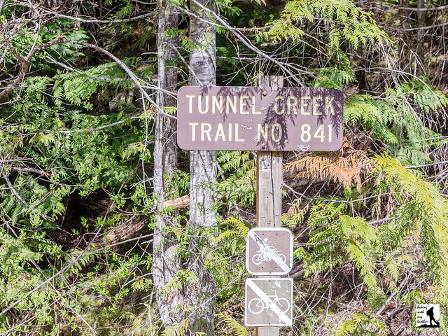
Tunnel Creek Trail #841 to 5050 Pass

Our Hiking Time: 4h 20m
Total Ascent: 2600ft
Highest Point: 5000ft
Total Distance: 8 miles
Location: N 47° 45.384, W 123° 05.489
Required Permit: None
Difficulty: Moderate

Nathans PhotoMore than a few months ago we headed out to the Olympic Peninsula in search of a quiet walk in the woods. We turned our attention to the Buckhorn Wilderness and found the Tunnel Creek Trail, which promised a creekside hike, as well as some panoramic views of wild and rugged peaks. That was more than enough to entice us down ten miles of forest road to this peaceful and engaging trail.

The Tunnel Creek Trail #841 is a through hike, meaning that hikers can start on either end of the trail to make their way up to 5050 Pass. Like most hikers we took the Quilcene approach, which is less steep and somewhat easier to navigate than the Dosewallips end. The Quilcene route begins by following Tunnel Creek into the Buckhorn Wilderness and the quiet shelter of old growth. Ancient trees line the trail as it carves its way through a mossy forest floor and gently climbs up the creek valley. Tunnel Creek is your cheerful companion as you press deeper into the trees, keeping your attention by playfully tumbling over fallen logs or cascading down rocky ravines.

After 2.7 miles reach the Tunnel Creek Shelter, which has offered hikers a roof since at least the 1930s. Take a moment to duck in and read the names and dates carved into the wood stretching back through the decades. Rest up, because from here the trail gets more serious about reaching the pass. Cross Tunnel Creek over a short footbridge and begin your mile long climb to Harrison Lake, following the trail as it works its way steeply up the mountainside. As you climb, the trees will part just enough to offer brief glimpses of Mt. Constance and hints of the views to come. Eventually you'll pass a small tarn just before reaching Harrison Lake at 3.7 miles, then continue upwards another .3 miles to 5050 Pass and a short scramble out to the overlook. One 1932 map notes the location as a “Fine View of Surrounding County,” and that is something of an understatement. Mt. Constance dominates this stunning scene, though in the distance to the north you can pick out Buckhorn Mountain and Iron Mountain. Settle in to see how many peaks you can find or do some exploring to see if you can find a better perch than we did. If you’re still hungry for a challenge, you can push another 4 miles down from 5050 Pass into the Dosewallips Valley, though the trek is reportedly rough and very steep.

Tunnel Creek is a great choice for those that want a little taste of everything on a hike; rushing mountain waters, big views, alpine tarns and old growth forests all a little off the beaten path. The trail shelter offers a decent turn around point for a shorter day, while the climb up past Harrison Lake to 5050 Pass is sure to satisfy hikers looking for a full day in the wilderness. The trail is well maintained and easy to follow, thanks in park to trail volunteers who work diligently to remove blowdowns. For all the trail has to offer, it's often overlooked, which makes it a good alternative to more popular hikes in the area.

To get there, take the Bainbridge Island Ferry and follow State Route 305 through Poulsbo to State Route 3. Follow SR 3 to the Hood Canal Bridge, taking a left over the bridge onto State Route 104. Follow SR 104 as it merges onto US 101 and continue 11.3 miles through Quilcene to Penny Creek Road. Take a right and continue 1.4 miles to a split in the road and the end of the pavement. Veer left onto the Big Quilcene River Road (FR 27). Continue 3.1 miles to the intersection with FR 2740 over sections of both pavement and gravel. Veer left onto FR 2740 and continue 6.8 miles to the end of the road and the trailhead. -Nathan

Print Google Directions >>

Tunnel Creek

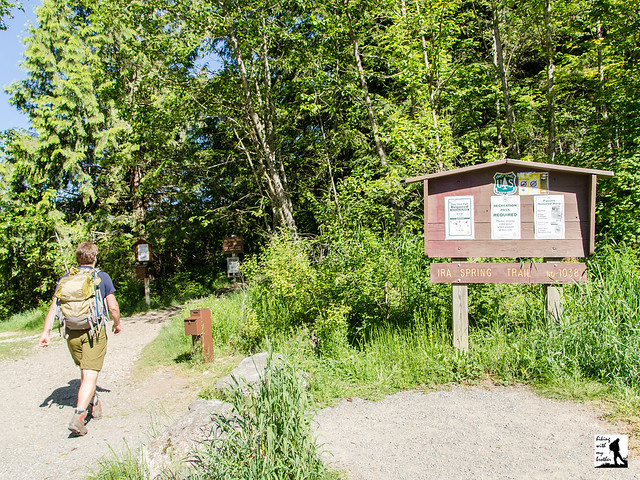
Island Lake via Ira Spring Trail #1038

Our Hiking Time: 5h 30m
Total Ascent: 2500ft
Highest Point: 4400ft
Total Distance: 10.2 miles
Location: N 47° 25.290, W 121° 32.185
Required Permit: Northwest Forest Pass
Difficulty: Moderate

Nathan's PhotoNot too long ago we decided to return to our old stomping grounds around Snoqualmie Pass to visit Island Lake, one of a handful of alpine lakes we’d overlooked on our last trek up Mt. Defiance. The lake is nestled at the base of Bandera Mountain about a mile beyond the beckoning shores of Mason Lake, putting it a little beyond the range of most day hikers.

Before the 1960s, the only way for hikers to reach Island Lake was to start at the Pratt Lake/Granite Mountain Trailhead and trek out to the Mt. Defiance Trail junction. Named for the lake’s small rocky island, the shores of Island Lake used to see many more visitors than it does today, and distant Mason Lake was a side trip for those heading to the top of Mt. Defiance. That changed in 1958, when a large wildfire on the slopes of Bandera Mountain prompted crews to hastily build a fire road to help fight the blaze. Not too long after, curious hikers took to exploring the area and using it as a “backdoor” to Mason Lake and as an approach to Bandera Mountain. Harvey Manning popularized the route and soon the official Mason Lake Trail #1038 was born, though its popularity soon led to erosion and a reputation for being steep, rocky, and often difficult to navigate. At the urging of wilderness advocate Ira Spring, a new route was proposed to address the trail’s issues, and between 2003 and 2004, a small army of volunteers in coordination with Forest Service made the trail a reality. With the passing of Spring in 2003, the new trail was renamed the Ira Spring Memorial Trail #1038.

The hike begins on the bones of the re-purposed fire road, with a grade suitable for conveying heavy machinery up a mountainside. Enter a young forest still recovering from fires that ravaged the mountain sometime in the nineteenth century as well as the 1958 fire. At times you can still catch the faint smell of charred wood mixed with the heavy aromas of pollen and dust. Leisurely weaving uphill, you'll cross Mason Creek early on before leaving the last of the water behind and entering the Alpine Lakes Wilderness. At 1.5 miles, the trail abruptly leaves the logging road and becomes serious, exchanging the road’s gentle grade for a steep and rocky path. After a short climb, the dusty trail moves beyond the pines for ever-larger glimpses at the valley below. Once the trail sheds the last of the trees, enjoy the enormous views that come with traversing a grassy mountainside.

At just under 3.0 miles, the Mason Lake Trail and the Bandera Mountain Trail diverge. Head left and to the west through sub-alpine meadows and talus fields, reaching the Ira Spring Memorial just before the short descent down to Mason Lake. While Mason’s lakeshore offers an abundance of campsites and the possibility of a refreshing dip, your destination lies beyond. Push onward following the trail along the lake and further from the shore to reach the Mt. Defiance Trail. Head right and soon find yourself wandering through peaceful tree-lined meadows. Pass Rainbow Lake at 4.0 miles and the signed junction to Island Lake at 4.5 miles. From here it’s just a short jaunt past a few tarns to sparkling Island Lake, resting quietly below Bandera Mountain. Find a cozy rock and enjoy a slice of tranquility.


The hike to Island Lake is a great option if you’re feeling ready to move beyond the more popular and well-trodden trails. While the first two-thirds of the route are likely to be crowded, as you push past the Bandera Mountain Trail junction and Mason Lake, you’ll soon find yourself almost entirely alone. Island Lake and Rainbow Lake also work as quick backpacking destinations, as you can be setting up camp on the quiet shores of a lovely alpine lake in fairly short order. Looking for more? The trail continues onward to connect with the Pratt Lake Trail #1007, providing access to Talapus Lake, Ollalie Lake and Pratt Lake. This also allows for the possibility of a through hike by parking a vehicle at the Ira Spring Trailhead and another at the Pratt Lake/Granite Mountain Trailhead.

To get there, take I-90 to Exit 45, going left under the freeway to Forest Road 9030. Follow FR 9030 for .9 miles until the road splits. Veer left onto FR 9031 and follow it for 2.9 miles until the road terminates in a parking lot. - Nathan

Print Google Directions >>

Island Lake

Eagle Lake & Paradise Meadow Backdoor

Our Hiking Time: 3h
Total Ascent: 500ft
Highest Point: 3900ft
Total Distance: 4 miles
Location: N 47° 47.668, W 121° 24.752
Required Permit: None
Difficulty: Easy

Nathan's Photo A few months ago we decided that we wanted to return to Barclay Lake and tackle the reportedly rough approach up to Eagle Lake. On our last trip we noted the unmarked junction, but decided to leave it for another day. When we were gearing up, we saw that there was a “backdoor” approach to the lake that piqued our interest. Still unmarked, this route had the advantage of being a little shorter and a new area to explore.

Back around the 1920s, prospectors patented a claim in the area around Eagle Lake and spent some time looking to strike it rich. The prospectors struck out, but soon after a gentleman by the name of Ole Stone built the Eagle Lake Cabin and lent his name to nearby Stone Lake. He also built cabins at both ends of Barclay Lake, kept the cabins well-supplied on his own dime and even maintained the trails from Baring up to Eagle Lake. Stone built the Barclay cabins for public use and eventually turned them over to the Forest Service, while reserving the Eagle Lake cabin for himself and his friends.

Perhaps because of Stone’s devotion to the area, for decades it was a favorite destination for the anglers, hikers, and backpackers willing to make the roughly 6.5 mile hike from Baring up to Barclay Lake. Things changed when timber companies began logging Barclay Creek valley in the late 1960s. Not only did the clear cutting practices radically change the landscape, but logging roads were cut more than 4 miles up the valley, making the once-remote Barclay Lake much easier to reach. The logging roads brought many more visitors to the area, and the Barclay Lake cabins could not stand up to all that extra wear and tear.  It wasn't long before they had to be removed.  At the same time, the trail up to Eagle Lake was largely abandoned. Today, while the same roads still lead many hikers and campers to Barclay Lake, only an intrepid few make it up to Eagle Lake.

From the roadside the rough trail begins by plunging into a second generation forest, heading uphill over rocks and roots. Soon pass into the Wild Sky Wilderness under an increasingly dense canopy of hemlock and fir for about two miles before reaching an unmarked junction. The trail to the left heads down to Stone and Barclay Lake. Keep right and continue into the beginnings of Paradise Meadow, shedding some of the forest for fields of huckleberry and heather. Creeklets cut across the fading trail for the next half mile as you approach the lakeshore.

Once you reach Eagle Lake, follow well-trodden bootpaths to the cabin to take in the setting. That’s Merchant Peak to the west, flanked by Townsend Mountain to the northeast. There are faint scrambles that you can follow to reach these summits, but they are involve some bushwhacking and route finding and are best left to the most adventurous of us. Settle in to enjoy this little slice of wilderness. When exploring the lake and the cabin, note that the cabin is stocked by the generosity of your fellow hikers. If you use something, replace it. Keep in mind that someone might have already claimed the cabin for the night, so not everything you find is necessarily up for grabs.

This is a fun hike if you’re looking to get a little off the beaten path. It’s unmarked and under the radar, which means you’re not likely to have much company. At the same time, that means the trail is a bit narrow and can get slightly overgrown. Still, a steady stream of folks keep the route reasonably clear and easy enough to follow. If you can swing it, consider a mid-week overnight when you’re likely to get access to the cabin and the sprawling night sky all to yourself.

From Monroe, head east on Hwy 2 to Skykomish. Just past mile post 49, turn left on Beckler Road, also designated as FR-65. Reset your odometer after turning onto FR-65. Go 0.7 miles on Beckler Road and turn left on FR-6510. About 1 mile later, veer left onto FR-6514. Go another 3.6 miles and veer right on FR-6514. Continue 1.3 miles to an unmarked fork and veer left. Two-tenths of a mile later, come to a parking area marked with a National Forest Wilderness sign at a hairpin turn. There is parking for 6-7 cars, but no privy. If you reach a 'T' intersection, you've gone too far.

Print Google Directions >>

Eagle Lake & Paradise Meadow

Lena Lake Trail #810

Our Hiking Time: 3h 15m
Total Ascent: 1200ft
Highest Point: 1900ft
Total Distance: 5.8 miles
Location: N 47° 37.227, W 123° 9.659
Required Permit: Northwest Forest Pass
Difficulty: Easy

Nathan's PhotoEarly this past summer we headed out to Hood Canal to hike the Lena Lake Trail, one of the most popular trails in the area and one with a long history. While the shores of a large alpine lake always draw a crowd, Lena Lake also serves as a basecamp for exploring Upper Lena Lake, the Brothers Wilderness, portions of the Olympic National Park and a whole host of mountaintops.

For eons, Lena Creek flowed down between the shoulders of Lena Mountain and Mt. Bretherton. Then, roughly 1,000 years ago, a massive section of the ridge above the creek slid down into the basin below, blocking the creek. The creek backed up and Lena Lake was formed. Dozens of huge, moss-covered boulders from that slide can be seen from the trail, still sitting where they tumbled to rest centuries ago. Sometime in the late 1910s or early 1920s, the Hamma Hamma Lumber Company built a railroad to access timber in the Hamma Hamma Valley, paving the way for easier access to wilderness once reserved for trappers and prospectors. In 1927 Boy Scout Camp Cleland was established at Lena Lake and eventually grew to 6 scout cabins, a dock, a cook house and even a water system. Over the years thousands of Boy Scouts spent summers at Camp Cleland, including some that eventually made names for themselves in the outdoor community such as Chet Ullin and Ira Spring. By the late 1930s improvements to the Hamma Hamma Road and the Lena Lake trail provided easy access to the unattended camp. After months of rough use, the scouts would return in the summer to find ruined cabins and stolen supplies and by 1941 the decision was made to close the camp. Today all the remains of the camp is a small plaque on Chapel Rock commemorating the experiences of Cleland’s scouts and leaders.

From the trailhead, the well-maintained Lena Lake Trail #810 begins a series of fairly gentle switchbacks before starting to climb in earnest. As you climb, listen to the rushing sound of Lena Creek and watch as a young forest slowly gives way to sturdy old growth. After about two miles, cross a footbridge spanning Lena Creek and press onward for another mile through mossy forest to reach Chapel Rock. Perched a few hundred feet above the lake, Chapel Rock is a favorite stopping point for hikers to take in the panorama below. Have a snack or break out your lunch and enjoy the view before continuing down to the shore.

From Chapel Rock it's a short jaunt to Lena Lake, though the trail continues out to the far end of the lake, with plenty of opportunities to grab a little section of rocky beach. Along the way you’ll pass the trail for Upper Lena Lake and eventually cross a footbridge over Lena Creek. Here you can find the lake’s 28 campsites. From the camp the trail continues onward into the Valley of the Silent Men and provides access to the many scramble routes up the shoulders of The Brothers. Whether you’re spending the night or just want a longer day hike, a climb to Upper Lena Lake is well worth the effort, though the 3.5 mile climb is rougher and more difficult than the main trail.

Lena Lake is a classic. Approachable by almost any hiker and very popular in the summer, it’s a hike almost everyone knows. The hike is also a perfect option for an introductory backpack or a day hike with the kids. And while the lake loses some luster when the water level drops late in the season, the quiet, tree-lined shores offer solace and more than a day’s worth of exploration.

To get there, take I-5 south to Olympia to Exit 104 toward Aberdeen and Port Angeles. Follow US 101 along Hood Canal almost 49 miles through Shelton and Hoodsport to FR 25, also known as the Hamma Hamma River Road. Take a left and follow the road 7.6 miles to the Lena Lake Trailhead. Privy available. -Nathan

Print Google Directions >>

Lena Lake
Copyright 2008-2016 - hikingwithmybrother.com
hikingwithmybrother@gmail.com