about us | links | permit info
Subscribe to Hiking With My Brother Email Subscribe Follow Hiking With My Brother on Facebook Follow Hiking With My Brother on Twitter Hiking With My Brother Picasa Hiking With My Brother YouTube

Lake of the Angels via Putvin Trail #813

Our Hiking Time: 6h 45m
Total Ascent: 3400ft
Highest Point: 4950ft
Total Distance: 7 miles
Location: N 47° 35.8200, W 123° 16.3440
Required Permit: None
Difficulty: Hard

Nathan's PhotoWe headed back over to the Olympic Peninsula to take on a famously obscure hike of legendary proportions. With names like the Valley of Heaven and St. Peter’s Gate, we anticipated a trip to the Lake of Angels would be stunning – and it delivered.

While we highly recommend this hike, it’s definitely not for the unprepared. It’s not the most difficult hike we’ve ever done, but the Lake of Angels was certainly challenging to get to. At the same time, many guidebooks give the impression that this trail requires some serious mountaineering skills to tackle – this is not the case. While there is one very small section that will probably require you to use some handholds to help you climb up the roots and rocks, that’s as harrowing as it gets. lake of angels valley of heaven hiking with my brotherIf you’re a strong hiker and are looking for something a little out of the ordinary, this is definitely a trail to check out. There are a few wilderness campsites around the lake, making an overnight an easy option. From the lake there is access to a variety of destinations including Hagen Lake or Mt. Stone and the Stone Ponds via a pass known as St. Peter’s Gate.

There's a lot more to Lake of the Angels, and you can learn all about it in our book, Hiking Through History Washington.  You'll find a trail map, route descriptions, history, and more for this and many more hikes throughout the State.  Help support hikingwithmybrother.com and the work we do by picking up a copy!

To get there, take I-5 south to Olympia to Exit 104 toward Aberdeen and Port Angeles. Follow US 101 along Hood Canal almost 49 miles through Shelton and Hoodsport to FR 25, also known as the Hamma Hamma River Road. Take a left and follow the road 12 miles to the trailhead just beyond Boulder Creek. The last five miles of the road are unpaved and have seen some washouts. A high clearance vehicle is recommended. -Nathan

Print Google Directions >>
Lake of the Angels

Upper Royal Basin via Royal Creek Trail #832

Our Hiking Time: 12h
Total Ascent: 3000ft
Highest Point: 5700ft
Total Distance: 16 miles
Location: N 47° 49.2780, W 123° 13.1160
Required Permit: Northwest Forest Pass
Difficulty: Moderate

Nathan's PhotoIt has been a long time coming, but this week we finally hopped a ferry and did our first hike in the Olympics. Despite the logistical hassle of ferries and extra driving time, we were excited to explore some new territory. We decided to start with the heavily traveled and ever-popular Royal Basin, one of the jewels of the Olympic National Park’s rain shadow region.

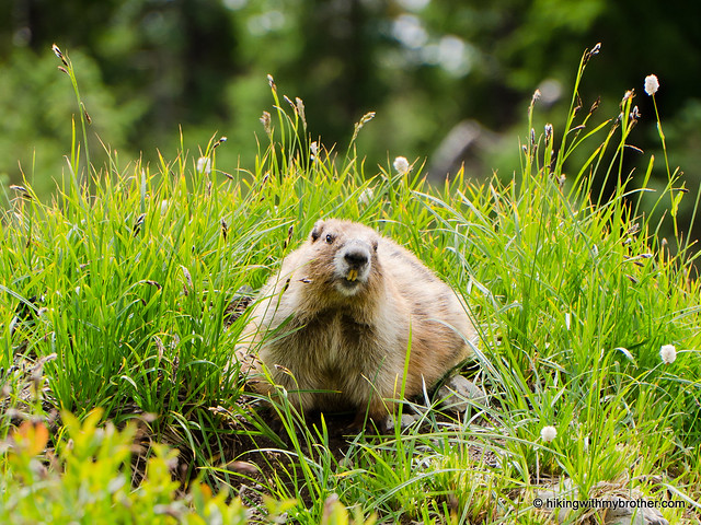
This is an excellent hike, one that we recommend you consider for a weekend backpack. The distance from Seattle and the length of the hike makes this a very long day if you’re not planning on anroyal basin hikingwithmybrother overnight. Though, on a sunny day the Royal Creek Valley is picturesque in and of itself, making a shortened version of this hike well worth the effort. Although definitely a popular and well-known hike, we did not encounter that many people along the way. In fact, we ran into more wildlife than people – not only a countless number of deer, but marmots and a few close

There's a lot more to Royal Basin, and you can learn all about it in our book, Hiking Through History Washington.  You'll find a trail map, route descriptions, history, and more for this and many more hikes throughout the State.  Help support hikingwithmybrother.com and the work we do by picking up a copy!

To get there, take the Bainbridge Island Ferry, following State Route 305 through Poulsbo to State Route 3. Follow SR 3 to the Hood Canal Bridge, taking a left over the bridge onto State Route 104. Follow SR 104 as it merges onto US 101 and continue another 18 miles and turn left onto left on Palo Alto Road. From here, take a right onto FR 2880 near the Dungeness River. Continue just under two miles to FR 2870. Head left and follow for six-and-a-half miles to the trailhead. -Nathan

Royal Basin

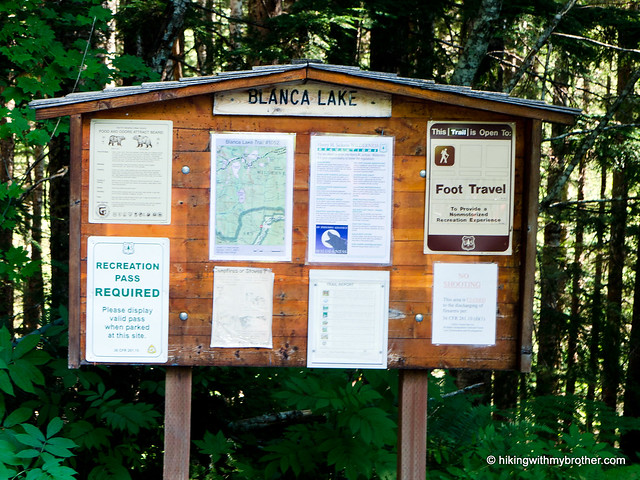
Blanca Lake Trail #1052

Our Hiking Time: 4h 40m
Total Ascent: 3400ft (2700ft in; 700ft out)
Highest Point: 4700ft
Total Distance: 7.5 miles
Location: N 47° 56.0760, W 121° 20.5920
Required Permit: Northwest Forest Pass
Difficulty: Hard

Nathan's PhotoThe bright blue skies of a September weekend were enough to push us to tackle an alpine lake that’s been on our list for years: Blanca Lake. The hike is known for the vivid colors of the lakewater and a relentless series of switchbacks gaining nearly 3000ft in three miles. We expected a challenge and Blanca Lake delivered.

blanca lake hikingwithmybrother

We recommend this hike for most hikers, though some will find the elevation gain a little too taxing. Of course, as we mentioned, Lake Blanca attracts quite a few hikers, and you can expect quite a bit of company when you make the trek. However, this isn’t a hike to do early in the season to avoid the crowds, as the lake needs to thaw in order to reveal its trademark colors. This is definitely a destination for those hikers looking for something a little different – Lake Blanca is not your typical alpine lake.

There's a lot more to Blanca Lake, and you can learn all about it in our book, Hiking Through History Washington.  You'll find a trail map, route descriptions, history, and more for this and many more hikes throughout the State. Help support hikingwithmybrother.com and the work we do by picking up a copy!

To get there, take Highway 2 out past Skykomish to milepost 50. Take a left onto FR 65, also known as the Beckler River Road. Continue for almost seven miles to a junction and pavement end. From here continue north for just under six miles to a 5-way intersection known as Jack Pass. Take the second left and continue two-and-a-half miles to FR 63. Turn right and drive two miles to the trailhead. -Nathan

Print Google Directions >>

Blanca Lake

Jolly Mountain Trail #1307 - Shortcut

Our Hiking Time: 4h
Total Ascent: 1800ft
Highest Point: 6433ft
Total Distance: 7.5 miles
Location: N 47° 23.0220, W 121° 1.2900
Required Permit: None
Difficulty: Moderate

Nathan's PhotoThis week we headed over Snoqualmie Pass to continue exploring the Teanaway area. After flipping through some guidebooks and doing a little research online, we set our sights on Jolly Mountain. With clear skies overhead we geared up and headed up the trail toward great views and the remains of a fire lookout.

jolly mountain hikingwithmybrotherThere are a number of approaches to Jolly Mountain. The more traditional approach is via the Jolly Mountain Trail #1307, a 12 mile route through pine forest climbing over 4000ft along the way. We decided to take a shortcut to shave off some of that distance and elevation by following logging roads halfway up the mountainside. While shorter, the shortcut is somewhat less scenic, as it involves hiking along forest roads and traversing a few clearcuts. Still, the views from the summit are the real price of this hike, and the shortcut delivers you to those views quickly.

Unfortunately, we couldn’t determine how the mountain came to be known as Jolly, though we assume there is probably a good story behind it. Between the railroads and the Forest Service, fire spotters were camping on Jolly Mountain’s summit by 1916, though it would be five more years before permanent cabin would be constructed. In 1936, the cabin was replaced and remained standing for over 30 years before it was destroyed in 1968. Today, lingering pieces of rusting metal and some carefully arranged rocks are the only remains of the lookout.

jolly mountain hikingwithmybrotherThe shortcut begins by following FR 4315 as far up the mountain as possible. There are two gates along the road, if the first one is locked, you’re better off taking the traditional approach rather than hiking up miles of steep forest road. For us, we were stopped and the second gate, which left only about a mile of road to deal with before connecting up with the Sasse Mountain Trail #1340 and ascending the ridge. The route has a number of ups and downs, so be prepared for something of a workout. And, while hiking through clearcuts isn’t typically something we look forward to doing, in this case they provided a great preview to the vistas that awaiting you at the summit.

There are a number of trail junctions along this route which can potentially cause some confusion. To avoid getting turned around, stick to the Sasse Mountain Trail until is connects with Jolly Mountain Trail #1307. Here, head uphill and stay on the Jolly Mountain Trail until you reach the summit and its impressive 360-degree views. You’ll be able to easily pick out Mt. Rainier, Glacier Peak, Mt. Adams, Mt. Stuart and Mt. Daniel. Some of Jolly’s neighbors are also in attendance, including Sasse Mountain and Skookum Peak. Plan on spending some time here soaking up these expansive views.

jolly mountain hikingwithmybrotherWhile a shortcut, this route is still a little hard on the knees, so we don’t recommend it for everyone. However, the views rank among some of the best we’ve ever seen, making it more than worth the effort to get to the top. Much like Hex Mountain, this is not a wildly popular hike, typically seeing more traffic during the winter months, so you’re unlikely to run into too many other hikers. However, both the Sasse Mountain Trail and the Jolly Mountain Trail are open to both motorcyclists and horseback riding, so be prepared to share the trail.

To get there, take I-90 to Exit 80. Head left over the freeway following Bullfrog Road to SR 903. Follow 903 15.8 miles through Roslyn and along Cle Elum Lake to FR 4315. The road is not well signed, if you hit the Salmon La Sac Guard Station, you’ve gone too far. Once you find FR 4315, take a right and follow it about six miles as it switchbacks up the mountainside to a locked gate. Park and head up the road to connect with the Sasse Mountain Trail. –Nathan

Jolly Mountain
Copyright 2008-2016 - hikingwithmybrother.com
hikingwithmybrother@gmail.com