about us | links | permit info
Subscribe to Hiking With My Brother Email Subscribe Follow Hiking With My Brother on Facebook Follow Hiking With My Brother on Twitter Hiking With My Brother Picasa Hiking With My Brother YouTube

Little Ranger Peak

Our Hiking Time: 2h 30m
Total Ascent: 1500ft
Highest Point: 3900ft
Total Distance: 5.5 miles
Location: N 47° 1.8660, W 121° 31.7520
Required Permit: Northwest Forest Pass
Difficulty: Moderate

Nathan's PhotoOnce again finding ourselves a little tight on time, we headed back out to 410 for a short hike up to a prominence known as Little Ranger Peak. Drawn to the promise of an expansive view of the White River Valley we packed up hoping the weather would be in a cooperative mood by the time we got to the top.

With its gentle grade and quick rewards, take this little hike up to a rocky prominence if you’re short on time. Be aware that you may be sharing the trail with mountain bikerslittle ranger peak hikingwithmybrother and be prepared to give them a little room – the trail is much more challenging on a bike! And, as a word of caution, clambering all the way out to the viewpoint can be dangerous, especially if the rocks are slick with moisture. Use caution if you decide to risk the scramble.

There's a lot more to Little Ranger Peak, and you can learn all about it in our book, Hiking Through History Washington.  You'll find a trail map, route descriptions, history, and more for this and many more hikes throughout the State. Help support hikingwithmybrother.com and the work we do by picking up a copy!

To get there, take I-5 south to Highway 18 Exit 142A. Follow Highway 18 into Auburn and take the SR 164 exit. Head left on SR 164 through Enumclaw to SR 410. Head left onto SR 410 and continue to milepost 54 and the Buck Creek Recreation Area. Take a right over the bridge to find parking. Gear up and hike back out to 410, crossing the highway, either hiking straight up the hill side or a few hundred yards west to the junction with the White River Trail. -Nathan

Print Google Directions >>

Little Ranger Peak

Hex Mountain via Sasse Mountain Trail #1340

Our Hiking Time: 2h 30m
Total Ascent: 1500ft
Highest Point: 5030ft
Total Distance: 5 miles
Location: N 47° 19.2600, W 121° 3.8760
Required Permit: Northwest Forest Pass
Difficulty: Moderate

Nathan's PhotoThis week, the forecast predicted the type of clear and sunny day that just begs for a summit hike. With so many nearby mountaintops still covered in snow, we decided to head out over Snoqualmie Pass hoping to avoid another snowshoe. Luckily, our hunch panned out – snows have retreated much further on the east side of the mountains, and our hike up Hex Mountain was almost snow-free.

Short and rewarding, this is a great hike to take your reluctant hiking friends on. The trail is in great shape and not at all rough, with only one small blowdown along the way. The elevation gain might be little strenuous for some – about 600ft per mile – but should be approachable for most. hex mountain hikingwithmybrotherAnd the views will be enough to placate any complaints. As an added bonus, the motorcycles do a decent job of keeping other hikers at bay – don’t expect too much company on this one. Ideally, hit this one during the work week to dodge the motorized traffic.

There's a lot more to Hex Mountain, and you can learn all about it in our book, Hiking Through History Washington.  You'll find a trail map, route descriptions, history, and more for this and many more hikes throughout the State. Help support hikingwithmybrother.com and the work we do by picking up a copy!

To get there, take I-90 to Exit 80. Head left over the freeway following Bullfrog Road to SR 903. Follow 903 for 10 miles through Roslyn and along Cle Elum Lake to FR 4305 (about 1/4 mile before the Wish-poosh Campground). Turn right into FR 4305 and follow for a half-mile to the first intersection. Veer left and continue on FR 4305 for another mile, watching for a sign pointing left to Sasse Mountain. From here it is another mile to the end of the road and the trailhead. –Nathan

Hex Mountain

Myrtle Lake via Dingford Creek Trail #1005

Our Hiking Time: 6h 45m
Total Ascent: 2400ft
Highest Point: 3800ft
Total Distance: 10 miles
Location: N 47° 32.842, W 121° 22.958
Required Permit: Northwest Forest Pass
Difficulty: Moderate

Nathan's PhotoThis week we returned to the Middle Fork Valley to take on a hike that has been on our list for years – Myrtle Lake via the Dingford Creek Trail. After our recent Rock Creek experience, we wanted to make sure we made it to our destination. We geared up for deep snow and headed up to the lake.

Myrtle Lake is the more popular of the trail’s two major destinations, the other being Hester Lake. Frequented mostly by backpackers and fishermen, the lakes don’t see a great deal of traffic. This is probably because, in addition to the trailhead’s relatively remote location, FR 56 is subject to intermittent-and-frequent-enough-to-frustrate closures at the Taylor River - which adds another ten miles to the hike. This portion of FR 56 is slated to close for repairs this summer. Maybe these will make the trailhead more accessible in years to come.

myrtle lake hikingwithmybrotherThe Dingford Creek Trail begins steeply, following Dingford Creek. The first mile is for the most part rocky switchbacks that eventually yield to a gentler grade upon entering the Alpine Lakes Wilderness. Here the second growth forest, replaced by older stands of fir and cedar, deepens, and begins to feel wilder. At three miles, the trail forks. The right branch leads out to Hester Lake, so continue to the left for Myrtle. Although we’ve not yet tried our hand at the Hester Lake Trail, it is reportedly rough as well as notoriously marshy.

myrtle lake hikingwithmybrother
Past the junction, you’ll cross a couple of major streams flowing down from various small lakes tucked into the hills above the creek basin. The grade continues to ease as you approach Myrtle, eventually depositing you on the shores of the shallow lake. On a clear day, Big Snow Mountain looms above, an impressive backdrop to a typical alpine lake. There are a few comfortable camping sites here, making it an ideal base camp for exploring the sprawling lake country above.

If you’re one of those heading on to explore, a faint path continues along the lakeshore and switchbacks up for about a mile to Little Myrtle Lake. From here, there is cross-country access to the Arthurian-inspired Merlin, Le Fay and Nimue Lakes to the west, and to Big Snow Lake to the east. Or, you could just climb a little higher to a pass above Little Myrtle Lake to get some views of Lake Dorothy far below.

The snow made this hike a little more difficult for us than it would be after the melt. However, the trail more than makes up for it – rushing waters, open valleys, deep forests are all here. It’s easy to see why some hikers are so fond of this trail. With all the effort it takes to get to the lake, myrtle lake hikingwithmybrotherwe recommend this more as an overnight than a day hike. After 18 miles of pot-holed forest road, and nearly 2400ft in elevation gain, there isn’t much energy left to explore all the other nearby hidden vistas and lakes. Save this one for your first backpack of the season.

To get there, take Exit 34 off I-90 and take a left on 468th Ave. Follow the road past the truck stop for about a half-mile until you reach SE Middle Fork Road, also known as Forest Road 56. Continue to follow the twists in the road until the pavement runs out. Continue on FR 56 for 12 miles, crossing the Taylor River. Once across, FR 56 veers to the right while the Taylor River Road continues another quarter mile to the Snoqualmie Lake Trailhead. Veer right and continue for about five miles to the Dingford Creek Trailhead. -Nathan

Myrtle Lake

Rock Creek Trail #1013.1

Our Hiking Time: 6h 20m
Total Ascent: 2800ft
Highest Point: 4100ft
Total Distance: 12.5 miles
Location: N 47° 29.3580, W 121° 26.3120
Required Permit: Northwest Forest Pass
Difficulty: Hard

Nathan's Photo
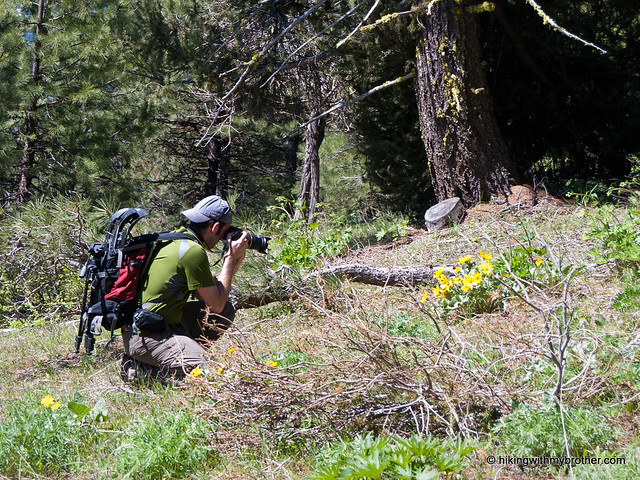
Last year, on our hike out to Goldmyer Hot Springs, we passed by an intriguing side trail signed “Rock Creek.” We made a mental note of the rough-looking spur and with warming temperatures and the re-opening of the Dingford Creek Road we returned to investigate.

During the early 20th century, the Rock Creek Trail served as a link between the Snow Lake mining claims and the bustling timber industry of the Middle Fork Snoqualmie Valley. As the mines closed and the timber interests moved on, hikers and backpackers took their place. The Rock Creek Trail was once part of the Cascade Crest Trail, a regional predecessor of the Pacific Crest Trail (PCT). When PCT trailblazers blasted a more efficient route into the side of a mountain – now known as Kendall Katwalk – the Rock Creek route was largely abandoned. Today, the trail has become a road less traveled, with relatively few visitors every year.

rock creek hikingwithmybrotherFrom the 
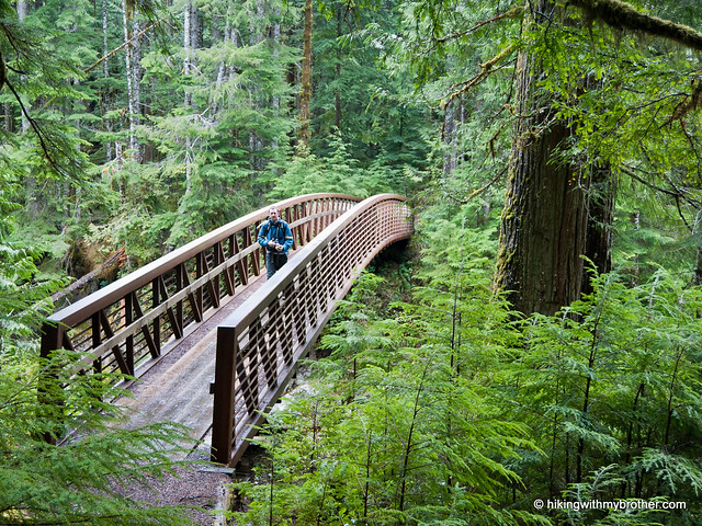
Dingford Creek Trailhead, drop down and cross the Middle Fork Snoqualmie River, before joining up with the Middle Fork Trail. The trail follows the river through second growth forests with only a few short bursts of elevation. Cross Wildcat Creek and eventually join up with the old railroad grade which that will carry you almost all the way to Rock Creek. The grade over the creek washed out long ago, forcing a short detour downstream to cross the creek and rejoin the grade on the other side. Here, after three and a half miles, find the signed junction to the Rock Creek Trail 1013.1.

rock creek hikingwithmybrother
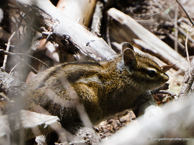
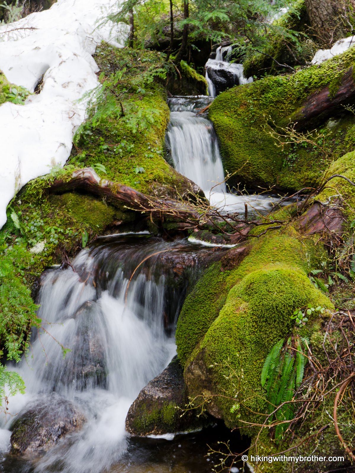
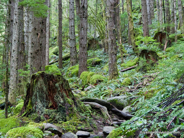
The hike now begins in earnest. The trail is steep, rough, and rocky. It steadily climbs up the creek basin in a long series of tight switchbacks. As you gain elevation, you slowly enter old growth forest, complete with massive firs and hemlocks. Cross mossy talus fields while taking in views of Mt. Garfield’s sprawling granite faces. Hop across numerous streamlets that cut across your path as you continue your uphill battle into the Alpine Lakes Wilderness and eventually to the impressive Rock Creek Falls. Watch as waters flow out of Snow Lake and cascade almost 1200ft down to the basin.

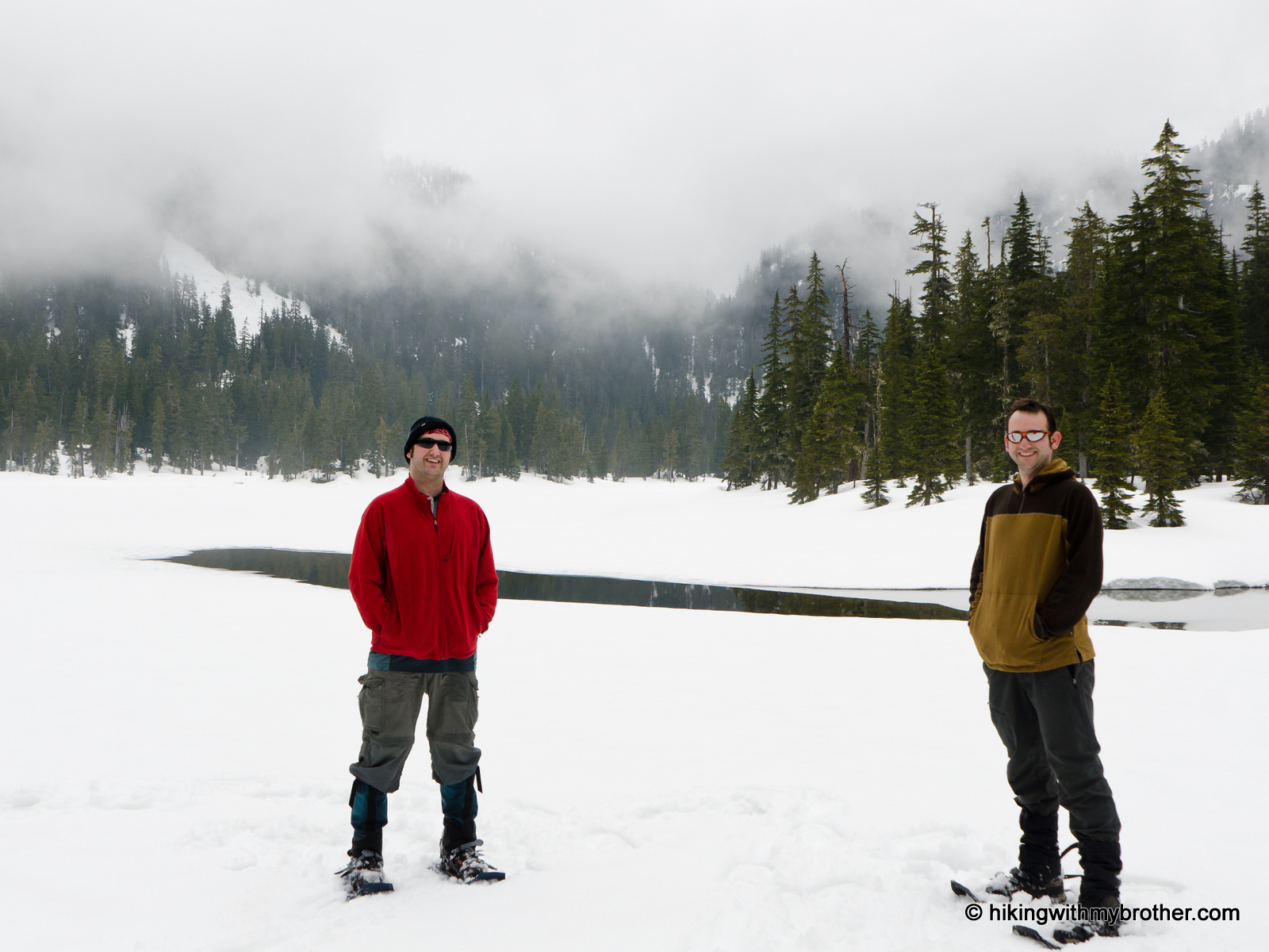
Or, so we’re told. Our trek up to the falls was a bit premature, as deep snows forced us to turn back a half-mile from our destination. On the other hand, most hikers report that by the time full summer hits, the trail becomes a little overgrown, and often requires some bushwhacking to get to the falls. Either way, reaching one of the largest waterfalls in the Alpine Lakes Wilderness is going to take some effort. As for us, we’re planning on visiting Rock Creek Falls as part of a hike out to Gem Lake sometime in the coming months.

rock creek hikingwithmybrotherThis is not an easy hike, though it is a great alternative approach to Snow Lake that exchanges the crowds for an impressive waterfall. But this route doesn’t get a lot of traffic, and it shows – the trail is rough, narrow, and overgrown. You’ll definitely want to bring the gaiters and some hiking poles on this one. However, if solitude is what you’re after, this trail comes highly recommended.

To get there, take Exit 34 off I-90 and take a left on 468th Ave. Follow the road past the truck stop for about a half-mile until you reach SE Middle Fork Road, also known as Forest Road 56. Continue to follow the twists in the road until the pavement runs out. Continue on FR 56 for 12 miles, crossing the Taylor River. Once across, FR 56 veers to the right while the Taylor River Road continues another quarter mile to the Snoqualmie Lake Trailhead. Veer right and continue for about five miles to the Dingford Creek Trailhead. -Nathan

Rock Creek

Historic Robe Canyon Trail

Our Hiking Time: 2h
Total Ascent: 300ft
Highest Point: 1080ft
Total Distance: 3 miles
Location: N 48° 5.7780, W 121° 51.9000
Required Permit: None
Difficulty: Easy

Nathan's PhotoUnexpectedly nice weekday weather tempted us out to the Mountain Loop Highway and back to Robe Canyon Historic Park for a post-work hike along the Stillaguamish River. We’d already explored the west end of the park and the Lime Kiln, so we decided to start from the other end of the park; following the Old Robe Trail through the historic town site of Robe out to the railroad tunnels.

robe canyon hikingwithmybrotherWe recommend this three-mile jaunt as an after-work hike or just a quick visit to nature. For a short hike, this trail manages to cover a variety of landscapes and is steeped in history. While not at all something you need to break out the compass and gaiters for, it is still a little wilder than Mt. Si or Tiger Mountain.

There's a lot more to Robe Canyon, and you can learn all about it in our book, Hiking Through History Washington.  You'll find a trail map, route descriptions, history, and more for this and many more hikes throughout the State. Help support hikingwithmybrother.com and the work we do by picking up a copy!

To get there, take I-5 North to Exit 194. Follow Highway 2 for about two miles. Stay in the left lane and merge onto Lake Stevens Highway 204. Follow for two miles to Highway 9. Take the left onto Highway 9 toward Lake Stevens. In just under two miles, reach Highway 92 to Granite Falls. Take a right and follow for about eight miles to Granite Falls. Proceed through the town to the Mountain Loop Highway following it for six miles. Keep an eye out for cars parked on the right side of the road and a large brick sign across from Green Mountain Road. Park on the shoulder. -Nathan

Print Google Directions >>

Robe Canyon
Copyright 2008-2016 - hikingwithmybrother.com
hikingwithmybrother@gmail.com