about us | links | permit info
Subscribe to Hiking With My Brother Email Subscribe Follow Hiking With My Brother on Facebook Follow Hiking With My Brother on Twitter Hiking With My Brother Picasa Hiking With My Brother YouTube

Iron Horse Trail - John Wayne Pioneer Trail

Our Hiking Time: 3h 30m (biking)
Total Ascent: 450ft
Highest Point: 2400ft
Total Distance: 18 miles
Location: N 47° 23.5620, W 121° 28.4400
Required Permit: Discover Pass
Difficulty: Easy

Nathan's PhotoSnaking along mountainsides from North Bend to Snoqualmie Pass and beyond, our hikes often involve treading on some portion of Iron Horse State Park. Sometimes referred to as the “backbone” of the Mountains-to-Sound Greenway, the 21 miles of the Park that lie between Hyak and the Cedar Falls Trailhead at Rattlesnake Mountain are quite popular, seeing thousands of hikers and bikers a year. We decided it was time to tour this portion of the Park. Because we’d already hiked sections of it, we opted to bike and experience the trail a little differently.

iron horse trail hikingwithmybrotherThe 110-mile long Iron Horse State Park follows the railbed of the Chicago, Milwaukee, St. Paul & Pacific Railroad. The park is the developed portion of the John Wayne Pioneer Trail, which continues out to the Idaho border. The Milwaukee Railroad went bankrupt in 1977, and Washington State slowly acquired the land. By the mid-1980s the process of converting the railroad to a multi-use trail had begun.

One of the most popular attractions over the years has been the Snoqualmie Tunnel, often referred to as Tunnel 50.  The two-mile tunnel was bored between 1912 and 1914 by 700 men working from either side and meeting in the middle. After its conversion to a park, the tunnel made for a spooky addition to a hike or ride – dark enough to require a flashlight to navigate, and complete with dripping water, echoing conversations, and the chill of being underground.

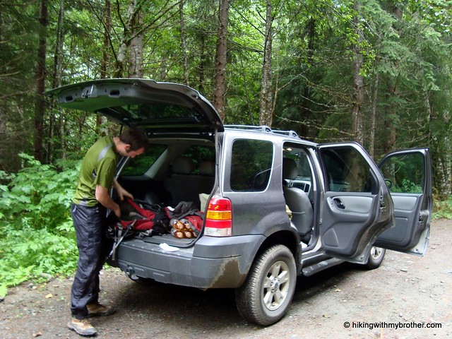
Unfortunately, there is no real detour around the tunnel closure, so we had to improvise. We parked at the Annette Lake Trailhead and pushed our bikes two-thirds of a mile to the Iron iron horse trail hikingwithmybrother
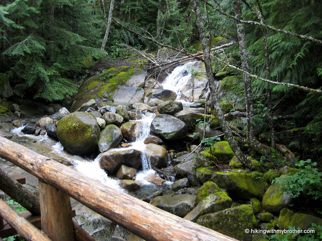
Horse Trail. Once we got going the ride was a breeze, passing old snow sheds and depots and going over trestles, the relics of the Milwaukee Railroad that add flavor to the flat trail. Although it’s impossible to escape the dull roar of I-90, dozens of creeks and streams offer nice stopping points to trade the noise for the sound of rushing water. A number of campsites also dot the trail, offering a few comfortable places for the long distance hiker or biker to bed down for the night.

Iron Horse State Park is a great way for anyone to experience the Snoqualmie Valley. Whether hiking, biking, jogging or just passing through on your way to another destination, it has something to offer everyone. The wide path also makes this a great way for a larger group to do an activity together and avoid walking single file down the trail. The compact gravel means that the park is stroller and wheelchair friendly.

To get there, take I-90 to exit #32 and turn right, following Cedar Falls Road three and a half miles to the trailhead. Alternatively, when the tunnel reopens, take exit #54 and turn right to Highway 906, also known as Road 2219. Take a left for a half-mile following the signs to Iron Horse State Park. -Nathan

Iron Horse Trail

Duke, Duchess, and Earls of Kent

Our Hiking Time: 3h
Total Ascent: 700ft
Highest Point: 3000ft
Total Distance: 2.5 miles
Location: N 47° 23.6520, W 121° 36.3300
Required Permit: None
Difficulty: Moderate

Nathan's PhotoThis week we decided to go a little off the beaten path and explore a set of crags known as the Duke, Duchess, and Earls of Kent. Situated on the opposite side of the Alice Creek Valley from Mt. Kent, the lonely cliffs get few visitors. After a little research, the approach seemed relatively straightforward, so we packed up and headed out I-90 toward Mt. Gardner hoping for better experience than the last time we were there. No such luck.

The route to the base of the crags is entirely along forest roads, duke of kent hikingwithmybrotherbeginning at the roadblock just before the Alice Creek washout along FR 9020. As we started down the path, we noticed the washout had been repaired, and wondered at the large tire marks as we progressed up the relatively steep forest road. About a half-mile into our journey, the road abruptly ended. It was clear this was where all the machinery we’d seen indications of had been working. Huge holes had were scooped out of the road and brush and fallen logs were scattered across the roadbed.

We’d seen treatment similar to this before – churning up a few dozen feet of road to prevent motorized access – so we pressed on, anticipating the road to quickly reappear. It never did. For the next mile or so we slogged through rock-filled soft earth, clinging underbrush, and rain-soaked debris. Every last inch of the former road and been obliterated. By the time we got to the base of the crags, we looked up into the fog and decided we’d had enough of the soggy day and headed back to the car.

Did we mention it was raining? Of course it was.

It’s pretty rare that we find ourselves on a really bad hike. Sometimes the trail is overgrown, sometimes the weather is awful or sometimes our information is bad and we hike in the wrong duke of kent hikingwithmybrotherdirection. But this hike presented us with a first: never before have we unexpectedly found the route to our destination utterly demolished. We hunted around online for details on the project, but came up empty. One has to wonder why so much effort was put into breaking up the road, when typically they are left to slowly fade away. Or why money was spent on this project and not some other much needed forest road maintenance.

The lesson here is that even if you do your research, it’s possible to get out on the trail and find that conditions have drastically changed. Had the weather been better, we probably would have scrambled up the talus fields to check out the views, but the rain and fog made us stop for the day before we discovered any more unpleasant surprises.

We don’t recommend this hike for anyone, but if for some reason you’d like to go there, take I-90 to Exit 38. Then take a right and head past Olallie State Park and the access to Deception Crags for about two miles to reach FR 9020. Follow the progressively rougher logging road to the roadblock at 4.5 miles. - Nathan

Duke of Kent

Free iPhone App | Hiking With My Brother

Jer's Photo Hiking With My Brother has gone truly mobile with the release of the first version of our free iPhone application. Take us on the go and never be without the information that you need to find a hike and to stay on route. Sick of work? Use our app to pull up our latest trip reports and in no-time you'll be day-dreaming of summit panoramas, pristine alpine lakes, and cascading waterfalls. Just like hikingwithmybrother.com, start by using the Hike Map to find a trip you want to take...
Hike Map
Trip Report


...then, tap the blue arrow on the Hike Map and review the Trip Report for the hike. Or, tap "Blog" at the bottom of the screen to check out a list of trip reports just like the RSS feed. Browsing photos from the hikes is easy too! Tap on "Photos", to pull up a list of Photo Galleries...

Photo Galleries
Gallery


...tap the Gallery that you want to see and the photos of the hike will be pulled up as a grid of thumbnails that you can easily browse. To see all the features that our iPhone App has to offer, go to the apple iPhone App store, or click on the Hiking With My Brother iPhone App icon below. -Jer

Bare Mountain Trail #1037

Our Hiking Time: 4h
Total Ascent: 3200ft
Highest Point: 5353ft
Total Distance: 8.2 miles
Location: N 47° 38.9640, W 121° 30.4500
Required Permit: Northwest Forest Pass
Difficulty: Moderate

Nathan's PhotoThis week we returned to the North Fork Snoqualmie to tackle Bare Mountain, a summit we’d had our sights on for a few months. The site of a fire lookout cabin from 1935-1973, we were looking forward to the mountaintop’s famed panoramic views. Despite a cloudy morning, we optimistically packed up and headed out to North Bend.

The Bare Mountain Trail #1037 follows the remains of a mining bare mountain hikingwithmybrotherroad built to service the mines drilled into the mountainside above Bear Creek. Around the two mile mark, where the trail to the summit abruptly switchbacks upwards, the mining road continues onward to the mines. Although we did not hike out to the mines, there are reportedly many open adits to explore, along with a substantial amount of derelict mining equipment to clamber around on. Evidently, one can also find pieces of a small plane that crashed nearby mixed in with the rusting mining refuse.

The trail itself begins mildly, traversing a number of small creekbeds, following Bear Creek for a half-mile before crossing it. Fording Bear Creek can be tricky when the water is running high, and hikers should use caution during the spring and fall. During the summer, the crossing is easy and should not be an issue. Beyond Bear Creek, the trail continues into the Alpine Lakes Wilderness and into the open valley below the mountain.

Aside from the storied views at the summit, the hike is infamous for the “fern-forest” of bracken fern that encroaches on the lower reaches of the trail each year. Volunteers fight an endless bare mountain hikingwithmybrotherbattle against the vegetation, hacking wide swaths through the brush, only to have it quickly return. The ferns also obscure the trail, hiding pits and potholes that can easily twist an ankle. Proceed with some caution through these sections.

At two miles, veer left and continue along switchbacks up through the ferns, which slowly recede and give way to heather and endless patches of alpine blueberries. About a quarter-mile from the top, attain the ridgeline and take a quick peek down to Bench Lake and Paradise Lakes. Then press on to the rocky summit, still clinging to the last remnants of the lookout that stood there for 40 years. Although the clouds obscured our view, we’re led to believe that Mount Rainier dominates the skyline while Glacier Peak and Mount Baker are both visible. In addition to the familiar Snoqualmie Pass peaks and a huge portion of the Alpine Lakes Wilderness, Mt. Index and other Highway 2 peaks can also be seen.

This is a great hike with a singular drawback: the 21 miles to the trailhead. FR 57 is in decent shape, but, like any forest road, is riddled with the potholes and rocks, which makes for a long, bumpy ride. Once past that hurdle, the trail itself is approachable for bare mountain hikingwithmybrotherjust about anyone. The long switchbacks smooth out the elevation, all but eliminating “steep” portions of the trail. A little caution crossing Bear Creek and navigating the “fern-forest” are all that is need to enjoy the views at the top. Having missed out on both the mines and the view, we’ll most likely be back in the future for the full experience.

To get there, take I-90 to exit #31, taking a left into North Bend. After the outlet malls, take a right on North Bend Way and an almost immediate left onto Ballarat Street. After four miles the road splits, veer left onto the North Fork County Road (Forest Road #57). Continue a little over 18 miles to a junction where FR 57 turns left across the river. At the next junction, follow FR 57 to the right for another three miles to the trailhead. -Nathan

Print Google Directions >>

Bare Mountain
Copyright 2008-2016 - hikingwithmybrother.com
hikingwithmybrother@gmail.com