about us | links | permit info
Subscribe to Hiking With My Brother Email Subscribe Follow Hiking With My Brother on Facebook Follow Hiking With My Brother on Twitter Hiking With My Brother Picasa Hiking With My Brother YouTube

Granite Mountain

Our Hiking Time: 6h 40m
Total Ascent: 3700ft
Highest Point: 5629ft
Total Distance: 8.6 miles
Location: N 47° 25.0260, W 121° 28.8720
Required Permit: Northwest Forest Pass
Difficulty: Hard

Nathan's PhotoA gorgeous cloudless day begs for a climb up the side of a mountain that can deliver views measured in miles and landscapes vast enough to stretch beyond description. Luckily, we knew exactly the hike to live up to the expectations of the day. And so, since the snow had melted out sufficiently to allow easier access to the summit, we paid a visit to our old friend Granite Mountain.

granite mountain hikingwithmybrother
At 5,629’, Granite Mountain is one of the most easily accessible and therefore one of the more popular summits in the Snoqualmie Pass region. The summit is graced with an operational fire lookout staffed by the Forest Service during the summer months. First established in 1920, the lookout began as a flimsy cabin that was rebuilt and elevated in 1924. When the snow melts, the cement foundations of the 1924 cabin can still be seen near the current lookout tower, which was built in 1955.

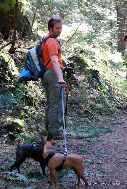
The hike begins on the Pratt Lake Trail #1007, rolling through lush forests of cedar and Douglas fir, frequently passing over creeks and streamlets. After about a mile the route meets the Granite Mountain Trail #1016 and the tenor of the trail shifts from an uphill amble to a thigh-burning workout. granite mountain hikingwithmybrother
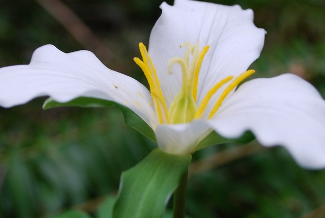
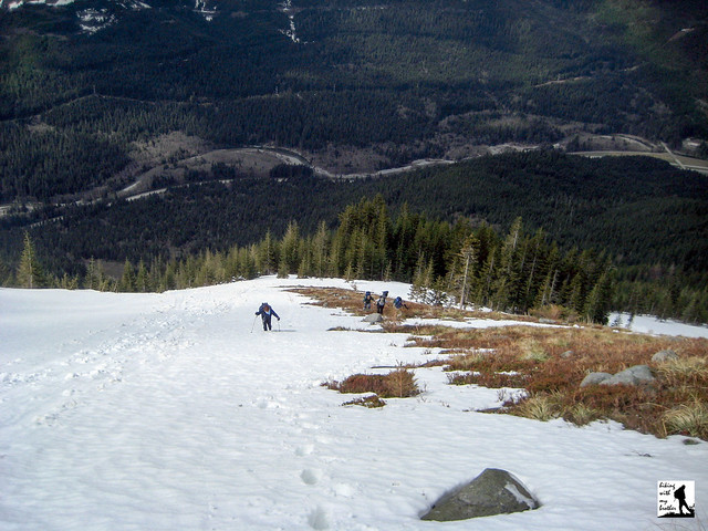
Navigate the rocky trail as it switchbacks through the increasingly dry terrain and catch the occasional glimpse of your eventual goal high overhead. As you gain elevation, trees thin and become more diminutive while ferns yield ground to bear grass and mountain blueberry. Eventually the trees are entirely left behind, the views are laid bare, breezes keep the bugs at bay during the summer months, and the trail grade relents slightly as the fire lookout comes into view. While snow is on the ground, a ridge route straight to the summit avoids most avalanche danger. As the snow recedes, the rocky ridge is less appealing than the formal trail route that snakes beneath the ridge before zigzagging up the bluff the lookout resides upon.

The views that begin hundreds of feet below culminate as you attain the lookout, snowy mountaintops spreading out with a mesmerizing immensity. Mt. Rainier dominates the skyline, in every way demanding attention and dwarfing Mt. Catherine and Humpback Mountain just across I-90 far below. If you can tear your eyes off Rainier, the beginnings of Keechelus Lake can be seen to the east, and Bandera Mountain quietly neighbors to the west. Looking north, the eye is drawn to the distinctive Kaleetan Peak, as well as Chair Peak and Mt. Stuart, while just below Crystal Lake and Upper Tuscohatchie Lake gleam invitingly in the sunlight.

This hike can be challenging. In summer months the sun beats down on exposed rocks and meadows, making the trail dusty without much relief in the form of extra water. Avalanches have taken the lives of hikers on Granite, so take extra caution during the spring. The trail is almost exclusively an uphill battle, so prepare for a long day. If necessary, take that extra break to fuel up for the final push – the views from the top are more than rewarding and well worth your perseverance. Of course, when there’s snow, getting down the mountain is quick and a lot of fun.


To get there, take I-90 to Exit 47, cross the freeway and take a left. Continue for a short distance to find parking and the trailhead. Don’t forget to put out your Northwest Forest Pass before heading up. - Nathan Granite Mountain

Talapus and Olallie Lakes

Our Hiking Time: 2h 30m round trip to Olallie
Total Ascent: 650ft to Talapus, 1150ft to Olallie
Highest Point: 3800ft
Total Distance: 4.5miles round trip to Talapus, 6.5miles round trip to Olallie
Location: N 47° 24.8287, W 121° 30.9840
Required Permit: Northwest Forest Pass
Difficulty: Easy

Nathan's PhotoAfter weeks of ascending peaks such as Bandera and Teneriffe, we were looking forward to a change in our routine. We had not stood on the shore of an alpine lake since Melakwa Lake and realized a lake hike was long overdue. After some research we decided to explore some of the more popular alpine lakes in the region: Talapus and Olallie lakes.

talapus lake olallie lake hikingwithmybrotherNestled within the Alpine Lakes Wilderness, Talapus and Olallie Lakes are among the most easily accessible lakes in the region. Established in 1976, the nearly 400,000-acre Alpine Lakes Wilderness hosts more than 700 lakes. Like so many place names in the area, these lakes bear the legacy of the early interaction of pioneers and Native Americans. Talapus translates to “coyote” in the pidgin language Chinook Jargon, while Olallie roughly means “berry.” Largely born through the necessity of trade, Chinook Jargon is an amalgamation of French, English and Salishan languages native to the Pacific Northwest.

talapus lake olallie lake hikingwithmybrotherTalapus Lake Trail #1039 begins with a gentle wander on wide track through the woods, crossing Talapus Creek and traversing marshy areas through a long series of bridges and raised walkways. Long switch backs and mild grades follow Talapus Creek a little over a mile into the Alpine Lakes Wilderness to reach Talapus Lake, tucked in a bowl between Bandera and Pratt Mountain. Find various small paths winding around the lake that travel past nooks, perfect for a snack or extended stay, overlooking the water.

Continue past Talapus on #1039 toward the smaller Olallie Lake three-quarters of a mile distant, passing a small trail connecting #1039 to the Pratt Lake Trail #1007. Enjoy the meander through the mature cedars and firs until you reach the wooded lake, resting beneath West Granite Mountain and Pratt Lake Saddle.

Both of these lakes are extremely popular in the summer months, so etalapus lake olallie lake hikingwithmybrotherxpect company as you take the short trek up. This hike is a great introduction to the Alpine Lakes Wilderness and is extremely family-friendly. For the more adventurous, the connection to the Pratt Lake Trail provides access to a myriad of destinations beyond the lakes’ crowded shores. Winter or summer, this hike provides a tempting taste of the wilderness – the clarity of the water is interrupted only by the reflections of the surrounding landscapes, making it easy to forget the relatively close trappings of civilization.

To get there, take I-90 to Exit 45, going under the freeway to Forest Road 9030. Follow FR 9030 for about a mile until the road splits. Continue on FR 9030 to the right and follow it for a little over two miles until you reach the trailhead parking lot. -Nathan

Print Google Directions >>

Talapus & Olallie Lakes

Fuller Mountain

Our Hiking Time: 2h
Total Ascent: 900ft
Highest Point: 1840ft
Total Distance: 3.5 miles
Location: N 47° 35.1930, W 121° 44.6720
Required Permit: Hancock Recreation Pass
Difficulty: Moderate

Nathan's PhotoKnowing we’d be a little short on time this week, we spent some time looking for short hikes that didn’t take us too far out on I-90. We decided on an interesting little knob just west of Mt. Si called Fuller Mountain, located in what is now called the Snoqualmie Forest, a sprawling working forest near North Bend.

Fuller Mountain sits on land that made up some of the original acreage purchased by the newly formed Weyerhaeuser Company in 1900. Over the years, as the company harvested timber and replanted it in successive waves, fuller mountain hikingwithmybrother moon wall mt sithe 104,000 acres of timberland came to be known as the Snoqualmie Tree Farm. For decades Weyerhaeuser allowed recreational access to the Tree Farm, including hiking, biking, fishing, and hunting. In 2003 Weyerhaeuser sold all 104,000 acres to the Hancock Timber Resource Group who currently manages the property and continues the tradition of allowing recreational access to the area. A year later, in 2004, King County purchased the development rights to 90,000 acres of the Tree Farm in one of the largest public purchases of development rights in U.S. history. Thus safeguarded against future suburban growth, the name was officially changed to the Snoqualmie Forest.

The trail begins at Spur Gate 10, narrowly winding through uniformly planted Douglas fir to Ten Creek. After crossing the creek and continuing on the trail for a few minutes, you will eventually find fuller mountain hikingwithmybrother moon wall mt siyourself dumped onto a logging road. At this point many hikers are understandably confused. Head to the left and follow the road for a minute or two to the first intersection with a spur road. Take this road uphill for a few hundred yards to pick the trail back up again. The small path isn’t immediately obvious so keep an eye out for it on the left.

From here the trail traverses rocky fields and winds through a sparse forest of alder awash in sword fern. Through the trees you’ll catch increasingly better glimpses of Klaus Lake as you get closer to the summit. The highest point of Fuller Mountain does not have any view, so be sure to continue on to southeast to a rocky outcropping that overlooks much of the Snoqualmie Forest and gives a nice view of Mt. Si’s Moon Wall.

Expect to have this trail largely to yourself; the combination of a somewhat confusing route and being located within a working forest probably keeps hikers on more familiar trails in other locations. The quiet solitude does have a price – the lack of foot traffic means this trail is barely scratched into the side of the mountain and can be a little tough to fuller mountain hikingwithmybrother moon wall mt sinavigate. Soil is loose and rocky and there are a few trees that need to be crawled over or around. Despite a few obstacles, Fuller Mountain was a peaceful alternative to the crowds of Tiger or Si, and the view at the top was well worth the climb.

To get there, take I-90 to North Bend, Exit 31. Head into town on Bendigo Boulevard to North Bend Way and take a right. After a few blocks take a left on Ballarat Ave and follow it as it becomes North Fork Snoqualmie Road and winds through fields and Christmas tree farms. Eventually the road splits into a Y – veer uphill and drive on the gravel for a few miles until you reach an intersection. A few hundred feet to the left is Spur Gate 10. Once there, find an unobtrusive place to park, and do not drive past the gates if they happen to be open unless you have a Recreation Access Permit. Walk past Spur Gate 10 and across the Mainline Truck Road to find the trail. - Nathan

Print Google Directions >>

Fuller Mountain

Bandera Mountain

Our Hiking Time: 4h
Total Ascent: 2900ft
Highest Point: 5100ft
Total Distance: 6.8 miles
Location: N 47° 24.9240, W 121° 32.2860
Required Permit: Northwest Forest Pass
Difficulty: Moderate

Nathan's PhotoBandera Mountain. Words that often are followed by “brutal,” “intense,” and “dry”. While we knew this as we were mapping out our hike this week, we focused on another word often associated with Bandera: “breathtaking.”

Bandera has long been a name entwined with the history of Snoqualmie Pass. Though officially recognized by the US Geographic Board as Bandera Mountain only in 1920, a nearby train station along the Chicago, Milwaukee, St. Paul and Pacific Railroad named “Bandera,” had been in operation since 1909 and would continue Bandera Mountain hikingwithmybrotherservice up until 1980. In 1948 the Bandera Airstrip was dedicated, marking the first emergency air field in the pass, which is still actively used today. The original trail up the mountain was first blazed to provide access for crews fighting a large fire around Mason Lake in the summer of 1958, and was later popularized by Harvey Manning.

There's a lot more to Bandera Mountain, and you can learn all about it in our book, Hiking Through History Washington.  You'll find a trail map, route descriptions, history, and more for this and many more hikes throughout the State. Help support hikingwithmybrother.com and the work we do by picking up a copy!

To get there, take I-90 to Exit 45, going under the freeway to Forest Road 9030. Follow FR 9030 for about a mile until the road splits. Veer left onto FR 9031 and follow it for two more miles until the road terminates in a parking lot. Put out your Northwest Forest Pass and hit the trail. -Nathan

Print Google Directions >>

Bandera Mountain
Copyright 2008-2016 - hikingwithmybrother.com
hikingwithmybrother@gmail.com