about us | links | permit info
Subscribe to Hiking With My Brother Email Subscribe Follow Hiking With My Brother on Facebook Follow Hiking With My Brother on Twitter Hiking With My Brother Picasa Hiking With My Brother YouTube

Pinnacle and Bear Lake Trail #703

Our Hiking Time: 2h 40m
Total Ascent: 1200ft
Highest Point: 3800ft
Total Distance: 4.2 miles
Location: N 48° 3.1140, W 121° 45.3000
Required Permit: Northwest Forest Pass
Difficulty: Moderate

Nathan's PhotoThis week we headed out to the Mountain Loop Highway with plans to check out the Bathtub Lakes Basin via Pinnacle Lake. Unfortunately, while we made it to the lake, lingering snow and foggy weather kept us from trudging up Iodine Gulch to what some have called “The Poor Man’s Enchantments.”


pinnacle lake hikingwithmybrotherWhile hikers have been making treks to Pinnacle Lake since at least the 1920s, any mention of the Pinnacle Lake Trail has been overshadowed by the tragedy that happened there a few years ago. On July 11, 2006, a mother and daughter, Mary Cooper and Susanna Stoddard, were found murdered on the trailside. Both shot in a random act of violence that remains unsolved. Both avid hikers and lovers of the outdoors, the pair had logged a great deal of trail miles in the Cascades together and with the rest of their family. The event reverberated through hiking community, raising questions around hiker safety and protection. Today, in an effort to raise public awareness and honor their memories, friends and family organize an annual memorial walk around Green Lake every July 11th.

The route follows Bear Lake Trail for a few tenths of a mile before branching off on The Pinnacle Lake Trail #703.1. Before pressing on, we recommend you take some time to trek out to Bear Lake and check it out – its tree-lined shores are worth the extra few tenths of a mile. Once back pinnacle lake hikingwithmybrother
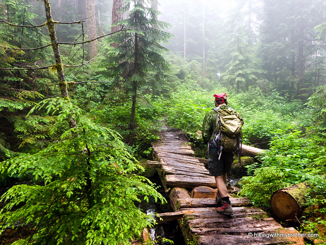
on the path to Pinnacle Lake, the trail quickly begins a series of somewhat steep switchbacks, made more difficult by healthy amounts of rocks, roots, and mud. The trail stays wet most of the year, so come prepared to squish through boggy mud flats and dodge areas of standing water. Eventually younger mixed conifer forest grudgingly gives way to sub-alpine forest, and the switchbacks also begin to yield to a gentler grade, signaling that the lake is near.

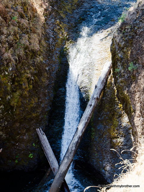
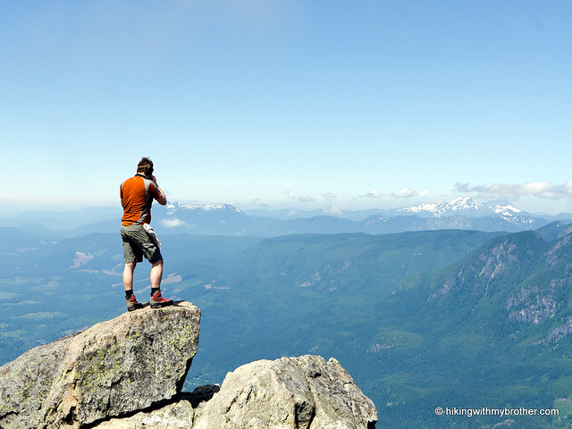
The trail deposits you a bit above the shore, near Black Creek, Pinnacle’s outlet. From here, you can take in the entire length of the lake. Almost entirely surrounded by the steep, rocky shoulders of Mt. Pilchuck, the lake has an air of rugged isolation. Find one of the many social trails down to the rocky lakeshore and enjoy the quiet. Or, for the more adventurous, continue around the left side of the lake to the bootpath leading up the talus fields of Iodine Gulch to the Bathtub Lakes Basin.

This hike is something of a mixed bag. Although it’s short, the trail is more than a little rough, making it challenging for hikers looking for less mileage. At the same time, the route quickly transports the hiker from a logging road to a serene alpine lake in less than three miles. We’d recommend this hike to more experienced hikers who are short on time, or who have their sights set on the Bathtub Lakes Basin.

pinnacle lake hikingwithmybrotherTo get there, take I-5 North to Exit 194. Follow Highway 2 for about two miles. Stay in the left lane and merge onto Lake Stevens Highway 204. Follow for two miles to Highway 9. Take the left onto Highway 9 toward Lake Stevens. In just under two miles, reach Highway 92 to Granite Falls. Take a right and follow for about nine miles to the Mountain Loop Highway (MLH). Follow the MLH for just over 15 miles to FR 4020. Take a right and follow for about two-and-a-half miles to a junction. Veer right onto FR 4021 and continue for three miles following signs to Bear Lake and the trailhead. - Nathan

Pinnacle Lake

Boulder Cave Trail #962

Our Hiking Time: 45m
Total Ascent: 250ft
Highest Point: 2700ft
Total Distance: 1.5 miles
Location: N 46° 57.4620, W 121° 5.0067
Required Permit: Northwest Forest Pass
Difficulty: Easy

Nathan's PhotoWith guests in from out of town, we decided to show off Washington’s variety by heading over the mountains to Yakima. Along the way, we wanted a short hike to stretch our legs and explore some new terrain. Boulder Cave, just off of Highway 410, seemed the perfect fit.

boulder cave hikingwithmybrotherBoulder Cave is something of a misnomer, as it’s really a 300ft long tunnel arching over Devil’s Creek. The tunnel was created when the creek, which had been happily carving a small canyon through the hard basalt left by ancient lava flows, suddenly found a layer of softer rock beneath the basalt. The creek quickly began to wear away at the underlying rock, eventually causing part of the canyon wall to tip over, enclosing the creek in darkness. The tunnel then became home to a colony of Pacific Western big-eared bats. Once numbering in the thousands, after the Civilian Conservation Corps built the trail and recreation area in 1935, the bat population quickly declined as visitors increased. Today, only a handful of bats return during the winter to hibernate. To protect them, the Forest Service closes the trail from October to May. Although the trail is only open four months a year, it still sees over 35,000 visitors annually.

Boulder Cave #962 is a very short trail, wide enough to accommodate the crowds that flock to it. The trail runs along the top of the gorge before dropping down to the far end of the cave through a series of switchbacks and boardwalks that help even the youngest hikers navigate their way down to the creek. Visitors are all funneled in one direction to keep people shuffling through the darkness at a steady pace. As you enter the cave the temperature drops, the dark closes in, and the creek echoes loudly off the slanted ceiling. In less than five minutes, you’re back in the daylight and headed back to the car.

boulder cave hikingwithmybrotherThis isn’t much of a hike, but it’s a nice little roadside attraction. It’s also very toddler-friendly, making it a good choice for young families. However, the easy access means that you should expect a lot of company. Boulder Cave sees hundreds of visitors a day and parking is often a challenge. If you go, be prepared to share the trail. Some respite from the crowds can be found by forgoing the cave and continuing to follow the trail. The unmaintained path quickly thins and passes a small waterfall before depositing you at the creekside. From here, it’s possible to scramble a half-mile upstream to Devil Creek Falls.

To get there, take I-5 south to Highway 18 at Exit 142A. Follow Highway 18 into Auburn and take the SR 164 exit. Head left on SR 164 through Enumclaw to SR 410. Head left onto SR 410 and continue 71 miles to Forest Road 1704, signed Boulder Cave. Take a right over the river and follow the signs about a mile to the trailhead. -Nathan

Boulder Cave

Mount Persis Trail

Our Hiking Time: 4h 30m
Total Ascent: 2700ft
Highest Point: 5464ft
Total Distance: 4 miles
Location: N 47° 47.4240, W 121° 36.7140
Required Permit: None
Difficulty: Hard

Nathan's PhotoThis week, blue skies and warm weather lured us out toward Index to climb Mt. Persis, a seemingly short summit that’s been on our list for years. After winding our way up some rough logging roads, we found the unmarked trailhead and headed out on the rough bootpath for a hefty workout and some spectacular views.

mt persis hikingwithmybrotherThe area around Index was first settled by Amos and Persis Gunn back in 1889. The area quickly became a stopping point for travelers, and the town of Index was platted in 1893. By 1907 the town was officially incorporated and Persis Gunn had named many of the peaks surrounding the growing settlement, including Gunn Peak, Mt. Persis, and the original Mt. Index (now called Mt. Baring). The first recorded ascent of Mt. Persis was in 1917 by Harry B. Hinman and his climbing party. Today, hikers continue to make the climb to the summit following an unofficial trail straight up the mountainside.

From the beginning this trail is a challenge. It’s rough and difficult, traveling through young forest and clearcuts into older stands of cedar and Douglas fir that proved too difficult to log off the steep slopes. The first mile sees the most elevation gain, with the trail eventually leveling out at the first view of Index and the top of Persis. From there, traverse along the ridgeline, through mt persis hikingwithmybrothertalus fields and thinning trees before beginning the final leg of the hike. Push upward past two small lakes to the ridge that runs between Persis and Index. Veer left to climb to the top of Persis. If Mt. Index is your goal, head right and be prepared for a long day.

Once you reach the summit of Persis, soak up the expansive views. Neighboring Index is massive. Pick out Baring, Mt. Baker, Gunn Peak, and Mt. Rainier. The exposed granite of the Index Town Wall is easy to spot above the miniature town of Index, and Heybrook Ridge sits just under Mt. Baring. The 360-degree views offer plenty to see before starting the steep slog back down the mountain.

We’ve probably already made this clear, but be prepared: this is not an easy hike. More a bootpath than a real trail, the route occasionally disappears in the undergrowth. The trail is also very steep in places, requiring a little help from nearby trees to make your way up. But the mt persis hikingwithmybrotherviews are incredible - more than worth the effort it takes to make it to the top. Just don’t let the short mileage fool you, and plan on spending a few extra hours tackling this one.

To get there, take US 2 about 33 miles and turn right onto Forest Road 62, just before the town of Index. Follow FR 62 about three and a half miles to a junction with FR 6220. Head left for a little over a mile to another junction, and then again veering left. Continue on the increasingly rough road for another mile, watching for a small pullout on the left just a few hundred feet from road’s end. A steep, well-trod gully opposite the pullout marks the trailhead. -Nathan

Mount Persis

Kelly Butte Fire Lookout Trail #1031

Our Hiking Time: 2h
Total Ascent: 1100ft
Highest Point: 5400ft
Total Distance: 3.4 miles
Location: N 47° 10.1580, W 121° 29.4180
Required Permit: None
Difficulty: Moderate

Nathan's PhotoFinding ourselves a little short on time this week, we headed out to Kelly Butte for a quick hike to up to a restored fire lookout. We navigated our way through a maze of logging roads to find ourselves rapidly climbing through fields of wildflowers toward expansive views of Mt. Rainier and the Green River Valley.

This is a fun little hike, quickly delivering a short workout and some views. Despite the steep start, this hike is approachable for almost every hiker. The most challenging part kelly butte hikingwithmybrotherof this hike is actually finding it. There are quite a few unmarked logging roads to deal with, and it is fairly easy to get turned around. Once you find the road to the trailhead, we really encourage you to park at the makeshift lot near the Kelly Butte Trail sign. While you can probably make it down the somewhat overgrown road to the base of the butte, the road is extremely narrow and there are no pullouts, making it impossible for two cars to pass each other on it. If you happen to encounter another car going the opposite direction, one of you will have to reverse all the way to either end of the road to make room.

There's a lot more to Kelly Butte, and you can learn all about it in our book, Hiking Through History Washington.  You'll find a trail map, route descriptions, history, and more for this and many more hikes throughout the State. Help support hikingwithmybrother.com and the work we do by picking up a copy!

To get there, take I-5 south to Highway 18 Exit 142A. Follow Highway 18 into Auburn and take the SR 164 exit. Head left on SR 164 through Enumclaw to SR 410. Turn left onto SR 410 and drive about 20 miles through the town of Greenwater, past the fire station to FR 70 on the left. Follow FR 70 a little over eight miles to FR 7030. Take a left onto the gravel road and continue about four miles to a T-intersection. Take a left and continue a mile to the next intersection, again veering to the left. Continue for about a half-mile to another intersection, this time heading right. Find the signed trailhead on the left in about a mile. -Nathan

Print Google Directions >>

Kelly Butte
Copyright 2008-2016 - hikingwithmybrother.com
hikingwithmybrother@gmail.com