Our Hiking Time: Overnight
Total Ascent: 3400ft (2200ft in; 1200ft out)
Highest Point: 5600ft
Total Distance: 15 miles
Location:
N 47° 32.5683, W 121° 8.3816
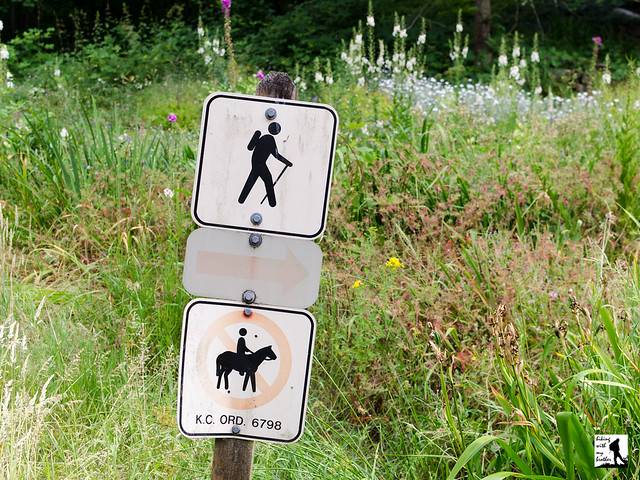
Required Permit:
Northwest Forest Pass
Difficulty: Moderate

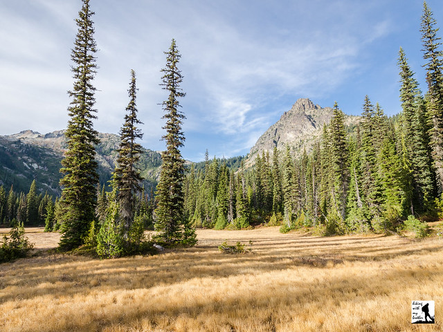
Recently we decided to get one last overnight in before the snows seal off the mountains for a few months. We wanted to capture some fall color so we headed out to the Salmon la Sac area to tackle Cathedral Rock and explore some nearby alpine lakes. With good weather on our side, we enjoyed spectacular autumn landscapes and the quiet of the wilderness.
Back in the late 1800s, prospectors and sheepherders were far more common in this area than hikers. One of those prospectors was a gold miner named James “Jimmy” Grieve, who was likely the first to scale Cathedral Rock. As a result it was known as Grieve’s Peak and Jimmy’s Jumpoff for years. The name did not sound regal enough for the Forestry Service, so someone in the 1940s or 50s decided Cathedral Rock was a better fit. Grieve had several claims in the area and built a cabin near Peggy’s Pond that was a popular site for hikers to visit for decades, though it is little more than a pile of crumbling logs today. The story behind some of the places in the area is a bit murkier. Supposedly it was Spanish-speaking shepherds that gave the Spinola Meadows their name. Deep Lake, unsurprisingly, was named for its depth, perhaps by the same folks that decided Grieve’s Peak somehow resembled a cathedral.

The Cathedral Pass Trail #1345 begins from the Cathedral Pass Trailhead (officially part of the Tucquala Meadows Trailhead), near the end of FR 4330. From the parking area, craggy Cathedral Rock juts dramatically into the skyline, giving you some perspective on the hike ahead. The rocky trail begins without fanfare, crossing a few creeks before beginning a series of long switchbacks, slowly ratcheting up the mountainside. After .4 miles the trail brings you into the Alpine Lakes Wilderness without fanfare, drawing you past brushy undergrowth and deeper into dark stands of hemlock and fir. Soon the trail begins to level out and at the 2.2 mile mark reaches the junction to the Lake Waptus Trail #1322. Push ahead for another .5 mile to your first destination, Squaw Lake. There are a number of campsites around this little tarn, as well as a backcountry toilet, making it a decent option for a quick overnight with the kids or basecamp for exploring the area trails.
From Squaw Lake, the trail begins a long, rocky traverse up to Cathedral Pass offering occasional views of the Wenatchee Mountains just to the east, while snaking past the occasional pond. Continue to push upwards through the thinning sub-alpine forest for another two miles to the connection with the Pacific Crest Trail #2000 at the 4.2 mile mark. Cathedral Pass is less than .25 mile up ahead, so climb the last few feet to the 5400’ pass, though do not expect a lot of fanfare - there is not much in the way of big panoramic views. But be sure to take a moment to scan the cliffs for mountain goats before beginning the long descent down into the Spinola Valley.

Compared to the Cathedral Pass Trail the Pacific Crest Trail is a breeze. Wide and almost smooth, the trail gently guides you down the mountainside. At the first big switchback you’ll reach the junction with the Peggy’s Pond Trail #1375 - it’s a decent .6 mile side trip out to a lovely tarn, though the trail is rough and somewhat challenging to navigate. Most hikers will opt to continue down another three miles to Spinola Meadows and the shores of Deep Lake, 7.5 miles from the trailhead. As you descend, enjoy a bird’s-eye view of Deep Lake and the valley below as well as Circle Lake Falls cascading down the opposite side of the valley into the lake below. Depending on the season, you may be in for quite a show before the views disappear into the trees as you re-enter the forest. Eventually you’ll reach the bottom and the old growth will give way to meadow. Here the barren cliffs of Cathedral Rock rise dramatically above Deep Lake, demanding your attention as you take in the panorama. Take some time to explore the shore before settling in - there are plenty of campsites around the lake for those planning to spend the night and you can afford to find the best vantage point to take in this gorgeous alpine landscape.
This hike is a classic, offering some of the best the Alpine Lakes Wilderness has to offer: a pristine alpine lake, views of the surrounding rugged landscape, and the quiet solace of the wilderness. While some hikers can tackle this one as a day hike, the distance really lends itself better to an overnight or a multi-day exploration of the area, as there are a number of destinations right nearby including a popular scramble route up Mt. Daniel by way of Peggy’s Pond.
To get there, take I-90 out over Snoqulamie Pass to Exit 80. Head left over the freeway following Bullfrog Road to SR 903. Follow 903 16.6 miles through Roslyn and along Cle Elum Lake to FR 4330 just beyond the Salmon La Sac guard station. Veer right, avoiding the campground and continuing onto the dirt and gravel FR 4330 for 12.3 miles to the Cathedral Pass Trailhead. Privy available. -Nathan
Print Google Directions >>


 Looking for inspiration to get out on the trail? Looking for a great holiday gift? Look no further! For the fifth year in a row, we've put together a great calendar with a different hiking trip every weekend in the new year. The Weekend Hike Calendar 2016 recommends a different hike every Saturday that we've chosen specifically with the season in mind.