Total Ascent: 500ft
Highest Point: 3400ft
Total Distance: 5.2 miles
Location: N 46° 58.7760, W -121° 38.1120
Required Permit: None
Difficulty: Easy
 We are always keeping an eye out for trails that have been somehow overlooked or are underused. Sometimes the trail has fallen into disrepair or has been officially abandoned, other times they are paths cut for something other than just hiking, but the best finds are those trails that have simply slipped off the radar. The Huckleberry Creek Trail #1182 is one of these rare finds. Unsigned and with almost no parking, this rarely visited trail makes for a perfect summer hike.
 Huckleberry Creek is one of only two watersheds in Mt. Rainier National Park that do not originate with glacial meltwater. The creek flows from the large meadowed area known as Huckleberry Park (aka Huckleberry Basin) near the base of Sourdough Mountain between Sunrise Park and McNeeley Peak. The name is in reference to the abundance of mountain huckleberry found in the region. While historical evidence is limited, historians believe that at least some portions of today’s Huckleberry Creek Trail follows a traditional route used by Native American tribes to gather huckleberries and other resources. As times changed, the route became popular with prospectors, hunters and eventually poachers.
 While the trail likely existed before Mt. Rainier National Park was created in 1899, today’s trail and patrol cabin were not built until the 1930s. A plan to expand trails and place cabins and trail shelters strategically around the park was created during the short tenure of Superintendent Roger W. Toll (1919-1920). The plan was implemented between 1922 and 1934 largely by Superintendent Owen A. Tomlinson (1923-1941). Some semblance of the Huckleberry Creek Trail existed before this time, as the park boundary marker you will pass along the trail was placed in 1908. The Huckleberry Creek Patrol Cabin was built between 1933 and 1934, probably with assistance from either the Public Works Administration or the Civilian Conservation Corps. The trail was also expanded at that time, but not to provide the public access to the park as some theorize, but instead to ensure fire fighters had adequate access to this portion of the park in the event of a forest fire. In 1991 the cabin was officially added to the National Register of Historic Places.
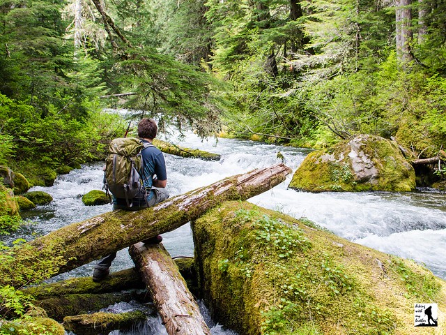
 The unmarked trail begins from Forest Road 73, dropping through a small, grassy clearing. Immediately find yourself under stands of young fir and hemlock. Soon you’ll cross Lost Creek - named for large sections of the creek that are “lost” under a rock slide - before continuing deeper into the forest. Watch your surroundings as you enter areas of mossy old growth, complete with towering stands of fir and cedar. Enjoy the sounds of Huckleberry Creek as you wander beside the water. In about a mile you’ll reach the National Park Boundary, beyond which National Park rules prohibit bikes, pets, and stock.
 Just after you enter the National Park you’ll find the patrol cabin. Although it is now boarded up and no longer in use, it’s still fun to poke around the clearing and inspect the old log cabin. This also makes for a decent turn-around point for young hikers. As you continue past the cabin, the forest only gets older and bigger, and the trail begins to gain a slight amount of elevation, a trend that will only continue as you forge onward. Continue until you’ve had your fill then turn back toward the car.
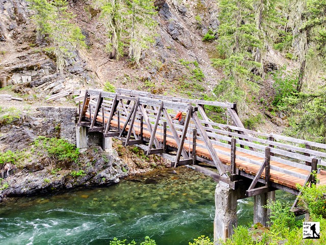
While we only explored the first 2.5 miles of the trail, those looking for a big day can continue all the way out to the Sunrise Visitor Center - a good 10 miles from the trailhead. If you are not up for a 20 mile day hike, there are some intermediate stopping points along the way. Find Josephine Creek roughly 4 miles from the trailhead, beyond that Prospectors Creek is at about the 6 mile mark. Still want more? Eventually you’ll reach Forest Lake, a decent sub-alpine backpacking destination at about 7.5 miles from the trailhead. From here it’s another 2.5 miles to Sunrise through the alpine meadows of Huckleberry Park.
 We highly recommend adding the Huckleberry Creek Trail #1182 to your hiking list this season. This versatile creekside hike has enough rewards to make a satisfying short hike for the family and enough trail for a long, challenging day hike for experienced hikers. Its lower elevation means it continues to be accessible late in the season, and melts out a little earlier than nearby hikes like Lake Eleanor. At the same time, the forested trail and the cool waters of Huckleberry Creek make this a great choice for those hot summer days. Add to all this a healthy dose of history and an excellent chance you’ll be the only hikers on the trail to enjoy it. All in all this makes for a great hike.
 To get there, take I-5 south to Highway 18 Exit 142A. Follow Highway 18 into Auburn and take the SR 164 Exit. Head left on SR 164 through Enumclaw to SR 410. Head left onto SR 410 for 25 miles to Huckleberry Creek Road (FR 73). Turn right onto FR 73 and follow for 6 miles to Huckleberry Creek. Do not cross the bridge. Find parking along the shoulder. The unmarked trail begins by dropping down to the creek through a small clearing on the south side of the road. -Nathan
Print Google Directions >>