about us | links | permit info
Subscribe to Hiking With My Brother Email Subscribe Follow Hiking With My Brother on Facebook Follow Hiking With My Brother on Twitter Hiking With My Brother Picasa Hiking With My Brother YouTube

Cedar Butte Trail

Our Hiking Time: 3h 20m
Total Ascent: 900ft
Highest Point: 1880ft
Total Distance: 3.5 miles
Location: N 47° 26.0280, W 121° 44.5200
Required Permit: Discover Pass
Difficulty: Easy

Nathan's PhotoBetween the holidays and navigating snowbound-Seattle for a week, Jer and I were looking for a nice short hike. Flipping through our trusty book we quickly found a winner: Cedar Butte, a three mile trek just outside of the city in familiar Rattlesnake Ledge territory. The scant page and a half devoted to describing the hike radiated ease and simplicity, so we packed our snow gear and hit the trail.

cedar butte hikingwithmybrotherThis little project is all about getting to be better hikers and perhaps becoming a bit more competent. This hike is a fine example of the unexpected little lessons you learn along the way. This week’s lesson was “ensure your trail book is up to date." While Harvey Manning’s crotchety meanderings were entirely accurate, changes to the surrounding trail system made getting to the trailhead something of an adventure.

Evidently Cedar Butte now has two trailheads, in old-school traditional and newly built flavors. The path to the older trailhead has had at least six years to grow up and out, but decades of use had left enough of an impression for us to follow. Our easy hike began with more bushwhacking than we expected, compounded by the foot of snow and insistent drizzle. The path spit us out onto the John Wayne Pioneer Trail, which now runs in the old Milwaukie Railroad rail bed.

cedar butte hikingwithmybrotherA pleasantly brush and scramble free half-mile from here we found the signed trailhead on the right, a few hundred yards after crossing a bridge over Boxley Creek. The sign implored us to “Check the Website!”, but alas, details as to which website should be interrogated seemed to be missing, so we were forced to forge blindly ahead. Snowshoe traffic clearly outlined the trail, which was helped along by small arrows nailed to trees and stumps and an occasional signpost. The trail is fairly varied, with stretches of level ground and lazy switchbacks peppered with patches of steepness.

At the top of one of the longer hills you'll find yourself at an intersection, giving you the option to head toward the Boxley Blowout or up toward the summit. We opted, in the rain and snow, to go for the summit, although the Blowout comes highly recommended, reportedly giving a view into the lingering evidence of the 1918 reservoir failure that inundated and ultimately destroyed the fledgling town of Edgewick. Something of a scandal at the time, as apparently Seattle forged ahead on the planned Masonry Reservoir despite a number of surveys stating that the site chosen was not suitable for the project. Long story short, millions of cedar butte hikingwithmybrothercubic yards of earth and water spilled downstream, now manifested in a wide swath of deciduous trees cutting through the surrounding evergreen forest.

The trail is welcoming, close to the city, and pretty easy – great for a summer evening hike or an aggressive trail run. Along the way one can catch glimpses of Rattlesnake Lake, and the 1880’ summit gives limited views to Mailbox Peak, Rattlesnake Ledge and Mount Si. We’re recommending you ditch the “traditional” approach and head to the Cedar Falls Trailhead. Take I-90 to Exit 32, take a right onto 436th St, following it over the Snoqualmie River for about three miles to the Rattlesnake Recreation Area. Drive past initial signs to Rattlesnake Lake and find the signed Cedar Falls Trailhead ahead on the left. - Nathan

Print Google Directions >>
Cedar Butte

Cougar Mountain - Anti-Aircraft Peak

Our Hiking Time: 1h 40m
Total Ascent: 600ft
Highest Point: 1400ft
Total Distance: 3 miles
Location: N 47° 31.2500, W 122° 5.4833
Required Permit: None
Difficulty: Easy

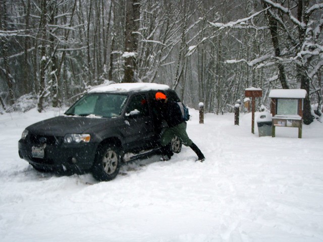
tiger mountain hikingwithmybrotherNathan's PhotoDespite greater Seattle being pretty much snowed in, and I-90 closed past North Bend, and fresh snow beginning to fall, we decided to go for a quick hike anyway. Still, this severely limited our options. We chose Cougar Mountain because we were familiar with parts of it already and knew the 8 inches of snow would make the hike that much more fun. Plus it would round out the Cougar-Squak-Tiger trifecta for us. Major roads were not too bad and we managed to make it to the Anti-Aircraft Peak Trailhead with only a few questionable moments. We positioned the car so we wouldn’t get stuck, geared up, and took a study of the free trail maps before setting off.

The peak is named in honor Cougar Mountain's military legacy. Following World War II, 90mm anti-aircraft guns were installed in 1953 to guard Puget Sound until they were replaced from 1957-1964 by a Nike Ajax Missile Defense System. The installation languished until 1983 when King County acquired it from the military and began developing a regional park to preserve Cougar Mountain's cultural and historic heritage. Envisioned by Harvey Manning and first proposed in 1979, the Cougar Mountain Regional Park concept eventually managed to block planned residential development in the park and gain enough voter support to pass a bond measure. Today the park is the largest “urban wildland” in the United States with over 3,000 acres of forest riddled with 36 miles of trails.
tiger mountain hikingwithmybrother
We took to the trail and tromped down the Tibbetts Marsh trail toward the Fantastic Erratic, a short mile and a half away. The trails are wide and very well used and maintained, taking you over streams, beside gullies, and through a mixed forest of alders and evergreens. The network of trails is sprawling but well signed. If you’re unfamiliar with the 45 trail names that appear on these signs, however, be sure to take a map to help reorient you when needed. Trails are also helpfully named with what side of the park they are on they are at as the first letter, (N)orth, (S)outh, (E)ast, (W)est and (C)enter.

The Fantastic Erratic was much less fantastic under a layer of snow, but the trek down to the basin where it resides was worth it - especially after Jer took a tumble or three off the trail and the Erratic itself. Not only did the snow keep most people away, but provided that close, tiger mountain hikingwithmybrotherinsulated feel, making it seem like were snowshoeing deep in the Cascades instead of within a few miles of sprawling housing developments. We did not meet up with anyone else on the trail, though the fresh tracks we encountered let us know we were not entirely alone. Having started at the top, our way back was almost entirely uphill, made more slightly more difficult by the icy crust that had formed over the snow clawing at our boots and gaiters.

Overall, the trails are easy – great for the family, pets, or trail running – though from our own experience and from everything we’ve read, this is a very popular destination, so expect some company on your forays. The Anti-Aircraft Trailhead can be accessed via I-90 Exit 13. Take a left up Lakemont Boulevard following for roughly 3 miles before taking a left onto Cougar Mountain Way. Meander through the housing developments, continuing to head uphill and Cougar Mountain Way will change into Cougar Mountain Drive and terminate in the trail head parking lot. - Nathan

Print Google Directions >>

Cougar Mountain

Annette Lake Trail #1019

Our Hiking Time: 3h 50m
Total Ascent: 1700ft
Highest Point: 3700ft
Total Distance: 7 miles
Location: N 47° 21.5220, W 121° 28.4400
Required Permit: Northwest Forest Pass
Difficulty: Moderate

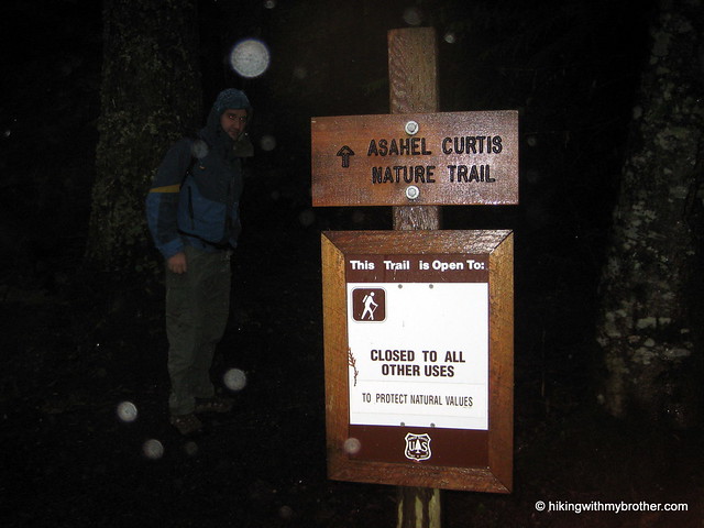
Nathan's PhotoWe had planned to tackle one last peak this year before the snows came in and made them inaccessible, thus the heights of Mt. Defiance or Bandera Mountain were on our minds as we set out on I-90. Sadly, the amount of rain and cloud cover forced us to steer toward something with less exposure to the elements. We chose the nearby Annette Lake hike for two reasons: the tree cover looked good enough to shelter us from the rain and it had the added bonus of the Asahel Curtis Nature Trail.

annette lake hikingwithmybrotherAnnette Lake has been a favorite of Seattle hikers for over a century. Named in honor Annette Wiesling, a prominent member of The Mountaineers near the turn of the 20th century, today the lake welcomes hundreds of hikers every summer.

The Annette Lake Trail #1019 begins quite mildly, not too rocky or rough, and is fairly well maintained. You’ll quickly cross over Humpback Creek and shortly thereafter break out into forest cleared for the high tension power lines overhead. A few hundred feet before the power lines, see if you can find the 8’ wide abandoned culvert skulking off the trail. Presumably a portion of Humpback Creek was once funneled through this monster. Makes a fun little stop and provides a much needed roof in the rain.

annette lake hikingwithmybrotherBeyond the power lines the well-marked path intersects with the Iron Horse Trail and begins a mild ascent up towards the lake. Both switchbacks and inclines increase as you press onward, ratcheting up the challenge after lulling you for the first two miles. The trail cuts through more than a few talus fields afforded some interesting views of the Humpback Mountain’s craggy outcroppings and colorful rock faces.

The forest is a pleasant mix of firs and pine, old enough to have long since replaced brushy undergrowth a carpet of moss. The last half-mile or so of the trail levels out and you soon find yourself at the lakeside, at the bottom of a bowl formed by the surrounding Humpback Mountain, Abiel Peak and Silver Peak. There are small picnic and camp sites on the trail around the edge of the lake, as well as some rough amenities for an overnight stay. For those looking for more of a challenge, rough trails lead up from the lake to Humpback and Silver Peak.

annette lake hikingwithmybrotherThe rain deterred us from exploring scrambles up the small waterfall on the opposite side of the lake, or even poking around too much on the shore. Instead we huddled down for a quick lunch and battled a couple of exceedingly bold gray jays, who all but dive bombed us for a scrap of food before we headed back down.

Surrounded by mature forest and nestled beneath intriguing heights, it is easy to see what brings the crowds to Annette Lake. Moreover, the trail is well-maintained trail and not too strenuous, making it approachable for a wide range of hikers of all ages. At the same time Annette Lake is certainly not the most stunning alpine lake in the area. If you prefer a little more quiet and solitude, we recommend skipping Annette Lake during the summer months.

To get there, take Exit 47 off I-90 and take a right at the end of the ramp on to Forest Road 55. At the T take a left onto Forest Service Road 5590 and follow the gravel road to the parking lot. Trailheads for both the Nature Trail and Annette Lake are at the east end of the lot. -Nathan

Print Google Directions >>

Annette Lake
Copyright 2008-2016 - hikingwithmybrother.com
hikingwithmybrother@gmail.com