about us | links | permit info
Subscribe to Hiking With My Brother Email Subscribe Follow Hiking With My Brother on Facebook Follow Hiking With My Brother on Twitter Hiking With My Brother Picasa Hiking With My Brother YouTube
Showing posts with label snoqualmie pass. Show all posts

Mt. Catherine Trail #1348

Our Hiking Time: 2h
Total Ascent: 1320ft
Highest Point: 5052ft
Total Distance: 3 miles
Location: N 47° 22.3380, W 121° 25.6080
Required Permit: Northwest Forest Pass
Difficulty: Moderate

Nathan's PhotoShort on time, we pored through our resources to find a hike that would give us some new and interesting views in the time we had available. Mt. Catherine was an easy choice: just over Snoqualmie Pass with good views to the north and south without too much trail distance. Without much research, we packed up and headed out.

mt catherine hikingwithmybrotherAccording to Manning, back in the early days of aviation in 1920s and 30s, a beacon sat atop Mt. Catherine, one in a long series that included Rattlesnake Mountain and McClellan Butte, meant to guide planes through the low point in the Cascades. Today the beacon is long gone, though remnants remain in the form of rusted cables and bolts driven into Catherine's rocky peak.

The trail begins off Forest Road 9070, briefly following a logging spur before connecting with a rocky trail heading up the side of the mountain. The trail spares little in the way of switchbacks or other concessions for the casual hiker. Instead, the trail aims to deliver you to the summit with a mischievous efficiency. False summits abound, and each time you feel you've gained the prominence, you're quickly faced with even more mountain to ascend.

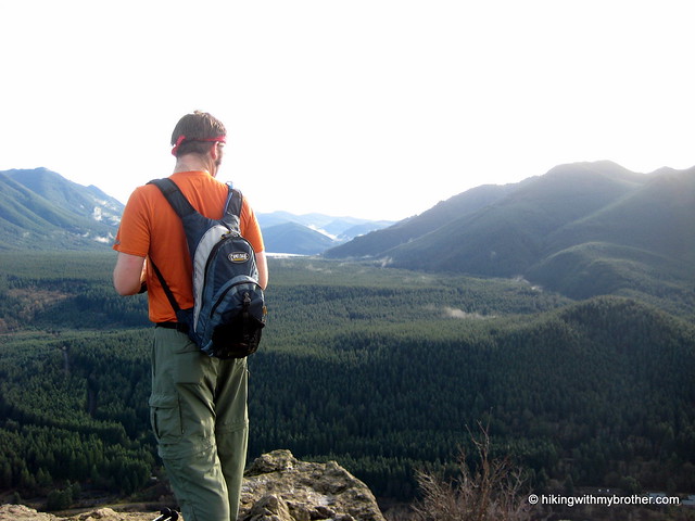
While the trail is short, Mt. Catherine makes up for it in grade. Mostly steep and rocky, the path is easy to follow and the rewards at the top are well worth the sweat. Look down on Keechelus mt catherine hikingwithmybrotherLake with I-90 hugging its shore. To the south, Rainer quietly lurks behind Silver and Tinkham Peaks. Humpback Mountain is immediately to the west and Red Mountain stands boldly to the north.

To get there take I-90 to Hyak Exit 54 and head right. Take a left into the ski area parking lot and head toward the houses at the far end. Pass a small water treatment plant on your way to FR 9070. Keep to the left and follow the meandering forest road for just over four miles to a widening in the road at 3700ft. Park and find the trail nearby. - Nathan

Print Google Directions >>

Mt. Catherine

Lodge and Beaver Lakes

Our Hiking Time: 2h 30m
Total Ascent: 800ft (450ft in; 350ft out)
Highest Point: 3500ft
Total Distance: 4 miles
Location: N 47° 24.5400, W 121° 25.8600
Required Permit: Northwest Forest Pass
Difficulty: Easy

Nathan's PhotoNow that the snow had begun to loosen its grip on the trails in and around Snoqualmie Pass, we were on the lookout for an opportunity to do a short hike to a destination that for years played a leading role in the recreational history of the Pass. So, despite the gloominess of the day we packed up and headed out for a pilgrimage to historic Lodge Lake.

lodge lake hikingwithmybrother
The route follows a section of the Pacific Crest Trail, a 2,650 mile trail from Canada to Mexico that was only fully completed in the early 1990s after decades of effort to connect the Washington Cascade Crest Trail to other extensive trail networks in Oregon and California. The section was first blazed by the Mountaineers in 1919 for alternative access to the club lodge that gave the lake its name. Mountaineers would take the train from Seattle to the Rockdale station and then make the mile and a half trek to the volunteer-built lodge for weekends of snowy outdoor excursions, snowshoeing the nearby peaks, and late night dances to the windup Victrola.

The original 1914 Lodge was lost in a fire in 1944. Volunteers rebuilt the structure in 1948, and it stood until another fire burned it to the ground in 2006. lodge lake hikingwithmybrotherToday there is no longer a lodge at Lodge Lake, though the Mountaineers still own some 77 acres of land around the lake and continue to discuss the possibility of re-establishing this lost icon.

From the trailhead, the gentle trail quickly jaunts through a stretch of young firs before depositing you in The Summit ski area. Wander through the now-green ski slopes, under the silent ski lifts and over the small rivulets bringing the last of the spring runoff down the mountainside. Beyond the lifts the trail alternates between being a path and a streambed as it enters an increasingly pristine forest of cedar and fir. At just shy of a mile the trail arrives at Beaver Lake and hugs its shores before starting a gradual descent down to Lodge Lake. Through the trees you will catch brief glimpses of the water as the trail winds down toward the far end of the Lodge Lake where a signed spur trail will take you to the lakeshore.

beaver lake hikingwithmybrotherThis is fantastic hike for all ages, especially in the spring and summer when The Summit can be experienced without the familiar snowy backdrop. The short trek through meadows and forests covers a wide variety of terrain in a very short distance, and for the more adventurous there are plenty of destinations beyond Lodge Lake to satisfy the need for a longer hike.

To get there, take Exit 53 off I-90 into The Summit ski area. Turn right into the gravel parking areas and head toward the back of the lot. You’ll find the signed trailhead where the gravel ends. - Nathan

Print Google Directions >>

Lodge and Beaver Lakes

Franklin Falls Trail #1036

Our Hiking Time: 1h 20m
Total Ascent: 200ft
Highest Point: 2560ft
Total Distance: 2 miles
Location: N 47° 25.4760, W 121° 26.0100
Required Permit: Northwest Forest Pass
Difficulty: Easy

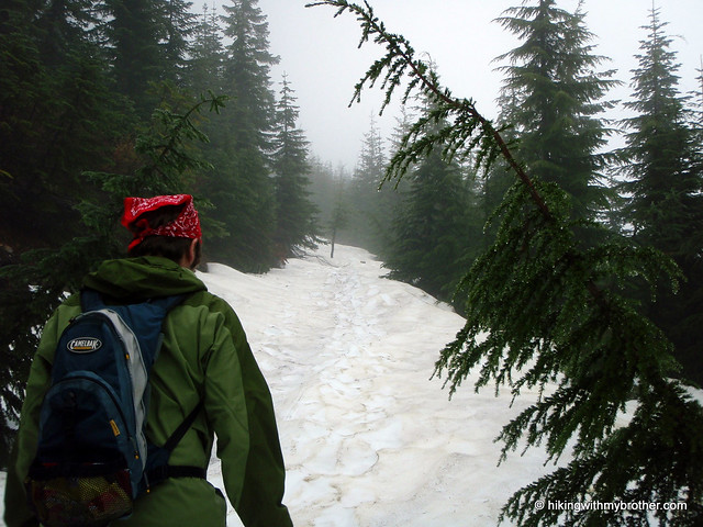
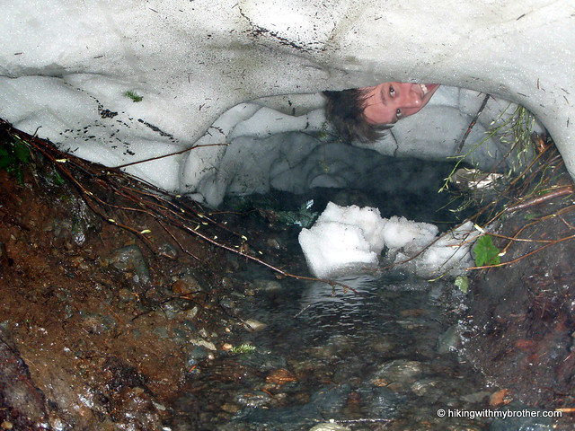
Nathan's PhotoOne of the best times to re-discover a hike is during the winter; the crusty snow and low temperatures work to transform a mundane stroll into an exciting exploration. franklin falls hikingwithmybrother Such was the case with Franklin Falls. While we’d made the mile-long trek from the parking lot to the waterfall a number of times in the past, it had always in the heat of summer alongside many other hikers. This was an opportunity to experience the trail in a whole new light.

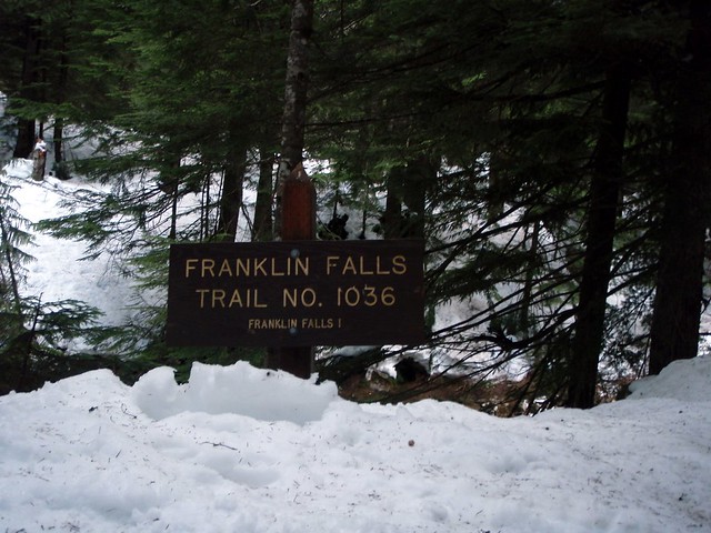
Franklin Falls Trail No. 1036 hugs the bank of South Fork Snoqualmie River as it winds beneath a thick canopy of cedar and pine. Early on the trail, you’ll wander past a few summer homes and short spur trails that wind down to access the creek. As you gain some elevation, the din of I-90 will occasionally rise above the babble of the creek, but this is soon replaced by the roar of the falls themselves.

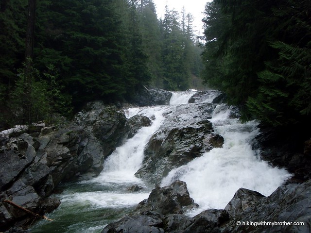
At about 1/4 mile we found the trail washed out and were forced to take a bit of a detour around the mess. Regaining the trail, we enjoyed the views of the icy creek below, having few problems with the footing until we were almost within sight of the falls. Slick snow banks necessitated using our hiking poles to make sure we didn’t slip and take a dunk in the creek. With some delicacy, we navigated the snow and found our way down to the rocks below. The constant spray franklin falls hikingwithmybrotherfrom the 70’ falls had built up a thick layer of ice on the rocks, which made getting close impossible, though that didn’t stop us from a few creative attempts at it. Even had we succeeded, we would have still been unable to make out the full extent of the 135’ falls. Shrouded in the trees above, the two additional tiers of Franklin Falls plunge into a series of deep pools, the granite tinting the water a rich green.

For those looking for a loop, just as you climb up from the falls, a signed junction to Wagon Road Trail No. 1021 offers a lesser-used track back to the car. The Wagon Trail follows small portions of the same 1860’s Snoqualmie Pass Wagon Road that we saw at Ollalie State Park. While it certainly offers a quiet alternative, this trail is not well-signed, which can cause problems when it crosses over the winding Forest Road 58 before depositing you near the parking for the Franklin Falls Trailhead.

To get there, take I-90 to Exit 47 and head left over the freeway to afranklin falls hikingwithmybrother signed "T". Take a right here, heading under the freeway for about a 1/2 mile to find FR 58. Head left on FR 58 for a few miles to Denny Creek Campground. Just past the entrance to the campground take a left onto Road No. 5830 and park just before the bridge. If this area is full, continue on to the Melakwa Lake trailhead and parking located at the end of the road. If you want to access the upper falls, continue on FR 58 for two miles to a large pullout on the left side of the road. An unmarked trail leads to the falls. –Nathan

Print Google Directions >>

Franklin Falls

Olallie State Park

Our Hiking Time: 1hr
Total Ascent: Negligible
Highest Point: 1200ft
Total Distance: 0.5 miles
Location: N 47° 26.2800, W 121° 39.3000
Required Permit: Discover Pass
Difficulty: Easy

Nathan's PhotoWe took some time recently to tie up some loose ends around Olallie State Park. While we’d seen Twin Falls, we had not fully explored the rest of the park, which promised more trails, cliffs, and waterfalls.

weeks falls olallie state park hikingwithmybrotherFinding a reliable route over the Cascades to connect Seattle with the rest of the state was an early goal of Seattle’s founders. After numerous surveys and more than a little help from Snoqualmie guides, a trail was established over what would later be known as Snoqualmie Pass. By 1865 efforts were underway to expand the trail enough to support wagon traffic. Known as the Snoqualmie Pass Wagon Road, it opened in 1867 and was the first in a long series of road-building projects eventually culminating the I-90 freeway. The short trail to Weeks falls hugs the South Fork Snoqualmie River, travelling over the lingering traces of that long abandoned wagon road. The first portions of the park were acquired back in 1950, and given the name “Olallie” a Chinook jargon term for “berry,” a nod to the proliferation huckleberries found in the park during the summer months.

Weeks Falls, like Twin Falls, is now the site of a hydroelectric plant, though less effort has gone into concealing the facilities. One perk of visiting in the winter months was the high water levels, which made this 60ft cascade a little more exciting. The plant pumps out a little over 4 megawatts a year, enough to power about 800 homes.

olallie state park hikingwithmybrother Rock climbers flock to Olallie for the expansive climbing walls, most of which are located just above the Iron Horse Trail. An unmarked trail up to the climbing area begins at Change Creek, winding up the mountainside to the old railroad grade. The path begins by following the creek but quickly delves deeper into the woods, past boulders and exposed rock. Ahead, a railroad bridge spans Change Creek and eventually you find yourself passing the girders holding it aloft. The cliffs, known as Deception Crags are impressive, are impressive and full of climbers year-round. Just across the bridge is the fledgling Hall Point - Change Creek Trail which eventually winds its way up to the top of Mt. Washington, and is a nice alternative to the traditional route.

We’d recommend exploring this portion of Olallie State Park while visiting Twin Falls, perhaps taking the Iron Horse Trail between the two points. However, if you’re short on time or have some toddlers or need some additional accessibility, Weeks Falls is a nice place to visit on a jaunt out of the city.

To get there, take Exit 38 off 1-90. Head left and follow the road for about a half-mile until you see the signed parking lot on your left. -Nathan

Print Google Directions >>

Olallie State Park

Best of Hiking with My Brother (so far)

As we push into the double-digits with our hikes, we wanted to highlight our favorite. However, despite lengthy discussion, we were unable to come to a consensus on the matter, ultimately narrowing it down to two hikes. Tiger, Squak, and Cougar we immediately put out of the running, a combination of over-familiarity with the trails and the encroachment of housing developments into the scenery. Cedar Butte, Rattlesnake and Little Si are great hikes, but again, we have visited all of these with some regularity in the past, making it hard for the experience to really resonate with us. Annette Lake is the only alpine lake we've visited, but the amount of rain and snow coming down really soured the journey for us. Both Dirty Harry's Peak and Mailbox Peak are really great hikes, but because both are pretty difficult, much of our focus and attention was on getting one foot in front of the other, rather than taking in our surroundings.

This left us with Mt. Washington, which I was rooting for, and Twin Falls, Jer's favored hike. In the end, rather than trying to resolve our impasse, we decided to just talk about both.


Nathan's Photo
Nathan's Pick - Mt. Washington

Given the set of hikes we've done so far, Mt. Washington really hits the right note with me. It's a decent length, it's just hard enough to be engaging, but not so difficult you cannot enjoy the trees going by, and your hard work is rewarded at the top. Moreover, it's far enough out that you can escape from housing and the crowds, yet you can get to the trail head from downtown Seattle in about a half-hour. Finally, the trail itself is refreshingly varied; the path takes you through an engaging landscape past lakes, streams and rivers, second and third generation forests, and also offers the opportunity to see the impacts of past logging on a landscape. Then there is the view. Jer has somehow forgotten the unique and stunning view of Rainier over the Cedar River Watershed that this hike provides. This is the backdrop to the little alpine meadow at the top making it ideal for a small picnic, especially in the spring when the wildflowers are in bloom.

Accessible, engaging, and rewarding: Mt. Washington is easily a better trail experience than Twin Falls. Jer is absolutely right - I'm going to point out that Twin Falls is crowded. We were there in the dead of winter and ran into dozens of people and the parking lot was overflowing when we left. We met just a handful of other hikers on Mt. Washington and it was never intrusive or unpleasant. I'll grant that the falls themselves were great to see, and I'm glad we got to see them with relatively little human traffic in the snowy landscape. However, it's very short, designed to convey one to the waterfall as quickly as possible, which makes the walk to the falls feel like a chore, something to be done with so one can take in the main attraction. Out of the hikes we've done so far, I've recommended Mt. Washington repeatedly to friends, and I do it again now: if you're looking for a great casual hike, you can't miss with Mt. Washington.


Jer's PhotoJer's Pick - Twin Falls

Twin Falls stands out as my favorite of the last ten hikes because it can be accomplished by hikers of all skill levels, but doesn't shortchange you on the natural beauty that can be seen in the Pacific Northwest. The trail literally touches the shores of the South Fork of Snoqualmie River, which means there's plenty of opportunities for hitting the ice cold water on a hot summer day. To top it all off, only a mere mile and quarter walk from the trailhead, you can reach the lower observation deck where you will be face-to-face with the gushing 135ft tall cataract that is Lower Twin Falls. Feeling a little more adventurous? Then just continue walking past the falls and you will eventually join up with the Iron Horse trail, where you'll have easy access to all that Olallie State Park has to offer.

I agree with Nathan in that Mt. Washington is a great hike and you should definitely put it on your to-do list. However, first I suggest you forgo the "opportunity" to see the impacts of logging, and instead enjoy the grandeur of the 14ft diameter stands of old growth forest that you will see inside Twin Falls State Park. Sure, Mt. Washington has its views, but so does almost every other summit that we recently climbed. And unlike Washington, your enjoyment of this hike will not be interrupted by losing the path down an old logging road because you overlooked a haphazardly placed rock cairn. Nathan will probably try to argue that this hike will be swarming with people, but as with many outdoor destinations in close proximity to Seattle, there is a optimal time that you should go. Do this hike in the winter off-season or on a weekday and you will not be disappointed.

Little Si Trail

Our Hiking Time: 1h 40m
Total Ascent: 1100ft
Highest Point: 1576ft
Total Distance: 4 miles
Location: N 47° 29.9220, W 121° 45.3780
Required Permit: Discover Pass
Difficulty: Moderate

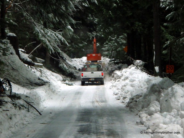
Nathan's PhotoHiking in the winter always has a few unexpected hiccups. Despite having made sure to review closures on the Department of Transportation site, and despite having reviewed avalanche warnings, weather, and local conditions, we still ran into a surprise on our way to our selected hike. The narrow forest road we were on was entirely blocked by construction crews clearing debris, forcing us to throw it into reverse for a full mile. This left us without much of a plan so we decided to make the best of it and visit an old friend, Little Si.

little si hikingwithmybrotherLittle Si crouches in the shadow of Mount Si’s western slopes, both edifices named in honor of Josiah "Uncle Si" Merritt, who set up a cabin at the base of Si in 1862. Until 1985, when Will Thompson and friends blazed new trail and revamped the existing scramble to the summit, Little Si was the province of scramblers and adventuring types. In 1989, the 28.2 acre Little Si Natural Area was acquired by King County and infrastructure improvements have continued since that time, including dedicated parking areas and the shift of the trailhead further away from private property. With this most recent visit, we took note of additional parking that seems nearly ready for public use, which will help take some pressure off the existing lot which is almost always overflowing.

little si hikingwithmybrotherOver the years, perhaps because of these improvements, Little Si has become increasingly popular, and you can expect to meet plenty of company on the trail. The short hike up to the top is pleasant nonetheless, beginning with a moderate grade and continuing up into thick stands of second generation forest. The trail winds beneath this canopy until it is broken by the rocky overhangs frequented by climbers. A number of spurs split off from the main trail to the base of these cliffs, allowing you a few more places to explore on the way back down. Switchbacks become more common as you near the top, while the trees open up to reveal views of Si and the haystack. The rocky summit will likely be occupied, but as you jockey for a view, you’ll see North Bend spread out below, Rattlesnake Mountain dominating the skyline to the south, and Mt. Washington marking the beginnings of the Cascades to the southeast.

Little Si is close, easily accessible, and just hard enough to feellittle si hikingwithmybrother like a hike, yet still gentle enough for the whole family. While not exactly high adventure, it was good to go back and see how things have progressed; most notably the old truss bridge that long spanned the Middle Fork Snoqualmie has vanished, replaced by the new bridge that had been in progress for years. To get there take I-90 to Exit 31, taking a left into town. Navigate the roundabout and outlet mall traffic until you get to North Bend Way, and take a right and head north to Mount Si Road (aka 432nd NE) on the left. Keep an eye out for this one, it comes up fast. Once you’re on the road, follow it about a mile, going over the bridge and attempt to find a spot in the lot you’ll see on the left. - Nathan

Print Google Directions >>

Little Si

Twin Falls to Iron Horse Trail

Our Hiking Time: 3h
Total Ascent: 900ft
Highest Point: 1360ft
Total Distance: 4 miles
Location: N 47° 26.7420, W 121° 42.1800
Required Permit: Discover Pass
Difficulty: Easy

Nathan's PhotoThe high tide of the holidays finally began to recede with the New Year. We’ve been so awash with friends, family, and holiday traditions that we wanted to keep it short and simple this week. With bigger adventures on the close horizon, we settled on exploring the Twin Falls Natural Area, a short hike just off the interstate - famed, according to Mr. Manning, for being the “toddler-friendliest” path in the I-90 corridor.

twin falls hikingwithmybrotherMuch of this landscape has changed since old US10 was the primary thoroughfare for Snoqualmie Pass. The Twin Falls Recreation Area was the first of four parcels that now comprise Olallie State Park, acquired by the Parks Department in 1950 as plans were finalized for early phases of present day I-90. What was a short pullout and trail to the falls overlook on US10 became isolated with the advent of the new freeway. Despite the successful efforts to preserve the land as parkland, access to the falls nonetheless languished. Then, in the early 1980s, the Weeks Falls Hydroelectric Project just upriver from Twin Falls was brought online. This was followed swiftly by a project for Twin Falls, which ultimately led to the rebuilding of the trail in late 1989, as well as the helicopter-assisted bridge construction.  However, all of the Twin Falls hydropower workings are underground or underwater, hidden from view.

The path begins gently, hugging the banks of the South Fork Snoqualmie River for just under a mile before starting a series of ups and downs.  The rushing river is your friendly companion as you press toward the falls through a young forest of pine and alder.  Find the path down to the lower falls near the two mile mark.  It is a short 104 steps down to a the observation deck to take in the stunning cascade and look up at the 80’ bridge spanning the river. Beyond the bridge, the trail winds up to an overlook of the upper falls before ptwin falls hikingwithmybrotherushing onward to connect up with the John Wayne Pioneer Trail.

Accessible year round, this approachable trail is ideal for little hikers, as the falls make for a dramatic end to the hike.  At the same time, because it is so easily accessible, it's a very popular trail, so you can expect some company on this little walk in the woods.

To get there, take Exit 34 off I-90 and take a right. Follow 468th Ave until just before the steel truss bridge where a tiny brown sign reading “Twin Falls” directs you to take a left on 159th St. Follow this for about a half a mile to the trailhead. - Nathan

Print Google Directions >>

Twin Falls

Annette Lake Trail #1019

Our Hiking Time: 3h 50m
Total Ascent: 1700ft
Highest Point: 3700ft
Total Distance: 7 miles
Location: N 47° 21.5220, W 121° 28.4400
Required Permit: Northwest Forest Pass
Difficulty: Moderate

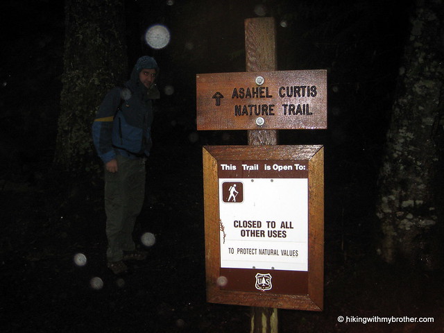
Nathan's PhotoWe had planned to tackle one last peak this year before the snows came in and made them inaccessible, thus the heights of Mt. Defiance or Bandera Mountain were on our minds as we set out on I-90. Sadly, the amount of rain and cloud cover forced us to steer toward something with less exposure to the elements. We chose the nearby Annette Lake hike for two reasons: the tree cover looked good enough to shelter us from the rain and it had the added bonus of the Asahel Curtis Nature Trail.

annette lake hikingwithmybrotherAnnette Lake has been a favorite of Seattle hikers for over a century. Named in honor Annette Wiesling, a prominent member of The Mountaineers near the turn of the 20th century, today the lake welcomes hundreds of hikers every summer.

The Annette Lake Trail #1019 begins quite mildly, not too rocky or rough, and is fairly well maintained. You’ll quickly cross over Humpback Creek and shortly thereafter break out into forest cleared for the high tension power lines overhead. A few hundred feet before the power lines, see if you can find the 8’ wide abandoned culvert skulking off the trail. Presumably a portion of Humpback Creek was once funneled through this monster. Makes a fun little stop and provides a much needed roof in the rain.

annette lake hikingwithmybrotherBeyond the power lines the well-marked path intersects with the Iron Horse Trail and begins a mild ascent up towards the lake. Both switchbacks and inclines increase as you press onward, ratcheting up the challenge after lulling you for the first two miles. The trail cuts through more than a few talus fields afforded some interesting views of the Humpback Mountain’s craggy outcroppings and colorful rock faces.

The forest is a pleasant mix of firs and pine, old enough to have long since replaced brushy undergrowth a carpet of moss. The last half-mile or so of the trail levels out and you soon find yourself at the lakeside, at the bottom of a bowl formed by the surrounding Humpback Mountain, Abiel Peak and Silver Peak. There are small picnic and camp sites on the trail around the edge of the lake, as well as some rough amenities for an overnight stay. For those looking for more of a challenge, rough trails lead up from the lake to Humpback and Silver Peak.

annette lake hikingwithmybrotherThe rain deterred us from exploring scrambles up the small waterfall on the opposite side of the lake, or even poking around too much on the shore. Instead we huddled down for a quick lunch and battled a couple of exceedingly bold gray jays, who all but dive bombed us for a scrap of food before we headed back down.

Surrounded by mature forest and nestled beneath intriguing heights, it is easy to see what brings the crowds to Annette Lake. Moreover, the trail is well-maintained trail and not too strenuous, making it approachable for a wide range of hikers of all ages. At the same time Annette Lake is certainly not the most stunning alpine lake in the area. If you prefer a little more quiet and solitude, we recommend skipping Annette Lake during the summer months.

To get there, take Exit 47 off I-90 and take a right at the end of the ramp on to Forest Road 55. At the T take a left onto Forest Service Road 5590 and follow the gravel road to the parking lot. Trailheads for both the Nature Trail and Annette Lake are at the east end of the lot. -Nathan

Print Google Directions >>

Annette Lake

Rattlesnake Ledge and Rattlesnake Mountain Trail

Our Hiking Time: 4h 30m
Total Ascent: 2600ft
Highest Point: 3500ft
Total Distance: 10 miles
Location: N 47° 27.5000, W 121° 48.3667
Required Permit: Discover Pass
Difficulty: Moderate

Nathan's PhotoThis week we had some unfinished business to attend to with the Rattlesnake Mountain Trail. Months ago, Rattlesnake Ledge was a good warm up during our Rainier training, but as the weather heated up, the amount of traffic increased exponentially. This created the difficulty of navigating between folks with large packs, which prompted us to forgo this hike in favor of the Cable Line. On one of our last climbs up to the Ledge we pushed past the crowds and further down the Rattlesnake Mountain Trail, quickly encountering icy snowpack that we were fairly unprepared to navigate. After meandering through trails and logging roads, rattlesnake mountain rattlesnake ledge hikingwithmybrotherwe were forced to turn around before reaching the next waypoint on the trail and assumed that we had somehow lost the trail.

We returned this week interested in finishing what we had started earlier in the year and shaking up our routine by doing a through-hike instead of a peak. We parked a car on the Snoqualmie Point end of the trail, and then carpooled up to the Rattlesnake Recreation Area to get started.

On the whole the trail is well maintained and friendly. The short two mile jaunt up to the Ledge makes it an attractive and easily accessible hike for families and large groups, which can quickly clog the sometimes narrow trail. The signed Ledge provides a fairly impressive panorama over Rattlesnake Lake, with Mt. Si, Mailbox Peak, and Mt. Washington dominating the view to the north. From here you can see two more outcroppings perched higher on the mountain which can be easily accessed by continuing up the trail. rattlesnake mountain rattlesnake ledge hikingwithmybrotherThe final ledge gives the greatest vantage point and most western view, with tiny trails carved into the scrub for the more adventurous scramblers to clamber around on.

The trail continues up through increasingly dense forest; at times sunlight is largely blocked out and footsteps lost in browned pine needless and the smell of humus. At about three miles, the trail begins to open up and intersect with a series of logging roads in various states of use and abandon. The trail is well signed and we had no trouble making our way to East Peak and its resident tower and vistas. The forest is young here, still not fully recovered from the timber harvest decades earlier. A mix of Noble firs and pines gives way to cedars and eventually alders, all no more than 30 years old. Trees continue to get younger as the trail progresses until you finally reach very recent cuts. Roughly the last two miles of the trail winds through recent select cut patches, with only a few trees left standing to foster an eventual rebirth.

rattlesnake mountain rattlesnake ledge hikingwithmybrotherEast Peak marks the end of the elevation gain at 3500’, and the rest of the trek was mostly a gentle downhill. Several other viewpoints await the hiker from here; Windy’s Point, Grand Prospect, and Stan’s Overlook are signed stopping points along the route to Snoqualmie Point, all offering expansive views to the north, eventually including views of Mr. Baker, Russian Butte and Mt. Teneriffe. Moderate in difficulty only because of the initial short bouts of steep grade going up to the ledge, this route is a great casual hike through the woods if you’re short on time but want to get some miles in.

From the number of hikers we passed coming from the opposite direction, Snoqualmie Point seems to be the more popular starting point of this trail; however, we’re recommending you start early at Rattlesnake Lake and avoid the crowds and the longer incline. Snoqualmie Point is easily accessed via Exit 27 off I-90 coming from the city. Take a right and follow the road for a ¼ mile until you hit the trailhead. Unfortunately there’s no onramp from Exit 27, so you’ll have to traverse North Bend to get back on I-90. To reach the Rattlesnake Recreation Area take Exit 32 off I-90 and a right on 436th Ave. SE. Follow the main road for a little over three miles before reaching the parking area. The trailhead begins on the opposite side of the lake, accessed via a service road opposite the lot. Park it and get going! - Nathan

Print Google Directions >>

Rattlesnake Mountain

Dirty Harry's Peak & Balcony

Our Hiking Time: 4h 30m
Total Ascent: 3400ft
Highest Point: 4680ft
Total Distance: 8 miles
Location: N 47° 27.0498, W 121° 37.2336
Required Permit: Discover Pass
Difficulty: Hard

Nathan's PhotoOn the heels of our Mt. Washington hike, we decided to return to the Exit 38 area to explore a ridge on the opposite side of the I-90 corridor.  We had our sights set on an area unofficially known as Dirty Harry's Peak, which promised broad vistas and rusting artifacts from the area's logging past.

The roughness of the former logging road -- large rocks, often made slippery by water -- and uncompromising inclines after the Balcony makes this a difficult hike. dirty harrys peak dirty harrys balcony hikingwithmybrotherDefinitely attainable by most prepared hikers, just make sure to bring the hiking poles to steady you over water hazards and rock.  If the full trip up to the summit is more than you want to tackle, the hike up to the Balcony is a fine hike unto itself.  This hike is also less traveled than the more popular hikes nearby, which means you're likely to get these big views all to yourself.

There's a lot more to Dirty Harry's Peak, and you can learn all about it in our book, Hiking Through History Washington.  You'll find a trail map, route descriptions, history, and more for this and many more hikes throughout the State. Help support hikingwithmybrother.com and the work we do by picking up a copy!

To get there, take Exit 38 off I-90 and take a right. Follow the remnants of old US 10 for two miles past Olallie State Park and back under I-90.  Find the gate for the State Fire Training Academy warning you that it closes at 4pm. Park in the paved lot just outside the gates, as the Washington State Patrol which manages the Academy prefers hikers do not attempt to park on the shoulder near the trailhead.  From the lot, follow the road over a bridge for about three-quarters of a mile to a bend in the road.   The trail is on the right and is unmarked.  To find it, look for a trail flanked by a large concrete block.  -Nathan

Print Google Directions >>

Dirty Harry's Peak

Mt. Washington Trail

Our Hiking Time: 4h 15m
Total Ascent: 3400ft
Highest Point: 4420ft
Total Distance: 8.5 miles
Location: N 47° 25.5667, W 121° 42.0167
Required Permit: Discover Pass
Difficulty: Moderate

Nathan's PhotoStanding watch over I-90, Mt. Washington and Mailbox Peak are the gateway to Snoqualmie Pass. Here, the Issaquah Alps end and the Cascades begin. A hike to the top of Mt. Washington through a maze of forest roads can be a little disorienting, but the views are more than worth it.

Originally named Profile Mountain, Mt. Washington was renamed for a likeness of George Washington on one of the mountain’s many exposed rock walls. Extensively logged decades ago, the main route to the top is almost entirely logging roads in various states of decay. Over the years, multiple routes have been blazed to the mount washington hikingwithmybrothersummit which can make the hike a little confusing. Occasionally an unofficial-looking sign will point you in the right direction, though none of the trails on Mt. Washington are really considered “official.” This is probably because Mt. Washington is managed piecemeal by the Forest Service and Washington Parks and Recreation. Half the mountain is part of Iron Horse State Park and the other half is in Mount Baker-Snoqualmie National Forest. To further complicate matters, there is at least one large privately owned plot on Mt. Washington. In the end, this means that trail maintenance is left to independent trailblazers and trail stewards like the Washington Trails Association.

Finding the trail can be trickiest part of this hike, as it is unsigned. From the Upper Twin Falls Trailhead, take the spur up to Iron Horse Trail and head right. Keep an eye out for a small trail to your left, not more than a few hundred feet after you get on the Iron Horse. Depending on the time of year it can be a little overgrown. Once you find the trail and start up, the route becomes increasingly rocky, as it wanders through alder and maple, past streams and waterfalls. Before long you’ll encounter the first of many rock walls that attract the bouldering and climbing crowd. On summer days you’ll see climbers roped in and clambering up rock walls just off the trail.

mount washington hikingwithmybrotherThe first couple of miles of trail are the most difficult. Expect long and steady inclines. At two miles or so you’ll hit the Owl Hike Spot, a small viewpoint carved out of the trees opposite a sheer rock wall. Years ago, the Mountaineers had a number of Owl Hikes - short hikes close to the city that could be done after work and into the evening - though today this turnaround point seems to be the only lingering legacy of the Owl Hikes. The spot offers some good views of Rattlesnake Ledge, Cedar Butte and Rattlesnake Lake, and wall serves as a makeshift bench for taking it all in. From here on out the trail is pretty friendly, mild inclines intermingled with lengthy distances of level ground.

Eventually you’ll break out of the trees and into meadows revealing a spectacular view of Mt. Rainier presiding over the Cedar River Watershed. From the summit you can easily pick out Little Si, Mt. Si, Mt. Teneriffe and Green Mountain. Mailbox Peak to the immediate northeast, peeking out from behind another ridge of Mt. Washington. Soak up the view and enjoy.

mount washington hikingwithmybrotherThe is an engaging route. The trail regularly transforms itself from friendly ex-logging road - spacious, flat, and graveled - to intermittent streambed, complete with water-carved contours and exposed rock. It’s not a particularly easy hike, but the views are excellent. As an added bonus this trail is a little under the radar, so it makes a great alternative to Mailbox or Mt. Si on a summer weekend.

To get there, take I-90 to Exit 38 and head right. Almost immediately, take a right onto a gravel road to the Upper Twin Falls Trailhead. -Nathan

Print Google Directions >>

Mt. Washington

Squak Mountain - Central Peak & Bullitt Chimney Trails

Our Hiking Time: 1h 45m
Total Ascent: 1300ft
Highest Point: 2000ft
Total Distance: 4.6 miles
Location: N 47° 28.908, W 122° 03.248
Required Permit: Discover Pass
Difficulty: Easy

Nathan's PhotoWe were short on time last Sunday, with a number of familial factors limiting the duration of our hike, so we took the opportunity to visit something closer to home. We’d often bypassed Squak in the past, preferring to push further out the I-90 corridor to places a bit more remote and potentially rugged. But, considering the number of times we’d been up and down Tiger, we thought a visit to Squak was long overdue.

squak mountain hikingwithmybrotherSquak Mountain is tucked between Tiger and Cougar Mountains, somehow dodging the feline-themed naming craze that struck the area back in the day. Back in 1972 the Bullitt family donated their one-time summer retreat of roughly 600 acres near the top of Squak to the State of Washington which has since managed to expand the boundaries of the park to encompass some 1,545 acres. There are several entrances to the park; we took one of the lesser known. I-90 to exit 17. Take Front Street N to W Sunset Way. Take a right and head straight, heading up Mt Park Blvd SW until taking a left on Mountainside Dr SW. Follow Mountainside around a curve or two before seeing a spur and some park signs just as Mountainside Dr continues a major switchback up Squak. Go ahead and park and pile out.

Arriving mid-drizzle we geared up and started off to conquer the nominal peak. We were, perhaps, over-prepared for the well maintained and gentle trail that greeted us. The primarily deciduous forest had already dropped the majority of their leaves and carpeted the trail in gold big leaf maple and brown alder. While the network of trails is fairly extensive, nearly every fork in the trail is well signed, making it unlikely that one could get too twisted around. The detailed map on at the trail head is worth a perusal before setting out, just to get a rough idea of where you’re going.

Our trek up to Central Peak followed the Bullitt Access trail, still fairly wide and graveled despite it being decades since a vehicle clunked its way up to the Bullitt summer cabin near the summit. squak mountain hikingwithmybrotherAfter a few junctions we took the Central Peak fork, where the trail became a little steeper and the vegetation shifted to a more familiar mix of ferns and Douglas fir. At about 1,700 feet, we were in the clouds, giving the trail an otherworldly feel that allowed us to pretend that we might be more than just a few miles outside of town, and that perhaps the occasional rumble was something other than rocks tumbling down the nearby quarry. Almost before we knew it arrived at the microwave towers that currently reside at the summit, along with the obligatory beige shacks, dreary chain link fencing and borderline hysterical over-signage. There’s no real view to speak of, though we supposed that on a clear day one could see Tiger and parts of Issaquah. We didn’t linger.
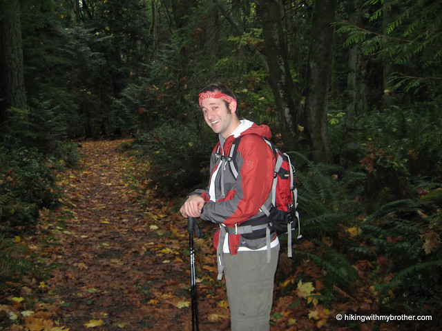
We took a slightly different route back to swing out and take a peek at the Bullitt Chimney, all that remains of the summer home that once stood here. The Chimney and cement foundation sit in a clearing along with a forlorn picnic table. Bullitt Chimney squak mountain hikingwithmybrother We assume that when a cabin stood here the residents hacked out some sort of view from the surrounding forest, felling trees to take in what could be a nice vista of Renton, Seattle, and the south end of the Sound. As it stands, the rejuvenated forest suffices.

The autumnal smell of damp rotting leaves returned as we descended – there were several opportunities to explore more branches of the trail network, however, we felt that we’d already captured the essence of the park. Squak is great for walking the dog or getting in some trail running close to home, and we would highly recommend bringing the family out for a stroll – nice, well maintained trails, lots of room, not too crowded, but easily accessible. It was not intense enough for our hiking needs, however, so save this one for the kids and look elsewhere if you're yearning for something of a challenge. -Nathan

Print Google Directions >>

Squak Mt Bullitt Chimney
Copyright 2008-2016 - hikingwithmybrother.com
hikingwithmybrother@gmail.com