about us | links | permit info
Subscribe to Hiking With My Brother Email Subscribe Follow Hiking With My Brother on Facebook Follow Hiking With My Brother on Twitter Hiking With My Brother Picasa Hiking With My Brother YouTube

Heather Lake Trail #701

Our Hiking Time: 2h 30m
Total Ascent: 1000ft
Highest Point: 2400ft
Total Distance: 5 miles
Location: N 48° 4.0800, W 121° 46.9260
Required Permit: Northwest Forest Pass
Difficulty: Easy

Nathan's PhotoWe returned to the Mountain Loop Highway this week to tour Heather Lake, a multi-season hike that rivals Lake Twentytwo’s popularity. With the snow already falling as we drove out to the trailhead, we said goodbye to snow-free hikes for the next few months. Like Lake Twentytwo, we’d seen Heather Lake in warmer months, but wanted to get a feel for the winter experience. Mother Nature was happy to oblige.

heather lake hikingwithmybrother
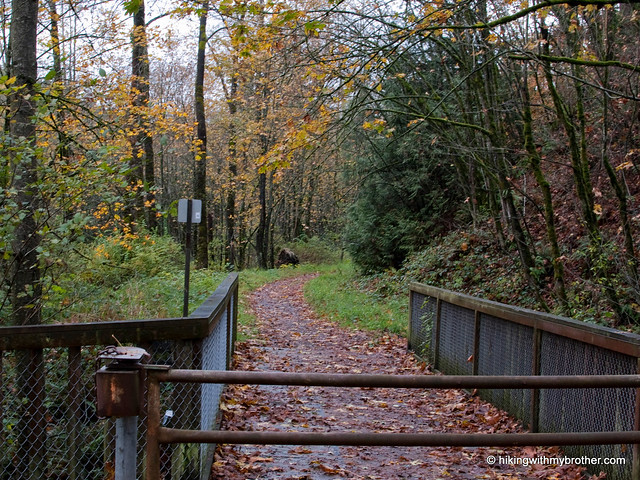
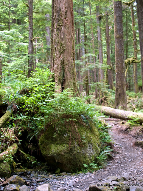
Heather Lake Trail No. 701 meanders through a young forest born of the heavy logging practices back in the early 1900s. A mixture of hemlock and fir, all roughly the same age, surround cedar stumps several times their diameter, a quiet reminder of the forest that was. At roughly half a mile, the trail briefly connects with the remnants of an old 1940s logging road before shifting back to the more familiar rocky trailbed. As you continue to gain elevation, the uniformity of the second-growth is replaced by an older and wilder forest. A quarter-mile from the lakeshore the path smoothes out, and it’s an easy stroll alongside Heather Creek to the lake.

heather lake hikingwithmybrotherUntil the late 1990s, the trail simply ended at the lake. Today, thanks to the Forest Service and trail volunteers, the trail continues around the edge of the lake, complete with boardwalks over some of the marshier areas. The loop is just over a half-mile and allows for a closer look at the waterfalls streaming down the side of Mt. Pilchuck. It also adds a little extra distance for those wanting a longer hike. Although our trip was something of a whiteout, we know that Heather Lake and its surroundings can border on stunning. Tucked beneath looming cliffs, the lakeshore has plenty of room for a picnic, some fishing, or even a little camping.

Despite a few streams intersecting the trail, which might mean a little rock hopping, the Heather Lake Trail is fairly mild. The trail is so well graded that the 1000’ elevation gain is hardly noticeable, making this an excellent choice for young hikers. This is also a perfect hike for a quick and easy snowshoe expedition. Of course, an approachable hike to an attractive destination means that you should expect to share the trail along the way.heather lake hikingwithmybrother Push to the far side of the lake if you’re looking to minimize company.

To get there, take I-5 North to Exit 194. Follow Highway 2 for about two miles. Stay in the left lane and merge onto Lake Stevens Highway 204. Follow for two miles to Highway 9. Take the left onto Highway 9 toward Lake Stevens. In just under two miles, you’ll reach Highway 92 to Granite Falls. Take a right and follow for about nine miles to the Mountain Loop Highway. Take the MLH for 13 to Mount Pilchuck Road (FR 42), turn right and drive two miles to the trailhead. - Nathan

Heather Lake

Lake Twentytwo Trail #702

Our Hiking Time: 4h
Total Ascent: 1350ft
Highest Point: 2450ft
Total Distance: 6.25 miles
Location: N 48° 3.8880, W 121° 45.9360
Required Permit: Northwest Forest Pass
Difficulty: Moderate

Nathan's PhotoThis week we did the first of the many winter hikes we have planned along the Mountain Loop Highway. Although we've done some hikes along the MLH during the summer, snow-covered hikes in the area are new to us, so we decided to start with one of the most popular: Lake Twentytwo. Over 12,000 hikers a year make the trek up to the lake, many in the winter months. We packed up and headed out to join the ranks.

lake twentytwo hikingwithmybrotherLake Twentytwo is drained by Twentytwo Creek, which flows down the mountainside to the South Fork Stillaguamish. “Twentytwo” is such an odd name, it begged for some explanation. One explanation is that in the late 1800s all the land in Washington State was surveyed and categorized into a grid system that assigned every square mile a numerical designation called a township section. We’re still using this grid system today. The “township section” the creek runs through happens to be 22, which appears on USGS maps of the area. However, there is another school of thought that suggests this creek was the 22nd on the long-gone Everett and Monte Cristo Railway, and this gave rise to the name. The area was surveyed in 1895 and the railroad company was formed in 1892, making it likely that the earlier railroad number may have informed the survey.

The railroad helped logging companies pull timber out of the area even faster than usual. Lake Twentytwo was already a popular recreation area early in the 20th century, sporting a YMCA camp by the 1930s. In 1947 roughly 800 acres around the lake were designated a Research Natural Area (RNA), preserving it from logging interests. Today, because of RNA protections, old growth western red cedar and western hemlock tower over hikers as they switchback their way to the lakeshore.

lake twentytwo hikingwithmybrotherThe Lake Twentytwo Trail #702 begins slowly, wandering over streams through lush underbrush. Eventually the hike begins in earnest, becoming steeper and rockier. Most of the route follows Twentytwo Creek and more than a few impressive cascades. Use caution if you choose to follow a bootpath down to the creek to get a better view of a waterfall - they tend to be slick and unstable. Within the last ten years, the trail has been re-routed, extending some of the switchbacks to further ease the grade. Eventually, a talus field opens up the canopy for a view of the river valley below. Beyond the talus field, the trail plateaus in the final stretch to the lake.

Lake Twentytwo sits at the base of Mt. Pilchuck, fed by a half-dozen waterfalls cascading off the mountainside. In 2006, a trail around the trout-filled lake was completed, minimizing the impact of thousands of booted feet along the lakeshore. The area is prone to avalanches in late winter and early spring, so use caution during these times. Or, do what most folks do lake twentytwo hikingwithmybrotherand find a spot near the lake’s outlet to enjoy the view.

This trail is a pleasure to hike. An undisturbed forest surrounds the route, making it feel more wild than other nearby hikes. Although often crowded in the summer, the trail makes for a great winter hike. You’ll undoubtedly still have some company, but it’s much easier to find your own little slice of the outdoors at this time of year. Despite over a thousand feet of elevation gain, the trek is manageable for almost anyone, making it a good choice for families and new hikers. If you haven’t made it out to Lake Twentytwo, this is an excellent time to check it out!

To get there, take I-5 North to Exit 194. Follow Highway 2 for about two miles. Stay in the left lane and merge onto Lake Stevens Highway 204. Follow for two miles to Highway 9. Take the left onto Highway 9 toward Lake Stevens. In just under two miles reach Highway 92 to Granite Falls. Take a right and follow for about nine miles to the Mountain Loop Highway. Follow the MLH for 13 miles to the trailhead on the right side of the road marked by a Forest Service sign reading "Lake 22 Trailhead." - Nathan

Lake Twentytwo

Hiking With My Brother Wins! - Backpacker Map Correspondent Contest

Jer's PhotoOur hard work this year has paid off big by winning the Backpacker Map Correspondent Contest! Between May 1st and November 1st this year we put together 46 trail maps, which racked us up 9 pieces of gear and the grand prize of a closet-full of Editors' Choice gear and a week-long trip to the Colorado Rocky Mountains with the Backpacker map editors!

We're already excited to fly out to Colorado next year to hang out with the best folks in the industry and to backpack through some of the most rugged terrain in the county. We're ready to learn everything we can to make hikingwithmybrother.com even better for you! Also, as you can imagine, some of the gear we've won is already being put to good use on the trail, and has replaced that old gear that we seem to wear out all too quickly. Big thanks to Backpacker for hosting this contest and for motivating us to hit the trail! -Jer

Grand Ridge Trail - High Point Trailhead

Our Hiking Time: 2h
Total Ascent: 900ft
Highest Point: 900ft
Total Distance: 5.25 miles
Location: N 47° 31.9140, W 121° 58.8540
Required Permit: None
Difficulty: Easy

Nathan's PhotoThis week we stumbled onto Grand Ridge, a portion of the Issaquah Highlands new to us. We’ve spent countless hours on Tiger Mountain never suspecting almost 10 miles of trail were hidden on the other side of I-90. When the morning brought more rain, we decided it was a good day for a short hike and headed out to Grand Ridge to see what we’d been missing.

grand ridge hikingwithmybrotherGrand Ridge is perhaps most famous for the coal mine that operated on and off from the early 1900s through the 1950s. The last of Issaquah’s mines to close down, the Grand Ridge mine was filled in and developers soon began to stake out claims. Fortunately, King County was able to work out a deal in the 1990s that set aside four acres of land for every one acre developed. This 4:1 plan eventually yielded 1,400 acres that became the home of the Grand Ridge Trail System, built largely by the Washington Trail Association.

We started from the High Point Parking Area and followed the access road out to the High Point Trailhead, marked by a small trail map of Grand Ridge. Heading up from here will connect you to the short Coal Mine Loop that covers the lower section of Grand Ridge, and provides access to most of the trailheads in the area. Anyone who has spent time hiking around the Issaquah grand ridge hikingwithmybrotherAlps will feel right at home wandering through salal and sword fern. Although we chose not to head to the 1,422’ summit, it is accessible via an unmarked trail, which isn’t on King County’s map. Simply follow the Grand Ridge Trail toward the Mitchell Hill Connector Forest. Although there are no signs, this side trail is well-worn and should be obvious. If you hit the first log bridge, you’ve gone too far.

Grand Ridge is a great little alternative to the often-crowded Tiger Mountain. The surrounding forest is identical, though development occasionally intrudes into the forest scene. Like Tiger, the din of I-90 is almost inescapable, but it is nice to enjoy the mixed forest of maple and cedar without a lot of company. Check out Grand Ridge when you’re short on time and just want to take a walk in the woods without too much hassle.

To get there, take I-90 to Exit 20, and turn left at bottom of ramp. Pass underneath I-90 and find a gravel lot on the left just past the on-ramp. Park and follow the Issaquah–Preston rail trail to the trailhead. -Nathan

Grand Ridge - Highpoint Trailhead
Copyright 2008-2016 - hikingwithmybrother.com
hikingwithmybrother@gmail.com