


Total Ascent: 2900ft
Highest Point: 5100ft
Total Distance: 6.8 miles
Location: N 47° 24.9240, W 121° 32.2860
Required Permit: Northwest Forest Pass
Difficulty: Moderate
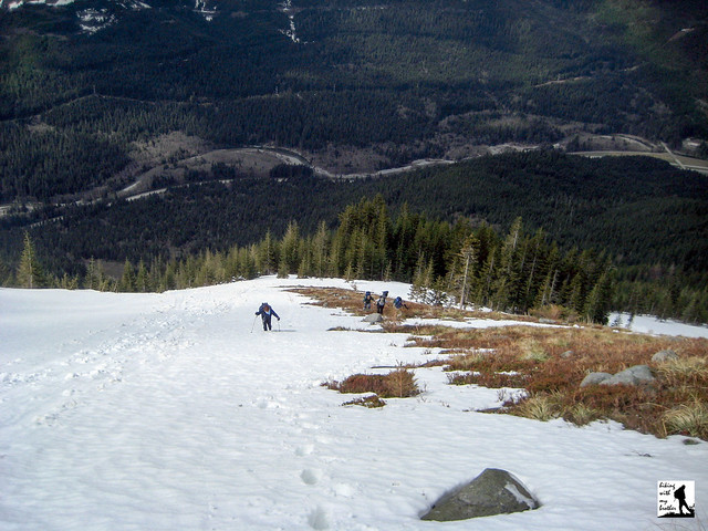
 Bandera Mountain. Words that often are followed by “brutal,” “intense,” and “dry”. While we knew this as we were mapping out our hike this week, we focused on another word often associated with Bandera: “breathtaking.”
Bandera has long been a name entwined with the history of Snoqualmie Pass. Though officially recognized by the US Geographic Board as Bandera Mountain only in 1920, a nearby train station along the Chicago, Milwaukee, St. Paul and Pacific Railroad named “Bandera,” had been in operation since 1909 and would continue
 service up until 1980. In 1948 the Bandera Airstrip was dedicated, marking the first emergency air field in the pass, which is still actively used today. The original trail up the mountain was first blazed to provide access for crews fighting a large fire around Mason Lake in the summer of 1958, and was later popularized by Harvey Manning.
There's a lot more to Bandera Mountain, and you can learn all about it in our book, Hiking Through History Washington. You'll find a trail map, route descriptions, history, and more
 for this and many more hikes throughout the State. Help support hikingwithmybrother.com and the work we do by picking up a copy!
 To get there, take I-90 to Exit 45, going under the freeway to Forest Road 9030. Follow FR 9030 for about a mile until the road splits. Veer left onto FR 9031 and follow it for two more miles until the road terminates in a parking lot. Put out your Northwest Forest Pass and hit the trail. -Nathan
Print Google Directions >>
0 Comments:
Post a Comment