


Total Ascent: 3000ft
Highest Point: 5700ft
Total Distance: 16 miles
Location: N 47° 49.2780, W 123° 13.1160
Required Permit: Northwest Forest Pass
Difficulty: Moderate
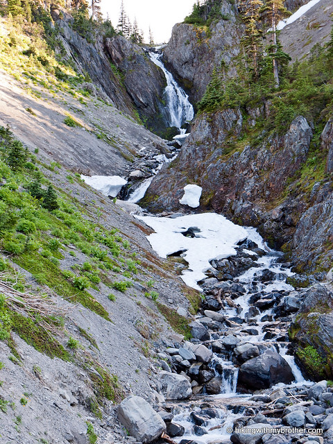
 It has been a long time coming, but this week we finally hopped a ferry and did our first hike in the Olympics. Despite the logistical hassle of ferries and extra driving time, we were excited to explore some new territory. We decided to start with the heavily traveled and ever-popular Royal Basin, one of the jewels of the Olympic National Park’s rain shadow region.
This is an excellent hike, one that we recommend you consider for a weekend backpack. The distance from Seattle and the length of the hike makes this a very long day if you’re not planning on an
 overnight. Though, on a sunny day the Royal Creek Valley is picturesque in and of itself, making a shortened version of this hike well worth the effort. Although definitely a popular and well-known hike, we did not encounter that many people along the way. In fact, we ran into more wildlife than people – not only a countless number of deer, but marmots and a few close
 There's a lot more to Royal Basin, and you can learn all about it in our book, Hiking Through History Washington. You'll find a trail map, route descriptions, history, and more for this and many more hikes
 throughout the State. Help support hikingwithmybrother.com and the work we do by picking up a copy!
To get there, take the Bainbridge Island Ferry, following State Route 305 through Poulsbo to State Route 3. Follow SR 3 to the Hood Canal Bridge, taking a left over the bridge onto State Route 104. Follow SR 104 as it merges onto US 101 and continue another 18 miles and turn left onto left on Palo Alto Road. From here, take a right onto FR 2880 near the Dungeness River. Continue just under two miles to FR 2870. Head left and follow for six-and-a-half miles to the trailhead. -Nathan
1 Comments:
Well done!! Thanks for sharing :)
Post a Comment