


Total Ascent: 2500ft
Highest Point: 4400ft
Total Distance: 10.2 miles
Location: N 47° 25.290, W 121° 32.185
Required Permit: Northwest Forest Pass
Difficulty: Moderate
 Not too long ago we decided to return to our old stomping grounds around Snoqualmie Pass to visit Island Lake, one of a handful of alpine lakes we’d overlooked on our last trek up Mt. Defiance. The lake is nestled at the base of Bandera Mountain about a mile beyond the beckoning shores of Mason Lake, putting it a little beyond the range of most day hikers.
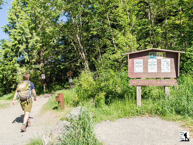
 Before the 1960s, the only way for hikers to reach Island Lake was to start at the Pratt Lake/Granite Mountain Trailhead and trek out to the Mt. Defiance Trail junction. Named for the lake’s small rocky island, the shores of Island Lake used to see many more visitors than it does today, and distant Mason Lake was a side trip for those heading to the top of Mt. Defiance. That changed in 1958, when a large wildfire on the slopes of Bandera Mountain prompted crews to hastily build a fire road to help fight the blaze. Not too long after, curious hikers took to exploring the area and using it as a “backdoor” to Mason Lake and as an approach to Bandera Mountain. Harvey Manning popularized the route and soon the official Mason Lake Trail #1038 was born, though its popularity soon led to erosion and a reputation for being steep, rocky, and often difficult to navigate. At the urging of wilderness advocate Ira Spring, a new route was proposed to address the trail’s issues, and between 2003 and 2004, a small army of volunteers in coordination with Forest Service made the trail a reality. With the passing of Spring in 2003, the new trail was renamed the Ira Spring Memorial Trail #1038.
 The hike begins on the bones of the re-purposed fire road, with a grade suitable for conveying heavy machinery up a mountainside. Enter a young forest still recovering from fires that ravaged the mountain sometime in the nineteenth century as well as the 1958 fire. At times you can still catch the faint smell of charred wood mixed with the heavy aromas of pollen and dust. Leisurely weaving uphill, you'll cross Mason Creek early on before leaving the last of the water behind and entering the Alpine Lakes Wilderness. At 1.5 miles, the trail abruptly leaves the logging road and becomes serious, exchanging the road’s gentle grade for a steep and rocky path. After a short climb, the dusty trail moves beyond the pines for ever-larger glimpses at the valley below. Once the trail sheds the last of the trees, enjoy the enormous views that come with traversing a grassy mountainside.
At just under 3.0 miles, the Mason Lake Trail and the Bandera Mountain Trail diverge. Head left and to the west through sub-alpine meadows and talus fields, reaching the Ira Spring Memorial just before the short descent down to Mason Lake. While Mason’s lakeshore offers an abundance of campsites and the possibility of a refreshing dip, your destination lies beyond. Push onward following the trail along the lake and further from the shore to reach the Mt. Defiance Trail. Head right and soon find yourself wandering through peaceful tree-lined meadows. Pass Rainbow Lake at 4.0 miles and the signed junction to Island Lake at 4.5 miles. From here it’s just a short jaunt past a few tarns to sparkling Island Lake, resting quietly below Bandera Mountain. Find a cozy rock and enjoy a slice of tranquility.
 The hike to Island Lake is a great option if you’re feeling ready to move beyond the more popular and well-trodden trails. While the first two-thirds of the route are likely to be crowded, as you push past the Bandera Mountain Trail junction and Mason Lake, you’ll soon find yourself almost entirely alone. Island Lake and Rainbow Lake also work as quick backpacking destinations, as you can be setting up camp on the quiet shores of a lovely alpine lake in fairly short order. Looking for more? The trail continues onward to connect with the Pratt Lake Trail #1007, providing access to Talapus Lake, Ollalie Lake and Pratt Lake. This also allows for the possibility of a through hike by parking a vehicle at the Ira Spring Trailhead and another at the Pratt Lake/Granite Mountain Trailhead.
To get there, take I-90 to Exit 45, going left under the freeway to Forest Road 9030. Follow FR 9030 for .9 miles until the road splits. Veer left onto FR 9031 and follow it for 2.9 miles until the road terminates in a parking lot. - Nathan
Print Google Directions >>
0 Comments:
Post a Comment