


Total Ascent: 1200ft
Highest Point: 1600ft
Total Distance: 3.5 miles
Location: N 47° 31.1880, W 122° 5.6100
Required Permit: None
Difficulty: Moderate
 Although we’ve explored much of Cougar Mountain, we’d yet to climb its highest peak and tour the somewhat lesser-traveled south-eastern portion of the park. A few weeks ago we finally found some time to head back into the Issaquah Alps and head up Wilderness Peak for a short hike a little closer to home.
  We’ve covered much of Cougar Mountain’s past on previous hikes. From the early coal mining days to the area’s more recent military history, the nearly 30-year-old park contains and preserves a rich cultural legacy. However, Wilderness Peak is conspicuously absent from this saga. Our only guess is that this section of forest really was something of a wilderness at one time – at least compared to the nearby coal mining operations. Wilderness Peak is made of different rock than other portions of Cougar Mountain, so there was little to lure the miners away from the rich coal seams that ran below the peak. And while some portions of the park were logged in the 1920s and 1940s, other sections were never logged at all, including areas near the top of Wilderness Peak.
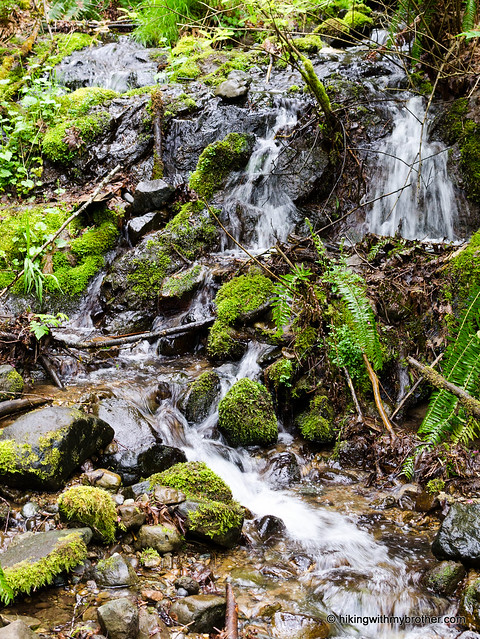
The trail begins at the Wilderness Peak Trailhead, and combines the Wilderness Creek, Wilderness Peak, and Wilderness Cliffs trails into a short loop through Cougar’s lush mixed forest. Begin by heading uphill and almost immediately crossing Wilderness Creek, which will be your companion for the next mile or so. Gently switchback through a sea of sword fern and salal for about a half-mile under a canopy of alder and maple to find the first junction. Here, a small bridge crosses the creek and the Wilderness Creek Trail continues to the left while Wilderness Cliffs Trail branches right. Either trail will get you to the top, but because the Cliffs Trail is significantly steeper, most folks head left onto the Wilderness Peak Trail.
 As you head left, you’ll pass through The Boulders, a collection of moss-covered glacial erratics deposited millennia ago by retreating glaciers. As you climb up the creek valley, more and more surfaces are covered with moss and fern. At the same time the forest increasingly yields to larger numbers of cedar and fir. Soon you’ll find yourself crossing boggy areas on narrow boardwalks before climbing out of the creek valley up to Shy Bear Pass where a number of trails intersect and connect up with the rest of the Cougar Mountain trail system. From here you can follow the Shy Bear Trail into the center of the park, or take a quick jaunt out to Long View Peak. While the area is well-signed, if you're looking to do a little extra roaming, you may want to take along a map.
We veered to the right onto Wilderness Peak Trail, which glides fairly easily to your destination. A short spur leads out to Cougar’s highest pinnacle. There are no views here, just the quiet of heavy forest, a sturdy bench and a summit register. Take a moment to write a little something in the register, then head back to the main trail and take the Wilderness Cliffs Trail down to complete the loop. One word of caution as you near the bottom: there is a very tempting trail junction that continues downhill. Resist the urge to follow it and head back to the Wilderness Creek Trail and the creek crossing.

To get there, take I-90 to Exit 15 and head right onto Highway 900, also known as Renton-Issaquah Road. Continue for a little over three miles to the signed Cougar Mountain Wilderness Creek Trailhead on your right. The driveway is easy to miss – keep an eye out for a paved road heading uphill. Park in the small parking lot and head up. -Nathan
Print Google Directions >>
4 Comments:
This was a great hike, yet it was really close! Thanks for the suggestion, me and my sister had a great time on this trail.
Thanks guys! We went to this hike today. One little revision - the trail head is called "Cougar Mountain Wilderness Creek Trail head".
We thought there is another one called "Cougar Mountain Wilderness Peak Trail head" further down the road, but "Creek" was it. :)
Whoops! Thanks for catching that. I have corrected the post. Hope the hike was good!
Heading up there tomorrow just hope the weather will be decent for us.
Post a Comment