


Total Ascent: 1200ft
Highest Point: 4500ft
Total Distance: 7.5 miles
Location: N 47° 22.2540, W 121° 32.1000
Required Permit: Northwest Forest Pass
Difficulty: Easy
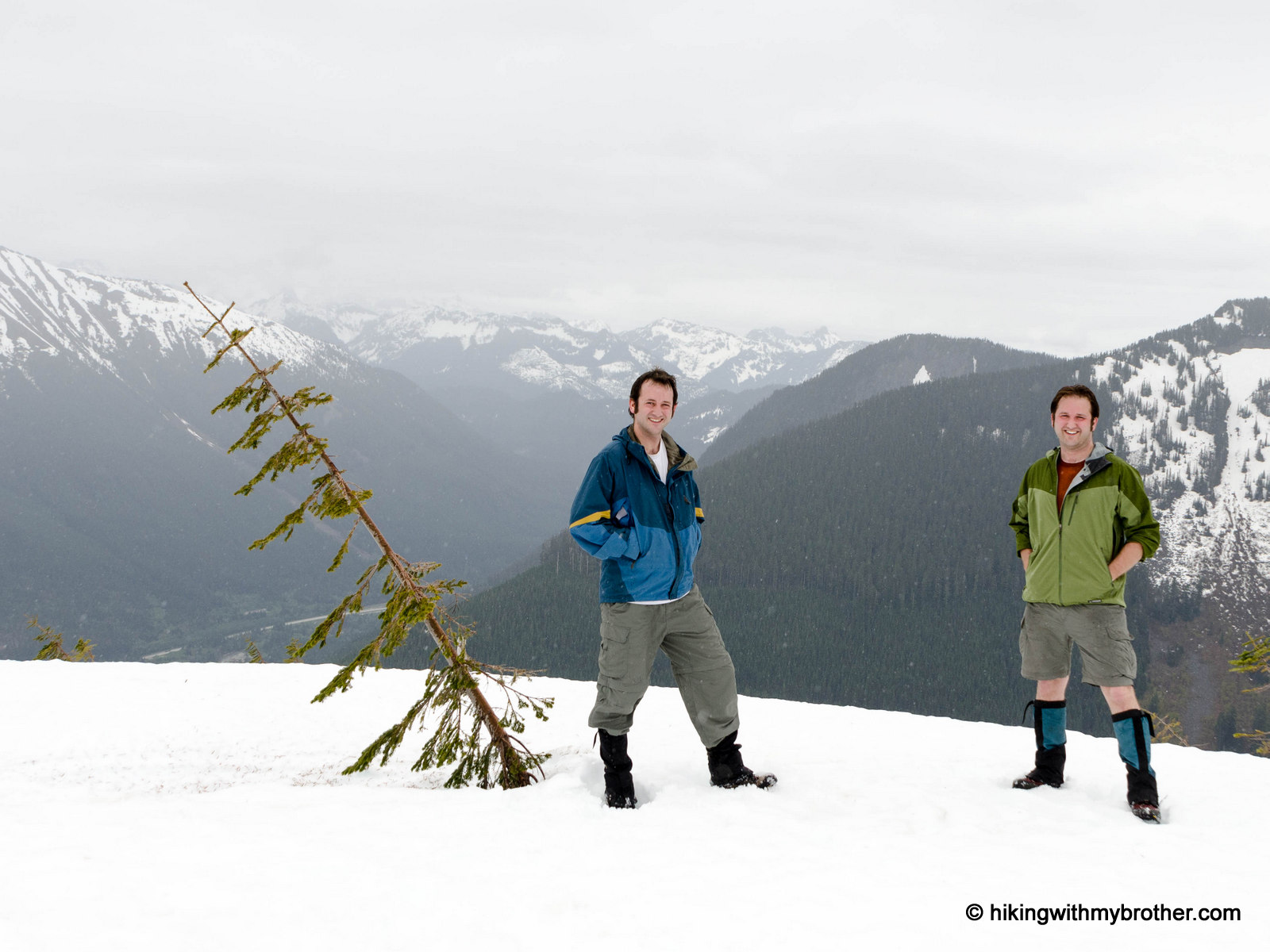
 We’ve spent a lot of time exploring the peaks and valleys that line the I-90 corridor. We’ve managed to hit most of the trails between Seattle and Snoqualmie Pass over the last few years, but there are quite a few destinations still to explore. Recently we trekked up to the top of Little St. Helens, a nondescript ridge tucked between Mount Gardner and Humpback Mountain.
For a variety of reasons, Little St. Helens does not see many hikers, and as a consequence there’s not much written about this overlooked highpoint. As to the name, we assume that like nearby Humpback Mountain, the ridge reminded folks of Mount St. Helens, though we had trouble seeing the resemblance. Few guidebooks mention this route -- the only one we know of is Dallas Kloke’s out of print Winter Climbs:
 One Day Ascents in the Western Cascades. If you have a little more information or background on this hike, we’d love to hear about it!
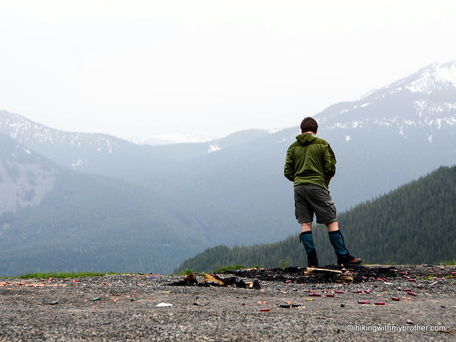
The route begins at the Hansen Creek Trailhead and follows a series of logging roads up to the summit. From the gravel pit, head west past the gate through sparse stands of young fir and hemlock. In a little under a mile, after walking up a long switchback you’ll reach a four-way intersection. Head right and uphill onto the flanks of Little St. Helens. As you continue, the trees increasingly give way to talus fields offering views of Humpback Mountain and the Snoqualmie Valley. Before long, the road wraps around the front of the ridge and soon delivers you to the nearly treeless summit. From here you can easily pick out Mt. Defiance, Bandera Mountain and Granite Mountain to the north. Humpback Mountain is directly to the east with Silver Peak rising in the distance. On a good day, Mt. Rainier looms large to the south. Mount Gardner lies to the west along with McClellan Butte’s sharply pointed peak.
Although the hike is not far out of the way, it sees very little traffic. For the most part, folks visiting Little St. Helens are zealous peak baggers, adventuresome mountain bikers and the occasional snowshoer looking for something a little different. The hike does feel a bit like a walk through a tree farm rather than a
 forest, and that probably makes it a little less appealing than many nearby hikes. Yet it is still able to offer some of the same panoramic views with a relative ease. If you’re looking for a new hike and want to beat the crowds, Little St. Helens is a great alternative. It might also be a good choice for relatively new hikers, as the road grade is fairly gentle and should not pose too much of a challenge.
To get there, take Exit 47 off I-90 and take a right over the bridge. At the intersection, turn right onto Tinkham Road (aka Forest Road 55). Continue for roughly a mile to a fork and veer left onto the Hansen Creek Road (aka Forest Road 5510). Follow the road for roughly four miles under the old railroad trestle and up two switchbacks to a former gravel pit that serves as the trailhead parking lot. -Nathan
Print Google Directions >>
4 Comments:
Good review and the hike seems easy as you say. But I think I'll pass on all that snow. Must be me and having to deal with icy weather and surroundings.
I see your post is dated June 29, 2012 but these pictures must have been taken several months ago right? A friend and I went up there July 9th and there was very little snow at the very top of the hill.
Once you park at the old shooting range (boy, what a mess left behind) you can make a choice. Go up the road for about 2 miles to the trail head or take the trail just to the right. The road to the trail head is dry, not much there but the trail itself is great – the mountain bikers association has made it really nice with lots of rocks, well defined trail, very pleasant elevation change and great views.
If you take the trail off the parking lot you will end up making a complete loop. We took the road, then the trail and about the ½ way point cut over and went to the top of the ridge, hard to find the old logging road, they have really hidden it but it does jump off to the left about 5 miles in.
The view from the top of the ridge of the back side of Rainer is great, well work the off-roading to get up there, still some snow but welcome at that point. I would recommend taking the trial but either way the hike is great. We had a nice 75 degree day, lots of water coming off the snow - great day hik
Hi Mac,
Sorry for the delay in response. You're right, we did this hike about 4 weeks before we got this trip report up. Thanks for providing some information on the area when it's a bit more melted out! Sounds like you had a great hike - we may have to make another trek out there soon.
-Jer
Hey guys,
Finally got to the site (last time I ran into a bear and didn't quite get there). the trail to artifacts site is heavy with debrits and couldn't get thru.
Post a Comment