Total Ascent: 1500ft
Highest Point: 3000ft
Total Distance: 4 miles (8.2 miles from Site 3)
Location: N 47° 57.5460, W 121° 34.9920
Required Permit: Discover Pass
Difficulty: Moderate
 Recently we had been hearing some good things about the Sultan Lakes Basin, and decided it was time to check it out. We chose a short and popular hike, Greider Lakes, to get a feel for the area. Unfortunately, when we hiked this trail, the road was closed almost two miles from the trailhead, extending our hike. As of late 2011, the closure is permanent and as a consequence this trail has deteriorated and is becoming overgrown from lack of maintenance.
The lakes were named by Claude E. Greider, a member of the Forest Service that evidently found the lakes reminiscent of himself. Sometime after their christening, the area around the lakes suffered a forest fire, evidence of which still lingers along the Grieder Lake trail. The lakes feed Greider Creek, which, in turn, flows into the massive
 Spada Lake Reservoir – the water source for nearby cities like Everett.
The well-marked trailhead begins at Reflection Ponds, a marshy area best explored in cooler, insect-free months. Once across the water, the trail begins to ascend at a decent clip. The vast majority of the elevation gain for this hike is in the first leg, comprised almost entirely of switchbacks. Additionally, the narrow trail is a bit rocky and root-ridden. To help things along, volunteers carved and hacked dozens of steps into the mountainside. Some areas of the trail are quite steep and the steps come in handy.
After a mile and a half, the trail levels out and enters quiet stands of older growth. Little Greider Lake appears at the two-mile mark, passing various campsites as the trail hugs the western shore. Of the two lakes, Little Greider has the better camping. One site in particular, located near Greider Creek, looked ideal, and would make a great base camp for exploring some of the surrounding peaks. Push on for another half-mile to Big Greider Lake.
Where Little Greider has the better camping, Big Greider has the more impressive landscape. The lake fills the bottom of a talus-lined bowl, with Greider Peak looming largest over the water. Depending on the time of year, snow-fed waterfalls pour down exposed cliff faces and into the
 lake. The lake’s outlet is clogged with driftwood, creating a great platform for viewing the lake or accessing the far side. The trail ends here, though the berry bushes that line the lakeshore are riddled with worn bootpaths. Find a log to eat lunch on or do some exploring to find a more secluded spot to enjoy the lake.
All in all, this is a fun little hike to a pair of lakes that have a backcountry feel normally associated with more remote areas. We declined to bushwhack our way up the overgrown and apparently “closed” trail to a lookout prominence on Greider Peak, but it is certainly a option for those that want a little extra. While the route is steep, extensive trail improvements have smoothed over the rough edges and made this hike approachable for most hikers. This hike has a good mixture of elevation and distance to make it a great hike.
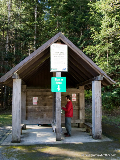
To get there, take Highway 2 to Sultan. Turn left onto Sultan Basin Road and drive 13 miles to Olney Pass and registration station. Stop to register, then right at the nearby junction and follow Forest Road 61 for seven miles to trailhead. If the road is still closed at Site 3, park at the boat launch and hike the remaining two miles to the trailhead. -Nathan


5 Comments:
Hi, I'm one of the fan in your website.
I'm going to hike this trail on this weekend.
How was the condition of Sultan Basin Road and Forest Road 61. It's very important to know before we go there.
If the road condition is just like Mt. Persis(huge gravels on the road), I never wanna go there. :(
Please help me out. (Mt.Pilchuck, Fuller Mt, Beckler Peak, those FR were just fine.)
Hi,
The Sultan Basin Road in general is well maintained, unlike Persis. However, the road is currently closed at the South Shore Gate for the winter.
http://www.snopud.com/PowerSupply/hydro/jhp/jhprecreation/jhpsultan.ashx?p=1500
Thanks for following our site!
Yea, I just came back from the RD 6129(was closed). I read your reply too late.. :<
alternatively, went to Heybrook Lookout. expected to see Mt. Persis and Index but it was pretty foggy on the top, couldn't see anything..
hey i cant find the link download the gpx file for free, did you guys stop offering that?
You can still download the GPX files for most of the hikes. I went ahead updated Greider Lakes so you can download the file now. Cheers! - Jer
Post a Comment