


Total Ascent: 2042ft
Highest Point: 2522ft
Total Distance: 4.75 miles
Location: N 47° 31.766, W 121° 59.783
Required Permit: Discover Pass
Difficulty: Hard
 Back when we were training to summit Mt. Rainier, Jer and I went up and down the Tiger Mountain Cable Line more times than we can remember. Those familiar with West Tiger Mountain #3 off I-90’s Exit 20 will recognize the view from the top, as the Cable Line culminates at the same summit, but arrives there via what is essentially a straight shot up the back of #3. This is not a hike for those that prefer the easy path. This hike should be reserved for training or trail running, as there is little difference to the flora and fauna between it and West Tiger #3, other than the possibility of spending so much time trying to catch your breath on the Cable Line that you might not notice the forest surrounding you.
The trail can be accessed a number of ways; our preferred method was off
 the paved road on the way to the West Tiger Mountain #3 parking lot. There’s something of a cul-de-sac just before the gated gravel road here. If you’re lucky - and by lucky I mean arriving either early in the morning or on a weekday – you’ll be able to park here. A more likely scenario will find you parking on the shoulder nearby. A short way east of the cul-de-sac you’ll find some fairly large boulders marking the trail up. This is where the fun begins. Looking up the trail things seems fairly benign, but the trail climbs up a bit to momentarily flatten in a power line meadow before really kicking into gear.
The trail is best thought of as a series of three hills with some short plateaus between them.
The first hill is at once the least intense and arguably most treacherous. At this lower level, there tends to be more water and more soil; meaning, more mud. The incline is such that, depending on the time of year, you could find things extremely slick. It is also your first challenge and your body has yet to figure out that you’re going to be asking it to work a bit harder than a normal hike. After scrambling up the first half of this hill you’ll be presented with a sign letting you know that no one officially maintains the Cable Line. You may have deluded yourself into thinking things are not going to be that bad, but as you continue past the sign the sheer ridiculousness of the grade will be made readily apparent.
The first hill ends with a nice flat plateau that you will see the end of. If you’re a little winded, take a few minutes. The second hill is much longer and is the real hump of the hike. Getting to the second leveling off after that monstrosity really puts the bulk of the work behind you. While not as slick as the first leg, the second hill can seem unending. Unlike other portions of the hike, this hill is much more open, and feels like you’re walking up some sort of washed out gully. Your reward after this point is a significantly longer plateau before hitting the rocky home stretch. Again, if you’re winded, take a minute or two. There’s still one leg left.
The last push is close up again, the underbrush crowding up to the edges of the trail. Things are rockier here with a lot of loose stone, might want to pull that hiking pole out to keep you from sliding backwards. You’ll know when you’re near the top when you reach the next iteration of Cable Line signs, this one marking where the West Tiger Mountain #3 trail cuts across the Cable Line. #3 veterans will likely remember this signpost as the indicator they used to note that they were less than a ½ mile to the top.
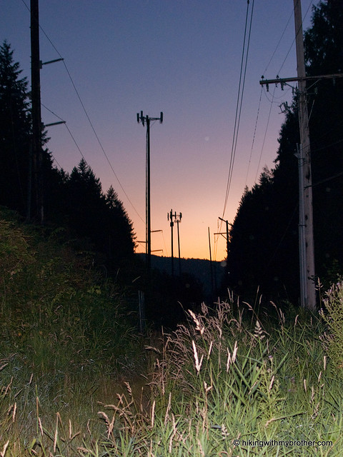
Sweating past that last portion will deliver you to the 2522’ summit,
 which looks roughly to the southwest. On a good day Mt. Rainier peers out from around a bluff to the south and the end of Lake Washington can be seen with I-90 stretching across it
So you made it up, now to get down. We recommend you try going from the summit back down to the regular trail on the Cable Line - it gives you a good sense of what you're in for and how steep it was on the way up. Once you get back to the regular trail, decide whether you want to brave the Cable Line down or if you'd like to take the easy road. As you can see from the map above, we took the easy road this time.
Over the course of 3 months or so we made the brutal slog to the top many times, methodically increasing the weight on our backs. Not surprisingly, during our early attempts we came up with a baseline time for ascending up the 2042’ to the summit. Everything thing we did after that was an attempt to push ourselves to shave a minute or two off our time. This became increasingly difficult as we started hauling up more and more weight, eliciting more and more cramping and cursing. We promised ourselves that after we beat Rainier we’d come back and see how fast we could do it without all that weight on our backs. Our current record to the top? 47 minutes. -Nathan
Print Google Directions >>
15 Comments:
47 minutes is Good!
I consider the Cable trail one that really justifies bringing a couple of trekking poles. The first time I accidently happened upon it, I only had my customary one, and I really regretted not having the other.
Also, I wouldn't recommend to anyone who isn't in top shape with youthful knees and very lightfooted to go down the Cable line - it's a treacherous decent, and high impact - especially when you consider the option of the regular trail.
The accent is a wonderful challenge though, and can be an absolute lung buster depending on your pace.
I don't want to brag, but I made it up in 40 minutes :-) Also training for Mt. Rainier.
Btw, your website is amazing. We refer to it all the time when heading outdoors. We love the outdoors and you have given us a lot of ideas and inspirations. Keep it up!!!
Brag away! 40 minutes is an excellent time! Good luck on Rainier, it is an amazing experience.
You're more than welcome for the site, we're having a lot of fun finding new trails and keeping things updated. Always good to know people find it useful!
N
Cable Line was our go-to for Rainier training...easily accessible and hard as hell, especially with 20 pounds of water on your back! In all honesty, I've never been in better shape than I was after 2 solid months of suffering on Cable Line once a week. :)
Hi Sara,
That's awesome, when was your climb up Rainier? This is still my go to hike for getting in shape because it's so close and so brutal. I've been up it three times this summer, and I'm hoping to make it out again this week!
Jer
You should check out Mailbox Peak for some equally-joyous, lung-busting times; it's a ~3800-ft ascent across 2.5 miles.
Does anyone know if this hike is more challenging than the Lake Serene Bridal Veils hike? I have done the Lake Serene hike, but have never done this one and am planning on doing it this Wednesday so any feedback would be appreciated =) Thanks yall!
Hi Jonathan, The grade and trail conditions are much more challenging than Lake Serene. The route up the cableline is not maintained, and is very steep. Hope that helps!
Thanks Jer! Your comments were very helpful =)
I'm leading a group of beginning hikers on a series of hikes this summer. We started with Little Si, will be doing Poo Poo Point this weekend, and the plan was to do the reverse route of this hike next weekend. In finally getting a chance to read it, I think it might be too difficult for a group of beginners with kids and dogs, even in reverse.
Can anyone confirm?
Paul
Paul, this hike is probably more difficult that you want for beginning hikers. Even on the way down it is very steep and is not a very well maintained trail. However, if you skip the Cable Line segment, the hike up to West Tiger 3 is a great hike for beginners, though it does not have the same views as Poo Poo Point.
OK, thanks Nathan. That really helps. Is West Tiger 3 a nice increase in difficulty from Poo Poo, or roughly the same? If the same, what would be a nice one to add that's a little harder? For context, the one AFTER next week will be Bandera.
Thanks again.
Paul, it's about the same as Poo Poo - another mile and another 400 ft of elevation. Assuming everyone has done Mt. Si (you could try the old route, which is on our site), a nice increase in that area might be the hike out to Pratt Lake Saddle. It's about 8 miles but only 2200 feet. That will help with the distance. Bandara is also about 8 miles, but another 1000ft of elevation.
Thanks, Nathan. We'll definitely do either Pratt Lake or West Tiger 3. Appreciate you helping us avoid a miserable hike :)
Thanks for the maps guys. I just moved to the area and already used your map to hike Poo poo point. The way points you marked are very helpful.
Post a Comment