Our Hiking Time: 2h 20m
Total Ascent: 200ft
Highest Point: 2200ft
Total Distance: 6.5 miles
Location:
N 47° 12.5280, W 120° 58.5360
Required Permit: None
Difficulty: Easy

We’re always looking for ways to inspire hiking during the winter months. With the New Year upon us, we wanted to find a hike that any family to could take on New Years Day to start 2013 off right. With that in mind, we decided to head out over Snoqualmie Pass to take a winter walk down the Coal Mines Trail.
In 1884, the rapidly expanding Northern Pacific Railroad began laying track toward Stampede Pass, in an effort to finally connect the Puget Sound to the Midwest. The previous year, the company’s engineers had located rich coal deposits near the railroad’s planned route and wasted no time in setting up a means to extract the substance that was fueling their locomotives. By 1886 the Northern Pacific Coal Company’s settlement around the coal mines was platted as Roslyn, named by the railroad’s vice president, Logan Bullitt, after a city in New York associated with his girlfriend. Nearby, the town of Ronald also sprang up,

named after Alexander Ronald, the superintendent of the coal company. A spur track was quickly built from Ronald through Rosyln to Cle Elum, where the coal could be loaded onto trains and shipped where it was needed. In 1987, the tracks were removed and in 1994 Coal Mines Trail was created following the old railroad grade.
The mines along the Coal Mines Trail operated for 77 years before the last one closed down in 1963. During that time the population of the area mushroomed as miners from many different groups came to work the mines. As they arrived, miners found others that spoke their language and shared their culture, creating small ethnic communities all along the rail route. That tradition had some interesting side effects such as the Rosyln cemetery, which consists of 5,000 graves divided between 25 different religious and ethnic cemeteries. Some of those graves are a product of Washington State’s worst mining disaster in 1892, when 45 miners perished after an explosion in the lower levels Roslyn’s No. 1 mine.
The trail begins directly from the street, passing the tree-lined backyards of current neighbors. Wide and flat, the trail can handle bikes and strollers in warmer months and snowmobiles and cross-country skiers when it snows. Houses quickly yield to more trees, cottonwoods and maples at first, followed by pines and firs further down the trail. With no elevation to slow you down, you’ll quickly glide past interpretive signs marking long-gone settlements such as Happy Hallow and Ducktown, as well as mine and building locations.

At just over a mile pass what remains of a coal washer that used waters from Crystal Creek to separate the coal from less useful substances. A quick climb up the hill reveals your first glimpse of the neatly sculpted hills made of slag and tailings from the mines. Miners dumped everything they brought up out of the ground in massive piles near the mines, some of which rise right next to the trail. At two miles a spur line leads out to the No.9 and No. 10 mines, where the curious can do some exploring and find the sealed mine entrances and the cement foundations of surrounding buildings.
Continue to follow the trail for another mile to find the site of the No. 1 mine and other buildings on the outskirts of Roslyn. From here, the trail takes you though the town, past a number of former mining offices and stores, and onward toward Ronald. The last mine on the route is the No. 3 mine, which has plenty of artifacts and crumbling foundations to explore.
While the Coal Mines Trail is not exactly a hike, it allows absolutely anyone to wander through the area’s coal mining past. Easily accessible and walkable year-round this trail should be on your list of alternatives when you need to entertain your non-hiking friends and family. During the fall months, the changing leaves attract even more folks to this popular walk. Try starting off your year with something a little different, and give the Coal Mines Trail a visit.

To get there, take I-90 to Exit 84 to Cle Elum, merging onto 1st Street. Continue for a mile to Stratford Street. Take a left and find the signed trailhead on the corner of Stratford and 2nd Street. Parking spots are available in front of Flag Pole Park, which includes a large map of the historical highlights along the trail. If you’re looking for more detailed information, free Coal Mine Trail pamphlets are available at the Cle Elum Chamber of Commerce located just across the street on 1st Street. -Nathan
Print Google Directions >>
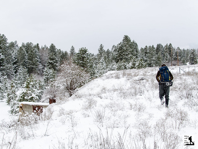


 destinations, so expect a little company as you head out to Staircase. There’s less traffic in the winter, so if you’re looking for an introductory snowshoe, Staircase Rapids is a good bet.