about us | links | permit info
Subscribe to Hiking With My Brother Email Subscribe Follow Hiking With My Brother on Facebook Follow Hiking With My Brother on Twitter Hiking With My Brother Picasa Hiking With My Brother YouTube

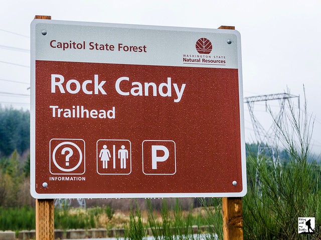
Rock Candy Trailhead - Capitol State Forest

Our Hiking Time: 2h 30m
Total Ascent: 1000ft
Highest Point: 1500ft
Total Distance: 5.5 miles
Location: N 47° 1.902, W 123° 5.592
Required Permit: Discover Pass
Difficulty: Moderate

Nathan's PhotoWhile snow will continue to keep many hikes out of reach for months to come, there are still plenty of low elevation hikes that can be accessed right now. A few weekends ago we found some time to head out to Capitol State Forest to explore some of the many trails in the area. We only had a chance to see a small portion of Capitol State Forest, but we saw enough that we'll definitely be back to see other sections of this sprawling forest.

Logging and the lumber industry loom large in the story of Capitol State Forest. Loggers have been knocking down its trees since the 1870s, back when this area of the country was still called the Washington Territory. Railroads and logging companies worked at a breakneck pace, chopping down forest as rapidly as possible, practices that ended up resulting in a series of forest fires that cleared tens of thousands of acres of vegetation. By 1933, the situation had become so dire that the legislature stepped in and purchased over 50,000 acres of what would become the Capitol State Forest to be managed as a commercial forest. In order to rehabilitate the land, the public was kept out of the area and the Civilian Conservation Corps was called in to plant millions of seedlings between 1938 and 1942.

By 1955 the area had recovered enough to allow public access and a long tradition of recreation in this managed forest began. Since that time, Capitol State Forest has only expanded, now boasting more than 90,000 acres and offering a wide variety of recreational resources. Riddled with forest roads, trails, and former railroad beds, Capitol State Forest attracts hikers, trail runners, campers, mountain bikers and off-road vehicle riders. Since 1975, the trails have been divided between motorized recreational use in the north half of the forest, and non-motorized recreation in the south to minimize interactions between equestrians and off-road vehicles. Today, Capitol State Forest hosts more than 800,000 visitors a year, and offers a little something for everyone.

This loop begins directly across the road from the Rock Candy  Trailhead parking lot, following the well maintained North Rim Trail into the woods. Continue along the wide trail for a few tenths of a mile to the junction with the Rock Candy Mountain Trail. Avoid the temptation to wander across the bridge, you’ll end up there at the end of the hike. For now, head right on the North Rim Trail as it begins its climb up the mountainside. The forest along the trail is fairly young, and evidence of recent logging is never too far off. As you press upwards the trail steepens and beings to switchback up to the shoulders of Rock Candy Mountain, ultimately reaching a forest road known as Army Road. This is the highest point on this loop, though there is little scenery to enjoy, recent logging activity has provided a view of the Black Hills to the south. Head left along Army Road to the Army Road Tie Trail and the shelter of the forest. Find the Rock Candy Mountain Trail almost immediately and follow it back to the trailhead.

While there isn’t anything particularly spectacular to see along this hike, this little loop is a decent winter option and is a great introduction to Capitol State Forest. These trails do see a lot of off-road vehicle traffic during the summer months, but they’re closed to motorized vehicles from November to May, making this a good time of year to do a little exploring. If you’re looking to expand on this route, the Department of Natural Resources offers a decent map to help you navigate the trails. If you haven’t given Capitol State Forest a visit, give this loop a try this weekend.

To get there, take I-5 South to Olympia and take Exit 104 onto US 101 North. Continue on US 101 North as it merges into US 8 after 6 miles. Take US 8 for 4.7 miles to Rock Candy Mountain Road. Turn left and follow the road a few tenths of a mile to the Rock Candy Trailhead and parking area. -Nathan

Download Capitol Sate Forest Trail Map

Print Google Directions >>
Rock Candy

Ranger Hole & Interrorem Nature Trail

Our Hiking Time: 40m
Total Ascent: 150ft
Highest Point: 300ft
Total Distance: 1.8 miles
Location: N 47° 40.458, W 122° 59.790
Required Permit: None
Difficulty: Easy

Nathan's Photo
A few months ago we headed out to the Olympic Peninsula to find hikes that could be done during any season. One of those hikes was Ranger Hole, a short forest hike to the Duckabush River through lush forest and over 100 years of history.

Back around the turn of the last century, the forests of the Olympic Peninsula were known as the Olympic National Reserve. In 1907, the Forest Service was reorganized and the Olympic National Forest was born. The newly created National Forest needed an administrative headquarters, and Assistant Forest Ranger Emery J. Finch was chosen to build it. Ranger Finch began construction of “No. 27 Interrorem Administrative Site” in 1907 and moved into the cabin with his new bride in April of 1908. While intended to be temporary, the name “Interrorem” stuck and, although Ranger Finch resigned in 1910, the Interrorem Ranger Station served as the main administrative building for the Olympic National Forest and the Mount Olympus National Monument for the next 25 years. In 1933, the Mt. Jupiter Fire Lookout was built, the cabin was re-purposed as a fireguard station, and the administrative functions were moved elsewhere.

The cabin, now known as Interrorem Guard Station, served as basecamp for activities organized under the Emergency Relief Act, which would become the Works Progress Administration. Workers participating in Depression Era programs such as the Civilian Conservation Corps were stationed on the acreage surrounding the cabin. Interrorem Guard Station then operated solely as a fireguard station from 1942 to 1986, when modernizations in fire detection made the fireguards no longer necessary. While occasionally used by volunteers after 1986, the cabin quickly fell into disrepair until 1994, when it was renovated and made available to the public for overnight rentals. In 2013, the Interrorem Guard Station was added to the National Register of Historic Places as the oldest Forest Service building in the Olympic National Forest and one of the oldest in the Pacific Northwest region.

The Ranger Hole Trail #824 begins from the Interrorem Guard Station, passing into a mixed second growth forest. The trail likely follows the same route the rangers used to access the Duckabush River over the years. Although the waters are currently closed to fishing, the trail leads out to a once-ideal fishing hole used by the rangers, which is where the trail gets its name. The fern-lined trail gently meanders under hemlock and alder, almost immediately offering a side trip along the Interrorem Nature Trail. This short trail is full of interpretive signs that provide additional background on rustic cabin life before reconnecting with the Ranger Hole Trail.

Push onward up a small rise before gently descending to the river. You’ll hear the river long before you see it, as the water crashes through a narrow canyon a few dozen feet below the end of the trail. Use caution in this area: the cliff drops off abruptly. Access to the fabled fishing hole can be difficult, as it requires a short scramble down the rocks to the riverside. Take a few moments to enjoy the river before heading back to the cabin.

This short little trail, accessible throughout the year, works as a great winter hiking option. With very little elevation gain and short distance, hikers of all ages can tackle this hike. While the hike is probably too short to justify a trek out to the Peninsula, it can easily be combined with the Duckabush River Trail or Murhut Falls. Consider taking this stroll through history the next time you head out to Hood Canal.

To get there, take I-5 south through Tacoma to Exit 132B SR 16 toward Bremerton. Continue on SR 16 for 27 miles to merge with SR 3 North. Follow SR 3 to the Hood Canal Bridge, taking a left over the bridge onto State Route 104. Follow SR 104 as it merges onto US 101 and continue 25 miles through Quilcene to Duckabush Road (FR 2150). Turn right and follow the road 3.7 miles to the end of the pavement. The cabin and trailhead are on the left. -Nathan

Print Google Directions >>

Ranger Hole

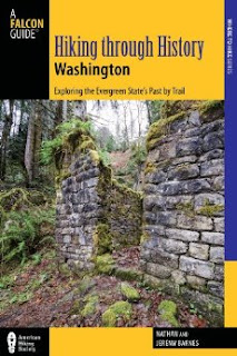
Hiking through History Washington: Exploring the Evergreen State's Past by Trail

Available Online!
Nathan's PhotoNow that it’s February, our guidebook has made it out to the shelves of local bookstores around Washington. While many of our readers know the book is available, we wanted to highlight a few of the features of the book and explain how we hope the guidebook can best be used.

First we should clarify what you’re getting when you purchase the guidebook. You get 50 hikes (40 full hikes and 10 “Honorable Mentions” which do not have full maps, but are otherwise complete) that we have carefully chosen to include a variety in the degree of difficulty and type of destination, so we could make sure there is something for every hiker, no matter what they are looking for. We’ve included everything from challenging summertime summits to short winter walks. You’ll also find waterfalls, alpine lakes, very popular hikes and a handful of obscure ones.  And you'll find historical background for every hike - although this is first and foremost a hiking guidebook, so expect the bulk of the focus to be on the hikes themselves.

All the hikes are within about 100 miles of Seattle, and are grouped roughly by the highway corridor they are located in. The guidebook sends readers out to the eastern side of the Olympic Peninsula along Highway 101 and out west along Interstate 90 toward Snoqualmie Pass. There are hikes down south along Highway 410 as it winds its way out toward Mt. Rainier National Park, and to the north there are quite a few hikes along Highway 2 and the Mountain Loop Highway. Please note that the majority of the hikes are in western Washington, despite the title of the guidebook. Our hope is that as we continue on this journey of writing about our hikes, future editions of this book will clarify this.

Beyond getting all the information you need to enjoy the hikes in the book, we also worked with the publisher to make sure the layout of the book was helpful and easy to use. Each hike is broken into sections allowing you to quickly get to the information you want. You won’t need to fish through paragraphs of trail history to find the location of the trailhead or turn-by-turn hiking directions. Of course, if you’re like us and you want to know the story behind the trail, it’s easy to flip to the history section for a few paragraphs of history. If you prefer prose, you can read the hike overview for a description of the trail route, but we’ve also provided succinct directions and mileages so you don’t have to do any more reading than you’d like.

Most of the hikes include a large, full color map that is easy to read and includes most of the features we reference in the text. If you’re someone that prefers to use a map to navigate, we think you’ll be pleased with what we’ve put together. We’ve also included quite a bit of our photography to give you a glimpse of what you can expect to find on the trail. Our goal was to try and translate the visual feeling of the website into a guidebook. The result is a guide that is more visually engaging than most, with a lot of color and a lot of landscapes we think will help inspire you to hit the trail.

We’ve written this guidebook with our website in mind. The idea is that the website will complement the guidebook – you’ll still be able to find the shortened versions of the hikes in the guidebook on our website along with any updated information about the hike. The idea is to try and make a “living” guidebook that will be continue to be useful as changes are made necessary by washouts, construction or trail re-routes. In addition, you can come to the website to download GPX routes for all the hikes featured in the guidebook, print out Google directions to the trailhead, and read any recent comments other hikers have posted about the hike. Plus, it’s always useful to come to hikingwithmybrother.com to check out our hiking map to see what is nearby your destination. Never hurts to check out other options!

Thanks again for all your support over the years. We hope you’ll pick up a copy of Hiking Through History Washington and help us continue this project into the future. We think we’ve put something together that you’ll find not only informative and easy to use, but also a guide you’ll enjoy using. We’ll see you on the trail. -Nathan
Copyright 2008-2016 - hikingwithmybrother.com
hikingwithmybrother@gmail.com