


Total Ascent: 1000ft
Highest Point: 1800ft
Total Distance: 2 miles
Location: N 47° 10.4220, W 121° 58.4040
Required Permit: None
Difficulty: Easy
 Time is often short around the holidays. It can be tricky to wedge a hike between visits to family and friends. We managed to find enough time to climb to the top of an old favorite, just outside of Enumclaw. Although we first knew the small summit as Mount Pete, it’s also known as Mount Peak, Pinnacle Peak, and most recently the Cal Magnusson Trail. No matter which name you prefer, this short-but-steep hike is perfect for a quick winter workout.
 While Pinnacle Peak is the official name of the 256-acre King County Park that encompasses the small mountain, there is some confusion over the “real” name of the peak. The Harvey Manning school advocates for Mount Pete, named after Pete Chorak, a Yugoslav émigré and businessman who settled in Enumclaw in 1911. Chorak donated land for a park, and founded the town pool; Pete’s Pool, which later became the city’s stadium. At some point, locals began referring to the mountain as Mount Peak. Our research did not dig up a reason for this switch, though one theory is that “Pete” sounds a lot like “Peak,” suggesting that the latter could have just been born in conversation. When King County bought the first sections of the mountain in the 1980s, the name Pinnacle Peak seems to have risen in prominence, though the fire lookout that stood there from 1928-1971 is always referred to as the Pinnacle Peak Lookout. In 2009, the trail to the summit was dedicated to Cal Magnusson, a Cascade climbing legend, who began maintaining the trail in 1975.
The trail begins steeply from the trailhead, switchbacking up the mountainside, through alder, cedar, and hemlock. From the outset, the plethora of trailside projects hints at the popularity of the trail. Platforms, benches, stairs, railings, nature signs are all here, maintained by a dedicated group of volunteers. Through their efforts the trail is wide, clear of brush, and easy to navigate.
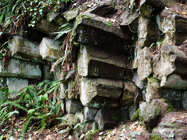
 The trail wastes little time in pushing you toward the summit. After a mile, the trail meets up with a logging road. Head left and continue upward, keeping an eye out for geologic evidence of the mountain’s volcanic past. Near the top you’ll notice exposed honeycombs of basalt, horizontal columns of rock protruding from the mountainside. Continue beyond these formations for the summit and the crumbling cement lookout foundation. Although there are some benches here for a rest and a snack, there is very little in the way of views, as trees have long since blocked the views. However, on good days Mt. Rainier can be spied from a small pocket viewpoint just below the summit, roughly where the road ends.
Close and easily accessible, this is a great winter hike or works perfectly as a last minute escape to the outdoors. However, expect a lot of company on this short hike. Hikers young and old tackle this trail everyday, trail runners are common, mountain bikers frequent the south side of the mountain, even local police and firefighters incorporate the route into their training regimen. So many visitors can’t be wrong. If you haven’t made it out to Pinnacle Peak, put this on the list for your first hike of 2012.
To get there, take I-5 south to Highway 18 Exit 142A. Follow Highway 18 into Auburn and take the SR 164 exit. Head left on SR 164 through Enumclaw to SR 410. Follow SR 410 for just under a mile to 284th Street. Take a right and follow 284th for a mile and a half to 472nd Street. The Cal Magnusson Trailhead is a half-mile ahead. -Nathan
3 Comments:
Vivid description of your hike and your pics of the trail are great. Love those moss-covered trees and stuff. Good for you to be able to slide in a winter hike during the hectic holidays.
Awesome! I'm glad you guys did this hike! I did the south end of the trail during Summer. Did not make for good times when your climbing a steep mountain when it was 85 degrees. I was going to do the Cal Magnusson trail, but I heard it was steeper than the south side. :)
-Elle
Yes, the south approach is less steep - probably the better option in the heat! Might be a good time of year to try the Cal Magnusson. It's definitely a different experience. And while it is steep, it's also pretty short!
Post a Comment