


Total Ascent: 350ft
Highest Point: 600ft
Total Distance: 3.6 miles
Location: N 47° 50.8440, W 122° 2.9760
Required Permit: None
Difficulty: Easy
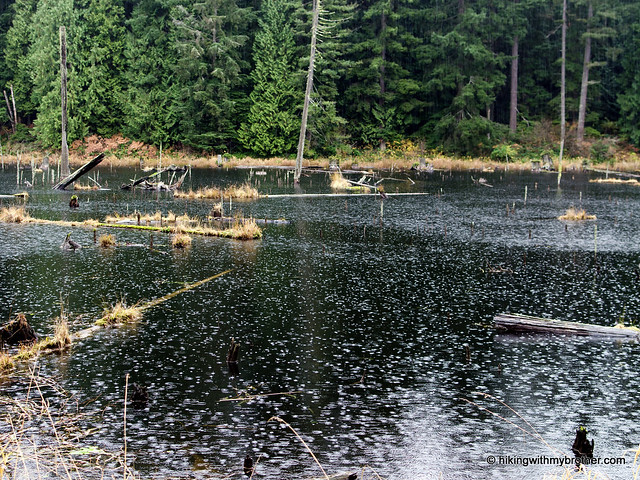
 Recently, we found some time to visit Lord Hill Regional Park, a 1,300-acre park in Snohomish County. With over 11 miles of walking trails so close to the city, we took a little tour to see what the park had to offer.
The park is a decent hiking destination during the winter. It’s close and easily accessible, but still large enough to feel like you’re getting out into nature. During warmer weather, this is a great place for youngsters to get out into the woods for the day,
 but be prepared to share the mixed use trails with mountain bikers and equestrians. All in all, it’s worth an afternoon to trek out to explore Snohomish County’s largest park.
There's a lot more to Lord Hill Regional Park, and you can learn all about it in our book, Hiking Through History Washington. You'll find a trail map, route descriptions, history, and more for this and many more hikes throughout the State. Help support hikingwithmybrother.com and the work we do by picking up a copy!

To get there, take SR 522 north toward Monroe. Take the Monroe W Main Street exit and circle around the roundabout to head west on 164th Street. Follow this road for about three-and-a-half miles as it changes from 164th to the Old Snohomish-Monroe Highway to 127th Ave SE. Turn left and continue for a mile-and-a-half to 150th St SE. Take a right and find parking at the end of the road. –Nathan
Print Google Directions >>
3 Comments:
Looks like an interesting trail based on your description. Would be good for us to try it out some time.
I'm glad I found your blog. My family and I stood at the entrance of Lord Hill for a few minutes today and decided to come back when we were prepared for a hike.
I've attempted this one but there are so many side trails that its best to get a detailed map first. Its best not to attempt it on the S side due to the 522 construction. You'd never imagine a place like this amongst cities and construction, a place to fish, ride a horse, touch the waters of the Snohomish River. Doesnt take hours to get to either!!!
Post a Comment