


Total Ascent: 1300ft
Highest Point: 1800ft
Total Distance: 2.5 miles
Location: N 47° 49.4100, W 121° 34.0380
Required Permit: None
Difficulty: Hard
 We continued our exploration of the Index area this week by checking out the iconic Index Town Wall. We had viewed these exposed cliff faces from Heybrook Lookout and Bridal Veil Falls, and this time we decided to see if we could find a way to the top. With a little bushwhacking and some inventive route finding, we eventually came up with the best approach to access the cliffs.
This is a fun little hike, good for a day when you don’t have
 a lot of time, with some great rewards on a short, if somewhat challenging, route. There is more to see and explore in the 1300-acre Forks of the Sky State Park for those that want to do a little extra. Obviously, use caution while up on the cliffs. It’s a 500’ foot sheer drop to the bottom. This area is extremely popular climbing spot, so be aware that there are likely climbers below.
There's a lot more to Index Town Wall, and you can learn all about it in our book, Hiking Through History Washington. You'll find a trail map, route descriptions, history, and more
 for this and many more hikes throughout the State. Help support hikingwithmybrother.com and the work we do by picking up a copy!
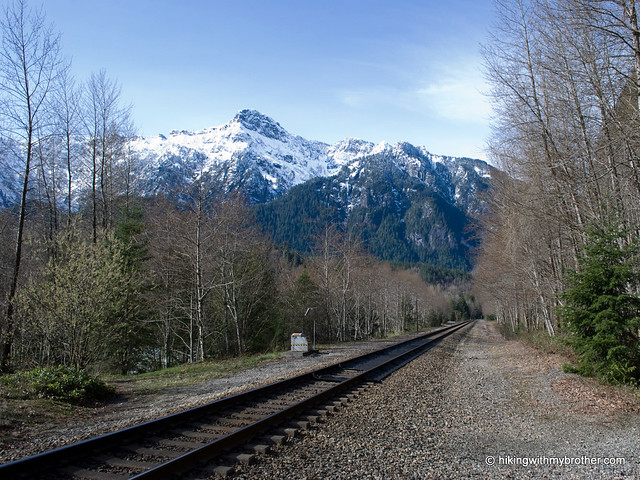
 To get there, take Highway 2 to the Index turnoff near Milepost 34. Follow the Index-Galena Road for about a mile to the bridge. Take a left across the river, proceeding through town to Index Ave. Take a left crossing the railroad tracks and following Index Ave as it turns left and becomes 2nd Street. Take the next left onto Avenue A and follow it out of out of town for a half mile to find the parking area on the right. Park and hit the trail. -Nathan
Print Google Directions >>
7 Comments:
Thanks for your excellent directions to the trailhead, they really helped me out!
I thought it was the Skykomish Indians. The Skokomish are somewhere in the peninsula, correct?
Yes, that is correct, and thanks for spotting that typo! All fixed now.
N
Hi Nathan, I've been wanting to take my youth group, of about 20, out on this hike. However, many reviews, from places such as WTA, say that this hike is very difficult, and some even turned back. What would you think if I took my group out on this hike? Thanks!
This hike isn't difficult in the sense that it is extremely strenuous, it is difficult because it is challenging to navigate. The trails here are narrow and steep, mostly made by rock climbers. There are lots of junctions and you can get twisted around (the easy thing to do is always take the trails leading up). This is less of a problem when it's just you and a friend, but could be really a problem with 20 people in tow. We would suggest that you do a test drive of this hike before you bring your youth group, just to make sure you can confidently lead them up. If you're looking for an alternative, Lake Serene is right nearby, and if your group hasn't done that one, it's a great hike. Hope that helps!
I've done a lot of climbing at Index over the years, where is that huge split boulder located?
www.mrbills.org
As smartphones get smarter every year, our taste in wallpapers is growing too. In 2025, people want more than just basic backgrounds — they want something that actually reflects who they are. HD, 4K, even 8K wallpapers are now the go-to because they make your screen look sharper, cleaner, and way more personal.
Whether it’s your lock screen or home screen, the right wallpaper can completely change the vibe of your phone. It turns your device into something that feels more “you” — stylish, expressive, and visually uplifting.
https://colornjoy.com/products/rainbow-friends-coloring-pages-water-bottle-blue-green-purple-adventure-time
https://colornjoy.com/blogs/hello-kitty-wallpapers/aesthetic-hello-kitty-pfp-download-8gf5r10b7
https://colornjoy.com/blogs/pink-wallpapers-1/hello-kitty-pink-pfp-free-3wz5v84t1
https://colornjoy.com/blogs/hello-kitty-wallpapers/4k-background-cute-hello-kitty-wallpaper-download-6ap4t38h7
Post a Comment