


Total Ascent: 1300ft
Highest Point: 2000ft
Total Distance: 4.6 miles
Location: N 47° 28.908, W 122° 03.248
Required Permit: Discover Pass
Difficulty: Easy
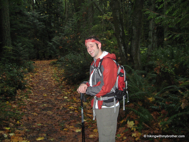
 We were short on time last Sunday, with a number of familial factors limiting the duration of our hike, so we took the opportunity to visit something closer to home. We’d often bypassed Squak in the past, preferring to push further out the I-90 corridor to places a bit more remote and potentially rugged. But, considering the number of times we’d been up and down Tiger, we thought a visit to Squak was long overdue.
 Squak Mountain is tucked between Tiger and Cougar Mountains, somehow dodging the feline-themed naming craze that struck the area back in the day. Back in 1972 the Bullitt family donated their one-time summer retreat of roughly 600 acres near the top of Squak to the State of Washington which has since managed to expand the boundaries of the park to encompass some 1,545 acres. There are several entrances to the park; we took one of the lesser known. I-90 to exit 17. Take Front Street N to W Sunset Way. Take a right and head straight, heading up Mt Park Blvd SW until taking a left on Mountainside Dr SW. Follow Mountainside around a curve or two before seeing a spur and some park signs just as Mountainside Dr continues a major switchback up Squak. Go ahead and park and pile out.
Arriving mid-drizzle we geared up and started off to conquer the nominal peak. We were, perhaps, over-prepared for the well maintained and gentle trail that greeted us. The primarily deciduous forest had already dropped the majority of their leaves and carpeted the trail in gold big leaf maple and brown alder. While the network of trails is fairly extensive, nearly every fork in the trail is well signed, making it unlikely that one could get too twisted around. The detailed map on at the trail head is worth a perusal before setting out, just to get a rough idea of where you’re going.
Our trek up to Central Peak followed the Bullitt Access trail, still fairly wide and graveled despite it being decades since a vehicle clunked its way up to the Bullitt summer cabin near the summit.
 After a few junctions we took the Central Peak fork, where the trail became a little steeper and the vegetation shifted to a more familiar mix of ferns and Douglas fir. At about 1,700 feet, we were in the clouds, giving the trail an otherworldly feel that allowed us to pretend that we might be more than just a few miles outside of town, and that perhaps the occasional rumble was something other than rocks tumbling down the nearby quarry. Almost before we knew it arrived at the microwave towers that currently reside at the summit, along with the obligatory beige shacks, dreary chain link fencing and borderline hysterical over-signage. There’s no real view to speak of, though we supposed that on a clear day one could see Tiger and parts of Issaquah. We didn’t linger.
We took a slightly different route back to swing out and take a peek at the Bullitt Chimney, all that remains of the summer home that once stood here. The Chimney and cement foundation sit in a clearing along with a forlorn picnic table.
 We assume that when a cabin stood here the residents hacked out some sort of view from the surrounding forest, felling trees to take in what could be a nice vista of Renton, Seattle, and the south end of the Sound. As it stands, the rejuvenated forest suffices.
The autumnal smell of damp rotting leaves returned as we descended – there were several opportunities to explore more branches of the trail network, however, we felt that we’d already captured the essence of the park. Squak is great for walking the dog or getting in some trail running close to home, and we would highly recommend bringing the family out for a stroll – nice, well maintained trails, lots of room, not too crowded, but easily accessible. It was not intense enough for our hiking needs, however, so save this one for the kids and look elsewhere if you're yearning for something of a challenge. -Nathan
Print Google Directions >>
3 Comments:
We hiked to the Bullitt Chimney over the weekend and talked to another hiker who said the home that the chimney was part of was never occupied. They tore it down after it kept on getting vandalized. I tried looking up more info on the home but can't find much.
Yes, the our post breezes over the somewhat tortured saga of the home Stimson Bullitt built on Squak Mountain. An attorney in Seattle, Bullitt purchased the land in the 1940s, had a cabin designed, and construction was completed in 1952. It was meant to be a weekend and vacation home, but Stimson spent only a few nights there, as his wife at the time refused to spend time at the cabin. It stood unoccupied years, and vandals eventually set fire to it. The roof was intact for some time after - groups celebrated the first Earth Day in 1971 under its cover. Although Bullitt's children donated the cabin and surrounding 590 acres to the state in 1972, by 1975 the roof was gone; collapsed when all the supports were pulled out by people in jeeps. Hope that helps!
Thanks!
Post a Comment