Total Ascent: 2600ft
Highest Point: 3500ft
Total Distance: 10 miles
Location: N 47° 27.5000, W 121° 48.3667
Required Permit: Discover Pass
Difficulty: Moderate
 This week we had some unfinished business to attend to with the Rattlesnake Mountain Trail. Months ago, Rattlesnake Ledge was a good warm up during our Rainier training, but as the weather heated up, the amount of traffic increased exponentially. This created the difficulty of navigating between folks with large packs, which prompted us to forgo this hike in favor of the Cable Line. On one of our last climbs up to the Ledge we pushed past the crowds and further down the Rattlesnake Mountain Trail, quickly encountering icy snowpack that we were fairly unprepared to navigate. After meandering through trails and logging roads,
  we were forced to turn around before reaching the next waypoint on the trail and assumed that we had somehow lost the trail.
We returned this week interested in finishing what we had started earlier in the year and shaking up our routine by doing a through-hike instead of a peak. We parked a car on the Snoqualmie Point end of the trail, and then carpooled up to the Rattlesnake Recreation Area to get started.
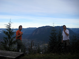
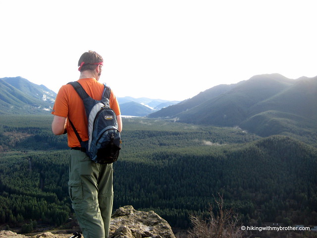
On the whole the trail is well maintained and friendly. The short two mile jaunt up to the Ledge makes it an attractive and easily accessible hike for families and large groups, which can quickly clog the sometimes narrow trail. The signed Ledge provides a fairly impressive panorama over Rattlesnake Lake, with Mt. Si, Mailbox Peak, and Mt. Washington dominating the view to the north. From here you can see two more outcroppings perched higher on the mountain which can be easily accessed by continuing up the trail.
 The final ledge gives the greatest vantage point and most western view, with tiny trails carved into the scrub for the more adventurous scramblers to clamber around on.
The trail continues up through increasingly dense forest; at times sunlight is largely blocked out and footsteps lost in browned pine needless and the smell of humus. At about three miles, the trail begins to open up and intersect with a series of logging roads in various states of use and abandon. The trail is well signed and we had no trouble making our way to East Peak and its resident tower and vistas. The forest is young here, still not fully recovered from the timber harvest decades earlier. A mix of Noble firs and pines gives way to cedars and eventually alders, all no more than 30 years old. Trees continue to get younger as the trail progresses until you finally reach very recent cuts. Roughly the last two miles of the trail winds through recent select cut patches, with only a few trees left standing to foster an eventual rebirth.
 East Peak marks the end of the elevation gain at 3500’, and the rest of the trek was mostly a gentle downhill. Several other viewpoints await the hiker from here; Windy’s Point, Grand Prospect, and Stan’s Overlook are signed stopping points along the route to Snoqualmie Point, all offering expansive views to the north, eventually including views of Mr. Baker, Russian Butte and Mt. Teneriffe. Moderate in difficulty only because of the initial short bouts of steep grade going up to the ledge, this route is a great casual hike through the woods if you’re short on time but want to get some miles in.
From the number of hikers we passed coming from the opposite direction, Snoqualmie Point seems to be the more popular starting point of this trail; however, we’re recommending you start early at Rattlesnake Lake and avoid the crowds and the longer incline. Snoqualmie Point is easily accessed via Exit 27 off I-90 coming from the city. Take a right and follow the road for a ¼ mile until you hit the trailhead. Unfortunately there’s no onramp from Exit 27, so you’ll have to traverse North Bend to get back on I-90. To reach the Rattlesnake Recreation Area take Exit 32 off I-90 and a right on 436th Ave. SE. Follow the main road for a little over three miles before reaching the parking area. The trailhead begins on the opposite side of the lake, accessed via a service road opposite the lot. Park it and get going! - Nathan
Print Google Directions >>


7 Comments:
Really enjoying reading your posts. I've done the Rattlesnake Traverse twice, both times starting at Snoqualmie Point and ending up at the lake. It works out well to do it this way, because you reach the 3 ledges near the end of your hike, the perfect time to take a break and soak in the view. I did the hike over Memorial Day weekend a couple years ago, and there was 6 or 8 feet of snow at East Peak (3500 feet). I think that was unusual. BTW, your link to the Rattlesnake Ledge hike mistakenly lands on the page for the Rattlesnake Mountain trail.
We'll be doing this hike this Saturday, meeting at the old Snoqualmie winery area at 7 AM, then car-pooling to Rettlesnake Lake and the trailhead...
I did nearly this hike this morning, except that all my friends canceled so I did not have a car for both ends of the hike. Parked on the Snoqualmie Point end and hiked to East Peak and back. Total distance: 12.2 miles. Great hike, thanks Bro!
Hey guys,
Looks like the link for rattlesnake ledge and mtn trail are identical--is there a separate link for the ledge trip?
thanks!
Hi Andrew,
The ledge and rattlesnake mountain are on the same trail. Follow the directions to reach the Rattlesnake Recreation Area off of Exit 32 and it's about 4 miles round trip on the trail to do the ledge hike!
Have a good hike!
Jer
aha, gotcha, thanks!
Really fun hike, cool ledge, spooky forest the higher you go up, but the East Peak view was relatively disappointing due to the limited vantage points. Fun afternoon, but Mt. Washington takes the cake.
-Aaron
Post a Comment