about us | links | permit info
Subscribe to Hiking With My Brother Email Subscribe Follow Hiking With My Brother on Facebook Follow Hiking With My Brother on Twitter Hiking With My Brother Picasa Hiking With My Brother YouTube

Kelcema Lake Snowshoe #718

Our Hiking Time: 4h 30m
Total Ascent: 1600ft
Highest Point: 3600ft
Total Distance: 9.0 miles
Location: N 48° 06.908, W 121° 36.069
Required Permit: None
Difficulty: Moderate due to distance and some route-finding

Nathans PhotoIt’s snowshoe season and the mountains are brimming with layer upon layer of decent snow. Our most recent snowshoe took us out along the Mountain Loop Highway to the popular Deer Creek Sno-park. While most folks are here to check out the Big Four Ice Caves or do a little sledding on the hill, we had our sights set on Kelcema Lake, tucked into the base of Mt. Baldy at the end of FR 4052.

According to local lore, Kelcema Lake was named by an early homesteader in honor of his three daughters, Kelly, Cecilia and Mary - Kel-Ce-Ma. With the Marten Creek Mine just over the ridge, the area has a rich mining history. More recently however, it was home to Boy Scout Camp Kelcema, from 1922 to 1944. Situated on the eastern shore, the camp was eventually quite extensive, with a lodge, quite a few cabins, and a makeshift dock. Scouts would spend their time climbing nearby peaks, swimming in the lake, and enjoying the pristine setting. It was renamed camp Mathews in 1944, and a few years later it was shut down entirely as the Scouts decided to consolidate summer camps. The buildings suffered from vandalism and disrepair until the Forest Service burned it down in 1966. Since that time, the lake has remained a popular, as the short .4 mile walk to the lakeshore from the road made it a summer destination for adventurers of all ages. More recently however, fallen trees and washouts have blocked the road and significantly lengthened the trek to the lake.

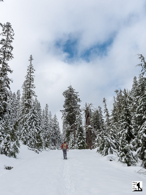
The snowshoe begins from the Deer Creek Sno-Park, following FR 4052 up a gentle grade and into the second generation forest. Your path is fairly straightforward. The road continues to climb while offering occasional glimpses of the forested ridges that surround you. You’ll cross a number of easily forded washouts as you work your way toward the lake. After about 3.5 miles you’ll reach a hairpin turn, signaling that you are nearing the trailhead. Continue onward and upward for another mile to the end of the road and the trailhead. The Kelcema Lake Trail #718 is signed, but if snow levels make it difficult to find, listen for Deer Creek and follow it the .4 mile into the Boulder River Wilderness and to the shores of Kelcema Lake.

Nestled in a bowl beneath Mt. Baldy and Devil’s Peak, it is not hard to imagine the area teeming with Boy Scouts. There is a rough trail around the lake, though sections can be difficult to navigate in the summer months. Find a good spot to settle down and enjoy the quiet before gearing up to head back. On your way out do a little exploring around the end of FR 4052 to find a view of nearby Big Four Mountain and Sperry Peak.

This is a great snowshoe for those looking to put in some distance rather than tromp through the backcountry. The snow makes the hike down four miles of forest road a lot more fun and you’re likely to have the icy lake all to yourself. With relatively little elevation gain, this is also a good area for young or novice snowshoers - even if you don’t make it to Lake Kalcema, it’s still a pleasant tromp in the woods.

To get there, take I-5 North to Exit 194. Follow Highway 2 for about two miles. Stay in the left lane and merge onto Lake Stevens Highway 204. Follow for two miles to Highway 9. Take the left onto Highway 9 toward Lake Stevens. In just under two miles, you’ll reach Highway 92 to Granite Falls. Take a right and follow for about nine miles to the Mountain Loop Highway. Take the MLH for a little over 23.5 miles to the Deer Creek Parking Area/Sno-Park. -Nathan

Print Google Directions >>
Kelcema Lake Snowshoe

High School Trail to Poo Poo Point

Our Hiking Time: 3h 10m
Total Ascent: 1900ft (1750ft in; 150ft out)
Highest Point: 1900ft
Total Distance: 6.6 miles
Location: N 47° 31.163, W 122° 01.778
Required Permit: None
Difficulty: Moderate

Nathans PhotoThis time of year, snowbound trailheads and forest roads push us toward winter walks on urban trails. These walks are a great chance to do a little exploring in our backyard and enjoy familiar forests without their usual abundance of greenery. Recently we decided to head back to Poo Poo Point, but wanted a different approach. The High School Trail was the perfect choice.


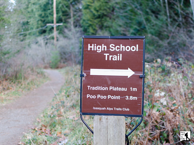
The trail begins from the 2nd Avenue Trailhead, following the Rainier Trail around the edges of the Issaquah High School sports fields. After .2 miles, you will arrive at the signed High School Trail junction. Although the sign states that Poo Poo Point is 3.8 miles down the trail, the actual distance is closer to 3.1. Veer right and enter a young forest dominated by red alder and sword fern. The wide, well-trodden trail soon begins to climb steadily upward, crossing over the Tiger Mountain State Forest boundary at the .5 mile mark. In another .3 tenths a mile reach a junction with the Adventure Trail, the first of a rapid secession of trail junctions on this route. Continue straight ahead and almost immediately find yourself leaving the forest and crossing under power lines. At .9 miles from the trailhead pass the junction with the Bonneville Grade and head back into the shelter of the forest. In a few hundred feet reach an intersection where the Gas Line, Section Line and Poo Poo Point trails cross. Head right, following the sign pointing toward Poo Poo Point.

From here the trail steepens and occasionally switchbacks as it works its way up Tiger Mountain’s shoulders. After 1.7 miles of climbing reach the West Tiger Railroad Grade and your last trail junction. Here the One View Trail, West Tiger Railroad Grade and the Poo Poo Point Trail intersect. Head right, toward Poo Poo Point, following the trail as it descends from the heights you just finished climbing before leveling out. At 3.3 miles reach Poo Poo Point and expansive views of Issaquah and Lake Sammamish. The forested hills to the west are Squawk Mountain’s Southeast and Central Peaks, with the Olympics rising in the distance behind them. On good days you can see Mt. Baker to the north. If you’re lucky, you may even find some hang gliders getting ready to launch themselves out into the open air. Take a few minutes to enjoy the view.

If Poo Poo Point is your goal, the High School Trail is a decent year-round alternate to the more crowded Chirico Trail. With enough elevation gain to get your blood moving, the trail is a great option for conditioning or trail running. What it lacks in wilderness appeal is made up for with its easy access and approachability. During the winter months, snow adds extra challenge and adventure to this normally tame trail. There is enough foot traffic that the snow is quickly compacted, which can make some sections of the trail slick and treacherous. Bring along your microspikes to make the climb a little easier. If you’re a Poo Poo Point veteran and are looking for something a little different, give the High School Trail a try.

To get there, take I-90 out to Exit 17. Take a right onto Front Street and drive 1.6 miles to 2nd Avenue. Take a left at the signal and find the 2nd Avenue Trailhead immediately on your right. Limited parking. - Nathan

Print Google Directions >>

High School Trail

Tunnel Creek Trail #841 to 5050 Pass

Our Hiking Time: 4h 20m
Total Ascent: 2600ft
Highest Point: 5000ft
Total Distance: 8 miles
Location: N 47° 45.384, W 123° 05.489
Required Permit: None
Difficulty: Moderate

Nathans PhotoMore than a few months ago we headed out to the Olympic Peninsula in search of a quiet walk in the woods. We turned our attention to the Buckhorn Wilderness and found the Tunnel Creek Trail, which promised a creekside hike, as well as some panoramic views of wild and rugged peaks. That was more than enough to entice us down ten miles of forest road to this peaceful and engaging trail.

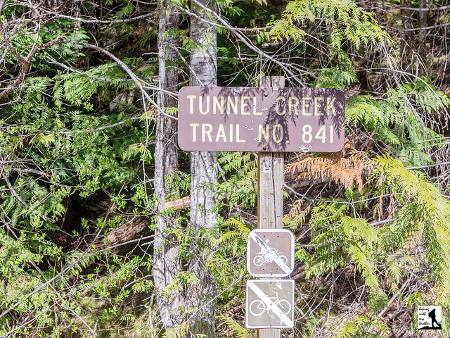
The Tunnel Creek Trail #841 is a through hike, meaning that hikers can start on either end of the trail to make their way up to 5050 Pass. Like most hikers we took the Quilcene approach, which is less steep and somewhat easier to navigate than the Dosewallips end. The Quilcene route begins by following Tunnel Creek into the Buckhorn Wilderness and the quiet shelter of old growth. Ancient trees line the trail as it carves its way through a mossy forest floor and gently climbs up the creek valley. Tunnel Creek is your cheerful companion as you press deeper into the trees, keeping your attention by playfully tumbling over fallen logs or cascading down rocky ravines.

After 2.7 miles reach the Tunnel Creek Shelter, which has offered hikers a roof since at least the 1930s. Take a moment to duck in and read the names and dates carved into the wood stretching back through the decades. Rest up, because from here the trail gets more serious about reaching the pass. Cross Tunnel Creek over a short footbridge and begin your mile long climb to Harrison Lake, following the trail as it works its way steeply up the mountainside. As you climb, the trees will part just enough to offer brief glimpses of Mt. Constance and hints of the views to come. Eventually you'll pass a small tarn just before reaching Harrison Lake at 3.7 miles, then continue upwards another .3 miles to 5050 Pass and a short scramble out to the overlook. One 1932 map notes the location as a “Fine View of Surrounding County,” and that is something of an understatement. Mt. Constance dominates this stunning scene, though in the distance to the north you can pick out Buckhorn Mountain and Iron Mountain. Settle in to see how many peaks you can find or do some exploring to see if you can find a better perch than we did. If you’re still hungry for a challenge, you can push another 4 miles down from 5050 Pass into the Dosewallips Valley, though the trek is reportedly rough and very steep.

Tunnel Creek is a great choice for those that want a little taste of everything on a hike; rushing mountain waters, big views, alpine tarns and old growth forests all a little off the beaten path. The trail shelter offers a decent turn around point for a shorter day, while the climb up past Harrison Lake to 5050 Pass is sure to satisfy hikers looking for a full day in the wilderness. The trail is well maintained and easy to follow, thanks in park to trail volunteers who work diligently to remove blowdowns. For all the trail has to offer, it's often overlooked, which makes it a good alternative to more popular hikes in the area.

To get there, take the Bainbridge Island Ferry and follow State Route 305 through Poulsbo to State Route 3. Follow SR 3 to the Hood Canal Bridge, taking a left over the bridge onto State Route 104. Follow SR 104 as it merges onto US 101 and continue 11.3 miles through Quilcene to Penny Creek Road. Take a right and continue 1.4 miles to a split in the road and the end of the pavement. Veer left onto the Big Quilcene River Road (FR 27). Continue 3.1 miles to the intersection with FR 2740 over sections of both pavement and gravel. Veer left onto FR 2740 and continue 6.8 miles to the end of the road and the trailhead. -Nathan

Print Google Directions >>
Tunnel Creek
Copyright 2008-2016 - hikingwithmybrother.com
hikingwithmybrother@gmail.com