


Total Ascent: 2100ft
Highest Point: 4800ft
Total Distance: 9.0 miles
Location: N 47° 59.904, W 121° 39.318
Required Permit: None
Difficulty: Hard due to rough trail and navigation
 A few months ago we stumbled onto a story about the Walt Bailey Trial - a volunteer effort to rebuild a lost trail that once led out to a set of pristine alpine lakes and big views of Spada Lake. We couldn’t resist taking the trek out along the Mountain Loop Highway to see it for ourselves.
During the Stillagumish River’s mining heyday back around the turn of the last century, miners would begin working claims all along the river. One enterprising miner began working a claim at the mouth of a creek along the Stilliguamish, but never bothered to officially file the claim. Perhaps for that reason, folks just started referring to the creek by the name of the miner: Mallardy. Over the years Mallardy Creek and Mallardy Ridge have played host to innumerable travelers making their way up the ridge to Cutthroat Lakes and beyond.

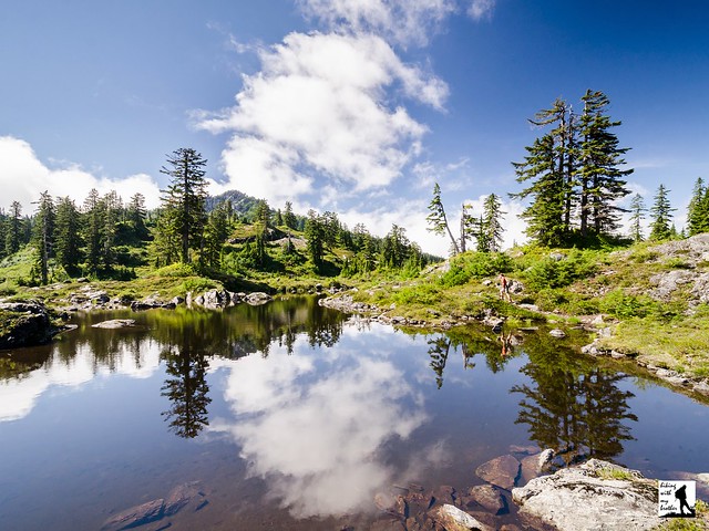
The Mallardy Ridge (Walt Bailey) Trail #706 begins from the end of the forest road and enters a mixed forest of alder, cedar and hemlock. The narrow trail wanders through the trees to broad meadows dotted with marshy ponds. After about a mile, the trail enters the Morning Star Natural Resource Conservation Area (NCRA), which protects over 33,000 acres of land around Spada Lake. The sign at the trailhead and some trail guides reference the Mt. Pilchuck NCRA, which no longer exists. Back in 2007 the Mt. Pilchuck and Greider Ridge NCRAs were merged into today’s Morning Star NCRA.
 Beyond the largest of the alpine meadows, the trail steepens and begins to switchback up through fields of talus toward Cutthroat Lakes. Arrive at the ridgeline to a small tarn with views of the lakes below. Follow the winding path as it descends down to the lakes. Along the way, numerous way paths branch off from the trail providing access to lakeshores. Stay on the widest path as it curves around the lakes and begins to climb up toward Bald Mountain. Switchback up the mountainside to the ridge, then climb up the back of the mountain to the summit. The views from the top are enormous. To the south, Mt. Rainier rises above the Spada Lake and Sultan Basin. Turn to the east to find Del Campo and Vesper Peaks, Big Four Mountain and Mount Pugh. To the north pick out Three Fingers and Whitehorse Mountain. Mt. Pilchuck can be seen to the west. Settle in and see how many mountaintops you can name.
This is a great trail with a little bit of everything - old growth forest, alpine lakes, big views, and not a lot of traffic. The trek to the top of Bald Mountain does involve a decent amount of elevation gain, but most hikers should have no problem reaching Cutthroat Lakes, which are a destination unto themselves. Keep in mind that this is a volunteer-built trail - some sections are rough and can be a little difficult to follow. Still, the added difficulty is more than worth the extra effort. If you haven’t already, put the Walt Bailey Trail on your list to hike in the near future.
 To get there, take I-5 North to Exit 194. Follow Highway 2 for about two miles. Stay in the left lane and merge onto Lake Stevens Highway 204. Follow for two miles to Highway 9. Take the left onto Highway 9 toward Lake Stevens. In just under two miles reach Highway 92 to Granite Falls. Take a right and follow for about nine miles to the Mountain Loop Highway. Follow the MLH for 17.8 miles to Mallardy Road (aka FR 4030). Turn right and follow the road 1.3 miles to FR 4032. Veer right onto FR 4032 and continue 5.7 miles to the end of the road and the trailhead. -Nathan
Print Google Directions >>



 Our 2014 hiking calendar has a fresh spin and a reduced price! For the 3rd year in a row, we've put together a great calendar to inspire a different hiking trip every weekend in the new year. The