Our Hiking Time: 4h
Total Ascent: 1100ft
Highest Point: 3000ft
Total Distance: 6.5 miles
Location:
N 47° 40.5600, W 121° 10.8360
Required Permit:
Northwest Forest Pass
Difficulty: Moderate

A few months ago, we ventured out along Highway 2 in search of a suitable hike for the day’s rainy weather. After consulting a few guidebooks, we settled on the Deception Creek Trail #1059, a hike that promised creeks, lakes, and the shelter of old growth forest.
There are quite a few geographical features in Washington that have earned the name “deception.” Usually, this is because the feature caused some sort of confusion upon discovery. Puget Sound’s Deception Pass, for example, was named by Capt. George Vancouver because it first appeared to be a narrow bay rather than a passageway. Our efforts to dig up the story behind the naming of Deception Creek and the Deception Lakes the creek drains came up empty, but we do know it has been called Deception Creek for quite some time. Back 1893 the last spike of the Great Northern Railway was driven at Deception Creek, connecting Seattle to St. Paul, Minnesota. You can learn more about the role the Great Northern Railway played at Stevens Pass by exploring the
Iron Goat Trail.

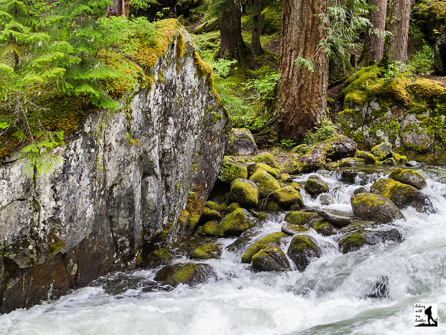
The trail begins beneath the crackle of power lines, but soon plunges into a mature forest of fir, cedar and hemlock. Almost immediately you’ll cross into the Alpine Lakes Wilderness and find yourself alongside Deception Creek. The first mile is fairly tame, climbing slowly but steadily up the valley. The somewhat narrow trail crosses over streams large and small, usually with a bridge or boardwalk to help you to the other side. Depending on the season, you may find that Deception Creek has spilled over onto the trail, and you may need to find creative ways of getting across.
After crossing the log bridge over Deception Creek, the trail steepens, pulling you up the mountainside high above the creek. Eventually the trail levels out and crosses over Sawyer Creek. At roughly three miles find a campsite well-suited for a break or a turn-around point for those looking for a shorter day. This was our stopping point, but you can continue on for another two miles to find the
Tonga Ridge Trail #1058. For those looking to do some backpacking, the connecting trail to Deception Lakes #1059B is found at the seven mile mark and Deception Pass and the Pacific Crest Trail is beyond ten miles from the trailhead.

Surprisingly, the Deception Creek Trail does not get a lot of traffic. It’s among the least traveled trails in the Alpine Lakes Wilderness, despite lush old growth and the fairly impressive cascades of Deception Creek. Beyond our stopping point the trail leaves the shelter of the forest and opens into sub-alpine meadows with views of the surrounding mountains. With fairly easy access to the trailhead and moderate elevation gain, this is a decent hike for almost anyone. We also recommend this area for your next backpacking trip, as you’re likely to get Deception Lakes all to yourself.
To get there, take Highway 2 out past Skykomish just beyond milepost 56, just past the Deception Falls Interpretive Site to FR 6088 also known as Deception Creek Road. The road is not well signed, and can be easy to miss. Take a right and follow FR 6088 under the railroad trestle for about a half-mile to the trailhead. -Nathan
Print Google Directions >>


 Almost every weekend for years, we have been trekking down hiking trails across Washington and reporting our experience on hikingwithmybrother.com. Now we've put together our 2nd annual calendar that draws on our all-season hiking experience. The Hiking with my Brother 2013 Calendar suggests a different hike every Saturday in 2013, each chosen with the season in mind. The calendar also showcases some of our best photography from the suggested hikes to inspire you to get out on the trail. Of course all the hike details, including directions, history, and photos can be found on hikingwithmybrother.com.