about us | links | permit info
Subscribe to Hiking With My Brother Email Subscribe Follow Hiking With My Brother on Facebook Follow Hiking With My Brother on Twitter Hiking With My Brother Picasa Hiking With My Brother YouTube
Showing posts with label tiger mountain. Show all posts

Raging River Trail - Tiger Mountain

Our Hiking Time: 4h 15m
Total Ascent: 1200ft
Highest Point: 1800ft
Total Distance: 9.0 miles
Location: N 47° 29.0640, W 121° 52.3520
Required Permit: Discover Pass
Difficulty: Moderate

Nathan's Photo
A few weeks ago we decided to stay a little closer to home and visit a lesser known portion of the Tiger Mountain State Forest. While we had a vague idea that there was portion of the Forest around the Raging River, we found very little information on it. Thinking that we could share a little of what we found with our readers, we set out on our expedition.

While our hike was all within the Tiger Mountain State Forest, just across Highway 18 is the nearly 11,000-acre Raging River Forest that connects the Tiger Mountain State Forest with Rattlesnake Mountain Recreation Area and also contains the headwaters of the Raging River. The river is named for the large seasonal variation in the volume of water that sometimes “rages” past its banks, often causing flooding damage, most recently in 2006. The river is also an important habitat for Chinook salmon that eventually find their way into the Snoqualmie River. For decades Weyerhaeuser managed the Raging River Forest, before selling it to the Fruit Growers Supply Company in the late 1990s. During that time the Raging River Forest represented one of the largest gaps in the Mountains to Sound Greenway. After years of effort, the Washington Department of Resources and King County partnered to purchase the forest in May 2009.

Note: while the majority of our hike was on trails, a washout at Deep Creek required a log crossing and some bushwhacking to get back to the trail. This section of the hike should be approached with caution.

From the trailhead, the Raging River Trail leads into a clearing carved into the forest for the power lines crackling overhead. Here you can head right and take the short side trail down to the Raging River and walk under the bridge to the riverside.  Across the water, you'll see a trail that heads up through the Raging River Forest and eventually connects with the Rattlesnake Mountain Trail - but currently, there's no easy way to cross the river and access the trail.  So, after you’ve checked out the river, head back to the main trail and follow it a few tenths of a mile to Deep Creek. Along the way you’ll pass side trails snaking off into the woods. Avoid these, as they usually lead to private property.

Once you reach the washout at Deep Creek, follow a boot path down to the water and carefully make your way across the creek on a fallen log. Once across, find a faint path leading up into the forest, through some bramble and eventually back to the Raging River Trail under the power lines. Push up to the top of the rise to connect with the East Tiger Road 7000 (variously labeled on different maps as Road 7500, Road 7000 and Highway 18 Powerline). From here you have a choice. You can head left following the power lines to the Tiger Summit Trailhead, or head right deeper into the forest.

We recommend you head right and follow the East Tiger Road two miles to the Preston Railroad Trail. Along the way you will pass junctions for the Northwest Timber Trail and the Silent Swamp Trail. Skip the Northwest Timber Trail as it just heads out to the Tiger Summit Trailhead, but when the Silent Swamp Trail re-opens after trail construction is complete, it will be possible to make a short loop by following it up to the main road and then following it back down to the East Tiger Road. Once you reach the Preston Railroad Trail, you can follow it up to the summit of East Tiger and all its radio tower glory.

We don’t recommend this hike for everyone. This is more for those folks that have a sense of adventure and don’t mind a little bushwhacking and route finding. This is also a decent choice if you’re looking for a nearby hike that avoids the crowds. Until a bridge is built across either Deep Creek or the Raging River there is not much easily accessible from the Raging River Trailhead. However, if you can navigate the log spanning Deep Creek, you can explore portions of the Tiger Mountain State Forest usually seen only by mountain bikers. Or, if you don’t mind fording the Raging River, you could easily make a day out of climbing up the backside of Rattlesnake Mountain.

To get to East Tiger, take I-90 to Exit 25 Highway 18 junction. Take Highway 18 south for 1.5 miles to the Raging River Bridge. Cross the bridge and almost immediately take a right onto a blue-gated road. This unsigned area is the Raging River Trailhead and has enough room for about four cars. -Nathan

Print Google Directions >>

Raging River

Perseid Meteor Shower from Tiger Mountain

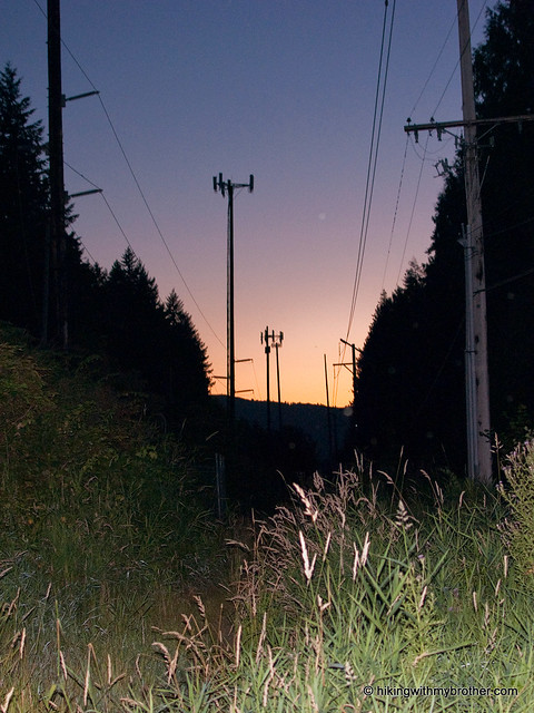
Nathan's PhotoEvery year the Perseid meteor shower brightens the summer sky. At the suggestion of a reader, we decided to do a midweek night hike and enjoy the show. Wanting a familiar trail for this adventure, we returned to tiger mountain cable line hikingwithmybrotherour old training grounds, the Tiger Mountain Cable Line. Just as the sun was setting, we dug out our headlamps and headed back out to Exit 20.

“Perseids” as the meteors are known, are so named because they seem to originate from the constellation Perseus. The meteors are the remnants of the comet Swift-Tuttle, which crosses the Earth’s orbit every 130 years on its way around the Sun. As the Earth travels through the comet’s dust and debris field, meteorites hit the atmosphere and streak across the night sky.

The Cable Line is still the same, and we found no reason to revise our previous review of the trail. In retrospect, hiking up the steep, slippery trail in the middle of a hot summer night was not ideal. Instead, we probably should have taken the longer and better-maintained West Tiger #3 trail to the top. As it turned out, we spent more time than expected navigating portions of the trail made more challenging by the lack of light. On the upside, it was impossible to see how much more uphill remained ahead of us, which might have helped us tackle the elevation a bit easier.

tiger mountain cable line perseid hikingwithmybrotherOnce at the summit, we settled down to try to capture an elusive Perseid. We knew we were not nearly far enough away from the city to fully escape the light pollution, but in the shadow of the mountain we were able to see more than a few Perseids streak across the sky. Surprisingly, in contrast to the dozens of cars at the bottom, only one other hiker was there to share in the show.

Although night hiking can be a little tricky, and is definitely more difficult than hiking during the day, it was fun to hike up and see the meteors. If ever you’re tired of your favorite trail, break out the headlamp and try a night hike; you’ll see it in a whole new way. - Nathan

Tiger Mountain Cableline

Poo Poo Point

Our Hiking Time: 1h 30m
Total Ascent: 1700ft
Highest Point: 1800ft
Total Distance: 4 miles
Location: N 47° 29.9730, W 122° 0.4870
Required Permit: Discover Pass
Difficulty: Moderate

Nathan's PhotoShort on time this week, we returned to Tiger Mountain to explore the curiously named Poo Poo Point. Years ago, Harvey Manning decided to christen the area in honor of the “poo poo” sound made by logging steam whistles. These same whistles presumably helped create the large open fields at the top. Today, these fields are used as a makeshift airport for both hang gliders and paragliders, managing to accommodate both launches and landings.

Traditionally, the Poo Poo Point Trail begins at the Issaquah High School and gently meanders its way 4 ½ miles up to the top. Lacking the time for a 9-mile excursion, we opted to take the moretiger mountain poo poo point hikingwithmybrother direct Chirico Trail to our destination, located a few miles down the road from the high school at the paraglider landing field.

The short hike up the side of Tiger was reminiscent of the Cable Line: a narrow trail blazing its way to the top as quickly as possible. Despite the drizzle, we were joined by many a hiker and more than a few canine companions as we switchbacked through the young forest. We passed many lesser-used trails branching off; some reconnected back up with the main thoroughfare, while others disappeared intriguingly off into the distance. Feeling adventurous, we took one of these paths on our way back down. Unfortunately, our explorations spit us out miles from the parking lot, forcing us on an unpleasant walk down the busy Issaquah-Hobart Road to get back to the car.

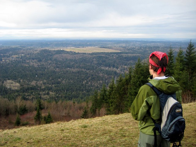
The two landing fields offer great views of Squak, Cougar, and Lake Sammamish to the northwest, and Mt. Rainer to the southeast. Take some time to marvel at the Astroturf runway and what it would mean to take a running leap into the air from here. Though moderately steep, this trail is short enough to coax the whole family up, though the narrow trail often becomes slippery with mud after prolonged rain.

To get there, take I-90 to Exit 17 and hang a right on Front Street.tiger mountain poo poo point hikingwithmybrother Front will take you through historic Issaquah before changing into the Issaquah-Hobart Road. Continue for about five miles until you see a large grassy field and a parking lot on your left. This is the paraglide landing area. Park - trail begins on the other side of the field. - Nathan

Print Google Directions >>
Poo Poo Point
Copyright 2008-2016 - hikingwithmybrother.com
hikingwithmybrother@gmail.com