


Total Ascent: 1800ft (700ft in; 1100ft out)
Highest Point: 1800ft
Total Distance: 8.4 miles
Location: N 47° 30.5583, W 121° 50.6516
Required Permit: None
Difficulty: Moderate
 A few weeks ago we decided to head out to Snoqualmie Point to do a little exploring in the Raging River State Forest. While we did not have a specific trail in mind, we hoped to find a route that would take us from Snoqualmie Point down to the Raging River near the Raging River Trailhead. With luck and some backtracking, we were able to put together a decent route.
 Back in 1983, a winery was built in the area now known as Snoqualmie Point. The Snoqualmie Winery operated until 1997, and allowed its visitors to enjoy expansive views of Mt. Si, Mailbox Peak and Mt. Washington rising over North Bend and the Snoqualmie Valley. After the winery was shuttered, plans were in the works to develop the area into an office park. In response, a group of community leaders including the Mountains to Sound Greenway Trust worked with the City of Snoqualmie to purchase the area in 1999. In 2009, the Washington Department of Natural Resources (DNR) purchased the nearly 11,000 acre Raging River Forest adjacent to Snoqualmie Point, creating a corridor of public forest connecting Rattlesnake Mountain to Tiger Mountain. Today the DNR is still working on developing the recreational opportunities, which are likely to include hiking, biking and equestrian trails.
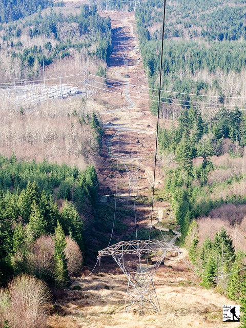
The trail begins from the parking area by following a graveled path through young forest. Bypass signs point you down the Rattlesnake Mountain Trail and continue along the trail as it crosses a forest road. Continue through the alders for about a mile to a graveled road. Head right a short distance to a junction and veer right again, following that forest road as it crosses under power lines and eventually leads to a high bluff with views of Tiger Mountain and the Raging River below. After you have taken a look at where you’re headed, backtrack a few dozen yards to a small unmarked path heading left into the woods. After a short descent arrive at a junction, head left, and you'll soon emerge into the clearings beneath the power lines at the base of the bluff. From here, the trail winds its way beneath the power lines down to the river and Highway 18. If you’re willing to ford the river, you could extend the hike by following the Raging River Trail to Tiger Mountain.
 If you’re up for some exploration, this is a fun trek through an area that has yet to have official trails built and routed. However, the hike follows a rough mixture of forest roads and mountain biking trails through a working forest, which leaves it a somewhat light on natural beauty. Still, there is enough elevation change on this hike to make it a decent workout, and because it is still undeveloped, you’re unlikely to run into too many other people. Close and easily accessible, the Raging River State Forest is a good alternative to some of the busier trails near North Bend.
To get there, take I-90 to Exit 27. Turn right onto Winery Road and follow for about 0.4 miles to the trailhead. -Nathan
Print Google Directions >>
5 Comments:
Love your site!
There's a minor error in your driving directions for this hike...there is no "roundabout" at exit 27, you just take a right at the end of the I-90 exit. There is a roundabout at exit 31, however 27 is the correct exit for this hike.
Hi Karen, Great catch! I've updated the directions. Thank you!! -Jer
What is the strange roof structure in your photo album?
Hi Yasuhiko, It's an accessible covered viewing area at Snoqualmie Point.
Hi, Jer. Thank you for the answer. My wife and I hiked on Rattlesnake Mountain Trail from Snoqualmie Point Park on 5/27. We went up to Grand Prospect and back, 8 miles total with 2000 feet gain. We took a side trip to the viewing area. We were able to see Mount Si, Mount Washington, and Mailbox Peak from there. We liked the park and the trail.
Post a Comment