


Total Ascent: 2200ft
Highest Point: 4400ft
Total Distance: 13 miles
Location: N 47° 58.7460, W 121° 21.7860
Required Permit: Northwest Forest Pass
Difficulty: Hard
 A few months ago we headed out to the Monte Cristo townsite to explore Glacier Basin, a rough hike that sees far fewer hikers than nearby Gothic Basin. Complete with waterfalls, wildflowers and relics of Monte Cristo’s mining past, we wasted no time clambering up into this alpine cirque. NOTE: The US Forest Service will be closing Monte Cristo in the fall of 2013 for a cleanup operation that will last until 2015. During this time both townsite and this approach to Glacier Basin will be closed.
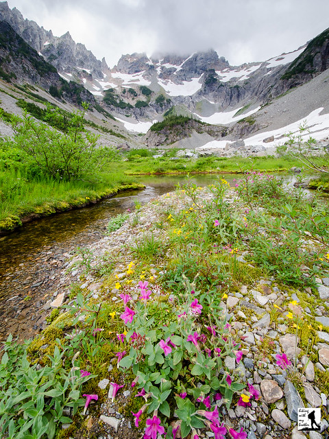
 This is not an easy hike, and it is likely a little too long for most day hikers. Some of the distance can be removed by biking to Monte Cristo, but hauling your bike across the South Fork Sauk River isn’t for everyone. However, this does make for a decent weekend backpacking trip, and you’re unlikely to meet too many other folks on this less-traveled trail.
 There's a lot more to Glacier Basin, and you can learn all about it in our book, Hiking Through History Washington. You'll find a trail map, route descriptions, history, and more
 for this and many more hikes throughout the State. Help support hikingwithmybrother.com and the work we do by picking up a copy!
 To get there, take I-5 North to Exit 194. Follow Highway 2 for about two miles. Stay in the left lane and merge onto Lake Stevens Highway 204. Follow for two miles to Highway 9. Take the left onto Highway 9 toward Lake Stevens. In just under two miles, you’ll reach Highway 92 to Granite Falls. Take a right and follow for about nine miles to the Mountain Loop Highway. Take the MLH for 31 miles to Barlow Pass. Park and find the gated Monte Cristo Road on the right side of the road, opposite the trailhead parking lot. -Nathan
Print Google Directions >>
9 Comments:
This brought back great memories of a camping trip there in 1987 (!). Thanks.
I actually didnt think this one was hard - the uphill rope climb isnt long. The distance to it is long from the car so defenitely start at daylight. You may see nude sunbathers in the summer but thats sure to stop with the clean-up approaching. Hard to imagine Blanca is up and over Columbia or Index for that matter!!!
Any word on how long this will be closed? I want to take my son here but its already (officially) spring! BTW, thanks for the awesome trip reports, I always turn here first when looking for a new hike.
Unfortunately, Glacier Basin is going to be inaccessible from the Monte Cristo approach until 2015. Accessing the trailhead is going to be a challenge right now, as the Mountain Loop Highway is closed at Deer Creek. It doesn't usually open again until late April or May. This means Glacier Basin is probably going to be out of reach until 2015 or so.
What kind of rodent is that??
What kind of rodent is that??
That's a pika!
The closure of Glacier Basin and Monte Cristo townsite has been postponed. It is currently accesible and will not be closed until 2015.
Post a Comment