Total Ascent: 2200ft
Highest Point: 4500ft
Total Distance: 6.5 miles
Location: N 47° 14.9040, W 121° 8.3640
Required Permit: None.
Difficulty: Moderate
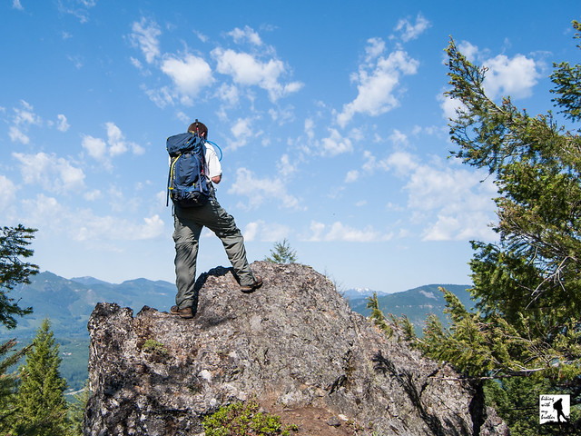
 A few months ago before the grey of autumn brought along chilly winds and endless rain, we found some time to head out over Snoqualmie Pass to tackle Easton Ridge. Much like nearby Kachess Ridge, the hike promised an exposed ridgeline with broad views of nearby peaks and lakes. Easton Ridge not only delivered the views, but also surprised us with abundant fields of wildflowers.
 Easton Ridge works well for an early season hike. At a lower elevation and located east of Snoqualmie Pass, it tends to melt out quickly. And while more folks are discovering the hikes near Easton, they do not get nearly as much traffic as other I-90 hikes leaving you to enjoy the big views without a lot of company. Although there is a bit of elevation gain, but most hikers should be able to tackle Easton Ridge, making it a great alternative on a sunny weekend. We recommend you tackle this hike in late June or July when the wildflowers will be at their height.
There's a lot more to Easton Ridge, and you can learn all about it in our book, Hiking Through History Washington. You'll find a trail map, route descriptions, history, and more
 for this and many more hikes throughout the State. Help support hikingwithmybrother.com and the work we do by picking up a copy!
 To get there, take I-90 to Exit 70. Take a left over the freeway and turn left onto West Sparks Road. Continue for a half-mile to FR 4818 (signed Kachess Dam Road) and take a right. Follow FR 4818 for a mile to an unmarked road on the right. Follow this road for a half-mile to the small parking area at the trailhead. -Nathan


1 Comments:
Thanks for sharing your thoughts. I truly appreciate your efforts and I am waiting for your next write ups thanks once again.
Sandara
www.imarksweb.org
Post a Comment