


Total Ascent: 100ft
Highest Point: 1400ft
Total Distance: 2 miles
Location: N 47° 0.7140, W 122° 0.9000
Required Permit: None
Difficulty: Moderate
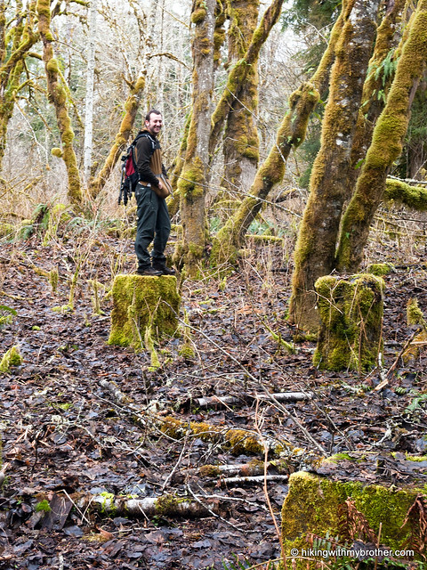
 As winter begins to wane and the snow levels grudgingly recede, we’re really looking forward to getting back on some mountaintops. Until then, we’ve found ourselves alternating between snowshoeing and finding out-of-the-way places in the lowlands. We recently stuck to the lower elevations and explored the Fairfax townsite, another coal-boom ghost town along the Carbon River.
Like Franklin and nearby Melmont, Fairfax sprang up around rich coal deposits. Founded in 1892, it was named for Fairfax County, Virginia by W.E. Williams and platted in 1897 when the Northern Pacific Railway was extended from Carbonado out to Fairfax. The town quickly
 expanded, and by 1901, 60 coking ovens were producing 252,000 tons of furnace grade coal a month. The population of Fairfax grew with the rising demand for coal during World War I, reaching 500 people by 1915. Access to the town was limited exclusively to railroad car until December 17, 1921, when the county extended the road over the Carbon River and into Fairfax.
However, over the next twenty years, the coal yields slowly dropped along with demand, as the country shifted toward oil and gasoline for its energy needs. By 1941 Fairfax was a ghost town, many inhabitants having hastily abandoned their homes and property. During this time Pierce County began to foreclose on properties in and around Fairfax for failure to pay property taxes. The lands remained as county “surplus” until 2002, when 640 acres were set aside as open space for public use, including the townsite and 80 acres of original old growth. Over the years, floods, fires, and salvaging destroyed most of the abandoned structures, and the forest continues to aggressively reclaim the townsite. Still, after seventy years you can find foundations, artifacts, and the long line of coking ovens.
The hike begins with a quick descent down toward the river, following the roadbed into town. Expect to navigate a little underbrush as you head down, as there is no formal trail maintenance happening in the area. Within a few minutes, you’ll be standing near the edge of the large
 meadow that was once Fairfax. From here, you can start exploring in any direction, or follow the loop we’ve put together. However, keep in mind that most of the structures are across the meadow to the north, including the swimming pool, the site of the old railroad bridge, and the coking ovens.
The easiest way to find most of these is to follow the faint impression of the main road through town, which cuts through the middle of the meadow. Keep an eye out for a large, artificial-looking hillock extending toward the river. A game trail here will lead you out to the river, and the cement foundation of the railroad bridge. Scramble up onto the embankment for a nice view of the Carbon River, as well as the rock jetty that was built to try and control flooding. Head back to the main road, and continue following it across the meadow and into the trees. The swimming pool foundation is just off to the right. From the foundation, head northwest toward a small stream. The coking ovens are tucked into the large mound on the other side of the water.
The most difficult part of this hike is finding it. There is almost nothing in the way of signage to indicate that you are in the right place. Eventually, after retracing our steps a few times, we found a small pullout that looked promising. Only then did we find the small laminated sign indicating that we were on the edge of Fairfax Forest. Beyond that, this is an easy walk through
 Washington’s mining history. However, while the hike is not strenuous, the area is undeveloped and some parts can be a little wet and muddy, so come prepared to get a little dirty. Fairfax is the largest ghost town we’ve visited, and there is much more to see than we’ve mentioned here. Consider exploring this section of the Carbon River Valley sometime soon.
To get there, take I-5 South to I-405. From I-405 take SR 167 south toward Auburn. In 20 miles take the SR 410 Exit toward Sumner/Yakima. Follow SR 410 for 12 miles to SR 165. Take a right and continue on SR 165 for about 10 miles through Carbonado to the Fairfax Bridge. Cross the bridge and continue on SR 165 for a half-mile. Veer left onto the Carbon River Road when the highway splits, and follow for just under two miles to a few large boulders on the left side of the road. There is a small pull out here. Park and follow the old roadbed down to the townsite. –Nathan
Print Google Directions >>
9 Comments:
Dunno why but the View Large versions link doesnt work unless you right click and open in a new tab. Networked Blogs being wonky with the click-thru or something. Both in Firefox and IE.
It's a fascinating and beautiful place! Also remember that since Fairfax is Pierce County property, all the cool historic features and artifacts that can still be found there belong to the Public. Please keep them there so they can be enjoyed by everyone! Disturbing them not only limits what we can learn about Fairfax, but is also a violation of state law.
Nathan, I haven't noticed that before, but you're right, when you're in Networked Blogs the links to Google websites don't work unless you open them in a new tab. The reason I think is because of the way Google has programmed Picasa and Google Maps, and not because of Networked Blogs. I got a message that says, "To help protect the security of information you enter into this website, the publisher of this content does not allow it to be displayed in a frame." Hope that helps!
Makes sense. I just started using NB for my blog, its pretty neat stuff and one less step for getting my blog on Facebook. Between tripadvisor and the blog my vacation evenings will be quite busy with posting!
Went up with a friend to Fairfax this last weekend (May 6th, 2012) a lot of water on the trial and in the meadows, lot of blow downs to scramble over and more nettles then I really wanted to deal with but.... once down the meadows are very peaceful, the few ruins (swimming pool and foundations) and cool (think of the civic pride that happened there when they openned the indoor pool!)and sitting in the sun by the river was wonderful - lots of bear poop though - hum.....
My grandfather lived in Fairfax in the 1970's, as caretaker of the property. A lady friend of his owned property there, had a small cabin there, and grandpa added a second, larger cabin while he lived there. Sadly, all existing structures were knocked down when Burlington Northern bought the property in 80's.
My sister and I took this hike two days ago. It was great! It was easy to find the trail to get down to Fairfax, but as mentioned, once down there isn't much of a trail. We kind of made it up as we went, and bam, we were at the pool out of nowhere. We found all of the landmarks mentioned. I thank you guys so much for you wealth of information.
Hi Steffani, Glad you and your sister had fun and glad that the information was helpful!
Have you guys ever hiked on the other side of the Fairfax bridge? there are more remnants of ghost town structures.
Post a Comment