Total Ascent: 1000ft
Highest Point: 2400ft
Total Distance: 5 miles
Location: N 48° 4.0800, W 121° 46.9260
Required Permit: Northwest Forest Pass
Difficulty: Easy
 We returned to the Mountain Loop Highway this week to tour Heather Lake, a multi-season hike that rivals Lake Twentytwo’s popularity. With the snow already falling as we drove out to the trailhead, we said goodbye to snow-free hikes for the next few months. Like Lake Twentytwo, we’d seen Heather Lake in warmer months, but wanted to get a feel for the winter experience. Mother Nature was happy to oblige.
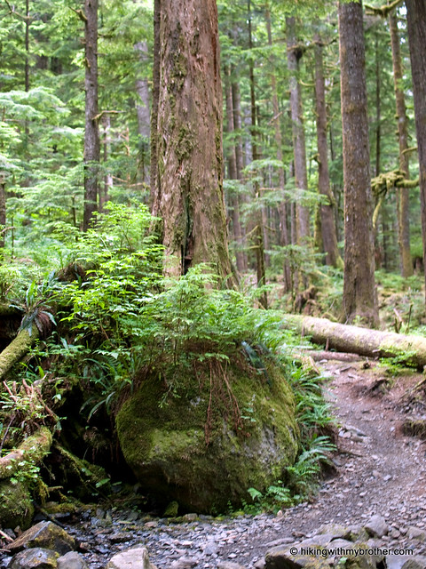
 Heather Lake Trail No. 701 meanders through a young forest born of the heavy logging practices back in the early 1900s. A mixture of hemlock and fir, all roughly the same age, surround cedar stumps several times their diameter, a quiet reminder of the forest that was. At roughly half a mile, the trail briefly connects with the remnants of an old 1940s logging road before shifting back to the more familiar rocky trailbed. As you continue to gain elevation, the uniformity of the second-growth is replaced by an older and wilder forest. A quarter-mile from the lakeshore the path smoothes out, and it’s an easy stroll alongside Heather Creek to the lake.
 Until the late 1990s, the trail simply ended at the lake. Today, thanks to the Forest Service and trail volunteers, the trail continues around the edge of the lake, complete with boardwalks over some of the marshier areas. The loop is just over a half-mile and allows for a closer look at the waterfalls streaming down the side of Mt. Pilchuck. It also adds a little extra distance for those wanting a longer hike. Although our trip was something of a whiteout, we know that Heather Lake and its surroundings can border on stunning. Tucked beneath looming cliffs, the lakeshore has plenty of room for a picnic, some fishing, or even a little camping.
Despite a few streams intersecting the trail, which might mean a little rock hopping, the Heather Lake Trail is fairly mild. The trail is so well graded that the 1000’ elevation gain is hardly noticeable, making this an excellent choice for young hikers. This is also a perfect hike for a quick and easy snowshoe expedition. Of course, an approachable hike to an attractive destination means that you should expect to share the trail along the way.
 Push to the far side of the lake if you’re looking to minimize company.
To get there, take I-5 North to Exit 194. Follow Highway 2 for about two miles. Stay in the left lane and merge onto Lake Stevens Highway 204. Follow for two miles to Highway 9. Take the left onto Highway 9 toward Lake Stevens. In just under two miles, you’ll reach Highway 92 to Granite Falls. Take a right and follow for about nine miles to the Mountain Loop Highway. Take the MLH for 13 to Mount Pilchuck Road (FR 42), turn right and drive two miles to the trailhead. - Nathan


2 Comments:
I love Heather Lake, I hiked it when it was much harder during the early spring of 2000 when the snowpack around the lake was over 13 feet deep still. It was a Wonderful hike however!
This is a great hike! There should be a dusting of fresh snow near the top of the trail right now! :)
Post a Comment