Total Ascent: 1350ft
Highest Point: 2560ft
Total Distance: 2.5 miles
Location: N 47° 25.7940, W 121° 39.9640
Required Permit: Discover Pass
Difficulty: Hard
 The Change Creek Trail is an unofficial hike off the Iron Horse Trail. Volunteer built, the trail is an alternative approach to Mt. Washington up the Change Creek Valley, that offers excellent views and minimizes hiking time on logging roads on Mt. Washington Trail.
 The Change Creek Trail branches off the Iron Horse Trail just above Olallie State Park near the Deception Crags climbing walls. Since being publicized in 1994, Deception Crags has become extremely popular, bringing hundreds of rock climbers to the walls every year.
 Like many of the other scramble routes in the area, the Change Creek Trail seems to have hacked out of the underbrush with an eye for expedience and utility without much in the way of deference to officialdom. The trail has been a work in progress since at least 2006, if not earlier. Trail building efforts have been led by local hikers through various hiking forums. We assume they are also behind small signs posted along the trail, marking such destinations as “Whitebark’s Bivouac” and “Raven’s Roost.”
The roughly hewn trail begins between the trestle bridges that span Change Creek and Hall Creek. It can be a bit tricky to spot, start looking for it as soon as you cross the bridge. A few feet up the trail a sign reading “Change Creek Trail” will confirm you’re on the right path. The first mile or so is on the steep side,
 and loose rock and soil is the norm as you switchback up the initial sections of narrow trail. As the forest and underbrush begin to thin, glimpses of Hall Creek Falls and I-90 give a taste of views to come. Eventually you’ll attain the ridgeline, and get a peek down at Change Creek before continuing up to Hall Point for some big views of the valleys below. To the west lies Mt. Teneriffe and Green Mountain, to the north Mailbox Peak anchors a ridgeline that flows east over Dirty Harry’s Peak and Putrid Pete’s Peak toward Snoqualmie Pass.
This route is a more challenging and engaging approach to Mt. Washington, and one that you can expect some solitude on. The trail also runs past a few opportunities to scramble out to rocky outcroppings and excellent views. Hall Point was a perfect place to settle down for a snack after slogging up the rough switchbacks of the early sections of the trail. Although still going through growing pains that should subside with more boot traffic, the trail is able to very quickly deliver big views,
 making it rewarding for even the most causal of hiker.
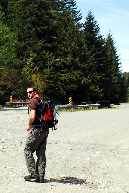
To get there, take Exit 38 off I-90 and take a right. Follow the remnants of old US 10 for about a mile to a widening in the road opposite Change Creek. More than likely other cars will also be parked here. Park and cross the road to find a short path leading up to the Iron Horse Trail. Head left over the bridge for a few hundred yards to find the fledgling trail beginning behind a section of fence. - Nathan
Print Google Directions >>


3 Comments:
Great post. Your blog is fantastic -- I could scarely imagine a cooler site for hiking enthusiasts who live on the corridor (like me)!
My wife and I hiked Rattlesnake Ledge last week and it was so crowded we were looking for some quiet. This was a great hike for a quick visit, beautiful viewpoint at top and not 1 person on trail, though lots of rock climbers below. Your sight is awsome, thanks for the info!
Glad this trail worked out for you. Many of the hikes we do lean toward the less-traveled, hopefully you'll find some more you can use. Happy hiking!
Post a Comment