about us | links | permit info
Subscribe to Hiking With My Brother Email Subscribe Follow Hiking With My Brother on Facebook Follow Hiking With My Brother on Twitter Hiking With My Brother Picasa Hiking With My Brother YouTube

Grand Park Backdoor via Lake Eleanor Trail

Our Hiking Time: 3h 30m
Total Ascent: 1100ft
Highest Point: 5600ft
Total Distance: 8.5 miles
Location: N 46° 57.7080, W 121° 40.9203
Required Permit: None
Difficulty: Moderate

Nathan's Photo
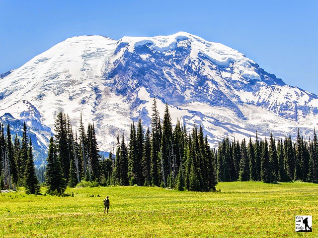
Mt. Rainier National Park boasts dozens of hikes leading out to dramatic landscapes dominated by the looming volcano. Few are more iconic than Grand Park; a sea of meadows and wildflowers lapping at the base of Mt. Rainier. The classic approach from Sunrise is long and tough, putting Grand Park out of reach for most casual day hikers. Luckily, there is an unofficial “backdoor” approach via Lake Eleanor that allows many more hikers to enjoy this stunning destination.

Around 500,000 years ago, Mt. Rainier began a cycle of volcanic activity that culminated in the mountain we see today. For thousands of years, volcanic rock boiled to the surface and built up the mountain, each time also producing a layer of pyroclastic flow. With the next eruption, softer pyroclastic flow would be covered by harder layers of thick lava that are more resistant to erosion. The plateau that Grand Park covers is an example of a hard layer of lava that remained as softer rock eroded around it. The area is among the largest open meadows in the national park, and was given the name Grand Park by park officials.

The “backdoor” approach likely began as a boot trail used by fishermen to access Lake Eleanor. This 20 acre alpine lake and the creek that drains it were named around the turn of the 20th century by Burgon D. Mesler in honor of his wife Eleanor. The Mesler family were early settlers in the area, running an inn and other amenities that catered to travelers heading over the Cascades or visiting the park.

The hike begins just off FR 73, following a bootpath along the edge of Eleanor Creek. The trail enters a mixed forest and begins a moderate climb toward Lake Eleanor. Within a half-mile, you will cross into Mt. Rainier National Park and in another mile or so you will arrive at the lakeside. There are a few campsites around Lake Eleanor that provide nice views of the lake and a pleasant place for a snack, though most hikers will be eager to push on to the meadowlands ahead.

From the lake the trail steepens and climbs through larger stands of hemlock and fir. The moderate climb is broken up by short wanderings through progressively larger meadows. Push onward and upward to the wide expanses of Grand Park. Often filled with wildflowers during the spring and summer months, the miles-long grassland can seem to be awash in color from the moment you arrive. Resist the temptation to linger at the edges, and continue on to the meadow’s highpoint for outstanding views of the mountain. Find a comfortable spot to settle in and soak up the panorama. If you're hungry for more you can continue all the way through Grand Park's meadows to connect with the North Loop Trail and the rest of the Wonderland Trail.

We highly recommend this approach to Grand Park. Not only is the trail fairly approachable for almost all hikers, but the Lake Eleanor route is usually accessible long after the road to Sunrise is closed for the season. Although the trail may have been difficult to navigate in the past, its popularity has brought thousands of boots to soften it up, and today the path is almost as well-maintained as an official trail. One word of caution: the area around Grand Park is the perfect breeding ground for mosquitoes and other bugs. Be sure to come prepared during the spring and summer months. If you haven’t made it out to Grand Park yet, add this one to the top of your list of future hikes.

To get there, take I-5 south to Highway 18 Exit 142A. Follow Highway 18 into Auburn and take the SR 164 Exit. Head left on SR 164 through Enumclaw to SR 410. Head left onto SR 410 for 25 miles to Huckleberry Creek Road (FR 73). Turn right onto FR 73 and follow for 6 miles to cross the Huckleberry Creek bridge. Continue on FR 73 as it climbs for another 4 miles to the bridge crossing Eleanor Creek, which is signed. There is no official trailhead, but there is room for a number of cars to park. -Nathan

Print Google Directions >>

Grand Park

Mount Townsend Trail #839

Our Hiking Time: 3h 45m
Total Ascent: 2900ft
Highest Point: 6300ft
Total Distance: 8.2 miles
Location: N 47° 52.0440, W 123° 3.5700
Required Permit: None
Difficulty: Moderate


Nathan's Photo
A few weeks ago we spent a long weekend hiking a number of trails in the Olympic Peninsula, exploring popular hikes and obscurities alike. By far the most challenging and popular hike we took on was Mt. Townsend, a favorite among hikers for its expansive views of Puget Sound and surrounding mountaintops.

On May 8, 1792, as Captain George Vancouver was exploring the Puget Sound, he named a large, protected bay Port Townshend. It took over 50 years, but eventually a town was founded on the bay and took the name Port Townsend as its own, dropping the “h” along the way. Other geologic features were also dubbed Townsend, such as Mt. Townsend and the creek that runs down the mountainside, Townsend Creek. All of these features were named in honor of George Townshend, the 1st Marquis of Townshend, a friend of Captain Vancouver. In 1933 a fire lookout cabin was constructed on the summit, and trails were expanded to provide access to the cabin -- both for the fire watcher and the mules that hauled supplies nearly 3000ft up the mountain. The cabin was destroyed in 1962.

Although there are a number of possible approaches to the summit, we recommend using the Upper Mt. Townsend Trailhead, as this cuts out a little over a mile of trail. From here, the wide, well-maintained Mount Townsend Trail #839 enters a forest of Douglas fir and hemlock intermingled with healthy stands of rhododendron. Almost immediately the trail begins a series of switchbacks up the mountainside before entering the Buckhorn Wilderness and beginning a long traverse up the Townsend Creek valley. The trees quickly begin to thin as you continue to gain elevation and eventually climb through rocky slopes covered in thick underbrush.

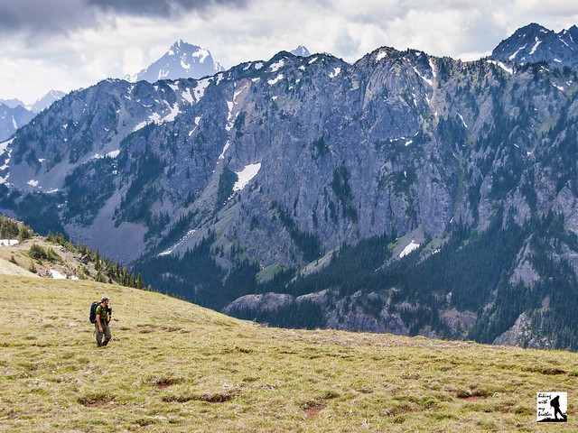
At roughly the 2.5 mile mark find Camp Windy, an unmarked spur providing access to Lake Windy, which lies just off the trail. There are areas to camp around this small tarn for those on longer journeys, but most day hikers will want to push on to better views. In another half mile find the junction with the Silver Lakes Trail #842. Keep right and continue upwards on the Mt. Townsend Trail. From here the meadows unfold and the trees fall away, providing ever-wider views of the surrounding landscape. Reach the exposed ridgeline and press onward through delicate fields of alpine flora to the short spur trail leading to the summit. From the junction you can either continue on for a half-mile to the former lookout site, or climb up to enjoy the view.

The summit offers a commanding view of the Puget Sound stretching from Canada to Seattle. Bands of water snake between islands below, and in the distance the big Cascade volcanoes rise above the surrounding peaks – Mt. Baker to the north, then Glacier Peak and finally Mt. Rainier to the south. To west you can spot the tops of Mt. Constance and Warrior Peak peaking over rocky ridgelines, and to the south find nearby Mt. Worthington and the Welsh Peaks.

There is a good general rule when it comes to the popularity of a hike: the more difficult it is to get to a trailhead, the fewer hikers make the trek. But every once in awhile we come across hikes like Mt. Townsend, where hikers flock down mile after mile of bumpy forest road for the promise of varied landscapes and stunning vistas. And this hike more than delivers on its promise. To add to the appeal, because of the rain shadow this hike tends to be free of snow a little earlier in the year. While the trail is well-trodden and relatively free of rocks and roots, much of it is exposed, which can make for a hot and dusty climb in the summer. Still, most hikers should be able to tackle this challenge without too much trouble. Of course, if you’re looking for solitude, this is not the hike for you – although other approaches will have less traffic and a mid-week visit will cut down on the number of folks on the trail.

To get there, take the Bainbridge Island Ferry and follow State Route 305 through Poulsbo to State Route 3. Follow SR 3 to the Hood Canal Bridge, taking a left over the bridge onto State Route 104. Follow SR 104 as it merges onto US 101 and continue 11.3 miles through Quilcene to Penny Creek Road. Take a right and continue 1.4 miles to Big Quilcene River Road. Veer left and proceed to FR 27. Continue for a little over 13 miles to the junction of FR 2760. For the lower trailhead, head left down FR 2760 for 0.7 miles to find the parking area. For the upper trailhead, continue on FR 27 for about a mile to FR 2700-190. Turn left and continue another mile to the upper trailhead. -Nathan

Mount Townsend

Huckleberry Creek Trail #1182

Our Hiking Time: 3h
Total Ascent: 500ft
Highest Point: 3400ft
Total Distance: 5.2 miles
Location: N 46° 58.7760,  W -121° 38.1120
Required Permit: None
Difficulty: Easy

Nathan's Photo
We are always keeping an eye out for trails that have been somehow overlooked or are underused. Sometimes the trail has fallen into disrepair or has been officially abandoned, other times they are paths cut for something other than just hiking, but the best finds are those trails that have simply slipped off the radar. The Huckleberry Creek Trail #1182 is one of these rare finds. Unsigned and with almost no parking, this rarely visited trail makes for a perfect summer hike.

Huckleberry Creek is one of only two watersheds in Mt. Rainier National Park that do not originate with glacial meltwater. The creek flows from the large meadowed area known as Huckleberry Park (aka Huckleberry Basin) near the base of Sourdough Mountain between Sunrise Park and McNeeley Peak. The name is in reference to the abundance of mountain huckleberry found in the region. While historical evidence is limited, historians believe that at least some portions of today’s Huckleberry Creek Trail follows a traditional route used by Native American tribes to gather huckleberries and other resources.  As times changed, the route became popular with prospectors, hunters and eventually poachers.

While the trail likely existed before Mt. Rainier National Park was created in 1899, today’s trail and patrol cabin were not built until the 1930s. A plan to expand trails and place cabins and trail shelters strategically around the park was created during the short tenure of Superintendent Roger W. Toll (1919-1920). The plan was implemented between 1922 and 1934 largely by Superintendent Owen A. Tomlinson (1923-1941). Some semblance of the Huckleberry Creek Trail existed before this time, as the park boundary marker you will pass along the trail was placed in 1908. The Huckleberry Creek Patrol Cabin was built between 1933 and 1934, probably with assistance from either the Public Works Administration or the Civilian Conservation Corps. The trail was also expanded at that time, but not to provide the public access to the park as some theorize, but instead to ensure fire fighters had adequate access to this portion of the park in the event of a forest fire. In 1991 the cabin was officially added to the National Register of Historic Places.

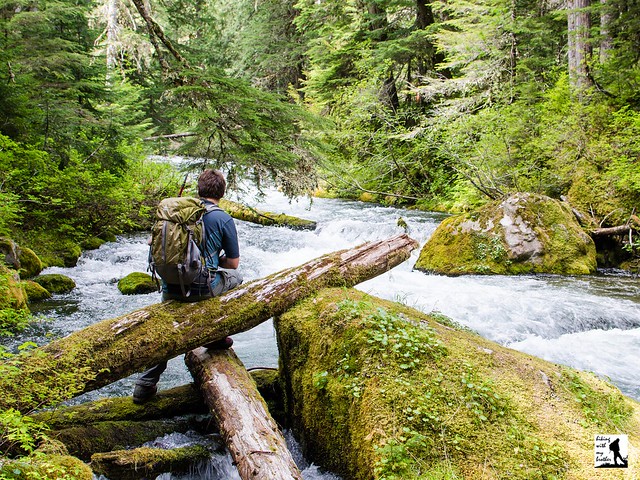
The unmarked trail begins from Forest Road 73, dropping through a small, grassy clearing. Immediately find yourself under stands of young fir and hemlock. Soon you’ll cross Lost Creek - named for large sections of the creek that are “lost” under a rock slide - before continuing deeper into the forest. Watch your surroundings as you enter areas of mossy old growth, complete with towering stands of fir and cedar. Enjoy the sounds of Huckleberry Creek as you wander beside the water.  In about a mile you’ll reach the National Park Boundary, beyond which National Park rules prohibit bikes, pets, and stock.

Just after you enter the National Park you’ll find the patrol cabin. Although it is now boarded up and no longer in use, it’s still fun to poke around the clearing and inspect the old log cabin. This also makes for a decent turn-around point for young hikers. As you continue past the cabin, the forest only gets older and bigger, and the trail begins to gain a slight amount of elevation, a trend that will only continue as you forge onward. Continue until you’ve had your fill then turn back toward the car.

While we only explored the first 2.5 miles of the trail, those looking for a big day can continue all the way out to the Sunrise Visitor Center - a good 10 miles from the trailhead. If you are not up for a 20 mile day hike, there are some intermediate stopping points along the way. Find Josephine Creek roughly 4 miles from the trailhead, beyond that Prospectors Creek is at about the 6 mile mark. Still want more? Eventually you’ll reach Forest Lake, a decent sub-alpine backpacking destination at about 7.5 miles from the trailhead. From here it’s another 2.5 miles to Sunrise through the alpine meadows of Huckleberry Park.

We highly recommend adding the Huckleberry Creek Trail #1182 to your hiking list this season. This versatile creekside hike has enough rewards to make a satisfying short hike for the family and enough trail for a long, challenging day hike for experienced hikers. Its lower elevation means it continues to be accessible late in the season, and melts out a little earlier than nearby hikes like Lake Eleanor. At the same time, the forested trail and the cool waters of Huckleberry Creek make this a great choice for those hot summer days. Add to all this a healthy dose of history and an excellent chance you’ll be the only hikers on the trail to enjoy it.  All in all this makes for a great hike.

To get there, take I-5 south to Highway 18 Exit 142A. Follow Highway 18 into Auburn and take the SR 164 Exit. Head left on SR 164 through Enumclaw to SR 410. Head left onto SR 410 for 25 miles to Huckleberry Creek Road (FR 73). Turn right onto FR 73 and follow for 6 miles to Huckleberry Creek. Do not cross the bridge. Find parking along the shoulder. The unmarked trail begins by dropping down to the creek through a small clearing on the south side of the road. -Nathan

Print Google Directions >>

Huckleberry Creek
Copyright 2008-2016 - hikingwithmybrother.com
hikingwithmybrother@gmail.com