about us | links | permit info
Subscribe to Hiking With My Brother Email Subscribe Follow Hiking With My Brother on Facebook Follow Hiking With My Brother on Twitter Hiking With My Brother Picasa Hiking With My Brother YouTube
Showing posts with label fire lookout. Show all posts

Tolmie Peak Lookout

Our Hiking Time: 3h 20m
Total Ascent: 1100ft
Highest Point: 5900ft
Total Distance: 5.4 miles
Location: N 46° 57.444, W 121° 52.867
Required Permit: National Park Pass
Difficulty: Moderate

Nathan's Photo
One of our longer overnights this summer involved a visit to the the Mowich Lake area. Popular and easily accessible, Mowich Lake serves as a jumping off point for a variety of adventures ranging from multi-day backpacks to short day hikes. Among the day hikes, a hike out to Tolmie Peak Lookout is among the most popular. With iconic views of Mt. Rainier and an operational fire lookout towering above an alpine lake, this hike should be on every hiker's bucket list.

Back in 1833, the newly hired Dr. William Fraser Tolmie arrived at Fort Vancouver to begin his tenure with the Hudson Bay Company. He immediately set off for Ft. Nisqually, a trading post situated in the Nisqually Basin. On his trip north, he caught his first glimpses of Mt. Rainier and made the decision to visit the mountain in the coming months. In August of 1833, Tolmie set off on a “botanizing excursion” with a number of Native American guides. The first European to explore this area, Tolmie was the first to report the mountain’s glaciers. During his trip, Tolmie climbed an exposed peak to get a better view of Rainier. Tolmie Peak is named in honor of that climb, though most historians now believe he was climbing up Hessong Rock.

In 1883, the lake below Tolmie Peak was dubbed Tolmie Lake. However, when it came time to map the area, the name was changed to Eunice Lake in honor of Mrs. W. H. Eunice Gilstrap, a frequent visitor to the area and wife of a Washington historian. Over time, the need for fire lookouts in the foothills around Mt. Rainier became increasingly apparent. Park officials quickly found that outposts on the mountain itself were often made ineffective by the cloud cover that Mt. Rainier is almost constantly creating. By the 1930s the Civilian Conservation Corps was hard at work building several lookouts, including the Tolmie Peak Fire Lookout that went up in 1933. Named a National Historic Place in 1991, today rangers staff the lookout on summer weekends to interact with visitors.

The trail begins from the Mowich Lake parking area, quickly dropping down to the lake and meandering along the lakeshore. Soon the well-trodden path slips deeper into a vibrant forest and begins to climb leaving the lake behind. After a few switchbacks and a mile of hiking reach the Wonderland Trail. Eunice Lake and the lookout are to the right, but before you head that direction, take a left and walk the few hundred feet to Ipsut Pass and the Ipsut Creek Basin. Once you’ve had a look, head back to the junction and continue onward.

From here, the trail becomes a bit more challenging, dropping slightly before climbing steeply up the mountainside. Press upward through a series of tight switchbacks before the forest begins to thin and you find yourself wandering through alpine meadows. After .9 miles of hiking, reach the shores of Eunice Lake. Take a few minutes to explore the shore and find the lookout perched on the cliffs high above the water. When you’re ready, gather yourself for the last steep push to the lookout. It’s another 600 feet or so to the top, but it is well worth the effort. While the views from the top are commanding in all directions, you’ll be hard pressed to look at anything other than the snow covered mountain that fills most of the southern horizon.

Popular and not too challenging, Tolmie Peak is a good choice for most hikers. There is something for everyone on this one. Not only is the view of Mt. Rainier spectacular, but Eunice Lake is a destination unto itself. During the late spring and summer, wildflowers are abundant in the meadows around the lake. The popularity of the hike likely means you’ll be sharing the summit, but the landscape is distracting enough to make it unlikely that you’ll notice the crowds. If you haven’t been up to Tolmie Peak, make sure to put this one on your list for next season.

To get there, take I-5 South to I-405. From I-405 take SR 167 south toward Auburn. In 20 miles take the SR 410 Exit toward Sumner/Yakima. Follow SR 410 for 12 miles to SR 165. Take a right and continue on SR 165 for about 10 miles through Wilkeson to the Carbon River Road/Mowich Lake Road junction. Veer right onto the Mowich Lake Road and follow for 16.2 miles to the end of the road and the trailhead. -Nathan

Print Google Directions >>
Tolmie Peak

Evergreen Mountain Lookout Trail #1056

Our Hiking Time: 2h 30m
Total Ascent: 1300ft
Highest Point: 5600ft
Total Distance: 2.6 miles
Location: N 47° 50.1900, W 121° 15.8340
Required Permit: None
Difficulty: Moderate due to steep terrain

Nathan's Photo
Not long ago, just before the snow firmed up its hold on the mountaintops, we headed out toward Stevens Pass to squeeze one more hike along Highway 2 into 2013. We had relatives in tow and needed a hike that was not too difficult, but also offered some decent views. We went with the obvious answer -- the popular Evergreen Lookout Trail which managed to more than deliver on its promise of big views.

Evergreen Mountain is named for the large meadows that cover the flanks of the mountain. Back in 1935, the US Forest Service built a fire lookout cabin on summit as part of its fire-fighting program. During the summer months, a lookout would watch for signs of smoke and radio the ranger station if they saw a fire. During World War II, the cabin was taken over by the Aircraft Warning Service, a band of civilian volunteers organized by the US Army to keep an eye out for enemy aircraft. From 1941 to 1944 members of the Aircraft Warning Service staffed the cabin year-round, ready to scramble fighters to respond to attacking aircraft. In 1944, the US gambled and shifted all of its home defense aircraft to the offensives in Europe and the Pacific. With no one to call if the enemy was spotted, the AWS returned Evergreen Lookout to the US Forest Service.

The lookout continued to be used for fire detection through the 1980s, surviving a large burn that crept up the sides of Evergreen Mountain in 1967. Remnants of that fire can still be seen along the trail today. When flooding washed out a forest road and added seven miles to the trail, the cabin fell into disrepair. Luckily, in the 1990s it was adopted by the Seattle Explorer Search and Rescue Group, a group of Explorer Scouts that focus on search and rescue training and wilderness survival skills. The restoration was done with the support of the Mountaineers, the Quest School and 141st Army Reserve Aviation Battalion. Today, you can rent the cabin through the Forest Service and take your turn at watching over the wilderness.

The Evergreen Mountain Trail #1056 begins from the forest road, climbing quickly through meadows and past the charred and bleached reminders of the 1967 burn. As you climb, keep an eye out for the huckleberry and mountain blueberry that are plentiful along the route. The narrow trail wastes little time ascending the ridge toward mature stands of hemlock and fir. Plunge into the forest and after two-thirds of a mile enter the Wild Sky Wilderness and the trail begins to level out. Continue through the trees to large alpine meadows filled with wildflowers in season. From here you can see your destination perched in the distance. Push up the last few switchbacks and soon find yourself on Evergreen Lookout’s front porch.

The 360-degree views are vast. To the north, Glacier Peak rises above the surrounding mountains. Pick out Columbia, Kyes and Sloan Peaks to the left of Glacier. Continue turning west to first pick out Del Campo Peak and Big Four Mountain, followed by Gunn and Merchant Peak, then Baring Mountain. As you turn south find Mt. Rainier dominating the skyline, rising over nearby Beckler Peak and Alpine Baldy. As you turn east find Mount Daniel and Mount Fernow, followed by Mount Stewart and finally the rolling mountains of the Henry M. Jackson Wilderness including nearby Scrabble Mountain and Grizzly Peak. Settle in and see how many more you can pick out.

Despite the roughly 20 miles of forest roads that must be navigated to reach the trailhead, the spectacular views draw plenty of hikers every year. While is a great hike if you’re looking for big rewards on a short trail, it’s a lot of driving for just over 2.5 miles of trail. The trail is probably a little too steep and rugged for the youngest of hikers, but everyone else should be able to tackle this one without too much of a problem. If you’re looking for more trail time, we recommend combining this hike with another nearby trail, such as Beckler Peak or Scorpion Mountain.

To get there, take Highway 2 out just beyond Skykomish to milepost 50. Take a left onto FR 65, also known as the Beckler River Road. After 7 miles the pavement ends at an intersection. Veer left and continue on FR 65 for .7 miles to FR 6550. At this point, you can continue on FR 65 to Jack’s Pass to the other end of FR 6550, or cut out a few miles and jump on FR 6550 now. If you’re looking to save time, veer right onto FR 6550 and continue for 4.3 miles to FR 6554. Hook right and take FR 6554 another 8 miles to the trailhead at road’s end. -Nathan

Print Google Directions >>

Evergreen Lookout

Sun Top Lookout Trail #1183

Our Hiking Time: 1h
Total Ascent: 600ft
Highest Point: 5280ft
Total Distance: 1.2 miles
Location: N 47° 2.4540, W 121° 35.7900
Required Permit: Northwest Forest Pass
Difficulty: Easy

Nathan's Photo
Last week we headed back out on Highway 410 to check out one of the most popular and easily accessible fire lookouts in the Mt. Baker-Snoqualmie National Forest, Sun Top Lookout. During high summer, anyone willing to spend sometime on some dirt roads can drive to the summit; during the rest of the year, reaching the lookout cabin is more of a challenge. With snow still on the ground, we headed out to see how close we could get.

So is it Suntop or Sun Top? If you ask the US Geological Survey and the National Register of Geographical Place Names, it is officially Sun Top. The US Forest Service seems on the fence, using both Suntop and Sun Top interchangeably, but ultimately seems to have decided on Suntop, as that’s what is carved into the signs along the trail and nailed to the side of the lookout. And because no one – including the folks over at the Historic American Buildings Survey – seems to know how the mountain and lookout got its name, it’s not clear which one is more correct.

The exact details of the construction of the lookout are somewhat hazy, but it was most likely built in 1933, given that its pyramidal roof indicates it was built to specifications developed in 1932. The L-4 Lookout House, as it was called, was designed to be hauled up a mountainside by a train of mules and easily assembled by crews as small as one or two people. From 1942-43, the lookout was staffed by volunteers as part of the US Army Aircraft Warning System, which kept an eye out for possible enemy aircraft. Until 1956, access was via a 6-mile trail from the White River. After that, the road was completed to the summit, allowing everyone easy access to the big views at the top. Over the years the lookout fell into disrepair. It was rescued and restored in the 1980s, entering the National Register of Historic Places in 1987.

There are many ways to reach Sun Top Lookout. One could take the Suntop Trail #1183, which, depending on who you ask, is a 14 or 16 mile day and begins near the Ranger Creek Airstrip. During the winter months, one can snowshoe the nearly 6 mile long FR 7515 up to the summit. Others prefer to combine two short hikes, driving out to nearby the Huckleberry Creek Trail to take a forested stroll along a creek, then driving up to Sun Top. Finally, if all the gates are open, you can just drive to the top. We’ve never been fans of hiking on a forest road if we didn’t have to, so we recommend finding a nearby hike to combine with Sun Top.

From any approach, the views from the lookout are well worth the effort. In the distance are big views of Mt. Rainier and Mt. Stuart along with Mt. Baker and the Olympic Mountains. Far below, the mountain is surrounded by water, with Huckleberry Creek to the west and the larger White River to the east. Find a picnic table or a comfortable patch of grass and enjoy the views.

If you’ve never had the chance to get up to Sun Top, we recommend you find some time this summer to check it out. It is a fantastic opportunity to share iconic and stunning landscapes with anyone. Of course, with such access comes quite a bit of traffic. If you’re looking to enjoy the views with less company, you’ll need to come when the snows melt just enough to reach the parking lot a half-mile below the lookout, but before the lookout gates open making it easy to drive to the top. For our part, we came a little early and were stopped by snow about a mile from the lower lot, and slogged up the logging road to the lookout.

To get there, take I-5 south to Highway 18, Exit 142A. Follow Highway 18 into Auburn and take the SR 164 exit. Head left on SR 164 through Enumclaw to SR 410. Head left onto SR 410 for 25 miles to Huckleberry Creek Road (FR 73). Take a right and follow FR 73 for 1.3 miles to the gated 7315, which is closed during the winter. Parking is available here. Veer left up 7315 for 4.8 miles to the Doe Falls Trailhead. If the gate is open, you can continue up another mile to the summit parking lot just below the lookout. Otherwise park here and find the trail a short ways up the road. -Nathan

Print Google Directions >>

Suntop Lookout

Kelly Butte Fire Lookout Trail #1031

Our Hiking Time: 2h
Total Ascent: 1100ft
Highest Point: 5400ft
Total Distance: 3.4 miles
Location: N 47° 10.1580, W 121° 29.4180
Required Permit: None
Difficulty: Moderate

Nathan's PhotoFinding ourselves a little short on time this week, we headed out to Kelly Butte for a quick hike to up to a restored fire lookout. We navigated our way through a maze of logging roads to find ourselves rapidly climbing through fields of wildflowers toward expansive views of Mt. Rainier and the Green River Valley.

This is a fun little hike, quickly delivering a short workout and some views. Despite the steep start, this hike is approachable for almost every hiker. The most challenging part kelly butte hikingwithmybrotherof this hike is actually finding it. There are quite a few unmarked logging roads to deal with, and it is fairly easy to get turned around. Once you find the road to the trailhead, we really encourage you to park at the makeshift lot near the Kelly Butte Trail sign. While you can probably make it down the somewhat overgrown road to the base of the butte, the road is extremely narrow and there are no pullouts, making it impossible for two cars to pass each other on it. If you happen to encounter another car going the opposite direction, one of you will have to reverse all the way to either end of the road to make room.

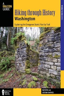
There's a lot more to Kelly Butte, and you can learn all about it in our book, Hiking Through History Washington.  You'll find a trail map, route descriptions, history, and more for this and many more hikes throughout the State. Help support hikingwithmybrother.com and the work we do by picking up a copy!

To get there, take I-5 south to Highway 18 Exit 142A. Follow Highway 18 into Auburn and take the SR 164 exit. Head left on SR 164 through Enumclaw to SR 410. Turn left onto SR 410 and drive about 20 miles through the town of Greenwater, past the fire station to FR 70 on the left. Follow FR 70 a little over eight miles to FR 7030. Take a left onto the gravel road and continue about four miles to a T-intersection. Take a left and continue a mile to the next intersection, again veering to the left. Continue for about a half-mile to another intersection, this time heading right. Find the signed trailhead on the left in about a mile. -Nathan

Print Google Directions >>

Kelly Butte

Thorp Mountain Lookout via Thorp Creek Trail #1316

Our Hiking Time: 5h 20m
Total Ascent: 2300ft
Highest Point: 5854ft
Total Distance: 6.5 miles
Location: N 47° 22.2420, W 121° 12.5160
Required Permit: None
Difficulty: Hard

Nathan's PhotoAfter all the luck we had dodging late snows up on Hex Mountain, when another sunny hiking day presented itself we headed back out over Snoqualmie Pass to continue exploring the trails around Cle Elum Lake. This time we set our sights on the long approach to Thorp Mountain Lookout hoping for some big views off of Kachess Ridge – we were not disappointed.

thorp mountain hikingwithmybrother
Thorp Mountain, along with Thorp Lake and Thorp Creek, are all named after Fielding Mortimer Thorp, an early pioneer in the Yakima Valley. Often attributed as the first permanent settler in the Valley in 1860, Thorp also went on in 1885 to found a small town. Years later, the town would be named Thorp by the Northern Pacific Railroad in honor of another member of the Thorp family. In the early 1930s, the US Forest Service built a fire lookout on the summit of Thorp Mountain, along with lookouts on nearby Jolly Mountain and Red Mountain. Today only the Thorp Lookout remains, still staffed by the Forest Service a few months out of the year.

Most hikers approach Thorp Mountain from the Knox Creek Trailhead, which is both shorter and easier than the Thorp Creek Trail we hiked. Currently, this route is made more complicated by the absence of a bridge over Thorp Creek near the trailhead. The creek might be friendlier in a few thorp mountain hikingwithmybrotherweeks after this year’s belated thaw, but currently it’s knee-deep, fast-flowing and ice-cold. Cross with caution.

Once across follow a converted logging road as it parallels the creek and takes you through recovering clearcuts. Slide alders and huckleberries line the trail, rising above the grass and brush that cannot quite disguise acres of bleached snags and stumps. Younger firs and pines eventually begin to appear, making this area more attractive to wildlife – we managed to stumble upon some elk and deer on our way up. Soon the trail begins in earnest, quickly transitioning from mild switchbacks to steeper grades.

Alas, we were not able to evade the lingering snows. We quickly lost the trail and found ourselves slogging up the icy mountainside. Still, we found the junction leading the half-mile down to Thorp Lake but chose to forge on to the ridgeline, and the rocky climb up to the lookout. This last stretch is a little steep, but the expansive views from the lookout are more than worth it. Mount Rainier rose above the shimmering blue of Kachess Lake. Nearby Red Mountain is easy to pick out to the northeast. Below, Thorp Lake is nestled amongst the trees. And beyond, the horizon is filled with hundreds of snow-topped peaks. Find a spot to settle down to take it all in.

thorp mountain hikingwithmybrotherWe liked this approach. It was a little more difficult, but it definitely made up for it in solitude. It also offers the possibility of making a loop out to the summit of Red Mountain following trails once used to connect the lookouts. The parts of the trail that were not covered in snow were in pretty good shape, but it’s still probably not for everyone. With over 2000ft of elevation in a little over three miles, it will definitely give your legs a work out. If you’re looking for a quiet alternative to a popular destination with some amazing views, give Thorp Creek Trail a try.

To get there, take I-90 to Exit 80. Head left over the freeway following Bullfrog Road to SR 903. Follow 903 for 16 miles through Roslyn and along Cle Elum Lake to FR 4308. Turn left onto FR 4308 and follow a little over 3 miles to a signed intersection. Head right down FR 4312 for the Thorp Creek Trail. Continue on FR 4312 for a mile and a half to a gated spur veering to the right. Find a spot to park here and hit the trail. –Nathan

Thorp Mountain Lookout

Mount Pilchuck Trail #700

Our Hiking Time: 4h 20m
Total Ascent: 2200ft
Highest Point: 5324ft
Total Distance: 5.2 miles
Location: N 48° 3.4740, W 121° 47.8680
Required Permit: Northwest Forest Pass
Difficulty: Hard

Nathan's PhotoThis week we topped off a month of Mountain Loop Highway destinations with a classic, Mt. Pilchuck. For years, readers have been telling us about the views from Mt. Pilchuck’s popular summit. Despite the deepening snow, the first sunny morning in weeks found us heading toward Mt. Pilchuck State Park.

In the summer, hikers flock to Pilchuck – with such stunning views at the end of a fairly short trail, it’s easy to see why. We had some company on our snowshoe to the top, but this was nothing compared the crowds you’ll navigate on a July weekend. mt pilchuck hikingwithmybrotherWe highly recommend trying this in the early winter, when the snow is clean and powdery, and the wind has sculpted the trees to look like something out of a children’s book. However, use caution in the winter months. The route is marked, but it occasionally skirts avalanche chutes, and the mountain has plenty of abrupt cliffs that can sneak up on the unwitting snowshoer. Snow also makes parking at the trailhead nearly impossible – simply go as far along Mt. Pilchuck Road as your vehicle can, and hike the remaining miles to the trailhead.

There's a lot more to Mount Pilchuck, and you can learn all about it in our book, Hiking Through History Washington.  You'll find a trail map, route descriptions, history, and more for this and many more hikes throughout the State. Help support hikingwithmybrother.com and the work we do by picking up a copy!

To get there, take I-5 North to Exit 194. Follow Highway 2 for about two miles. Stay in the left lane and merge onto Lake Stevens Highway 204. Follow for two miles to Highway 9. Take the left onto Highway 9 toward Lake Stevens. In just under two miles, reach Highway 92 to Granite Falls. Take a right and follow for about nine miles to the Mountain Loop Highway (MLH). Follow the MLH for 12 miles to Mount Pilchuck Road, just over the bridge crossing the South Fork Stillaguamish River. Follow the forest road seven miles to the trailhead. - Nathan

Print Google Directions >>

Mt. Pilchuck

CCC Trail #1264 to Nordrum Fire Lookout Site

Our Hiking Time: 3h 15m
Total Ascent: 700ft
Highest Point: 1500ft
Total Distance: 6 miles
Location: N 47° 32.2440, W 121° 34.5240
Required Permit: Northwest Forest Pass
Difficulty: Easy

Nathan's PhotoA few weeks ago, we found some extra time to wander down the most well maintained portion of the CCC Road Trail. In the past, we hiked the wilder sections of this former logging road, so to finish it out, we returned to the Middle Fork Snoqualmie Valley to explore its final leg and visit a former fire lookout site; Nordrum Lookout.

The trail abruptly begins off FR 56, without so ccc road trail hikingwithmybrothermuch as a widening in the road for parking. If you decide to start at this end of the trail as we did, try to find an unobtrusive place to park nearby. A small sign marks the “trailhead.” The path leads into a mossy mixed forest of alder, hemlock and cedar. Streams and rivulets frequently cross the trail, and occasionally the canopy opens up to reveal views of Mt. Garfield and Russian Butte. Unlike other sections of the CCC Road Trail, trail #1264 often wanders away from the old roadbed, crossing boardwalks and bridges erected over small streams and swamps. We passed by volunteers working to keep the trail in good shape – a stark contrast to other portions of the trail which are rocky, overgrown, and washed out.

The CCC Road as a long history that we have previously related, beginning with its Depression-era construction to its current recreational usage. Anyone who has ever camped at the Middle Fork Campground has probably taken a stroll down this gentle trail, but relatively few have followed the faint, mostly overgrown path up to the old Nordrum Lookout site.

ccc road trail hikingwithmybrotherThe lookout began in 1934 as a cabin on a recently logged hillock that suddenly found itself with an expansive view of the Middle Fork Valley. Within a few years, a tower was added, presumably to stay ahead of the rapidly recovering vegetation. By the 1950s, other lookouts on much taller perches made Nordrum obsolete, and the site was dismantled. Today, there is little more than a clearing with moss-covered foundation stones protruding with rusted metal.

While the route to the lookout site is unsigned, it is easily located. There is only one major junction on the trail, found just before reaching the Middle Fork Campground. Continuing straight will lead to the campground, while veering to the right will take you back to FR 56 and the Middle Fork Trailhead parking lot. Instead, take a left up the hill following the faintest of paths through the ferns to the lookout site. It is a short jaunt uphill to stand on a little ccc road trail hikingwithmybrotherpiece of history.

This hike is easily approachable for just about anyone. Very little elevation gain makes this a nice stroll through the woods, and lends an appreciation of what the Middle Fork has to offer. The hike up to the lookout site is more challenging, but it is also very short and makes a great little side trip for those itching to pull a little extra out of this hike. Although this portion of the CCC trail is on the tame side, it manages to do the best job of showcasing the natural beauty of the area.

To get there, take I-90 to exit 34 and take a left onto 468th Ave. Follow the road past the truck stop for about a half-mile until you reach SE Middle Fork Road, also known as Forest Road 56. The road has a few twists and turns, but continue onward until the asphalt ends at Mailbox Peak Trailhead. Press on for just over 10 miles to the trailhead or 12 miles to Middle Fork Campground, both on the left. -Nathan

CCC Trail North

Heybrook Lookout Trail #1070

Our Hiking Time: 1h 20mins
Total Ascent: 880ft
Highest Point: 1700ft
Total Distance: 2 miles
Location: N 47° 48.6299, W 121° 31.5180
Required Permit: Northwest Forest Pass
Difficulty: Easy

Nathan's PhotoAlways have a backup. Road closures and misinformation eventually forced us to abandon our planned hike this week along with a sizeable chunk of the morning. Finding ourselves suddenly short on time, we fell back to Heybrook Lookout, a short jaunt we were saving for just such an emergency.

Heybrook Lookout Trail #1070 is a just shy of a mile but gains roughly 800’ though second-generation forest still recovering from a clearcut in the 1920’s. A lookout was first placed here in 1925, and by 1932 a 45’ tower was erected. That tower stood until replaced by a larger tower in 1964. heybrook lookout hikingwithmybrotherThe current lookout was built in the late 1990’s, stands 73’ tall, and offers some excellent views of Mount Baring, Mount Persis, Mount Index, and Bridal Veil Falls.

Though it’s probably a little too short to warrant the drive out in and of itself, Heybrook makes an excellent side trip on the way to the slopes or in conjunction with another short hike. On the other hand, this is a great hike to bring those non-hiking friends on – quick and easy rewards just off the highway may pave the way for future outings. Best of luck and enjoy the views!

To get there, take Highway 2 just past milepost 37, shortly after the Index turnoff. Parking for the trailhead is a widened gravel shoulder on the north side of the highway. - Nathan

Heybrook Lookout

Granite Mountain

Our Hiking Time: 6h 40m
Total Ascent: 3700ft
Highest Point: 5629ft
Total Distance: 8.6 miles
Location: N 47° 25.0260, W 121° 28.8720
Required Permit: Northwest Forest Pass
Difficulty: Hard

Nathan's PhotoA gorgeous cloudless day begs for a climb up the side of a mountain that can deliver views measured in miles and landscapes vast enough to stretch beyond description. Luckily, we knew exactly the hike to live up to the expectations of the day. And so, since the snow had melted out sufficiently to allow easier access to the summit, we paid a visit to our old friend Granite Mountain.

granite mountain hikingwithmybrother
At 5,629’, Granite Mountain is one of the most easily accessible and therefore one of the more popular summits in the Snoqualmie Pass region. The summit is graced with an operational fire lookout staffed by the Forest Service during the summer months. First established in 1920, the lookout began as a flimsy cabin that was rebuilt and elevated in 1924. When the snow melts, the cement foundations of the 1924 cabin can still be seen near the current lookout tower, which was built in 1955.

The hike begins on the Pratt Lake Trail #1007, rolling through lush forests of cedar and Douglas fir, frequently passing over creeks and streamlets. After about a mile the route meets the Granite Mountain Trail #1016 and the tenor of the trail shifts from an uphill amble to a thigh-burning workout. granite mountain hikingwithmybrotherNavigate the rocky trail as it switchbacks through the increasingly dry terrain and catch the occasional glimpse of your eventual goal high overhead. As you gain elevation, trees thin and become more diminutive while ferns yield ground to bear grass and mountain blueberry. Eventually the trees are entirely left behind, the views are laid bare, breezes keep the bugs at bay during the summer months, and the trail grade relents slightly as the fire lookout comes into view. While snow is on the ground, a ridge route straight to the summit avoids most avalanche danger. As the snow recedes, the rocky ridge is less appealing than the formal trail route that snakes beneath the ridge before zigzagging up the bluff the lookout resides upon.

The views that begin hundreds of feet below culminate as you attain the lookout, snowy mountaintops spreading out with a mesmerizing immensity. Mt. Rainier dominates the skyline, in every way demanding attention and dwarfing Mt. Catherine and Humpback Mountain just across I-90 far below. If you can tear your eyes off Rainier, the beginnings of Keechelus Lake can be seen to the east, and Bandera Mountain quietly neighbors to the west. Looking north, the eye is drawn to the distinctive Kaleetan Peak, as well as Chair Peak and Mt. Stuart, while just below Crystal Lake and Upper Tuscohatchie Lake gleam invitingly in the sunlight.

This hike can be challenging. In summer months the sun beats down on exposed rocks and meadows, making the trail dusty without much relief in the form of extra water. Avalanches have taken the lives of hikers on Granite, so take extra caution during the spring. The trail is almost exclusively an uphill battle, so prepare for a long day. If necessary, take that extra break to fuel up for the final push – the views from the top are more than rewarding and well worth your perseverance. Of course, when there’s snow, getting down the mountain is quick and a lot of fun.


To get there, take I-90 to Exit 47, cross the freeway and take a left. Continue for a short distance to find parking and the trailhead. Don’t forget to put out your Northwest Forest Pass before heading up. - Nathan Granite Mountain
Copyright 2008-2016 - hikingwithmybrother.com
hikingwithmybrother@gmail.com