Total Ascent: 2300ft
Highest Point: 5854ft
Total Distance: 6.5 miles
Location: N 47° 22.2420, W 121° 12.5160
Required Permit: None
Difficulty: Hard
 After all the luck we had dodging late snows up on Hex Mountain, when another sunny hiking day presented itself we headed back out over Snoqualmie Pass to continue exploring the trails around Cle Elum Lake. This time we set our sights on the long approach to Thorp Mountain Lookout hoping for some big views off of Kachess Ridge – we were not disappointed.
Thorp Mountain, along with Thorp Lake and Thorp Creek, are all named after Fielding Mortimer Thorp, an early pioneer in the Yakima Valley. Often attributed as the first permanent settler in the Valley in 1860, Thorp also went on in 1885 to found a small town. Years later, the town would be named Thorp by the Northern Pacific Railroad in honor of another member of the Thorp family. In the early 1930s, the US Forest Service built a fire lookout on the summit of Thorp Mountain, along with lookouts on nearby Jolly Mountain and Red Mountain. Today only the Thorp Lookout remains, still staffed by the Forest Service a few months out of the year.
Most hikers approach Thorp Mountain from the Knox Creek Trailhead, which is both shorter and easier than the Thorp Creek Trail we hiked. Currently, this route is made more complicated by the absence of a bridge over Thorp Creek near the trailhead. The creek might be friendlier in a few
 weeks after this year’s belated thaw, but currently it’s knee-deep, fast-flowing and ice-cold. Cross with caution.
Once across follow a converted logging road as it parallels the creek and takes you through recovering clearcuts. Slide alders and huckleberries line the trail, rising above the grass and brush that cannot quite disguise acres of bleached snags and stumps. Younger firs and pines eventually begin to appear, making this area more attractive to wildlife – we managed to stumble upon some elk and deer on our way up. Soon the trail begins in earnest, quickly transitioning from mild switchbacks to steeper grades.
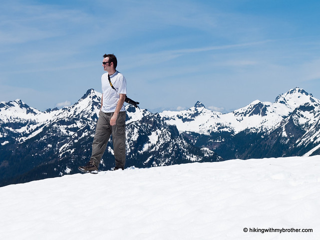
Alas, we were not able to evade the lingering snows. We quickly lost the trail and found ourselves slogging up the icy mountainside. Still, we found the junction leading the half-mile down to Thorp Lake but chose to forge on to the ridgeline, and the rocky climb up to the lookout. This last stretch is a little steep, but the expansive views from the lookout are more than worth it. Mount Rainier rose above the shimmering blue of Kachess Lake. Nearby Red Mountain is easy to pick out to the northeast. Below, Thorp Lake is nestled amongst the trees. And beyond, the horizon is filled with hundreds of snow-topped peaks. Find a spot to settle down to take it all in.
 We liked this approach. It was a little more difficult, but it definitely made up for it in solitude. It also offers the possibility of making a loop out to the summit of Red Mountain following trails once used to connect the lookouts. The parts of the trail that were not covered in snow were in pretty good shape, but it’s still probably not for everyone. With over 2000ft of elevation in a little over three miles, it will definitely give your legs a work out. If you’re looking for a quiet alternative to a popular destination with some amazing views, give Thorp Creek Trail a try.
To get there, take I-90 to Exit 80. Head left over the freeway following Bullfrog Road to SR 903. Follow 903 for 16 miles through Roslyn and along Cle Elum Lake to FR 4308. Turn left onto FR 4308 and follow a little over 3 miles to a signed intersection. Head right down FR 4312 for the Thorp Creek Trail. Continue on FR 4312 for a mile and a half to a gated spur veering to the right. Find a spot to park here and hit the trail. –Nathan


6 Comments:
For road conditions, you can call the Cle Elum Ranger District at (509) 852-1100. I just checked today (4/26/12) and FR 4308 is still closed, which would add an extra 3 miles to this hike.
Did you stay in the lookout or just camp nearby?
We just did this as a day hike, so no camping for us. Not entirely sure the Forest Service rents this one out for overnights. We'll have to check up on that one.
Could you please enable the download GPX link on this one? Thanks!
The GPX file is now available!
Thanks so much. This is Dave. I'm still walking in your footsteps!
Post a Comment