Total Ascent: 2600ft (2300ft in; 300ft out)
Highest Point: 5540ft
Total Distance: 8 miles
Location: N 47° 47.5440, W 121° 11.8620
Required Permit: None
Difficulty: Hard
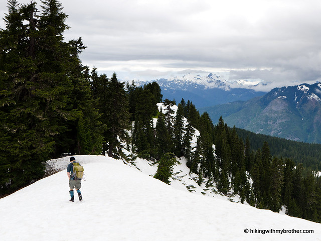
 This week we decided to find out if summer had reached the mountaintops along the Highway 2 corridor, holding on to the faint hope that snows had miraculously receded. We chose the somewhat obscure Scorpion Mountain, assuming its relatively low elevation would mean no lingering snow. The bad news? We encountered a lot more snow than we should have in July. But the good news is that the snow is definitely on the way out – at least under 6,000ft.
 This can be a challenging hike. The elevation gain is not insignificant, especially with all the ups and downs. While not an ideal hike for the whole family, many hikers should be able to navigate the sometimes rough trail to the top. The amazing views Scorpion Mountain offers are more than worth the extra workout. The lengthy drive down forest roads keeps this hike a little under the radar, so don’t expect to be sharing the views with a lot of company.
There's a lot more to Scorpion Mountain, and you can learn all about it in our book, Hiking Through History Washington. You'll find a trail map, route descriptions, history, and more
 for this and many more hikes throughout the State. Help support hikingwithmybrother.com and the work we do by picking up a copy!
 To get there, take Highway 2 out past Skykomish to milepost 50. Take a left onto FR 65, also known as the Beckler River Road. Continue for almost seven miles to a junction, taking a sharp right up FR 6520 and following it for almost three miles to an unsigned junction. Veer left here, continuing on FR 6520 for another four miles to the next junction. Here, take a right up FR 6526 and follow it for about a quarter mile to the last junction, taking a left up to a small trailhead at road’s end. -Nathan
Print Google Directions >>


0 Comments:
Post a Comment