


Total Ascent: 4000ft
Highest Point: 4841ft
Total Distance: 9.6 miles
Location: N 47° 27.745, W 121° 38.354
Required Permit: Discover Pass
Difficulty: Hard
 Not long ago, after years of effort, crews officially opened a new route up Mailbox Peak on September 27, 2014. While we had made the grueling trek up to the summit more than once in the past, after the Seattle Times contacted us about the old trail we decided it was time to explore the newly built approach.
 Before the 1940s, few hikers ventured up the steep sides of the then-unnamed Mailbox Peak. In 1956, Valley Camp was established near the base of the peak and some adventurous souls began regularly bushwhacking their way to the mountain. Around 1960 Carl Heine, a Seattle letter carrier by day and the camp’s director in his free time, had decided to lug a mailbox to the summit. Campers were then sent up the mountain to sign the summit register left in the mailbox. Over the years, hundreds of boots pounded out a steep path straight up the mountainside.
 While the original trailhead started from Valley Camp, logging operations in the 1970s cut a road across the trail and cleared the trees between the road and the camp, effectively obliterating that portion of the trail. Unsigned and still relatively unknown, the hike remained something of a secret amongst a small community of hikers. The hike’s low profile was helped by the difficult to find trailhead tucked a few tenths of a mile behind a gated forest road and famously marked only with toothbrushes jammed discreetly into the ground. That changed in 1991 when Sally Pfeiffer wrote an article for Signpost, the Washington Trail Association’s monthly publication, revealing the location of the trail to the hiking community at large. She also suggested a name: Mailbox Peak.
 Since that time, the hike’s popularity has exploded, drawing tens of thousands of hikers up a very rough and narrow trail. Built largely by happenstance, the old trail could not handle the crowds or the inexperienced hikers unprepared for the difficult terrain. As a result, sections of the trail quickly eroded and injuries were common. Today, the new route addresses most of these concerns.
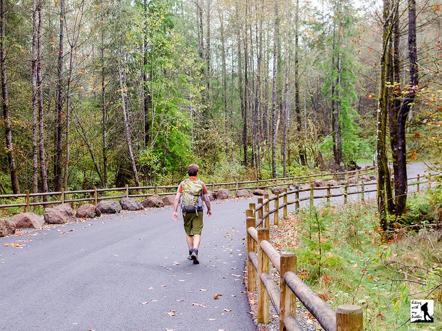
From the parking area, the trail begins, as it has for decades, by walking around a gated forest road and finding a trailhead a few dozen yards down the road. Today’s trailhead is an obvious and well-signed affair, complete with a detailed map of the path ahead. From here, the trail begins relatively gently, crossing a few creeks and a hefty bridge before beginning to switchback in earnest. Veterans of the hike will still find a familiar amount of elevation gain as the trail climbs through a mixed forest of maple, fir and cedar. And climb it does; endlessly and relentlessly up mile after mile of wide, well-made trail.

To the north find Glacier Peak and Mt. Pilchuck on a clear day. Swing east and pick out the crags of nearby Russian Butte with other peaks of the Middle Fork Snoqualmie River Valley beyond. Kaleetan Peak is easy to pick out before your views are blocked by the next prominence along the ridgeline, sometimes called Dirtybox Peak, for its location between Mailbox and Dirty Harry’s Peak. Turn south passing over McClellan Butte’s distinctive crown to find Mt. Rainier dominating the skyline above the interstate. Find Mt. Washington almost directly across the valley from you and as you swing north you can see Rattlesnake Ridge stretching back toward Seattle. Pass over neighboring Mt. Si and Mt. Teneriffe as you complete your 360-degree tour.
While the new route has smoothed a lot of Mailbox’s edges, it’s still a challenging hike. The hike will continue to be a popular destination for those looking for a great training hike or relatively quick access to big views. In other words, unless you’re going up on a weekday, you can expect company. On the upside, the new trail is able to accommodate a lot more hikers by spreading them out over a greater distance. On the downside, the added distance can make for a long day, though you can trim the route by taking the shorter old trail up and the longer new trail back. Keep in mind that the last half-mile has all the same hazards as the old trail and should still be approached with a healthy amount of respect. If you haven't tackled Mailbox Peak in a while, the new trail is a great new way to explore this old favorite.
 To get there, take I-90 to exit 34 and take a left onto 468th Ave. Follow the road past the truck stop for about a half-mile until you reach SE Middle Fork Road, also known as Forest Road 56. Turn right and follow the road for a few twists and turns, keeping left when the road splits. After 2.2 miles reach SE Dorothy Lake Road. Turn left and continue .3 miles find the road up to the parking area on your right. - Nathan
Print Google Directions >>
0 Comments:
Post a Comment