


Total Ascent: 2300ft
Highest Point: 4100ft
Total Distance: 18.6 miles
Location: N 46° 56.4600, W 121° 47.0459
Required Permit: National Park Pass
Difficulty: Moderate
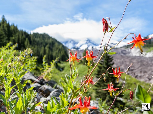
 We’ve done a lot of hiking in the Carbon River Valley this year, exploring quite a few trails in the area. After seeing so much of the river, we thought it only appropriate to head out to the Carbon Glacier to see where it all begins. While we expected to find a wall of ice, we underestimated just how impressive the river’s source would be.
The hike begins from the Carbon River Entrance, following the Carbon River Road through a temperate rain forest of fir and cedar. The road provides access to a number of hikes, and many people opt to bike the road to cut down on travel time, though there is something to be said for the more leisurely walk through the woods. Flat and wide, the miles pass quickly and easily, passing the Green Lake Trailhead after about three miles and the Chenuis Falls Trailhead another half-mile or so beyond. The river is your constant companion as you push past these popular day hikes toward Ipsut Campground. The campground is a good place to stop for a breather or to set up camp if you’re planning on a longer trip.
 Continue past Ipsut Campground following the Wonderland Trail deeper into the lush forest for another 1.7 miles to the junction with the Northern Loop Trail. While older guides will suggest that you continue on the Wonderland Trail to Carbon River Camp, that section of trail is currently closed. Instead, veer left crossing the logs the span various sections of the Carbon River, eventually crossing the rocky riverbed. Look upstream to catch your first glimpse of the glacier, through it will likely look more like a distant mountain than an ice field. Once across, climb up the riverbank to find a junction where the Northern Loop Trail splits. Head right, continuing to follow the river as the trail wanders through mossy old growth and over endless streams and creeklets. After another mile and a half reach the Carbon River Suspension Bridge, built in 1984 as an answer to the constant need to replace the bridge that spanned this area for decades. If you have a little extra time, we recommend taking a few moments to cross the bridge and head out to Cataract Falls, just a few tenths of a mile from the river. The bridge also provides easy access to Carbon River Camp, another option for those planning an overnight.
 From the bridge, the hike becomes a little more challenging, beginning to climb up the steep valley the glacier carved years ago. As you progress the trees fall away, providing big views of the enormous glacier and the river surging from the base of a icy wall hundreds of feet tall. There are plenty of places to stop along the way, though we recommend pushing onward and upward to Dick Creek Camp for views of the glacier and the valley below.
 This is a classic hike, though since the road closure it is a little on the long side for a day hike. At the same time most of the distance is along the Carbon River Road, which can be biked or hiked without much effort. With several campsites near the glacier, there are a lot of options for adding a hike to the Carbon Glacier to an overnight or multi-day backpack. And while the first few miles of the Carbon River Road tend to have a lot of traffic, the crowds quickly thin beyond the Chenuis Falls Trailhead.
To get there, take I-5 South to I-405. From I-405 take SR 167 south toward Auburn. In 20 miles take the SR 410 Exit toward Sumner/Yakima. Follow SR 410 for 12 miles to SR 165. Take a right and continue on SR 165 for about 10 miles through Wilkeson and Carbonado to the Carbon River Road/Mowich Lake Road junction. Veer left onto the Carbon River Road and follow for 7.7 miles to the Carbon River Entrance of Mt. Rainer and parking. -Nathan
Print Google Directions >>
0 Comments:
Post a Comment