


Total Ascent: 300ft
Highest Point: 200ft
Total Distance: 9.0 miles
Location: N 48° 14.8133, W 124° 42.018
Required Permit: Makah Recreation Pass (details below)
Difficulty: Moderate (due to rough trail conditions)
 A few weeks ago we took a weekend to head out to the Olympic Peninsula to tackle a few hikes along the Pacific Coast. One of those hikes was Shi Shi Beach and the Point of Arches, a tour of the most pristine beaches in the state out to an archipelago of sea stacks extending out into the Pacific. With headlands to scale, waves to dodge, and rocky tidepools to peer into, this hike has more than enough to fill a day of hiking and exploring.
 Shi Shi (pronounced “shy shy”), is a Makah work meaning “surf beach” or “smelt beach” in reference to the fish that are common along this section of coast. Around 1894, prospectors discovered gold in the sand along the Olympic Coast, and the most productive area was Shi Shi Beach. While major mining operations were never undertaken on the beach, claims were made and registered. When the beach was added to the Olympic National Park in 1976 after long negotiations with various interests and landowners, the one piece the Park Service did not get was the mineral rights. In 1980 the Point of Arches was named a National Natural Landmark, and the area as designated a wilderness in 1988. Despite these protections, the owners of the mineral rights were asserting their claims to the gold, silver, and platinum buried in the beach as late as 2005 but have not been successful.
 From the parking lot the Shi Shi Beach trail enters a forest of hemlock and spruce. The first portion of the hike follows a slightly convoluted route around sections of private property before connecting up with an old roadbed. The roadbed is often waterlogged and muddy, though side paths help navigate the worst portions. As you progress, occasional gaps in the trees offer glimpses of the coastline hundreds of feet below. After about 2 miles the trail enters the Olympic National Park and abruptly turns down toward the beach, steeply switchbacking down cliffs with the help of ropes.
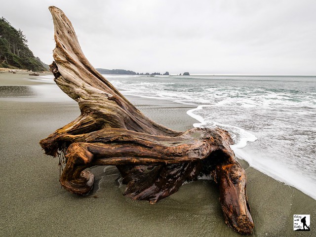
 Once on the beach, head south toward the Point of Arches in the distance. Depending on the tide, the crashing waves may push you toward the fields of driftwood piled at the base of the bluff, or you may find yourself walking next to shelves of barnacle-covered rock. Campsites can be found tucked into the trees as you progress, though the best sites are found along Petroleum Creek, about a mile and a half down the beach. Reach the Point of Arches a mile beyond the creek. If you can, aim to get to the Point of Arches at low tide, as it is inaccessible at high tide. Its easy to spend hours exploring the nooks and crannies of the rocks to find sea stars, anemones, and crabs.
 Wild and remote, Shi Shi Beach conjures images of shipwrecks and castaways. It is a popular destination for backpackers and it is easy to see why. The seascape changes dramatically with the tides, providing much more than can be seen in a single day. The only challenging portion of this hike is the steep and poorly maintained set of switchbacks down to the beach. The trail is not well defined here, and its easy to lose your footing. This short section will prove difficult for young and inexperienced hikers, though the ropes do help. Beyond this challenge, most hikers should have no problem reaching this stunning beach. Keep in mind that the area is managed by the Makah Tribe and all visitors are required to purchase a parking permit from the tribe - Washburn’s in Neah Bay is a good place to get one.

Print Google Directions >>
4 Comments:
Hiked from oil city to Shi Shi back in 1997 over the span of 9 days. One of my favorite trips ever.
That sounds amazing! From everything we've read that would be a great experience. Hope we can find time to do that trek one day.
At what time of year did you guys make this hike? Would it work in the fall?
We did this at the end of Feb last year. It will work in the fall, though it's better if you happen to have decent weather!
Post a Comment