


Total Ascent: 400ft
Highest Point: 600ft
Total Distance: 6.5 miles
Location: N 46° 54.666, W 123° 5.28
Required Permit: Discover Pass
Difficulty: Easy
 Not long ago we returned to Capitol State Forest to check out another of the working forest’s many trailheads. This time we headed to the Mima Falls Trailhead for a short trek out to the waterfall. While the falls are pleasant enough, the hike to reach them is not, as portions of this hike cut across large swaths of recently cleared forest and a nearby shooting range means you’ll never quite escape the sound of gunfire.
Mima Falls takes its name from the nearby Mima Mounds. “Mima” is a Native term meaning “a little further along.” Over the years, the Washington Department of Natural Resources (DNR) has worked with volunteers to build up the trail system in Capitol State Forest, expanding on the network of logging roads. It is likely that at least some portions of this trail are built on sections of former logging roads that once led to logging camps that supplied the sawmills in the lumber boom town of nearby Bordeaux. Established by the Bordeaux Brothers back in 1896, this area of the Black Hills were logged for over 40 years until the old growth timber ran out and Bordeaux became a ghost town in 1941. While Capitol State Forest has been a recreation destination for decades, the Mima Falls Trailhead and Campground was not built until 1973. In 2013 the DNR completed an overhaul of the Capitol State Forest Trail system that renamed most of the trails. Older guides will reference these outdated trail names.
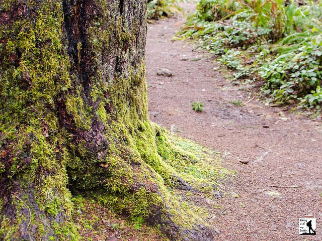
The trail begins from the Mima Falls Trailhead, along the Mima Falls Trail East Trail. The route immediately passes through the Mima Falls Campground and enters a large area that was very recently logged. After a half mile, reach a junction with the Campground Trail. Veer left and continue through the fields of stumps and newly planted seedlings to the shelter of the forest. In another 1.5 miles, the trail splits into Mima Falls Trail West and the Mima Falls Tie Trail. Veer left over Mima Creek and reach the falls within a few tenths of a mile. The only views of this short cascade are from a rough side trail that parallels the waterfall. If you’re looking to extend your hike, a series of interconnected trails make it easy to put together a number of loops. The Department of Natural Resources offers a decent map to help you navigate the trails.
 If you’re only heading out to Mima Falls, this isn’t a hike we can recommend highly. While it’s certainly approachable for any hiker, the sounds of the neighboring Evergreen Sportsman Club can be a bit overwhelming. The range was operating long before the Mima Falls Trailhead was built, making this a less than ideal location for a trailhead. In addition, the recent logging activity has taken a lot of the beauty out of this hike. While this trailhead serves bikers well, it’s not the best for a hike. We recommend heading to the Falls Creek Trailhead or the Rock Candy Trailhead instead.
To get there, take I-5 South to Exit 95 the Littlerock/Maytown exit. Follow Maytown Road through Littlerock as it turns into 128th Street for 3.7 miles to a T-intersection. Head left onto Mima Road for 1.3 miles to Bordeaux Road. Take a right and in .7 miles turn right onto Marksman Road. Mima Falls Trailhead is at the end of the road on the left. -Nathan
Print Google Directions >>
0 Comments:
Post a Comment