Total Ascent: 600ft
Highest Point: 4000ft
Total Distance: 3.8 miles
Location: N 46°57.041, W 121° 22.878
Required Permit: Northwest Forest Pass
Difficulty: Moderate
 Last summer we decided to do a little camping along Highway 410 out beyond Chinook Pass. We had high hopes of exploring a number of trails in the area, but ended up only having time to spend a day exploring the Union Creek Trail and its picturesque waterfalls.
 Back as early as 1880, prospectors were staking dozens of claims along Union Creek. In 1897 Robert and Thomas Fife were working a set of six claims they had dubbed the Blue Bell Claims, in what was then known as the Summit Mining District. Blue Bell Pass is named after these claims and nearby Fifes Peak is named in honor of the brothers. In 1897 there was no real trail to the claims, instead the brothers followed blazes carved into trees to reach their mining site.
 Over the years, as ore was dug from the ground and transported back to civilization, a rough trail was slowly carved into into the mountainside. Portions of today’s trail are likely built on the bones of that route.
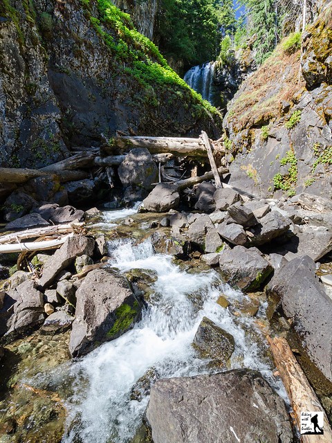
The Union Creek Trail #965 beings in a mature pine forest on a wide and well maintained trail. The trail almost immediately enters the Norse Peak Wilderness as it gently rises and begins to switchback up the mountain. After about a half-mile, a short side trail leads out to Union Creek and a view of Union Creek Falls, tumbling 60 feet from the cliffs above into a sheltered gorge, then sloshing down through a tangle of boulders and fallen logs. If you want to get closer to falls, push up the trail a bit more to find a steep social trail leading down to the base of the falls. After you’ve had your fill, continue to switchback up the mountain for another mile through sections of trail that still bear markings from a 1965 forest fire.
After a mile of hiking reach a small bridge crossing the North Fork Union Creek as it drops over a precipice to join Union Creek below. Before crossing the bridge and continuing up the trail, follow one of the rough paths hugging the creek back to North Union Falls which are not visible from the main trail. This secluded area offers an excellent place for a rest or makes for a decent turnaround point if you’re short on time. If you’re hungry for more, return to the main trail and press onward and upward for 3 more miles passing through forest punctuated by meadows before dropping back to Union Creek. From here, it’s a steep 2 mile climb up to Crown Point and the Pacific Crest Trail just below Blue Bell Pass.
Long and on the challenging side, the full length of this trail is probably too long for most day hikers. However, those interested in a short waterfall tour should have little problem climbing up the dusty trail to North Union Falls. This area is also a popular snowshoeing destination during the winter months. Whether you’re looking for a short day or a longer one, there is enough to see along the Union Creek Trail for every hiker to find what they are looking for.
To get there, take I-5 south to Highway 18 Exit 142A. Follow Highway 18 into Auburn and take the SR 164 exit. Head left on SR 164 through Enumclaw to SR 410. Head left onto SR 410 for 55 miles over Chinook Pass to the Union Creek Trailhead on the left side of the highway. -Nathan
Print Google Directions >>


0 Comments:
Post a Comment