Total Ascent: 1700ft
Highest Point: 6089ft
Total Distance: 6 miles
Location: N 47° 1.4100 W 121° 48.9483
Required Permit: Northwest Forest Pass
Difficulty: Moderate
 At the end of last summer we headed out toward the Carbon River entrance to Mt. Rainier National Park to do a little exploring around that area. One of the hikes we chose was Bearhead Mountain, a former fire lookout site with enormous views of Mt. Rainier and the surrounding landscape.
Bearhead Mountain is labeled on maps as far back as 1913, though it is not clear who first christened the peak. Presumably that person found a resemblance between the mountain and the head of a bear. In 1931 the Forest Service built a fire lookout cabin at the summit, along with a number of other nearby cabins like Suntop. Lookouts manned the cabin until 1957 when it was removed. Today little evidence of the cabin remains, though you can still find the nub of a rusted pipe among the rocks - that’s all that is left of a mounting shaft for an Osborne Firefinder, the instrument the lookouts used to pinpoint fires.
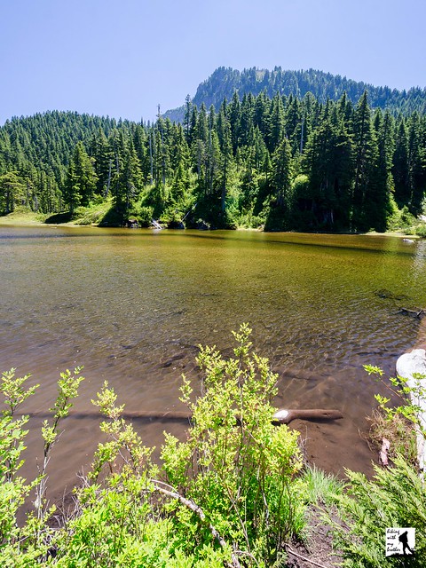
From the trailhead, the hike begins along the Summit Lake Trail #1177 by climbing up through a young forest yet to recover from a recent timber harvest. Before long, find yourself entering more mature stands of fir and hemlock as the trail swings into a long switchback up the mountainside. The trail here is fairly wide and well maintained, though there are plenty of roots to trip you up if you’re not paying attention. After about a mile of trail reach a junction with the Carbon River Trail #1179 and Twin Lake. While you're here, look for the short unmarked trail that leads out to lonely Twin Lake, which lacks both a twin and the sprawling vistas of Bearhead Mountain.
At the junction, veer right onto the Carbon River Trail and begin the long traverse across the base of Bearhead. Thick stands of old growth begin to thin as you progress, eventually providing glimpses of Mt. Rainier rising above a sea of peaks. As you continue, the trail is punctuated with the occasional talus field and stretches of meadow that burst with wildflowers in season. After about a mile, reach the junction with the Bearhead Mountain Trail #1179.1. From here, the trail turns steeply upward, switchbacking up the flanks of the mountain to the summit. As you climb, the expanding vistas hint at the views waiting at your destination. When you eventually reach the rocky summit, find peaks stretching out in nearly every direction. Mt. Rainier looms to the south. Old Baldy Mountain and Pritchard Mountain are the nearest peaks to the west, rising above Coplay Lake. Find Summit Lake and Summit Lake Peak, and on good days pick out Glacier Peak and Mt. Thompson to the east. Do a little exploring along the ridge to find a good spot to settle in and enjoy the views.
 This trail does see some traffic in the summer months, but most hikers opt for Summit Lake over this climb. A little more challenging than Summit Lake, the ascent may give some hikers pause, but the trail is in decent shape and the hike should be attainable for those willing to put in a little extra effort. With bigger views than Summit Lake Peak and a handful of wildflower-filled meadows, Bearhead Mountain is a great alternative to Summit Lake on a summer day. On the other hand, if you’re looking for a longer day, why choose? Round out your day by heading back down to Twin Lake and making the trek up to Summit Lake.
To get there, take I-5 South to I-405. From I-405 take SR 167 south toward Auburn. In 20 miles take the SR 410 Exit toward Sumner/Yakima. Follow SR 410 for 12 miles to SR 165. Take a right and continue on SR 165 for about 10 miles through Wilkeson and Carbonado to the Carbon River Road/Mowich Lake Road junction. Veer left onto the Carbon River Road and follow for 7.5 miles to FR 7810, just before the Carbon River Ranger Station. Turn left onto the FR 7810 and continue 6.5 unpaved miles to the trailhead at the end of the road. –Nathan
Print Google Directions >>


1 Comments:
Looks like a great hike! Lovely photos as well!
If you like photography we would like to invite you to participate in the next edition of our Travel Photography Competition. Every week we publish 3 winning shots on our website and write a nice bio with a link to the photographers' websites/FB/Flickr pages.
Find more details here: http://hitchhikershandbook.com/your-contributions/travel-photography/
Have a nice weekend!
Post a Comment