


Total Ascent: 300ft
Highest Point: 2200ft
Total Distance: 2.8 miles
Location: N 46° 59.586, W 121° 53.466
Required Permit: National Park Pass
Difficulty: Easy
 We’ve spent a lot of time in the Carbon River area this summer, visiting many of the more popular destinations such as Mowich Lake and the Carbon Glacier. Along the way, we also found a few short side trips like the Old Mine Trail that added a little taste of the mining history that helped shape the Carbon River we know today.
The Carbon River Valley has a long mining history, and around the turn of the last century, companies were pulling gold, silver and
 copper out of mines in the area. Following these successes, the Washington Mining and Milling Company staked 38 claims on the south side of the Carbon River beginning in 1906. In an effort to get more supplies to their claims, the company agreed to help build portions of what would eventually become the Carbon River Road. While the company christened their claims with hopeful names such as the Copper King Group, Gold Coin Group and Silver King Group, the exploratory adits they dug did not yield any significant finds. Low production and pressure from the Park Service led the company to cease operations in 1913.
While records are not complete, the Old Mine appears to be one of the company’s adits. It extends about 165 feet back into the rock. In 1950 or 1951, a ranger named Aubrey L. Haines was told about a mine near the Carbon River Road. Based on the description, Haines was able to locate the Old Mine as well as a number of buildings and an inclined railway track. The buildings disappeared by the 1980s, and the tracks have since followed. Today only the entrance of the mine remains.
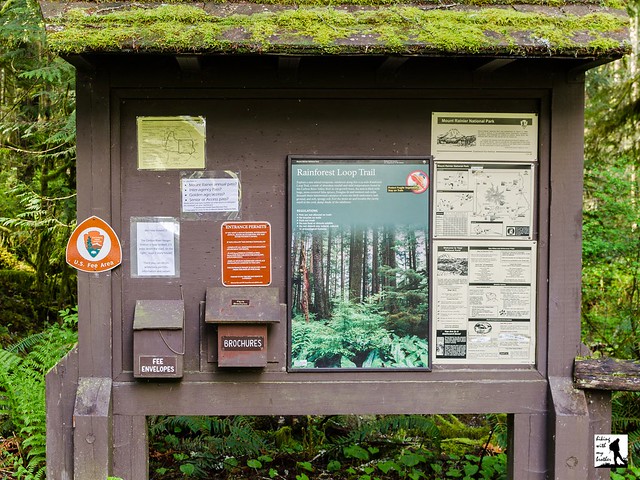
The hike begins at the gated Carbon River Entrance to Mt. Rainier National Park. Whether hiking or biking, follow the Carbon River Road for 1.2 miles to a small parking area and the signed Old Mine Trailhead. The trail plunges into the mixed forest and quickly begins to switchback steeply up the mountainside. After a few minutes of climbing, find yourself facing the gated mine entrance. Take a few minutes to explore the entrance and shine a light into the darkness. Once you’re rested up, head back down and continue on to your next destination.
 While not much in the way of a hike, this quarter-mile detour from the Carbon River Road is an easy add-on to a day of hiking. Trail volunteers have recently upgraded the trail, making the short trek even easier. Easily accessible from the Carbon River Road,the Old Mine Trail is something any hiker can explore.
To get there, take I-5 South to I-405. From I-405 take SR 167 south toward Auburn. In 20 miles take the SR 410 Exit toward Sumner/Yakima. Follow SR 410 for 12 miles to SR 165. Take a right and continue on SR 165 for about 10 miles through Wilkeson and Carbonado to the Carbon River Road/Mowich Lake Road junction. Veer left onto the Carbon River Road and follow for 7.7 miles to the Carbon River Entrance of Mt. Rainer and parking. -Nathan
Print Google Directions >>
1 Comments:
I have'nt been to that exact destination (mt.rainier)the park entrance ranger station for many years but let me tell you i have combed through the most part heavy.and found by accident as i hiked up one mt.hill and looked across is when i discovered my first mine up there.Then half of the heavy cart was still in it.Its so neat to find something you know not many know about.Right before you get to ranger station there is a road that crosses river on left back then it was gravel go up quarter mile and pull off to side and park and climb straight up on left side of hill.Its great sight.
Post a Comment