Total Ascent: 500ft
Highest Point: 2800ft
Total Distance: 4.4 miles
Location: N 47°57.0170, W 120° 19.968
Required Permit: None
Difficulty: Easy
 Not long ago we spent a weekend hiking around the bluffs above Lake Chelan. We explored a number of trails, all of which had something a little different to offer. One of those trails was the North Fork 25 Mile Creek Trail, a dusty mixed use trail that follows the creek to a washout.
Back around the turn of the last century, homesteaders settled in the area around Twentyfive Mile Creek, grazing sheep and cattle in the dry hills and the valleys made green by the streams working their way down to Lake Chelan. By the 1930s the area was overgrazed and the sheep and cattle declined, but left an area already prone to wildfires even more vulnerable to fire. In 1945, despite the occasional fire, Roger Hale built a mile-long pipeline from the North Fork Twentyfive Mile Creek to his family’s homestead.
 Throughout the 1970s the fires intensified, and the more recent 1994 Tyee Fire, the 1998 North 25 Fire and the 2004 Pot Peak fire have all left thousands of acres of charred forest behind. In 2006 floods washed out the trail just past the two mile mark, and the upper reaches of the trail have since become overgrown and been all but officially abandoned. Today, it is easy to spot large swaths of burnt trees on the hillsides near the trail and you can still catch the smell of ash in the air.
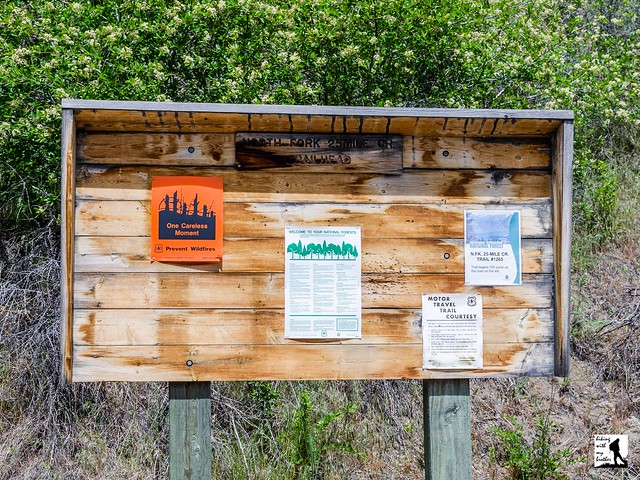
The trail begins from the main forest road, following a dusty utility road toward the sounds of the creek (ignore the mislabeled sign at the trailhead; rest assured that while it reads #1256 instead of #1265, you are in the right place). After about a quarter mile, catch your first glimpses of the creek in the ravine below the road. Continue following the pine tree and brush-lined trail out 1.2 miles to the road’s end. From here, leave the road behind and begin the hike in earnest, following the rocky trail down to the creek. Almost immediately, you’ll come across the North Fork Water System installed by Mr. Hale, which is still in full operation and easily accessed from the trail. After you’ve taken a look at the water system, continue deeper into the forest passing trees and brush scarred by recent fires along the way. As you progress, the creek is never far from your side, despite a few steep ups and downs. Reach the washout at the 2.2 mile mark and settle in to enjoy the water.
This is a short creekside day hike that offers a taste of the hikes in the area. Although once more of an ORV trail, since the 2006 washout this has become more of a hiking route. While the trail does not boast big views or a sparkling lake, the creek offers pleasant company as you wind your way through a forest still recovering from recent fires. With a limited amount of elevation gain, most hikers should not have a problem reaching the gravel beach created by the washout. If you’re looking for some adventure, you can push onward past the washout and try to connect with the Lone Peak Trail.
 To get there, take I-90 to Exit 85 to Cle Elum/Leavenworth. Cross the freeway and head right on WA 970 toward Leavenworth as it merges into WA 97. As WA 97 ends, merge on US 2 toward Wenatchee following signs for US 2 and WA 97. In West Wenatchee, follow signs for WA 97 ALT. Once on WA 97 ALT, continue 23.5 miles to WA 971, taking a left and following to Lakeshore Road. Take a left and continue 10.4 miles past Twentyfive Mile Creek State Park to FR 5900. Take a left and follow FR 5900 3.3 miles to a switchback in the road. Park here. The signed trailhead is a few hundred feet up the road on the left. -Nathan
Print Google Directions >>


0 Comments:
Post a Comment