Total Ascent: 850ft
Highest Point: 2300ft
Total Distance: 9.0 miles
Location: N 47° 2.07, W 122° 1.368
Required Permit: None
Difficulty: Easy
 A few weeks ago we headed out to the Carbon River to continue exploring an area steeped in history. This time we were headed to Gleason Hill to try and locate an old sawmill we’d found some references to. While we never found what we were looking for, we did manage to put together an interesting little hike that works well as a winter outing.
Gleason Hill sits on the east side of the Carbon River opposite the townsite of Fairfax. The former coal and lumber town was platted in 1897 and supported
 a bustling population for nearly 50 years before being abandoned in the 1940. Another community thrived on the other side of the river at the base of Gleason Hill. Known as Upper Fairfax, the town focused on logging the forests atop Gleason Hill. In the 1930s, the Civilian Conservation Corps built a road along the river to help expand access to Gleason Hill’s timber. The Fairfax CCC Road is still being used today, and most of this hike follows that road. Today, there are still a few houses in Upper Fairfax, but the industry is long gone.
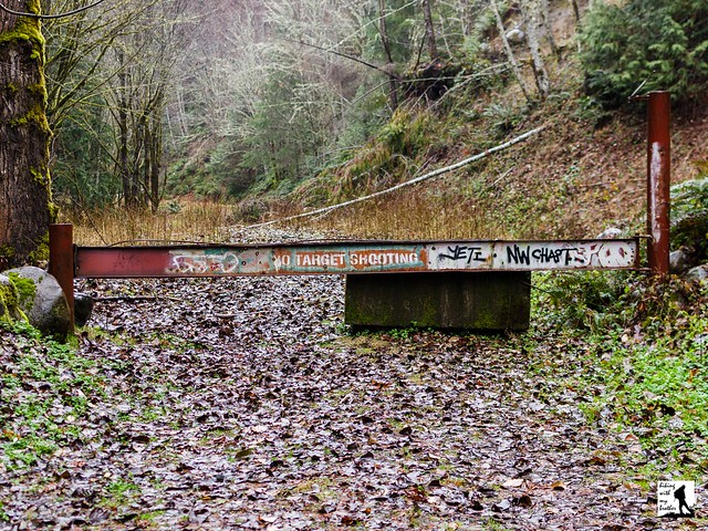
The hike begins at an unmarked and gated forest road. Step around the gate and over a stream, following the rough road as it begins its gradual ascent. Although the young mixed forest offers occasional glimpses of the Carbon River and nearby mountainsides, most of the route is confined to the trees. At about the two mile mark, find what remains of an old forest road that provided quick access to Gleason Hill’s upper reaches. The roadbed is very overgrown and disappears almost entirely after a short distance. If you’re looking for a short cut and a little adventure, it is a fairly easy bushwack up to the forest road.
Continue onward for another mile or so, passing the occasional waterfall to a junction with another road. Veer right, continuing on the road as it begins to hook around the base of Gleason Hill. Find another forest road here that heads up the ridgeline. Turn right and follow for another mile or past vast expanses of clear cut to reach the tree-covered summit. Nothing marks the top other than the beginning of a gentle descent. You can end your hike here or continue onward to see where the roads take you.
 This hike is best if you’re up for doing some explorations and a little bushwhacking. The route we’ve mapped out here is just a baseline for getting around. The real adventure is in the network of roads that riddle the area. We were told that there are some artifacts and old foundations to explore, but we did not have any luck finding them. This hike doesn’t have big views or a lake to hike to. It's simply a pleasant forest walk that stays fairly snowfree throughout the year. In addition, because it isn't an area that many people frequent, Gleason Hill is an excellent choice if it's solitude you seek.
To get there, take I-5 South to I-405. From I-405 take SR 167 south toward Auburn. In 20 miles take the SR 410 Exit toward Sumner/Yakima. Follow SR 410 for 12 miles to SR 165. Take a right and continue on SR 165 for about 10 miles through Carbonado to the Fairfax Bridge. Cross the bridge and continue on SR 165 for a half-mile. Veer left onto the Carbon River Road when the highway splits, and follow for 2.9 miles to the Manley-Moore Road. Take a left and follow the Manley Moore Road for .3 miles to Kolisch Road, keeping left. Continue .5 miles across the Carbon River to a gated forest road with plenty of room for parking. -Nathan
Print Google Directions >>


0 Comments:
Post a Comment